How to get to STARBUCKS by bus?
Click on the bus route to see step by step directions with maps, line arrival times and updated time schedules.
From Maketto, Washington
49 minFrom COURTYARD-Washington DC US Capitol, Washington
63 minFrom Ben's Chili Bowl, Washington
61 minFrom Montgomery College-Takoma Park/Silver Spring, Montgomery County
43 minFrom Doctors Community Hospital, Prince George's County
42 minFrom REI, Washington
62 minFrom Hyatt Place Washington DC/US Capitol, Washington
56 minFrom WMATA Carmen Turner Facility, Prince George's County
64 minFrom Knollwood, Washington
92 minFrom Eastern High School, Washington
48 min
How to get to STARBUCKS by train?
Click on the train route to see step by step directions with maps, line arrival times and updated time schedules.
How to get to STARBUCKS by metro?
Click on the metro route to see step by step directions with maps, line arrival times and updated time schedules.
From Maketto, Washington
58 minFrom COURTYARD-Washington DC US Capitol, Washington
35 minFrom Ben's Chili Bowl, Washington
51 minFrom Montgomery College-Takoma Park/Silver Spring, Montgomery County
46 minFrom REI, Washington
37 minFrom Hyatt Place Washington DC/US Capitol, Washington
43 minFrom WMATA Carmen Turner Facility, Prince George's County
89 minFrom Eastern High School, Washington
64 min
Bus stops near STARBUCKS in Prince George's County
Metro station near STARBUCKS in Prince George's County
- College Park-U Of Md, 14 min walk,VIEW
Train station near STARBUCKS in Prince George's County
- College Park Marc Sb, 14 min walk,VIEW
Bus lines to STARBUCKS in Prince George's County
What are the closest stations to STARBUCKS?
The closest stations to STARBUCKS are:
- Baltimore Ave & Hartwick Rd is 166 yards away, 3 min walk.
- Montgomery Hall (Outbound) is 370 yards away, 5 min walk.
- College Park-U Of Md is 1097 yards away, 14 min walk.
- College Park Marc Sb is 1099 yards away, 14 min walk.
Which bus lines stop near STARBUCKS?
These bus lines stop near STARBUCKS: M44, P10, P1X.
Which train line stops near STARBUCKS?
MARC (Inbound - Camden)
Which metro line stops near STARBUCKS?
GREEN (Greenbelt)
What’s the nearest metro station to STARBUCKS in Prince George's County?
The nearest metro station to STARBUCKS in Prince George's County is College Park-U Of Md. It’s a 14 min walk away.
What’s the nearest train station to STARBUCKS in Prince George's County?
The nearest train station to STARBUCKS in Prince George's County is College Park Marc Sb. It’s a 14 min walk away.
What’s the nearest bus station to STARBUCKS in Prince George's County?
The nearest bus station to STARBUCKS in Prince George's County is Baltimore Ave & Hartwick Rd. It’s a 3 min walk away.
What time is the first metro to STARBUCKS in Prince George's County?
The GREEN is the first metro that goes to STARBUCKS in Prince George's County. It stops nearby at 5:03 AM.
What time is the last metro to STARBUCKS in Prince George's County?
The GREEN is the last metro that goes to STARBUCKS in Prince George's County. It stops nearby at 12:39 AM.
What time is the first train to STARBUCKS in Prince George's County?
The MARC is the first train that goes to STARBUCKS in Prince George's County. It stops nearby at 5:43 AM.
What time is the last train to STARBUCKS in Prince George's County?
The MARC is the last train that goes to STARBUCKS in Prince George's County. It stops nearby at 7:57 PM.
What time is the first bus to STARBUCKS in Prince George's County?
The P10 is the first bus that goes to STARBUCKS in Prince George's County. It stops nearby at 5:01 AM.
What time is the last bus to STARBUCKS in Prince George's County?
The 122 is the last bus that goes to STARBUCKS in Prince George's County. It stops nearby at 2:50 AM.
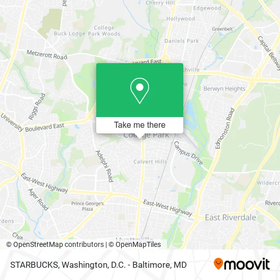
See STARBUCKS, Prince George's County, on the map
Public Transit to STARBUCKS in Prince George's County
Wondering how to get to STARBUCKS in Prince George's County? Moovit helps you find the best way to get to STARBUCKS with step-by-step directions from the nearest public transit station.
Moovit provides free maps and live directions to help you navigate through your city. View schedules, routes, timetables, and find out how long does it take to get to STARBUCKS in real time.
Looking for the nearest stop or station to STARBUCKS? Check out this list of stops closest to your destination: Baltimore Ave & Hartwick Rd; Montgomery Hall (Outbound); College Park-U Of Md; College Park Marc Sb.
Bus: M44, P10, P1X, NHD RH, 104.Train: MARC.Metro: GREEN, YELLOW.
Want to see if there’s another route that gets you there at an earlier time? Moovit helps you find alternative routes or times. Get directions from and directions to STARBUCKS easily from the Moovit App or Website.
We make riding to STARBUCKS easy, which is why over 1.5 million users, including users in Prince George's County, trust Moovit as the best app for public transit. You don’t need to download an individual bus app or train app, Moovit is your all-in-one transit app that helps you find the best bus time or train time available.
For information on prices of bus, metro and train, costs and ride fares to STARBUCKS, please check the Moovit app.
Use the app to navigate to popular places including to the airport, hospital, stadium, grocery store, mall, coffee shop, school, college, and university.
STARBUCKS Address: 7336 Baltimore Ave College Park, MD 20740 street in Prince George's County
- Sports Medicine,
- Boston Market,
- COLD STONE CREAMERY,
- Ken Pharmacy,
- F45 Training,
- T-Rex Consulting Corporation,
- Trinity Consulting Group,
- Kung Fu Tea Shop,
- Dorie Glass,
- Blink Charging,
- Tokoa Cheesesteak,
- Standard at College Park,
- The Quixote Center,
- Chick-fil-A,
- Little Blue Menu,
- PNC Bank,
- PNC Mortgage,
- Inspire Nail Bar,
- Aerothreads,
- Yale Locks College Park
Places Near STARBUCKS (Prince George's County)
- Washington DC VA Medical Center, Washington,
- The Anthem, Washington,
- Sibley Memorial Hospital, Washington,
- Westfield Montgomery Mall, Montgomery County,
- Warner Theatre, Washington,
- M&T Bank Stadium, Baltimore,
- Rock Creek Tennis Center, Washington,
- Washington National Cathedral, Washington,
- Amazon Hq2, Arlington County,
- National Museum of African American History and Culture, Washington,
- National Zoo, Washington,
- Museum Of The Bible, Washington,
- National Theatre, Washington,
- PG Mall, Prince George's County,
- Pennsylvania Ave NW (3rd st and pennsylvania), Washington,
- Capital One Arena, Washington,
- Georgetown, Washington,
- Basilica of the National Shrine, Washington,
- Marriott Marquis Washington, DC, Washington,
- Camden Yards, Baltimore
How to get to popular places in Washington, D.C. - Baltimore, MD with public transit
Get around Prince George's County by public transit!
Traveling around Prince George's County has never been so easy. See step by step directions as you travel to any attraction, street or major public transit station. View bus and train schedules, arrival times, service alerts and detailed routes on a map, so you know exactly how to get to anywhere in Prince George's County.
When traveling to any destination around Prince George's County use Moovit's Live Directions with Get Off Notifications to know exactly where and how far to walk, how long to wait for your line, and how many stops are left. Moovit will alert you when it's time to get off — no need to constantly re-check whether yours is the next stop.
Wondering how to use public transit in Prince George's County or how to pay for public transit in Prince George's County? Moovit public transit app can help you navigate your way with public transit easily, and at minimum cost. It includes public transit fees, ticket prices, and costs. Looking for a map of Prince George's County public transit lines? Moovit public transit app shows all public transit maps in Prince George's County with all Bus, Train, Metro, Light Rail and Ferry routes and stops on an interactive map.
Washington, D.C. - Baltimore, MD has 5 transit type(s), including: Bus, Train, Metro, Light Rail and Ferry, operated by several transit agencies, including WMATA, Montgomery County Ride On, Fairfax Connector, TheBus, PRTC, DASH - Alexandria, Arlington Transit (ART), RTA of Central Maryland, MDOT MTA, MDOT MTA Light RailLink, MDOT MTA Commuter Bus, MDOT MTA Local Bus, FXBGO!, Virginia Railway Express (VRE) and MARC