How to get to SUBWAY Doca by bus?
Click on the bus route to see step by step directions with maps, line arrival times and updated time schedules.
From Cabaré da Angel, Ananindeua
41 minFrom Linha Pedreira - Lomas (Linha B), Entroncamento
28 minFrom Cabanagem, Bengui
53 minFrom Bairro do Souza, Entroncamento
25 minFrom Universidade Federal do Pará (UFPA), Entroncamento
34 minFrom Rua Da Pedreirinha, Ananindeua
41 minFrom Formosa - Augusto Montenegro, Bengui
52 minFrom UNAMA - Universidade da Amazônia, Ananindeua
25 minFrom Avenida Augusto Montenegro, Km 03 s/n, Entroncamento
51 minFrom Shopping Bosque Grão Pará, Entroncamento
36 min
Bus stops near SUBWAY Doca in Belém
Ferry stations near SUBWAY Doca in Belém
Bus lines to SUBWAY Doca in Belém
- 113, Cremação I - Estrada Nova,VIEW
- 307, UFPA - Padre Eutíquio,VIEW
- 417, Ufpa/ Alcindo Cacela - José Malcher,VIEW
- 422, Alcindo Cacela - Domingos Marreiros,VIEW
- 443, Pedreira - Lomas (Linha A),VIEW
- 445, Pedreira - Lomas (Seletivo),VIEW
- 663, Benguí,VIEW
- 756, Jardim Europa - Ver-O-Peso,VIEW
- 785, Tenoné - Ver-O-Peso (Centenário) 5ª Linha / Laranjeiras,VIEW
- 795, Cabanagem - Pres. Vargas,VIEW
- 862, Tapanã - Felipe Patroni,VIEW
- 871, Icoaraci - Ver-O-Peso,VIEW
- 944, Pedreira - Lomas (Linha B / Águas Lindas),VIEW
- 984, 40 Horas - Pres. Vargas,VIEW
- M103, Terminal Marituba - Presidente Vargas,VIEW
- 308, UFPA - Alcindo Cacela,VIEW
- 316, Guamá - Pres. Vargas,VIEW
- 328, Cipriano Santos - Presidente Vargas,VIEW
- 439, Pedreira - Nazaré,VIEW
- 446, João Paulo II - Ver-o-Peso,VIEW
What are the closest stations to SUBWAY Doca?
The closest stations to SUBWAY Doca are:
- Gaspar Vianna Com Quintino is 192 meters away, 3 min walk.
- Doca Com Bernal | Boulevard is 253 meters away, 4 min walk.
- 28 De Setembro Com Rui Barbosa is 270 meters away, 4 min walk.
- Unimed | Municipalidade Com Doca is 325 meters away, 5 min walk.
- P.A. Cabral Com Doca is 422 meters away, 6 min walk.
- Doca Com Municipalidade | Fap is 477 meters away, 7 min walk.
- Praça Do Pescador is 1204 meters away, 17 min walk.
- Arapari Navegação is 2016 meters away, 27 min walk.
- Praça Princesa Isabel is 3414 meters away, 44 min walk.
Which bus lines stop near SUBWAY Doca?
These bus lines stop near SUBWAY Doca: 316, 642, 664, 872, 944, M103.
What’s the nearest bus station to SUBWAY Doca in Belém?
The nearest bus station to SUBWAY Doca in Belém is Gaspar Vianna Com Quintino. It’s a 3 min walk away.
What’s the nearest ferry station to SUBWAY Doca in Belém?
The nearest ferry station to SUBWAY Doca in Belém is Praça Do Pescador. It’s a 17 min walk away.
What time is the first bus to SUBWAY Doca in Belém?
The 664 is the first bus that goes to SUBWAY Doca in Belém. It stops nearby at 3:09 AM.
What time is the last bus to SUBWAY Doca in Belém?
The 869 is the last bus that goes to SUBWAY Doca in Belém. It stops nearby at 3:37 AM.
What time is the first ferry to SUBWAY Doca in Belém?
The T004 is the first ferry that goes to SUBWAY Doca in Belém. It stops nearby at 4:30 AM.
What time is the last ferry to SUBWAY Doca in Belém?
The T004 is the last ferry that goes to SUBWAY Doca in Belém. It stops nearby at 11:36 PM.
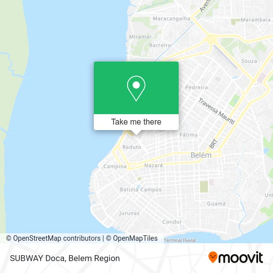
See SUBWAY Doca, Belém, on the map
Public Transit to SUBWAY Doca in Belém
Wondering how to get to SUBWAY Doca in Belém? Moovit helps you find the best way to get to SUBWAY Doca with step-by-step directions from the nearest public transit station.
Moovit provides free maps and live directions to help you navigate through your city. View schedules, routes, timetables, and find out how long does it take to get to SUBWAY Doca in real time.
Looking for the nearest stop or station to SUBWAY Doca? Check out this list of stops closest to your destination: Gaspar Vianna Com Quintino; Doca Com Bernal | Boulevard; 28 De Setembro Com Rui Barbosa; Unimed | Municipalidade Com Doca; P.A. Cabral Com Doca; Doca Com Municipalidade | Fap; Praça Do Pescador; Arapari Navegação; Praça Princesa Isabel.
Bus: 316, 642, 664, 872, 944, M103, 113, 307, 417, 422, 443, 308, 328, 439, 635, 306, 441, 636, 666, 757, 442, 754.Ferry: L022.
Want to see if there’s another route that gets you there at an earlier time? Moovit helps you find alternative routes or times. Get directions from and directions to SUBWAY Doca easily from the Moovit App or Website.
We make riding to SUBWAY Doca easy, which is why over 1.5 million users, including users in Belém, trust Moovit as the best app for public transit. You don’t need to download an individual bus app or train app, Moovit is your all-in-one transit app that helps you find the best bus time or train time available.
For information on prices of bus, costs and ride fares to SUBWAY Doca, please check the Moovit app.
Use the app to navigate to popular places including to the airport, hospital, stadium, grocery store, mall, coffee shop, school, college, and university.
SUBWAY Doca Address: Avenida Senador Lemos Umarizal Belém-PA 66050-000 street in Belém
- WESTERN UNION,
- Excelência Contabilidade,
- Harden Artigos Militares,
- Igreja Pentecostal as 7 Alianças de Jesus Cristo,
- Depyl Action,
- Dayana Hair Saloon,
- Amoras Comércio de Produtos Naturais,
- Armazem Fit Store,
- Amorim Representacao,
- Reduto da Carnes,
- Ap do Sime,
- Celma C Sena,
- FAST FIT,
- Sspf,
- Igreja Petencostal Deus é Amor,
- Acougue da Fazenda,
- Av Senador Lemos,
- Clínica de Psicologia _ Renata Dolzane Leal,
- Feira Do Ver-o-Peso,
- Departamento Jurídico - Prosegur Brasil S / A
Places Near SUBWAY Doca (Belém)
- Shopping Center Bosque Grão Pará, Entroncamento,
- Shopping Bosque Grão Pará, Entroncamento,
- Shopping Metrópole Ananindeua, Ananindeua,
- Bancrevea, Bengui,
- Aeroporto Internacional de Belém (BEL), Entroncamento,
- Shopping Pátio Belém, Belém,
- Praça Brasil, Belém,
- Parque Shopping Belém, Bengui,
- Grão Pará, Belém,
- Doca, Belém,
- Hangar PA, Belém,
- hospital Barros Barreto, Belém,
- Centro Integrado de Inclusão e Reabilitação - CIIR, Entroncamento,
- Mangal Das Garças, Belém,
- Av.Senador Lemos, Belém,
- Avenida Augusto Montenegro, Belém,
- Boulevard Shopping, Belém,
- Avenida Júlio Cesar, Belém,
- Santa Casa De Misericórdia, Belém,
- Linha 872: Icoaraci - Almirante Barroso (Presidente Vargas), Icoaraci
How to get to popular places in Belem Region with public transit
Get around Belém by public transit!
Traveling around Belém has never been so easy. See step by step directions as you travel to any attraction, street or major public transit station. View bus and train schedules, arrival times, service alerts and detailed routes on a map, so you know exactly how to get to anywhere in Belém.
When traveling to any destination around Belém use Moovit's Live Directions with Get Off Notifications to know exactly where and how far to walk, how long to wait for your line, and how many stops are left. Moovit will alert you when it's time to get off — no need to constantly re-check whether yours is the next stop.
Wondering how to use public transit in Belém or how to pay for public transit in Belém? Moovit public transit app can help you navigate your way with public transit easily, and at minimum cost. It includes public transit fees, ticket prices, and costs. Looking for a map of Belém public transit lines? Moovit public transit app shows all public transit maps in Belém with all Bus and Ferry routes and stops on an interactive map.
Belem Region has 2 transit type(s), including: Bus and Ferry, operated by several transit agencies, including BRT Metropolitano, BRT Belém, SETRANSBEL, Coopcaban, Expresso Modelo, Voyage Transportes, Amazonat, Coopersati, Luane Transportes, Cooptarvc, Ruth Transportes, Mayara Transportes, Cooptauá, Expresso São José and Castanhal (Clara, Rosa's, Salve Maria)