How to get to SWB A Fl General Partnership by bus?
Click on the bus route to see step by step directions with maps, line arrival times and updated time schedules.
From Joe Dimaggio Children's Hospital at Memorial, Hollywood
61 minFrom Jay's Professional Enterprises, Fort Lauderdale
61 minFrom Seminole Hard Rock Hotel & Casino, Hollywood
56 minFrom Fort Lauderdale Airport, Hollywood
36 minFrom Crystal River, Fort Lauderdale
58 minFrom The Red Light District, Fort Lauderdale
71 minFrom Inter Miami CF, Fort Lauderdale
70 minFrom Northeast High School, Fort Lauderdale
54 minFrom Griffin Road & Davie Road, Davie
53 minFrom Dania Pointe, Hollywood
56 min
How to get to SWB A Fl General Partnership by train?
Click on the train route to see step by step directions with maps, line arrival times and updated time schedules.
Bus stops near SWB A Fl General Partnership in Fort Lauderdale
Ferry station near SWB A Fl General Partnership in Fort Lauderdale
- Smoker Park, 20 min walk,VIEW
Bus lines to SWB A Fl General Partnership in Fort Lauderdale
What are the closest stations to SWB A Fl General Partnership?
The closest stations to SWB A Fl General Partnership are:
- Southeast 3rd Avenue/Southeast 14th Street is 137 yards away, 2 min walk.
- Broward Health Medical Center is 387 yards away, 5 min walk.
- Sun Trolley - Broward General Hospital is 673 yards away, 9 min walk.
- Davie Boulevard & Andrews Avenue is 714 yards away, 9 min walk.
- Smoker Park is 1687 yards away, 20 min walk.
Which bus lines stop near SWB A Fl General Partnership?
These bus lines stop near SWB A Fl General Partnership: 01, 06, 30, 40.
Which train line stops near SWB A Fl General Partnership?
BLFM (Mco)
What’s the nearest bus station to SWB A Fl General Partnership in Fort Lauderdale?
The nearest bus station to SWB A Fl General Partnership in Fort Lauderdale is Southeast 3rd Avenue/Southeast 14th Street. It’s a 2 min walk away.
What’s the nearest ferry station to SWB A Fl General Partnership in Fort Lauderdale?
The nearest ferry station to SWB A Fl General Partnership in Fort Lauderdale is Smoker Park. It’s a 20 min walk away.
What time is the first bus to SWB A Fl General Partnership in Fort Lauderdale?
The 101 is the first bus that goes to SWB A Fl General Partnership in Fort Lauderdale. It stops nearby at 4:48 AM.
What time is the last bus to SWB A Fl General Partnership in Fort Lauderdale?
The 01 is the last bus that goes to SWB A Fl General Partnership in Fort Lauderdale. It stops nearby at 12:24 AM.
What time is the first ferry to SWB A Fl General Partnership in Fort Lauderdale?
The WATER TROLLEY is the first ferry that goes to SWB A Fl General Partnership in Fort Lauderdale. It stops nearby at 10:00 AM.
What time is the last ferry to SWB A Fl General Partnership in Fort Lauderdale?
The WATER TROLLEY is the last ferry that goes to SWB A Fl General Partnership in Fort Lauderdale. It stops nearby at 10:20 PM.
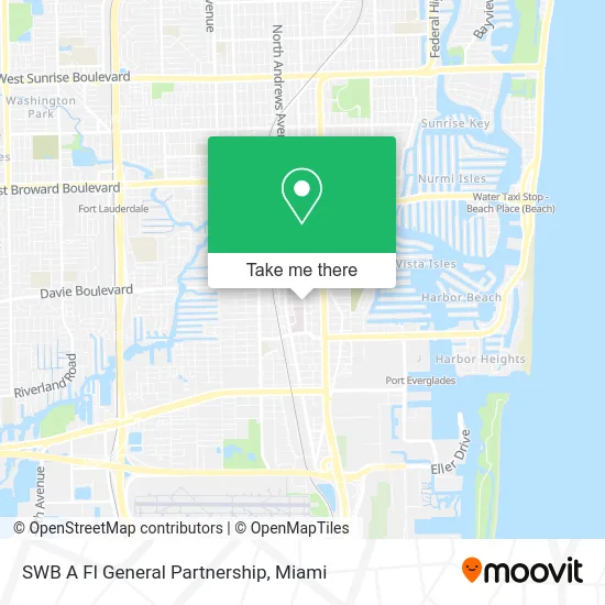
See SWB A Fl General Partnership, Fort Lauderdale, on the map
Public Transit to SWB A Fl General Partnership in Fort Lauderdale
Wondering how to get to SWB A Fl General Partnership in Fort Lauderdale? Moovit helps you find the best way to get to SWB A Fl General Partnership with step-by-step directions from the nearest public transit station.
Moovit provides free maps and live directions to help you navigate through your city. View schedules, routes, timetables, and find out how long does it take to get to SWB A Fl General Partnership in real time.
Looking for the nearest stop or station to SWB A Fl General Partnership? Check out this list of stops closest to your destination: Southeast 3rd Avenue/Southeast 14th Street; Broward Health Medical Center; Sun Trolley - Broward General Hospital; Davie Boulevard & Andrews Avenue; Smoker Park.
Bus: 01, 06, 30, 40, 101, BEACH LINK, DOWNTOWN LINK.Train: BLFM.Ferry: WATER TROLLEY.
Want to see if there’s another route that gets you there at an earlier time? Moovit helps you find alternative routes or times. Get directions from and directions to SWB A Fl General Partnership easily from the Moovit App or Website.
We make riding to SWB A Fl General Partnership easy, which is why over 1.5 million users, including users in Fort Lauderdale, trust Moovit as the best app for public transit. You don’t need to download an individual bus app or train app, Moovit is your all-in-one transit app that helps you find the best bus time or train time available.
For information on prices of bus and train, costs and ride fares to SWB A Fl General Partnership, please check the Moovit app.
Use the app to navigate to popular places including to the airport, hospital, stadium, grocery store, mall, coffee shop, school, college, and university.
SWB A Fl General Partnership Address: 1323 SE 3rd Ave Fort Lauderdale, FL 33311 street in Fort Lauderdale
- Ocean Health Center,
- Law Offices of Mark E. Sawicki, PA,
- Loving Scully Law Group,
- Forman Hanratty Thomas & Montgomery,
- Fox Braces & Invisalign,
- Clayton Michael Berger,
- GPG Law,
- Mediar,
- Raisman & Raisman, P.A.,
- Law Offices of McCullough & Leboff, P.A.,
- Sunshine State Probate,
- Parady & Zikakis PA,
- Whitelock & Associates PA,
- Fort Lauderdale Insurance Agency,
- Smith Building Inc,
- Criminal Defense,
- Hassett & Associates, P.A.,
- Camilo Ruiz do, Pa - Sleep and Internal Concierge Specialists,
- Leonel J Hernandez-Toledo MD,
- Dr. Camilo A. Ruiz, do, Facoi, Faasm
Places Near SWB A Fl General Partnership (Fort Lauderdale)
- Sawgrass Mall, Miami,
- Wynwood, Miami,
- Port of Miami Cruise Terminal, Miami,
- Miami Freedom Park, Miami,
- Richard E. Gerstein Justice Building, Miami,
- Keiser University Flagship Campus, West Palm Beach,
- Bayside Marketplace, Miami,
- Miami-Dade County Courthouse, Miami,
- Brickell City Centre, Miami,
- Marlins Park, Miami,
- Miami Design District, Miami,
- Zoo Miami, Miami,
- Sawgrass mall ( FL ), Miami Beach,
- Dolphin Mall, Miami,
- Hard Rock Stadium, Miami Gardens,
- Miami VA Hospital, Miami,
- Little Havana, Miami,
- Aventura Mall, Miami,
- Aventura Mall, Miami Beach,
- Dolphin Mall Bus, Miami
How to get to popular places in Miami with public transit
Get around Fort Lauderdale by public transit!
Traveling around Fort Lauderdale has never been so easy. See step by step directions as you travel to any attraction, street or major public transit station. View bus and train schedules, arrival times, service alerts and detailed routes on a map, so you know exactly how to get to anywhere in Fort Lauderdale.
When traveling to any destination around Fort Lauderdale use Moovit's Live Directions with Get Off Notifications to know exactly where and how far to walk, how long to wait for your line, and how many stops are left. Moovit will alert you when it's time to get off — no need to constantly re-check whether yours is the next stop.
Wondering how to use public transit in Fort Lauderdale or how to pay for public transit in Fort Lauderdale? Moovit public transit app can help you navigate your way with public transit easily, and at minimum cost. It includes public transit fees, ticket prices, and costs. Looking for a map of Fort Lauderdale public transit lines? Moovit public transit app shows all public transit maps in Fort Lauderdale with all Bus, Train, Light Rail and Ferry routes and stops on an interactive map.
Miami has 4 transit type(s), including: Bus, Train, Light Rail and Ferry, operated by several transit agencies, including Broward County Transit, Miami-Dade Transit, Metrorail, Palm Tran, Tri-Rail, Brightline, MARTY, City of Homestead Trolley, Key West Transit, Treasure Coast Connector, GoLine IRT, Amtrak, Greyhound-us, FlixBus-us and Aventura Express Shuttle Bus