How to get to S'KAP by bus?
Click on the bus route to see step by step directions with maps, line arrival times and updated time schedules.
From Zhongyi Petrochemical (Jindi Station), Yixing
60 minFrom Weiweizheng Beef Supermarket, Yixing
32 minFrom Zhongyuan 68 Group Road, Yixing
45 minFrom Xu Tongfen Clinic, Yixing
52 minFrom Bridge No. 3, Yixing
33 minFrom Yixing Traffic Police Detachment Dingshu Squad, Yixing
42 minFrom Haike Enterprise, Yixing
48 minFrom Kangyuan Pharmacy (Northeast of Yangshi Town Government), Yixing
51 minFrom Yixing Station Ticket Office, Yixing
32 minFrom Yixing Dingshu Town Taocheng Metal Ceramic Factory, Yixing
55 min
Bus stops near S'KAP in Yixing
Bus lines to S'KAP in Yixing
- 2, East City Transit Terminal,VIEW
- Route 105, Bus Company,VIEW
- Route 211, Yixing Terminal,VIEW
- Route 8, Golden Triangle Station,VIEW
- Route 113, Yibei Terminal,VIEW
- Route 115, Red Star Macalline,VIEW
- 1, Yibei Station - High Speed Rail Station,VIEW
- 3, Golden Triangle Station - Arts Institute,VIEW
- Route 6, Bus Company - Bus Third Depot,VIEW
- Route 112, Golden Triangle Station - Golden Triangle Station,VIEW
- Route 116, Produce Market - High Speed Rail Station,VIEW
- Route 11 Outer Ring, Golden Triangle Station - Golden Triangle Station,VIEW
- Route 17, Bus Company,VIEW
- Route 18, Bus Company,VIEW
- 12, Golden Triangle Station,VIEW
- Route 15 Inner Ring, Yibei Terminal,VIEW
- Route 16 Outer Ring, Yibei Terminal,VIEW
- Route 111, Arts Institute,VIEW
- Route 13 Inner Ring, Golden Triangle Station,VIEW
What are the closest stations to S'KAP?
The closest stations to S'KAP are:
- Health Building is 18 meters away, 1 min walk.
- Tea Bureau Lane is 36 meters away, 1 min walk.
- China Unicom is 276 meters away, 5 min walk.
- Asia is 327 meters away, 5 min walk.
- People's Theater is 344 meters away, 5 min walk.
Which bus lines stop near S'KAP?
These bus lines stop near S'KAP: Route 116, 2, Route 6.
What’s the nearest bus station to S'KAP in Yixing?
The nearest bus stations to S'KAP in Yixing are Health Building and Tea Bureau Lane. The closest one is a 1 min walk away.
What time is the first bus to S'KAP in Yixing?
The Route 6 is the first bus that goes to S'KAP in Yixing. It stops nearby at 5:34 AM.
What time is the last bus to S'KAP in Yixing?
The 1 is the last bus that goes to S'KAP in Yixing. It stops nearby at 11:17 PM.
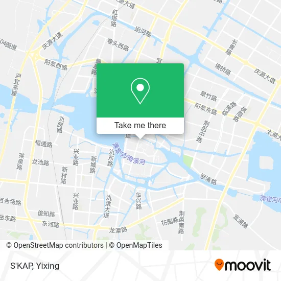
See S'KAP, Yixing, on the map
Public Transit to S'KAP in Yixing
Wondering how to get to S'KAP in Yixing? Moovit helps you find the best way to get to S'KAP with step-by-step directions from the nearest public transit station.
Moovit provides free maps and live directions to help you navigate through your city. View schedules, routes, timetables, and find out how long does it take to get to S'KAP in real time.
Looking for the nearest stop or station to S'KAP? Check out this list of stops closest to your destination: Health Building; Tea Bureau Lane; China Unicom; Asia; People's Theater.
Bus: Route 116, 2, Route 6, 2, Route 105, Route 211, Route 8, Route 113, Route 115, 1, 3, Route 6, Route 112, Route 116.
Want to see if there’s another route that gets you there at an earlier time? Moovit helps you find alternative routes or times. Get directions from and directions to S'KAP easily from the Moovit App or Website.
We make riding to S'KAP easy, which is why over 1.5 million users, including users in Yixing, trust Moovit as the best app for public transit. You don’t need to download an individual bus app or train app, Moovit is your all-in-one transit app that helps you find the best bus time or train time available.
For information on prices of bus, costs and ride fares to S'KAP, please check the Moovit app.
Use the app to navigate to popular places including to the airport, hospital, stadium, grocery store, mall, coffee shop, school, college, and university.
S'KAP Address: 无锡市宜兴市太滆西路17号苏南商厦(太滆社区卫生服务站西南)1层 street in Yixing
- Century Sea Seal Tribe (Huadi Department Store),
- YOUNGOR,
- Saint Gibb (Huadi Department Store Yixing Branch),
- E.LANDKIDS (Huadi Department Store Yixing Branch),
- Huadi Department Store Yixing Branch (Northwest Gate),
- D&X,
- L'OREAL,
- MINE,
- We'story,
- M.Latin (Huadi Department Store Yixing Store),
- W.Doubleudot,
- Leikerdel Counter (Huadi Department Store),
- RED.P.G,
- Geek Sweet,
- Puma (Huadi Department Store),
- Da Vinci (Huadi Department Store Yixing Branch),
- CARAN d'ACHE,
- Anli Fang (Huadi Department Store Yixing Branch),
- CANUDILO,
- General Service Desk
Places Near S'KAP (Yixing)
- Yixing Transportation Bureau - Retired Cadres Activity Center, Yixing,
- Ancient South Street of Shushan, Yixing,
- China Yixing Ceramic Museum, Yixing,
- Zhangzhu, Yixing,
- Taihu Flower Garden - South Gate, Yixing,
- Yixing Sports Center, Yixing,
- China Taodu Peninsula Hotel, Yixing,
- Yi Shang Ke, Yixing,
- Wuxi City Yixing City, Yixing,
- Baibaipin (South), Yixing,
- Yixing People's Hospital, Yixing,
- Foguang Ancestral Temple Dajue Temple, Yixing,
- South Garden Home Farmhouse Restaurant, Yixing,
- Yixing Bus Station, Yixing,
- China Unicom (Xieqiao Garden Business Hall), Yixing,
- Yixing Route 202 (Yixing Station - Yunhu Scenic Area), Yixing,
- Eco-Tech Park, Yixing,
- Yixing Dingshu Experimental Middle School - Parking Lot, Yixing,
- Nanjing Lukou International Airport Yixing City Waiting Hall, Yixing,
- Zhangzhu Town, Yixing
How to get to popular places in Yixing with public transit
Get around Yixing by public transit!
Traveling around Yixing has never been so easy. See step by step directions as you travel to any attraction, street or major public transit station. View bus and train schedules, arrival times, service alerts and detailed routes on a map, so you know exactly how to get to anywhere in Yixing.
When traveling to any destination around Yixing use Moovit's Live Directions with Get Off Notifications to know exactly where and how far to walk, how long to wait for your line, and how many stops are left. Moovit will alert you when it's time to get off — no need to constantly re-check whether yours is the next stop.
Wondering how to use public transit in Yixing or how to pay for public transit in Yixing? Moovit public transit app can help you navigate your way with public transit easily, and at minimum cost. It includes public transit fees, ticket prices, and costs. Looking for a map of Yixing public transit lines? Moovit public transit app shows all public transit maps in Yixing with all bus routes and stops on an interactive map.
Yixing has 1 transit type(s), including: bus, operated by several transit agencies, including Yixing Bus