Sabatini C./Martelli Castaldi stop - Monday schedule
| Line | Direction | Time |
|---|---|---|
| N705 | Piermarini | 3:10 AM |
| N705 | Piermarini | 3:10 AM |
| NME | Piazza Venezia | 3:28 AM |
| NME | Piazza Venezia | 3:28 AM |
| N705 | Piermarini | 3:51 AM |
| N705 | Piermarini | 3:51 AM |
| NME | Piazza Venezia | 4:24 AM |
| NME | Piazza Venezia | 4:24 AM |
| N705 | Piermarini | 4:33 AM |
| N705 | Piermarini | 4:33 AM |
| NME | Piazza Venezia | 5:09 AM |
| NME | Piazza Venezia | 5:09 AM |
| N705 | Piermarini | 5:14 AM |
| N705 | Piermarini | 5:14 AM |
| 787 | Val Fiorita | 5:36 AM |
| 777 | Blessed Virgin of Carmel | 5:37 AM |
| 787 | Val Fiorita | 5:56 AM |
| 777 | Blessed Virgin of Carmel | 5:57 AM |
| 787 | Val Fiorita | 6:17 AM |
| 777 | Blessed Virgin of Carmel | 6:19 AM |
| 787 | Val Fiorita | 6:38 AM |
| 777 | Blessed Virgin of Carmel | 6:39 AM |
| 787 | Val Fiorita | 6:59 AM |
| 777 | Blessed Virgin of Carmel | 7:00 AM |
| 787 | Val Fiorita | 7:19 AM |
Directions to Sabatini C./Martelli Castaldi stop (Roma) with public transit
The following transit lines have routes that pass near Sabatini C./Martelli Castaldi
 Bus: 777, 787, NME, N705, 778.
- Train: FC2.
- Metro: B.
How to get to Sabatini C./Martelli Castaldi stop by bus?
Click on the bus route to see step by step directions with maps, line arrival times and updated time schedules.
How to get to Sabatini C./Martelli Castaldi stop by train?
Click on the train route to see step by step directions with maps, line arrival times and updated time schedules.
How to get to Sabatini C./Martelli Castaldi stop by metro?
Click on the metro route to see step by step directions with maps, line arrival times and updated time schedules.
Bus stops near Sabatini C./Martelli Castaldi stop in Roma
- Sabatini C./Martelli Castaldi, 2 min walk,
- Indian Ocean/Decima, 3 min walk,
- Decima/Calcutta, 4 min walk,
- Ostiense/Tor Di Valle Station (RL), 12 min walk,
Metro stations near Sabatini C./Martelli Castaldi station in Roma
- EUR Palasport, 28 min walk,
Train stations near Sabatini C./Martelli Castaldi station in Roma
- Tor Di Valle, 34 min walk,
Bus lines to Sabatini C./Martelli Castaldi stop in Roma
- NME, Lido Station Square,
- N705, Laurentina (Metro B),
- 777, Blessed Virgin of Carmel,
- 787, Val Fiorita,
- 778, Blessed Virgin of Carmel,
- 712, Ortolani,
- C01, Colombo/Sports Palace,
- FC2 BUS, Cristoforo Colombo Station,
What are the closest stations to Sabatini C./Martelli Castaldi?
The closest stations to Sabatini C./Martelli Castaldi are:
- Sabatini C./Martelli Castaldi stop is 88 meters away, 2 min walk.
- Indian Ocean/Decima stop is 230 meters away, 3 min walk.
- Decima/Calcutta stop is 251 meters away, 4 min walk.
- Ostiense/Tor Di Valle Station (RL) is 804 meters away, 12 min walk.
- EUR Palasport station is 2155 meters away, 28 min walk.
- Tor Di Valle station is 2577 meters away, 34 min walk.
Which bus lines stop near Sabatini C./Martelli Castaldi?
These bus lines stop near Sabatini C./Martelli Castaldi: 777, 787.
Which train line stops near Sabatini C./Martelli Castaldi?
FC2 (Cristoforo Colombo)
Which metro line stops near Sabatini C./Martelli Castaldi?
B (Laurentina)
What’s the nearest metro station to Sabatini C./Martelli Castaldi in Roma?
The nearest metro station to Sabatini C./Martelli Castaldi in Roma is EUR Palasport. It’s a 28 min walk away.
What’s the nearest bus station to Sabatini C./Martelli Castaldi in Roma?
The nearest bus station to Sabatini C./Martelli Castaldi in Roma is Sabatini C./Martelli Castaldi. It’s a 2 min walk away.
What time is the first metro to Sabatini C./Martelli Castaldi in Roma?
The B is the first metro that goes to Sabatini C./Martelli Castaldi in Roma. It stops nearby at 5:31 AM.
What time is the last metro to Sabatini C./Martelli Castaldi in Roma?
The B is the last metro that goes to Sabatini C./Martelli Castaldi in Roma. It stops nearby at 12:07 AM.
What time is the first train to Sabatini C./Martelli Castaldi in Roma?
The FC2 is the first train that goes to Sabatini C./Martelli Castaldi in Roma. It stops nearby at 5:25 AM.
What time is the last train to Sabatini C./Martelli Castaldi in Roma?
The FC2 is the last train that goes to Sabatini C./Martelli Castaldi in Roma. It stops nearby at 11:57 PM.
What time is the first bus to Sabatini C./Martelli Castaldi in Roma?
The NME is the first bus that goes to Sabatini C./Martelli Castaldi in Roma. It stops nearby at 3:02 AM.
What time is the last bus to Sabatini C./Martelli Castaldi in Roma?
The NME is the last bus that goes to Sabatini C./Martelli Castaldi in Roma. It stops nearby at 3:29 AM.
Sabatini C./Martelli Castaldi station
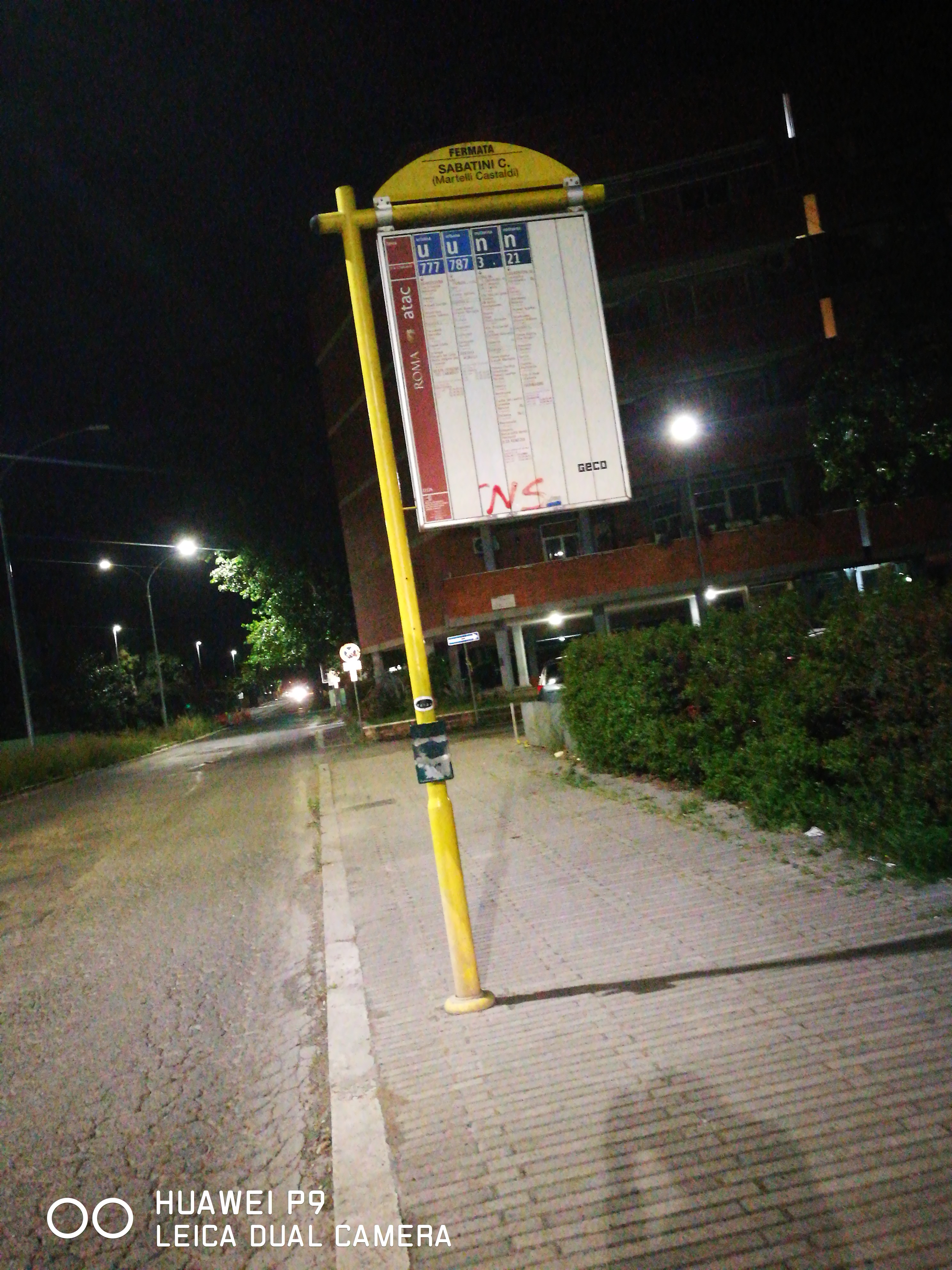 Taken by Davide M.
See Sabatini C./Martelli Castaldi stop, Roma, on the map
Public transit to Sabatini C./Martelli Castaldi stop (ID: 72124) in Roma
Looking for directions to Sabatini C./Martelli Castaldi in Roma, Italy?
Download the Moovit App to find the current schedule and step-by-step directions for Bus, Metro or Train routes that pass through Sabatini C./Martelli Castaldi.
Looking for the nearest stops closest to Sabatini C./Martelli Castaldi ? Check out this list of closest stops to your destination: Sabatini C./Martelli Castaldi; Indian Ocean/Decima; Decima/Calcutta; Ostiense/Tor Di Valle Station (RL); EUR Palasport; Tor Di Valle.
Bus: 777, 787, NME, N705, 778, 712, C01, FC2 BUS.Train: FC2.Metro: B.
We make riding on public transit to Sabatini C./Martelli Castaldi easy, which is why over 1.7 billion users, including users in Roma trust Moovit as the best app for public transit.
Use the app to navigate to popular places including to the airport, hospital, stadium, grocery store, mall, coffee shop, school, college, and university.
Sabatini C./Martelli Castaldi stop’s code is 72124
The first line to this stop is N705, at 3:10 AM, and the last line is NME at 2:38 AM.
Piazza Francesco Vannetti Donnini, Roma, Italy
This stop serves BIS and ATAC’s lines
- Sabatini C./Martelli Castaldi,
- Indian Ocean/Decima,
- Decima/Calcutta,
- Ostiense/Tor Di Valle Station (RL)
Bus stops near Sabatini C./Martelli Castaldi stop
- EUR Palasport
Metro station near Sabatini C./Martelli Castaldi station
- Tor Di Valle
Train station near Sabatini C./Martelli Castaldi station
- Ardea | Old Pontina Road Km 35.600,
- Monterotondo | Salaria Street (Piedicosta),
- Terme Dei Papi,
- Nemea/Delphic Games,
- Monte Capre/Orti Magliana,
- Giorgio Giorgis Street, 164,
- Gianicolo Pass/Medical Center,
- Roma Termini (East Platforms),
- Largo Pugliese,
- Minturno-Scauri,
- Trieste/Trento,
- Subaugusta (Metro A),
- Sora | Railway Station,
- Lungotevere Fiorentini/Paoli,
- Rhodesia/St. Eugenio (Hospital),
- Val Di Lanzo,
- Piazza Di Porta Maggiore,
- Boselli,
- Gianicolo Passage/Villa Corsini,
- Nomentana/Villa Torlonia
Popular public transit stations in Roma
Get around Roma by public transit!
Traveling around Roma has never been so easy. See step by step directions as you travel to any attraction, street or major public transit station. View bus and train schedules, arrival times, service alerts and detailed routes on a map, so you know exactly how to get to anywhere in Roma.
When traveling to any destination around Roma use Moovit's Live Directions with Get Off Notifications to know exactly where and how far to walk, how long to wait for your line, and how many stops are left. Moovit will alert you when it's time to get off — no need to constantly re-check whether yours is the next stop.
Wondering how to use public transit in Roma or how to pay for public transit in Roma? Moovit public transit app can help you navigate your way with public transit easily, and at minimum cost. It includes public transit fees, ticket prices, and costs. Looking for a map of Roma public transit lines? Moovit public transit app shows all public transit maps in Roma with all Bus, Train, Metro, Light Rail, Ferry, Funicular and Gondola routes and stops on an interactive map.
Rome and Lazio has 7 transit type(s), including: Bus, Train, Metro, Light Rail, Ferry, Funicular and Gondola, operated by several transit agencies, including ATAC, Cotral, Trenitalia, Troiani Transportation Services, BIS, ATR Mobility, Tuscia, Shuttle, Seatour, Troiani Bus Lines, CSC Mobility, Terravision, ATRAL, Tambus and Sitbus