How to get to Sabores do Brasil by bus?
Click on the bus route to see step by step directions with maps, line arrival times and updated time schedules.
From Parque Aquatico Amarante - Aqua Aventura, Amarante
227 minFrom Alijó, Alijó
256 minFrom Estação Ferroviária da Régua, Peso da Régua e Godim
83 minFrom Aquaplay Complexo Piscinas, Regadas
574 minFrom Parque Aquático de Amarante, Amarante
225 minFrom Hospital de Amarante ( Centro Hospitalar Tâmega e Sousa, EPE ), Amarante
100 min
Bus stops near Sabores do Brasil in Vila Real
Bus lines to Sabores do Brasil in Vila Real
What are the closest stations to Sabores do Brasil?
The closest stations to Sabores do Brasil are:
- Abambres is 182 meters away, 3 min walk.
- R. Teixeira M. e Castro is 520 meters away, 7 min walk.
Which bus lines stop near Sabores do Brasil?
These bus lines stop near Sabores do Brasil: 1, 9404, C-4019, IR004.
What’s the nearest bus station to Sabores do Brasil in Vila Real?
The nearest bus station to Sabores do Brasil in Vila Real is Abambres. It’s a 3 min walk away.
What time is the first bus to Sabores do Brasil in Vila Real?
The 1 is the first bus that goes to Sabores do Brasil in Vila Real. It stops nearby at 7:26 AM.
What time is the last bus to Sabores do Brasil in Vila Real?
The N is the last bus that goes to Sabores do Brasil in Vila Real. It stops nearby at 10:32 PM.
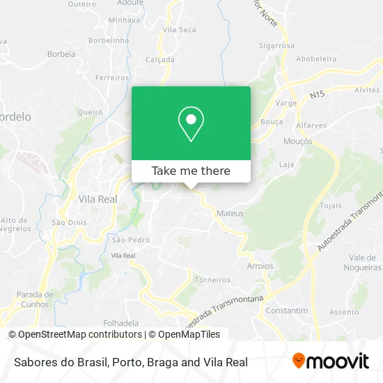
See Sabores do Brasil, Vila Real, on the map
Public Transit to Sabores do Brasil in Vila Real
Wondering how to get to Sabores do Brasil in Vila Real? Moovit helps you find the best way to get to Sabores do Brasil with step-by-step directions from the nearest public transit station.
Moovit provides free maps and live directions to help you navigate through your city. View schedules, routes, timetables, and find out how long does it take to get to Sabores do Brasil in real time.
Looking for the nearest stop or station to Sabores do Brasil? Check out this list of stops closest to your destination: Abambres; R. Teixeira M. e Castro.
Bus: 1, 9404, C-4019, IR004, N, 2.
Want to see if there’s another route that gets you there at an earlier time? Moovit helps you find alternative routes or times. Get directions from and directions to Sabores do Brasil easily from the Moovit App or Website.
We make riding to Sabores do Brasil easy, which is why over 1.5 million users, including users in Vila Real, trust Moovit as the best app for public transit. You don’t need to download an individual bus app or train app, Moovit is your all-in-one transit app that helps you find the best bus time or train time available.
For information on prices of bus and train, costs and ride fares to Sabores do Brasil, please check the Moovit app.
Use the app to navigate to popular places including to the airport, hospital, stadium, grocery store, mall, coffee shop, school, college, and university.
Sabores do Brasil Address: Rua Gaspar Sameiro street in Vila Real
- Santander,
- Escola Básica do 1. Ciclo N 2 de Mateus,
- Claudino Ferreira Gonçalves,
- Talho Villa Sol,
- Padaria Serrana,
- Restaurante Maria do Carmo,
- E.S. Vila Real Abambres,
- Palpite Mágico,
- Padaria Pastelaria - Matrafão Lda,
- José Pereira G Rosa,
- Urbanização Villa Sol,
- Análises Clínicas - Germano de Sousa,
- Bairro da Pimenta,
- Bundinha Seca - Creche Infantil,
- Cooperativa Agrícola de Vila Real,
- Sapataria Carocha,
- Bloco F,
- Auto Barradas - Reparação Automóvel,
- Coimbra B Café/Snack-Bar,
- Piscina do Boque
Places Near Sabores do Brasil (Vila Real)
- Arrábida Shopping, Santa Marinha e São Pedro da Afurada,
- Hospital Santos Silva, Vila Nova De Gaia,
- Hospital da Prelada, Ramalde,
- Espinho, Espinho,
- Parque Aquatico Amarante - Aqua Aventura, Amarante,
- Zoo Santo Inácio, Vila Nova De Gaia,
- VILA do CONDE PORTO FASHION OUTLET, Modivas,
- Valongo, Valongo,
- Leça da Palmeira, Matosinhos e Leça da Palmeira,
- Avintes, Vila Nova De Gaia,
- Rua Calouste Gulbenkian, Lordelo do Ouro e Massarelos,
- El Corte Inglés de Gaia, Mafamude e Vilar do Paraíso,
- Palácio de Cristal, Lordelo do Ouro e Massarelos,
- MAR Shopping, Matosinhos e Leça da Palmeira,
- Senhor de Matosinhos, Matosinhos e Leça da Palmeira,
- Maia, Maia,
- Hospital de Santo António, Cedofeita, Santo Ildefonso, Sé, Miragaia, São Nicolau e Vitória,
- Exponor, Matosinhos e Leça da Palmeira,
- Canidelo, Vila Nova De Gaia,
- Acesso ao Shopping Parque Nascente, Campanhã
How to get to popular places in Porto, Braga and Vila Real with public transit
Get around Vila Real by public transit!
Traveling around Vila Real has never been so easy. See step by step directions as you travel to any attraction, street or major public transit station. View bus and train schedules, arrival times, service alerts and detailed routes on a map, so you know exactly how to get to anywhere in Vila Real.
When traveling to any destination around Vila Real use Moovit's Live Directions with Get Off Notifications to know exactly where and how far to walk, how long to wait for your line, and how many stops are left. Moovit will alert you when it's time to get off — no need to constantly re-check whether yours is the next stop.
Wondering how to use public transit in Vila Real or how to pay for public transit in Vila Real? Moovit public transit app can help you navigate your way with public transit easily, and at minimum cost. It includes public transit fees, ticket prices, and costs. Looking for a map of Vila Real public transit lines? Moovit public transit app shows all public transit maps in Vila Real with all Bus, Train, Metro, Ferry, Funicular and Gondola routes and stops on an interactive map.
Porto, Braga and Vila Real has 6 transit type(s), including: Bus, Train, Metro, Ferry, Funicular and Gondola, operated by several transit agencies, including Metro do Porto, Metro do Porto - Metrobus, CP - Comboios de Portugal, STCP, UNIR Mobilidade da Area Metropolitana do Porto, Getbus - Aerobus, Mobiave, Valpibus, TUB - Transportes Urbanos de Braga, TuViana, Guimabus, Ave Mobilidade, Cávado Mobilidade, Transdev and Câmara Municipal de Santo Tirso