How to get to Sacara by bus?
Click on the bus route to see step by step directions with maps, line arrival times and updated time schedules.
From Hadassah Mount Scopus, Jerusalem
30 minFrom Magic Kass, Ma'ale Adumim
61 minFrom Pisgat Zeev, Jerusalem
28 minFrom Mishor Adumim, Ma'ale Adumim
44 minFrom Central Command, Jerusalem
37 minFrom Telz Stone, Kiryat Ye'arim
38 minFrom HaRtom, Jerusalem
28 minFrom Kiftzuba, Tzova
50 minFrom Magic Kass, Jerusalem
68 minFrom Herzog Hospital, Jerusalem
30 min
Bus stops near Sacara in Jerusalem
Light Rail stations near Sacara in Jerusalem
- Light Rail City Hall Station, 12 min walk,VIEW
Shuttle station near Sacara in Jerusalem
- Ministry of Finance, 46 min walk,VIEW
Bus lines to Sacara in Jerusalem
- 10, Mount Herzl Light Rail Station,VIEW
- 15, HaOman/Baram,VIEW
- 30, Gilo Terminal/HaMargalit,VIEW
- 34, HaOman/Baram,VIEW
- 49, Hebron Road/Rozmarin,VIEW
- 95, Yad Vashem,VIEW
- 102, Jerusalem Central Station/Yafo,VIEW
- 103, HaOman/Baram,VIEW
- 106, Jerusalem Central Station/Yafo,VIEW
- 108, Harry Truman/Golda Meir,VIEW
- 510, Rav HaHovel/Adam,VIEW
- 97, Jerusalem,VIEW
- 850, Marinov A,VIEW
- 5, Homat Shmuel Terminal,VIEW
- 12, Main Entrance/Hadassah Ein Kerem,VIEW
- 30A, Mount Scopus Terminal/Martin Buber,VIEW
- 105, Givat Ze'ev,VIEW
- 124, Jerusalem,VIEW
- 125, Jerusalem,VIEW
- 90, Rav HaHovel/Adam,VIEW
What are the closest stations to Sacara?
The closest stations to Sacara are:
- Hadar Mall/Pierre Koenig is 31 meters away, 1 min walk.
- Poalei Tzedek is 199 meters away, 3 min walk.
- HaSadna/Pierre Koenig is 297 meters away, 5 min walk.
- Pierre Koenig/Helez is 430 meters away, 6 min walk.
- HaOman/Building Center is 572 meters away, 8 min walk.
- Light Rail City Hall Station is 870 meters away, 12 min walk.
- Ministry of Finance is 3565 meters away, 46 min walk.
Which bus lines stop near Sacara?
These bus lines stop near Sacara: 15, 34, 49, 90.
What’s the nearest light rail station to Sacara in Jerusalem?
The nearest light rail station to Sacara in Jerusalem is Light Rail City Hall Station. It’s a 12 min walk away.
What’s the nearest bus station to Sacara in Jerusalem?
The nearest bus station to Sacara in Jerusalem is Hadar Mall/Pierre Koenig. It’s a 1 min walk away.
What time is the first light rail to Sacara in Jerusalem?
The 1 is the first light rail that goes to Sacara in Jerusalem. It stops nearby at 5:18 AM.
What time is the last light rail to Sacara in Jerusalem?
The 1 is the last light rail that goes to Sacara in Jerusalem. It stops nearby at 12:33 AM.
What time is the first bus to Sacara in Jerusalem?
The 8 Talpiot <> King David <> Talpiot is the first bus that goes to Sacara in Jerusalem. It stops nearby at 5:12 AM.
What time is the last bus to Sacara in Jerusalem?
The 15 is the last bus that goes to Sacara in Jerusalem. It stops nearby at 1:20 AM.
What time is the first shuttle to Sacara in Jerusalem?
The Shuttle is the first shuttle that goes to Sacara in Jerusalem. It stops nearby at 6:02 PM.
What time is the last shuttle to Sacara in Jerusalem?
The Shuttle is the last shuttle that goes to Sacara in Jerusalem. It stops nearby at 8:03 PM.
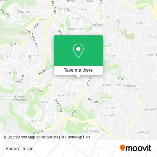
See Sacara, Jerusalem, on the map
Public Transit to Sacara in Jerusalem
Wondering how to get to Sacara in Jerusalem? Moovit helps you find the best way to get to Sacara with step-by-step directions from the nearest public transit station.
Moovit provides free maps and live directions to help you navigate through your city. View schedules, routes, timetables, and find out how long does it take to get to Sacara in real time.
Looking for the nearest stop or station to Sacara? Check out this list of stops closest to your destination: Hadar Mall/Pierre Koenig; Poalei Tzedek; HaSadna/Pierre Koenig; Pierre Koenig/Helez; HaOman/Building Center; Light Rail City Hall Station; Ministry of Finance.
Bus: 15, 34, 49, 90, 10, 30, 97, 850, 5, 12, 30A, 105, 124.Shuttle: Shuttle.
Want to see if there’s another route that gets you there at an earlier time? Moovit helps you find alternative routes or times. Get directions from and directions to Sacara easily from the Moovit App or Website.
We make riding to Sacara easy, which is why over 1.5 million users, including users in Jerusalem, trust Moovit as the best app for public transit. You don’t need to download an individual bus app or train app, Moovit is your all-in-one transit app that helps you find the best bus time or train time available.
For information on prices of bus, costs and ride fares to Sacara, please check the Moovit app.
Use the app to navigate to popular places including to the airport, hospital, stadium, grocery store, mall, coffee shop, school, college, and university.
Sacara Address: גנרל קניג פייר אזור תעשייה תלפיות, 90000 ירושלים street in Jerusalem
- Carolina Lemke,
- Yedid: the Association for Community Empowerment,
- Beauty and the Beast,
- A.L.M.,
- Royal Saturday,
- Sandleria,
- Smart Phone,
- SIXT,
- Osnat,
- Hair Stories,
- Sweets Kiosk,
- Home Style,
- Il Makiage,
- Jerusalem Nuts,
- Inventions and Patents in the Kitchen,
- Puzzle Quest Jerusalem,
- Millennium Intersection,
- Baggage Train,
- Mister Fix,
- The Red Pirate
Places Near Sacara (Jerusalem)
- Expo Tel Aviv, Tel Aviv-Yafo,
- Kashcafe, Kiryat Ata,
- Bloomfield Stadium, Tel Aviv-Yafo,
- Ichilov Hospital, Tel Aviv-Yafo,
- HaKotel, Jerusalem,
- Carmel Market, Tel Aviv-Yafo,
- Tel HaShomer North Gate, Ramat Gan,
- Azrieli, Tel Aviv-Yafo,
- Menora Mivtachim Arena, Tel Aviv-Yafo,
- Assuta Hospital - Ramat HaHayal, Tel Aviv-Yafo,
- Beilinson Hospital, Petah Tikva,
- Bislach 17, Ramat Negev Regional Council,
- Gideon Camp - Military Base 7, Emek Lod Regional Council,
- Moovit Office, Nes Ziona,
- Ramat Gan Stadium, Ramat Gan,
- Dizengoff Center, Tel Aviv-Yafo,
- Tel Hashomer Base, Ramat Gan,
- Yarkon Park, Tel Aviv-Yafo,
- Southern Medical Center, Ramat Negev Regional Council,
- Glilot Complex, Hof HaSharon Regional Council
How to get to popular places in Israel with public transit
Get around Jerusalem by public transit!
Traveling around Jerusalem has never been so easy. See step by step directions as you travel to any attraction, street or major public transit station. View bus and train schedules, arrival times, service alerts and detailed routes on a map, so you know exactly how to get to anywhere in Jerusalem.
When traveling to any destination around Jerusalem use Moovit's Live Directions with Get Off Notifications to know exactly where and how far to walk, how long to wait for your line, and how many stops are left. Moovit will alert you when it's time to get off — no need to constantly re-check whether yours is the next stop.
Wondering how to use public transit in Jerusalem or how to pay for public transit in Jerusalem? Moovit public transit app can help you navigate your way with public transit easily, and at minimum cost. It includes public transit fees, ticket prices, and costs. Looking for a map of Jerusalem public transit lines? Moovit public transit app shows all public transit maps in Jerusalem with all Bus, Israel Railways, Light Rail, Carmelit / Rachbalit and Shuttle routes and stops on an interactive map.
Israel has 5 transit type(s), including: Bus, Israel Railways, Light Rail, Carmelit / Rachbalit and Shuttle, operated by several transit agencies, including Dan, Tel Aviv Light Rail - Tevel - Red Line, Israel Railways, Egged, Metropoline, Kavim, Electra Afikim, Nateev Express, Extra, Extra Jerusalem, Jerusalem Light Rail - Kfir, Egged Jerusalem Envelope Route, Dan Badarom, Dan Beer-Sheva and Electra Afikim Transport
