How to get to Sacred Rituals by bus?
Click on the bus route to see step by step directions with maps, line arrival times and updated time schedules.
From Sinai Hospital, Baltimore
56 minFrom Loyola University Maryland, Baltimore
59 minFrom I-695 @ Exit 18 (Liberty Rd/MD 26), Baltimore County
51 minFrom Johns Hopkins Bayview Medical Center, Baltimore
58 minFrom Good Samaritan Hospital, Baltimore
67 minFrom Eastern Ave (eastern avenue and dundalk av), Baltimore
51 minFrom Baltimore Polytechnic Institute, Baltimore
59 minFrom Randallstown, MD, Baltimore County
60 minFrom Baltimore Soundstage, Baltimore
35 minFrom NSA Friendship Annex (FANX), Anne Arundel County
73 min
How to get to Sacred Rituals by train?
Click on the train route to see step by step directions with maps, line arrival times and updated time schedules.
Bus stops near Sacred Rituals in Baltimore
Train station near Sacred Rituals in Baltimore
- West Baltimore Marc Nb, 17 min walk,VIEW
Metro station near Sacred Rituals in Baltimore
- Penn North Metro, 20 min walk,VIEW
Bus lines to Sacred Rituals in Baltimore
What are the closest stations to Sacred Rituals?
The closest stations to Sacred Rituals are:
- Edmondson Ave & Mt Holly St Wb is 464 yards away, 6 min walk.
- Wildwood Pkwy & Gelston Dr Sb is 521 yards away, 7 min walk.
- Edmondson Ave & Allendale St Wb is 585 yards away, 8 min walk.
- West Baltimore Marc Nb is 1367 yards away, 17 min walk.
- Penn North Metro is 1669 yards away, 20 min walk.
Which bus lines stop near Sacred Rituals?
These bus lines stop near Sacred Rituals: 40, CITYLINK BLUE.
Which train line stops near Sacred Rituals?
MARC (Inbound - Penn)
What’s the nearest metro station to Sacred Rituals in Baltimore?
The nearest metro station to Sacred Rituals in Baltimore is Penn North Metro. It’s a 20 min walk away.
What’s the nearest train station to Sacred Rituals in Baltimore?
The nearest train station to Sacred Rituals in Baltimore is West Baltimore Marc Nb. It’s a 17 min walk away.
What’s the nearest bus station to Sacred Rituals in Baltimore?
The nearest bus station to Sacred Rituals in Baltimore is Edmondson Ave & Mt Holly St Wb. It’s a 6 min walk away.
What time is the first metro to Sacred Rituals in Baltimore?
The METRO is the first metro that goes to Sacred Rituals in Baltimore. It stops nearby at 5:01 AM.
What time is the last metro to Sacred Rituals in Baltimore?
The METRO is the last metro that goes to Sacred Rituals in Baltimore. It stops nearby at 12:18 AM.
What time is the first train to Sacred Rituals in Baltimore?
The MARC is the first train that goes to Sacred Rituals in Baltimore. It stops nearby at 4:39 AM.
What time is the last train to Sacred Rituals in Baltimore?
The MARC is the last train that goes to Sacred Rituals in Baltimore. It stops nearby at 10:53 PM.
What time is the first bus to Sacred Rituals in Baltimore?
The CITYLINK BLUE is the first bus that goes to Sacred Rituals in Baltimore. It stops nearby at 3:35 AM.
What time is the last bus to Sacred Rituals in Baltimore?
The CITYLINK BLUE is the last bus that goes to Sacred Rituals in Baltimore. It stops nearby at 3:25 AM.
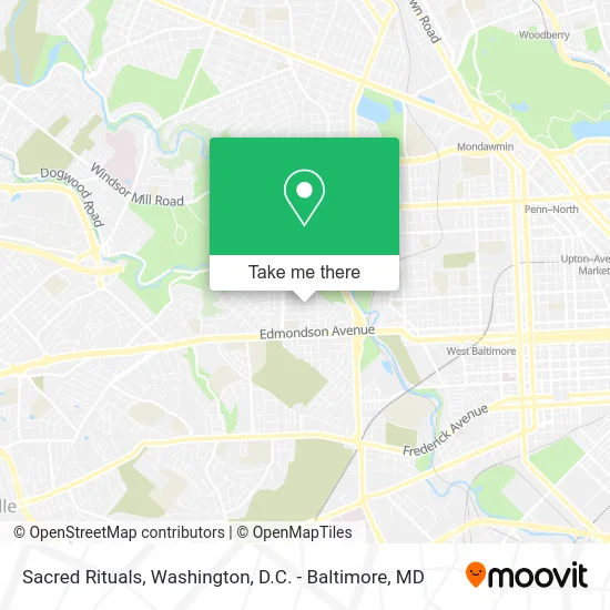
See Sacred Rituals, Baltimore, on the map
Public Transit to Sacred Rituals in Baltimore
Wondering how to get to Sacred Rituals in Baltimore? Moovit helps you find the best way to get to Sacred Rituals with step-by-step directions from the nearest public transit station.
Moovit provides free maps and live directions to help you navigate through your city. View schedules, routes, timetables, and find out how long does it take to get to Sacred Rituals in real time.
Looking for the nearest stop or station to Sacred Rituals? Check out this list of stops closest to your destination: Edmondson Ave & Mt Holly St Wb; Wildwood Pkwy & Gelston Dr Sb; Edmondson Ave & Allendale St Wb; West Baltimore Marc Nb; Penn North Metro.
Bus: 40, CITYLINK BLUE, 38, 77, 34.Train: MARC.Metro: METRO.
Want to see if there’s another route that gets you there at an earlier time? Moovit helps you find alternative routes or times. Get directions from and directions to Sacred Rituals easily from the Moovit App or Website.
We make riding to Sacred Rituals easy, which is why over 1.5 million users, including users in Baltimore, trust Moovit as the best app for public transit. You don’t need to download an individual bus app or train app, Moovit is your all-in-one transit app that helps you find the best bus time or train time available.
For information on prices of bus, light rail and train, costs and ride fares to Sacred Rituals, please check the Moovit app.
Use the app to navigate to popular places including to the airport, hospital, stadium, grocery store, mall, coffee shop, school, college, and university.
Sacred Rituals Address: 3800 Woodridge Rd Baltimore, MD 21229 street in Baltimore
- Mt Holly St,
- Williams Willie J Pastor,
- Edmondson Village,
- 949 Mt Holly St,
- Dorothy's Cleaning Services,
- Hinson Enterprises & Assoc,
- Hilton Janitorial Services,
- Edgewood Neighborhood Association,
- Brandsons Carpet & Upholstry Cleaning,
- Vasquez Glass Services,
- Bella Ma Catering,
- 3812 Harlem Ave,
- Edmondson,
- MD Baltimore,
- 1106 Mt Holly St,
- Eye Candy Nail and Day Spa,
- Harlem Ave & Mount Holly-Allendale 2,
- Gwynns Falls - Leakin Park,
- Harlem Ave (harlem and allendale),
- Saint Bernardines School
Places Near Sacred Rituals (Baltimore)
- National Museum of African American History and Culture, Washington,
- Amazon Hq2, Arlington County,
- National Theatre, Washington,
- Camden Yards, Baltimore,
- The Anthem, Washington,
- Rock Creek Tennis Center, Washington,
- Washington DC VA Medical Center, Washington,
- Basilica of the National Shrine, Washington,
- Museum Of The Bible, Washington,
- Pennsylvania Ave NW (3rd st and pennsylvania), Washington,
- M&T Bank Stadium, Baltimore,
- Washington National Cathedral, Washington,
- Sibley Memorial Hospital, Washington,
- Westfield Montgomery Mall, Montgomery County,
- National Zoo, Washington,
- Warner Theatre, Washington,
- Marriott Marquis Washington, DC, Washington,
- PG Mall, Prince George's County,
- Capital One Arena, Washington,
- Georgetown, Washington
How to get to popular places in Washington, D.C. - Baltimore, MD with public transit
Get around Baltimore by public transit!
Traveling around Baltimore has never been so easy. See step by step directions as you travel to any attraction, street or major public transit station. View bus and train schedules, arrival times, service alerts and detailed routes on a map, so you know exactly how to get to anywhere in Baltimore.
When traveling to any destination around Baltimore use Moovit's Live Directions with Get Off Notifications to know exactly where and how far to walk, how long to wait for your line, and how many stops are left. Moovit will alert you when it's time to get off — no need to constantly re-check whether yours is the next stop.
Wondering how to use public transit in Baltimore or how to pay for public transit in Baltimore? Moovit public transit app can help you navigate your way with public transit easily, and at minimum cost. It includes public transit fees, ticket prices, and costs. Looking for a map of Baltimore public transit lines? Moovit public transit app shows all public transit maps in Baltimore with all Bus, Train, Metro, Light Rail and Ferry routes and stops on an interactive map.
Washington, D.C. - Baltimore, MD has 5 transit type(s), including: Bus, Train, Metro, Light Rail and Ferry, operated by several transit agencies, including WMATA, Montgomery County Ride On, Fairfax Connector, TheBus, PRTC, DASH - Alexandria, Arlington Transit (ART), RTA of Central Maryland, MDOT MTA, MDOT MTA Light RailLink, MDOT MTA Commuter Bus, MDOT MTA Local Bus, FXBGO!, Virginia Railway Express (VRE) and MARC