How to get to Safe by train?
Click on the train route to see step by step directions with maps, line arrival times and updated time schedules.
From Krankenhaus Freudenstadt, Vereinbarte Verwaltungsgemeinschaft Freudenstadt
277 minFrom Lotto-Annahmestelle, Schopfheim
135 minFrom Parkplatz Bauhaus, Verwaltungsgemeinschaft Offenburg
101 minFrom Stadtwerke Villingen-Schwenningen GmbH, Villingen-Schwenningen
175 minFrom Hotel Palmenwald, Vereinbarte Verwaltungsgemeinschaft Freudenstadt
199 minFrom Klinik Hohenfreudenstadt, Vereinbarte Verwaltungsgemeinschaft Freudenstadt
283 min
Light Rail stations near Safe in Stuttgart
- Freiburg, Geschwister-Scholl-Platz, 2 min walk,VIEW
Bus stops near Safe in Stuttgart
Bus lines to Safe in Stuttgart
- 10, Freiburg, Paduaallee Bstg 3 - Freiburg, Bissierstraße Bstg 5,VIEW
- 15, Freiburg, Europaplatz Bstg 4 - Freiburg, Gundelfinger Straße Bstg 4,VIEW
- 19, Freiburg, Paduaallee Bstg 11 - Freiburg, Lehen Ziegelei,VIEW
- 22, Freiburg, Gundelfinger Straße Bstg 6 - Freiburg, Bissierstraße Bstg 5,VIEW
- 23, Freiburg, Gundelfinger Straße Bstg 7 - Freiburg Hauptbahnhof Bstg 4,VIEW
- 24, Gundelfingen (Brsg) Bahnhof - Freiburg, Munzinger Straße Bstg 5,VIEW
- 25, Freiburg, Munzinger Straße Bstg 2 - March Hugstetten Bahnhof Bstg 2,VIEW
- 33, Freiburg, Unterdorf - Freiburg, Munzinger Straße Bstg 4,VIEW
- 33, Freiburg, Munzinger Straße Bstg 4 - Freiburg, Unterdorf,VIEW
- 33, Freiburg, Gewerbestraße - Freiburg, Munzinger Straße Bstg 3,VIEW
- 36, Freiburg, St.-Agatha Weg - Freiburg, Moosweiher Bstg 3,VIEW
- 24, Gundelfingen (Brsg) Bahnhof,VIEW
- 32, Munzingen, Windhäuslegasse,VIEW
- 11, Freiburg Hauptbahnhof Bstg 14 - Freiburg, Munzinger Straße Bstg 12,VIEW
- 14, Freiburg, Munzinger Straße Bstg 9 - Freiburg, Lehener Straße,VIEW
- 7240, Freiburg Hauptbahnhof Bstg 9 - Bad Krozingen Bahnhof Bstg 4,VIEW
- 7240, Staufen (Brsg) Bahnhof - Freiburg Hauptbahnhof Bstg 11,VIEW
- 7240, Freiburg Hauptbahnhof Bstg 10 - Staufen Süd / Gymnasium,VIEW
- 7240, Bad Krozingen Bahnhof Bstg 1 - Freiburg Hauptbahnhof Bstg 11,VIEW
- 3, Freiburg, Munzinger Straße Bstg 1 - Freiburg, Gundelfinger Straße Bstg 3,VIEW
What are the closest stations to Safe?
The closest stations to Safe are:
- Freiburg, Geschwister-Scholl-Platz is 75 meters away, 2 min walk.
- Freiburg, Maria-Von-Rudloff-Platz Bstg 2 is 295 meters away, 4 min walk.
- Freiburg, Maria-Von-Rudloff-Platz Bstg 1 is 328 meters away, 5 min walk.
- Freiburg, Moosackerweg is 417 meters away, 6 min walk.
- Freiburg, Munzinger Straße is 520 meters away, 8 min walk.
Which train lines stop near Safe?
These train lines stop near Safe: RB 27, RB27, RE 7.
Which light rail line stops near Safe?
3 (Freiburg, Munzinger Straße)
What’s the nearest light rail station to Safe in Stuttgart?
The nearest light rail station to Safe in Stuttgart is Freiburg, Geschwister-Scholl-Platz. It’s a 2 min walk away.
What’s the nearest bus station to Safe in Stuttgart?
The nearest bus station to Safe in Stuttgart is Freiburg, Maria-Von-Rudloff-Platz Bstg 2. It’s a 4 min walk away.
What time is the first light rail to Safe in Stuttgart?
The 5 is the first light rail that goes to Safe in Stuttgart. It stops nearby at 5:01 AM.
What time is the last light rail to Safe in Stuttgart?
The 5 is the last light rail that goes to Safe in Stuttgart. It stops nearby at 1:25 AM.
What time is the first bus to Safe in Stuttgart?
The 36 is the first bus that goes to Safe in Stuttgart. It stops nearby at 4:20 AM.
What time is the last bus to Safe in Stuttgart?
The 17 is the last bus that goes to Safe in Stuttgart. It stops nearby at 1:37 AM.
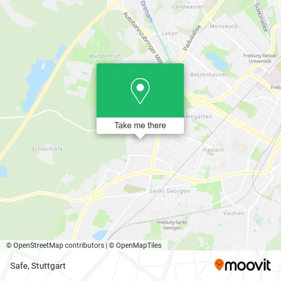
See Safe, Stuttgart, on the map
Public Transit to Safe in Stuttgart
Wondering how to get to Safe in Stuttgart? Moovit helps you find the best way to get to Safe with step-by-step directions from the nearest public transit station.
Moovit provides free maps and live directions to help you navigate through your city. View schedules, routes, timetables, and find out how long does it take to get to Safe in real time.
Looking for the nearest stop or station to Safe? Check out this list of stops closest to your destination: Freiburg; Freiburg; Freiburg; Freiburg; Freiburg.
Train: RB 27, RB27, RE 7.Light Rail: 3.Bus: 10, 15, 19, 22, 23, 24, 32, 11, 14, 7240, 7240, 7240, 3, 17, 18, 21, 27.
Want to see if there’s another route that gets you there at an earlier time? Moovit helps you find alternative routes or times. Get directions from and directions to Safe easily from the Moovit App or Website.
We make riding to Safe easy, which is why over 1.5 million users, including users in Stuttgart, trust Moovit as the best app for public transit. You don’t need to download an individual bus app or train app, Moovit is your all-in-one transit app that helps you find the best bus time or train time available.
For information on prices of train, light rail and bus, costs and ride fares to Safe, please check the Moovit app.
Use the app to navigate to popular places including to the airport, hospital, stadium, grocery store, mall, coffee shop, school, college, and university.
Safe Address: Rimsinger Weg 2 Sankt Georgen, 79111 Freiburg im Breisgau street in Stuttgart
- Hoch & Maier,
- Deutsches Rotes Kreuz,
- Safe Marketing,
- Hartmann + Stanyak Bürosysteme,
- Werbung & Visuelles Marketing,
- Systemlösungen für Ihr Büro,
- Micropelt: Micropelt,
- TÜV Süd Service-Center,
- Peter Tritschler,
- Genswein Galvanik,
- T Online,
- Ramstalhof,
- Tüv Süd,
- Athanasopoulos,
- Nif,
- Leber Satz & Druck, Inh. Harald Leber Druckerei,
- Winterhalter Stahlbau,
- Adler Bau Service,
- MB Reifenservice,
- Nabu Bezirksverband Südbaden
Places Near Safe (Stuttgart)
- Porsche Museum, Zuffenhausen,
- Hanns-Martin-Schleyer-Halle (Stuttgart Hans-Martin-Schleyerhalle), Bad Cannstatt,
- Hauptbahnhof Stuttgart, Stuttgart-Mitte,
- Im Wizemann (Halle), Bad Cannstatt,
- Klinikum Stuttgart - Katharinenhospital, Stuttgart-Mitte,
- Schleyerhalle, Bad Cannstatt,
- Wilhelma (U-Bahn Wilhelma), Bad Cannstatt,
- Geilhaus Haus 33a, Reutlingen-Betzingen,
- Mettingen Eros-Center Puff Laufhaus, Esslingen Am Neckar,
- Gleis 101/102 (tief), Stuttgart-Mitte,
- Mercedes-Benz Museum (Mercedes Museum Stuttgart), Bad Cannstatt,
- FlixBus Haltestelle, Stuttgart,
- Gasometer Pforzheim, Pforzheim,
- Waldfriedhof, Degerloch,
- SI-Centrum, Möhringen,
- Mercedes-Benz Museum, Bad Cannstatt,
- Pariser Platz Stuttgart, Stuttgart-Mitte,
- Hanns-Martin-Schleyer-Halle, Bad Cannstatt,
- Porsche-Arena, Bad Cannstatt,
- Marmorsaal Im Weissenburgpark, Stuttgart-Süd
How to get to popular places in Stuttgart with public transit
Get around Stuttgart by public transit!
Traveling around Stuttgart has never been so easy. See step by step directions as you travel to any attraction, street or major public transit station. View bus and train schedules, arrival times, service alerts and detailed routes on a map, so you know exactly how to get to anywhere in Stuttgart.
When traveling to any destination around Stuttgart use Moovit's Live Directions with Get Off Notifications to know exactly where and how far to walk, how long to wait for your line, and how many stops are left. Moovit will alert you when it's time to get off — no need to constantly re-check whether yours is the next stop.
Wondering how to use public transit in Stuttgart or how to pay for public transit in Stuttgart? Moovit public transit app can help you navigate your way with public transit easily, and at minimum cost. It includes public transit fees, ticket prices, and costs. Looking for a map of Stuttgart public transit lines? Moovit public transit app shows all public transit maps in Stuttgart with all Bus, Train, Subway, Light Rail, Ferry, S-Bahn and Funicular routes and stops on an interactive map.
Stuttgart has 7 transit type(s), including: Bus, Train, Subway, Light Rail, Ferry, S-Bahn and Funicular, operated by several transit agencies, including SSB - Stadtbahn, SSB, SSB - Seilbahn / Zacke, S-Bahn Stuttgart, Rhein-Neckar-Verkehr GmbH (rnv), Karlsruher Verkehrsverbund, DB AG, DB Regiobus BW, Arverio Baden-Württemberg GmbH, DB RegioNetz Verkehrs GmbH Westfrankenbahn, DB Regio AG Baden-Württemberg, Südwestdeutsche Verkehrs-AG, DB Regio AG Mitte Region Hessen, DB and Bodensee-Oberschwaben-Bahn
Public transit lines with stations closest to Safe in Stuttgart
Bus lines with stations closest to Safe in Stuttgart
Freiburg, Maria-Von-Rudloff-Platz Bstg 2
 10Freiburg, Paduaallee Bstg 3 - Freiburg, Bissierstraße Bstg 5
- 15Freiburg, Europaplatz Bstg 4 - Freiburg, Gundelfinger Straße Bstg 4
- 19Freiburg, Paduaallee Bstg 11 - Freiburg, Lehen Ziegelei
- 22Freiburg, Gundelfinger Straße Bstg 6 - Freiburg, Bissierstraße Bstg 5
- 23Freiburg, Gundelfinger Straße Bstg 7 - Freiburg Hauptbahnhof Bstg 4
Freiburg, Moosackerweg
- 11Freiburg Hauptbahnhof Bstg 14 - Freiburg, Munzinger Straße Bstg 12
- 14Freiburg, Munzinger Straße Bstg 9 - Freiburg, Lehener Straße
- 7240Freiburg Hauptbahnhof Bstg 9 - Bad Krozingen Bahnhof Bstg 4
- 7240Staufen (Brsg) Bahnhof - Freiburg Hauptbahnhof Bstg 11
- 7240Freiburg Hauptbahnhof Bstg 10 - Staufen Süd / Gymnasium
Freiburg, Munzinger Straße
- 3Freiburg, Munzinger Straße Bstg 1 - Freiburg, Gundelfinger Straße Bstg 3
- 17Freiburg, Laßbergstraße Bstg 4 - Freiburg, Molzhofsiedlung
- 18Freiburg, Langmatten - Freiburg, Laßbergstraße Bstg 4
- 21Freiburg, Dorfstraße Bstg 4 - Freiburg, Schauinslandbahn Talstation
- 27Freiburg, Europaplatz Bstg 4 - Freiburg, Richard-Strauss-Str.