How to get to Safe Harbor Christian Counseling by bus?
Click on the bus route to see step by step directions with maps, line arrival times and updated time schedules.
From Doctors Community Hospital, Prince George's County
73 minFrom Washington Nationals Youth Baseball Academy, Washington
92 minFrom New Carrollton MARC, Prince George's County
42 minFrom Hyattsville District Court, Prince George's County
81 minFrom Joint Base Andrews, Prince George's County
83 minFrom U.S. Census Bureau, Prince George's County
65 minFrom ZRZ, Prince George's County
41 minFrom Hyattsville, MD, Prince George's County
79 minFrom Costco, Washington
72 minFrom Bowie Town Center, Prince George's County
66 min
How to get to Safe Harbor Christian Counseling by metro?
Click on the metro route to see step by step directions with maps, line arrival times and updated time schedules.
Bus stops near Safe Harbor Christian Counseling in Prince George's County
Metro station near Safe Harbor Christian Counseling in Prince George's County
- Morgan Boulevard, 36 min walk,VIEW
Bus lines to Safe Harbor Christian Counseling in Prince George's County
What are the closest stations to Safe Harbor Christian Counseling?
The closest stations to Safe Harbor Christian Counseling are:
- Apollo Dr & Merchantile La is 39 yards away, 1 min walk.
- Lottsford Rd+Mccormick Dr is 151 yards away, 3 min walk.
- Mccormick Drive at Wayne Curry Building is 292 yards away, 4 min walk.
- Morgan Boulevard is 3059 yards away, 36 min walk.
Which bus lines stop near Safe Harbor Christian Counseling?
These bus lines stop near Safe Harbor Christian Counseling: P41, P52, P57.
Which metro lines stop near Safe Harbor Christian Counseling?
These metro lines stop near Safe Harbor Christian Counseling: BLUE, SILVER.
What’s the nearest bus station to Safe Harbor Christian Counseling in Prince George's County?
The nearest bus station to Safe Harbor Christian Counseling in Prince George's County is Apollo Dr & Merchantile La. It’s a 1 min walk away.
What time is the first metro to Safe Harbor Christian Counseling in Prince George's County?
The BLUE is the first metro that goes to Safe Harbor Christian Counseling in Prince George's County. It stops nearby at 4:54 AM.
What time is the last metro to Safe Harbor Christian Counseling in Prince George's County?
The SILVER is the last metro that goes to Safe Harbor Christian Counseling in Prince George's County. It stops nearby at 12:32 AM.
What time is the first bus to Safe Harbor Christian Counseling in Prince George's County?
The P41 is the first bus that goes to Safe Harbor Christian Counseling in Prince George's County. It stops nearby at 5:04 AM.
What time is the last bus to Safe Harbor Christian Counseling in Prince George's County?
The P41 is the last bus that goes to Safe Harbor Christian Counseling in Prince George's County. It stops nearby at 2:00 AM.
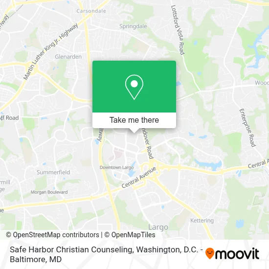
See Safe Harbor Christian Counseling, Prince George's County, on the map
Public Transit to Safe Harbor Christian Counseling in Prince George's County
Wondering how to get to Safe Harbor Christian Counseling in Prince George's County? Moovit helps you find the best way to get to Safe Harbor Christian Counseling with step-by-step directions from the nearest public transit station.
Moovit provides free maps and live directions to help you navigate through your city. View schedules, routes, timetables, and find out how long does it take to get to Safe Harbor Christian Counseling in real time.
Looking for the nearest stop or station to Safe Harbor Christian Counseling? Check out this list of stops closest to your destination: Apollo Dr & Merchantile La; Lottsford Rd+Mccormick Dr; Mccormick Drive at Wayne Curry Building; Morgan Boulevard.
Bus: P41, P52, P57, P5X.Metro: BLUE, SILVER.
Want to see if there’s another route that gets you there at an earlier time? Moovit helps you find alternative routes or times. Get directions from and directions to Safe Harbor Christian Counseling easily from the Moovit App or Website.
We make riding to Safe Harbor Christian Counseling easy, which is why over 1.7 million users, including users in Prince George's County, trust Moovit as the best app for public transit. You don’t need to download an individual bus app or train app, Moovit is your all-in-one transit app that helps you find the best bus time or train time available.
For information on prices of bus and metro, costs and ride fares to Safe Harbor Christian Counseling, please check the Moovit app.
Use the app to navigate to popular places including to the airport, hospital, stadium, grocery store, mall, coffee shop, school, college, and university.
Safe Harbor Christian Counseling Address: 1300 Mercantile Ln street in Prince George's County
- Kaiser Permanente (Kaiser Permanente Health Care),
- Staybridge Suites Washington DC East - Largo,
- Kaiser Permanente - Largo Medical Center,
- Jasper's in largo,md,
- UMUC Largo II,
- Largo Town Center,
- Ernest Everett Just Middle School,
- University Of Maryland Capital Region Medical Center,
- Golden Corral,
- Prince George's County Public (Board of Education of Prince George County, MD),
- Lake Arbor, MD,
- Largo Town Center Metro Station Parking - South Garage,
- AMC Magic Johnson Capital Center 12,
- Karma Lounge,
- St Joseph's Catholic Church (St Josephs Catholic Church),
- DoubleTree by Hilton Largo Washington DC,
- Futurecare Capital Region,
- Maryland DMV (Upper Marlboro DMV),
- Acclaim at Lake Largo,
- Largo / MD-202
Places Near Safe Harbor Christian Counseling (Prince George's County)
- The Anthem, Washington,
- Pennsylvania Ave NW (3rd st and pennsylvania), Washington,
- Washington National Cathedral, Washington,
- Basilica of the National Shrine, Washington,
- Washington DC VA Medical Center, Washington,
- National Theatre, Washington,
- National Zoo, Washington,
- Sibley Memorial Hospital, Washington,
- PG Mall, Prince George's County,
- Marriott Marquis Washington, DC, Washington,
- Warner Theatre, Washington,
- Camden Yards, Baltimore,
- Westfield Montgomery Mall, Montgomery County,
- Capital One Arena, Washington,
- Georgetown, Washington,
- Museum Of The Bible, Washington,
- Rock Creek Tennis Center, Washington,
- National Museum of African American History and Culture, Washington,
- Amazon Hq2, Arlington County,
- M&T Bank Stadium, Baltimore
How to get to popular places in Washington, D.C. - Baltimore, MD with public transit
Get around Prince George's County by public transit!
Traveling around Prince George's County has never been so easy. See step by step directions as you travel to any attraction, street or major public transit station. View bus and train schedules, arrival times, service alerts and detailed routes on a map, so you know exactly how to get to anywhere in Prince George's County.
When traveling to any destination around Prince George's County use Moovit's Live Directions with Get Off Notifications to know exactly where and how far to walk, how long to wait for your line, and how many stops are left. Moovit will alert you when it's time to get off — no need to constantly re-check whether yours is the next stop.
Wondering how to use public transit in Prince George's County or how to pay for public transit in Prince George's County? Moovit public transit app can help you navigate your way with public transit easily, and at minimum cost. It includes public transit fees, ticket prices, and costs. Looking for a map of Prince George's County public transit lines? Moovit public transit app shows all public transit maps in Prince George's County with all Bus, Train, Metro, Light Rail and Ferry routes and stops on an interactive map.
Washington, D.C. - Baltimore, MD has 5 transit type(s), including: Bus, Train, Metro, Light Rail and Ferry, operated by several transit agencies, including WMATA, Montgomery County Ride On, Fairfax Connector, TheBus, PRTC, DASH - Alexandria, Arlington Transit (ART), RTA of Central Maryland, MDOT MTA, MDOT MTA Light RailLink, MDOT MTA Commuter Bus, MDOT MTA Local Bus, FXBGO!, Virginia Railway Express (VRE) and MARC