How to get to Safe Home by bus?
Click on the bus route to see step by step directions with maps, line arrival times and updated time schedules.
From Volunteer Opportunities, Fort Wayne
142 minFrom Carboni, William J, Fort Wayne
29 minFrom Southtown Centre, Fort Wayne
28 minFrom Muddy River Run, Fort Wayne
25 minFrom DG Properties, Fort Wayne
33 minFrom Rudy Kachmann MD, Fort Wayne
147 minFrom Muscular Dystrophy Association, Fort Wayne
142 minFrom Lutheran Health Physicians, Fort Wayne
142 minFrom Russ Moore Transmission Specialist (Moore Transmission Service Parts), Fort Wayne
31 minFrom Vera Bradley, Fort Wayne
142 min
Bus stops near Safe Home in Fort Wayne
- Calhoun at Lewis, 2 min walk,VIEW
- Clinton at Lewis (Sb), 3 min walk,VIEW
- Central Station - Bay D, 5 min walk,VIEW
- Central Station - Bay C, 5 min walk,VIEW
- Central Station - Bay B, 6 min walk,VIEW
- Central Station - Bay G, 10 min walk,VIEW
- Central Station - Bay H, 10 min walk,VIEW
- Central Station - Bay E, 10 min walk,VIEW
- Central Station - Bay I, 10 min walk,VIEW
Bus lines to Safe Home in Fort Wayne
- 2G, Northwood Plaza,VIEW
- 4P, Harshman Hall,VIEW
- 6FP, Profit at Executive (Wb),VIEW
- 10NH, Central Station - Bay F,VIEW
- 1ARC, River Cove,VIEW
- 1N, Northcrest,VIEW
- 3C, Canterbury via PFW,VIEW
- 8GN, Glenbrook / Northrop,VIEW
- 1SS, Social Security Office,VIEW
- 1W, Hickory Creek Apartments,VIEW
- 4WL, Central Station - Bay C,VIEW
- 3VW, Central Station - Bay B,VIEW
- 7ANT, Southtown Centre (Sb),VIEW
- 8C, Southtown Centre (Sb),VIEW
- 6S, Central Station - Bay E,VIEW
- 9BT, Sandpoint at Allegany,VIEW
- 9SF, Central Station - Bay I,VIEW
What are the closest stations to Safe Home?
The closest stations to Safe Home are:
- Calhoun at Lewis is 117 yards away, 2 min walk.
- Clinton at Lewis (Sb) is 157 yards away, 3 min walk.
- Central Station - Bay D is 341 yards away, 5 min walk.
- Central Station - Bay C is 360 yards away, 5 min walk.
- Central Station - Bay B is 378 yards away, 6 min walk.
- Central Station - Bay G is 772 yards away, 10 min walk.
- Central Station - Bay H is 787 yards away, 10 min walk.
- Central Station - Bay E is 804 yards away, 10 min walk.
- Central Station - Bay I is 806 yards away, 10 min walk.
Which bus lines stop near Safe Home?
These bus lines stop near Safe Home: 2TC, 3C, 4WL, 7ANT, 8GN.
What’s the nearest bus station to Safe Home in Fort Wayne?
The nearest bus station to Safe Home in Fort Wayne is Calhoun at Lewis. It’s a 2 min walk away.
What time is the first bus to Safe Home in Fort Wayne?
The 6FP is the first bus that goes to Safe Home in Fort Wayne. It stops nearby at 6:03 AM.
What time is the last bus to Safe Home in Fort Wayne?
The 8GN is the last bus that goes to Safe Home in Fort Wayne. It stops nearby at 9:35 PM.
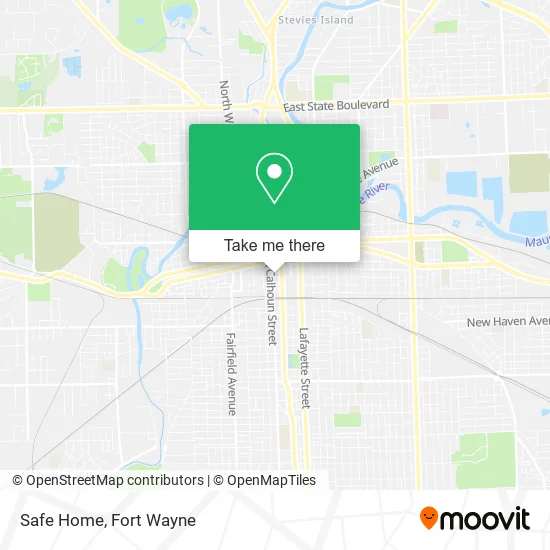
See Safe Home, Fort Wayne, on the map
Public Transit to Safe Home in Fort Wayne
Wondering how to get to Safe Home in Fort Wayne? Moovit helps you find the best way to get to Safe Home with step-by-step directions from the nearest public transit station.
Moovit provides free maps and live directions to help you navigate through your city. View schedules, routes, timetables, and find out how long does it take to get to Safe Home in real time.
Looking for the nearest stop or station to Safe Home? Check out this list of stops closest to your destination: Calhoun at Lewis; Clinton at Lewis (Sb); Central Station - Bay D; Central Station - Bay C; Central Station - Bay B; Central Station - Bay G; Central Station - Bay H; Central Station - Bay E; Central Station - Bay I.
Bus: 2TC, 3C, 4WL, 7ANT, 8GN, 2G, 4P, 6FP, 10NH, 1ARC, 1N, 1SS, 1W, 3VW.
Want to see if there’s another route that gets you there at an earlier time? Moovit helps you find alternative routes or times. Get directions from and directions to Safe Home easily from the Moovit App or Website.
We make riding to Safe Home easy, which is why over 1.5 million users, including users in Fort Wayne, trust Moovit as the best app for public transit. You don’t need to download an individual bus app or train app, Moovit is your all-in-one transit app that helps you find the best bus time or train time available.
For information on prices of bus, costs and ride fares to Safe Home, please check the Moovit app.
Get to Safe Home with public transit and pay for the ride in the Moovit app. In addition to all info you may need for your trip to Safe Home, including live directions, real-time arrivals and fare prices, you can also buy public transit passes for your rides. No need for cash or paper tickets to get to Safe Home - everything you need is accessible in the app with a click of the button.
Use the app to navigate to popular places including to the airport, hospital, stadium, grocery store, mall, coffee shop, school, college, and university.
Safe Home Address: 1200 S Clinton St Fort Wayne, IN 46802 street in Fort Wayne
- Schools Human Resources,
- JPSC Insurance Services,
- Conjure Coffee - Conservatory Cafe,
- Downtown Bar & Lounge,
- Lincoln Nat'l Life Ins,
- Lincoln Financial Securities,
- Bob Holtz Services,
- Federal Community Defenders,
- Young Todd US Senator,
- Schools Area Administration,
- Greyhound: Bus Station,
- The Fort Wayne Tincaps,
- Experience Great Service,
- 1501 S Clinton St Parking,
- Health Insurance Brokers Fort Wayne,
- Baker Street Bus Station,
- City Link Central Station,
- STARBUCKS,
- Get Fresh Eats, Frosty Treats, and Friendly Service at Your Local Wendy's,
- Camel Tow and Recovery
Places Near Safe Home (Fort Wayne)
- Dupont Hospital, Fort Wayne,
- Fort Wayne International Airport (FWA) (Fort Wayne International Airport), Fort Wayne,
- german Roasted Nuts Stand (Glenbrook Mall), Fort Wayne,
- Lutheran Hospital, Fort Wayne,
- North Side High School, Fort Wayne,
- Parkview Hospital Parking Garage, Fort Wayne,
- Lima Rd / W Coliseum Blvd, Fort Wayne,
- Sweetwater Sound, Fort Wayne,
- Lutheran Ministries Media, Fort Wayne,
- Illinois Road & Hadley Road Intersection, Fort Wayne,
- Trine University, Fort Wayne,
- Parkview Regional Medical Center,
- Aunt Gena's Sweet Corn,
- Walmart Supercenter, Fort Wayne,
- Jefferson Pointe, Fort Wayne,
- South Side Baseball - Derbyshire Field,
- Parkview North Hospital,
- Citilink Bus 10 (New Haven), Fort Wayne,
- Parkview Randallia Infusion Center, Fort Wayne,
- Fort Wayne International Airport, Fort Wayne
How to get to popular places in Fort Wayne with public transit
Get around Fort Wayne by public transit!
Traveling around Fort Wayne has never been so easy. See step by step directions as you travel to any attraction, street or major public transit station. View bus and train schedules, arrival times, service alerts and detailed routes on a map, so you know exactly how to get to anywhere in Fort Wayne.
When traveling to any destination around Fort Wayne use Moovit's Live Directions with Get Off Notifications to know exactly where and how far to walk, how long to wait for your line, and how many stops are left. Moovit will alert you when it's time to get off — no need to constantly re-check whether yours is the next stop.
Wondering how to use public transit in Fort Wayne or how to pay for public transit in Fort Wayne? Moovit public transit app can help you navigate your way with public transit easily, and at minimum cost. It includes public transit fees, ticket prices, and costs. Looking for a map of Fort Wayne public transit lines? Moovit public transit app shows all public transit maps in Fort Wayne with all bus routes and stops on an interactive map.
Fort Wayne has 1 transit type(s), including: bus, operated by several transit agencies, including Citilink