How to get to Safety First Company Of Va by bus?
Click on the bus route to see step by step directions with maps, line arrival times and updated time schedules.
From Lorton, VA, Fairfax County
235 minFrom Lorton, VA - Amtrak Auto Train Station (LOR), Fairfax County
240 minFrom Potomac Mills Mall, Prince William County
225 minFrom Rose Gaming Resort, Prince William County
250 minFrom Amazon Fulfillment Center-Ric3, Richmond
35 minFrom UVA Hospital Medical Center, Charlottesville
315 minFrom Woodbridge, VA, Prince William County
185 min
Bus stops near Safety First Company Of Va in Richmond
Bus lines to Safety First Company Of Va in Richmond
What are the closest stations to Safety First Company Of Va?
The closest stations to Safety First Company Of Va are:
- Broad Rock + Belt Boulevard is 211 yards away, 3 min walk.
- Belt Boulevard + Merry Oaks is 408 yards away, 6 min walk.
- Mcguire Medical Center is 496 yards away, 7 min walk.
Which bus lines stop near Safety First Company Of Va?
These bus lines stop near Safety First Company Of Va: 1A, 1B, 2C, 88.
What’s the nearest bus station to Safety First Company Of Va in Richmond?
The nearest bus station to Safety First Company Of Va in Richmond is Broad Rock + Belt Boulevard. It’s a 3 min walk away.
What time is the first bus to Safety First Company Of Va in Richmond?
The 20 is the first bus that goes to Safety First Company Of Va in Richmond. It stops nearby at 4:41 AM.
What time is the last bus to Safety First Company Of Va in Richmond?
The 2C is the last bus that goes to Safety First Company Of Va in Richmond. It stops nearby at 12:53 AM.
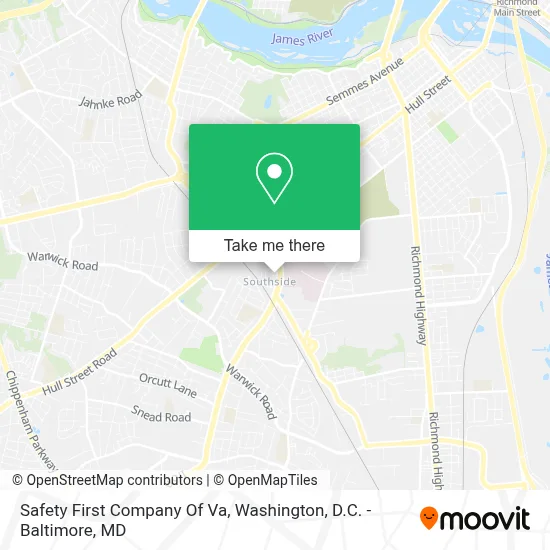
See Safety First Company Of Va, Richmond, on the map
Public Transit to Safety First Company Of Va in Richmond
Wondering how to get to Safety First Company Of Va in Richmond? Moovit helps you find the best way to get to Safety First Company Of Va with step-by-step directions from the nearest public transit station.
Moovit provides free maps and live directions to help you navigate through your city. View schedules, routes, timetables, and find out how long does it take to get to Safety First Company Of Va in real time.
Looking for the nearest stop or station to Safety First Company Of Va? Check out this list of stops closest to your destination: Broad Rock + Belt Boulevard; Belt Boulevard + Merry Oaks; Mcguire Medical Center.
Bus: 1A, 1B, 2C, 88, 20, 87, 86, 3.
Want to see if there’s another route that gets you there at an earlier time? Moovit helps you find alternative routes or times. Get directions from and directions to Safety First Company Of Va easily from the Moovit App or Website.
We make riding to Safety First Company Of Va easy, which is why over 1.7 million users, including users in Richmond, trust Moovit as the best app for public transit. You don’t need to download an individual bus app or train app, Moovit is your all-in-one transit app that helps you find the best bus time or train time available.
For information on prices of bus and train, costs and ride fares to Safety First Company Of Va, please check the Moovit app.
Use the app to navigate to popular places including to the airport, hospital, stadium, grocery store, mall, coffee shop, school, college, and university.
Safety First Company Of Va Address: 1603 Jefferson Davis Hwy street in Richmond
- Hunter Holmes McGuire VA Medical Center,
- Homeagain Veterans Transitional,
- Philip W. Coggins, R.PH.,
- Vamc Richmond VA,
- Virginia Dept of Veterans' Affairs,
- Hunter Holmes Mcguire Veterans Administration Medical Center,
- Cvhcs Parking Garage,
- Fisher House II,
- Fat Kid Sandwiches,
- Richmond Fisher House,
- Plaza Substation,
- Mcguire Virginia Medical Center Heliport,
- BP,
- Super Fresh Supermarket,
- T-Mobile,
- American Buffalo Wings,
- Hull Street Enterprise,
- Dante's Pizzeria,
- The Mews,
- Aaron Rents
Places Near Safety First Company Of Va (Richmond)
- Sibley Memorial Hospital, Washington,
- Basilica of the National Shrine, Washington,
- National Theatre, Washington,
- Capital One Arena, Washington,
- National Zoo, Washington,
- Westfield Montgomery Mall, Montgomery County,
- National Museum of African American History and Culture, Washington,
- Pennsylvania Ave NW (3rd st and pennsylvania), Washington,
- PG Mall, Prince George's County,
- Georgetown, Washington,
- M&T Bank Stadium, Baltimore,
- Washington DC VA Medical Center, Washington,
- Rock Creek Tennis Center, Washington,
- Warner Theatre, Washington,
- Amazon Hq2, Arlington County,
- Camden Yards, Baltimore,
- The Anthem, Washington,
- Marriott Marquis Washington, DC, Washington,
- Museum Of The Bible, Washington,
- Washington National Cathedral, Washington
How to get to popular places in Washington, D.C. - Baltimore, MD with public transit
Get around Richmond by public transit!
Traveling around Richmond has never been so easy. See step by step directions as you travel to any attraction, street or major public transit station. View bus and train schedules, arrival times, service alerts and detailed routes on a map, so you know exactly how to get to anywhere in Richmond.
When traveling to any destination around Richmond use Moovit's Live Directions with Get Off Notifications to know exactly where and how far to walk, how long to wait for your line, and how many stops are left. Moovit will alert you when it's time to get off — no need to constantly re-check whether yours is the next stop.
Wondering how to use public transit in Richmond or how to pay for public transit in Richmond? Moovit public transit app can help you navigate your way with public transit easily, and at minimum cost. It includes public transit fees, ticket prices, and costs. Looking for a map of Richmond public transit lines? Moovit public transit app shows all public transit maps in Richmond with all Bus, Train, Metro, Light Rail and Ferry routes and stops on an interactive map.
Washington, D.C. - Baltimore, MD has 5 transit type(s), including: Bus, Train, Metro, Light Rail and Ferry, operated by several transit agencies, including WMATA, Montgomery County Ride On, Fairfax Connector, TheBus, PRTC, DASH - Alexandria, Arlington Transit (ART), RTA of Central Maryland, MDOT MTA, MDOT MTA Light RailLink, MDOT MTA Commuter Bus, MDOT MTA Local Bus, FXBGO!, Virginia Railway Express (VRE) and MARC