Directions to Safeway #1281 (Howard County) with public transportation
The following transit lines have routes that pass near Safeway #1281
 Bus: 405.
How to get to Safeway #1281 by bus?
Click on the bus route to see step by step directions with maps, line arrival times and updated time schedules.
From Lincoln Tech, Howard County
136 minFrom Howard Community College, Howard County
115 minFrom Walmart, Baltimore County
76 minFrom Columbia, MD, Howard County
95 minFrom The Mall In Columbia, Howard County
78 minFrom Merriweather Post Pavilion, Howard County
86 minFrom I-695 @ Exit 18 (Liberty Rd/MD 26), Baltimore County
144 minFrom I-695 @ Exit 17 (Security Blvd/MD 122), Baltimore County
113 minFrom Randallstown, MD, Baltimore County
143 minFrom Social Security Administration (Robert M. Ball Building), Baltimore County
111 min
Bus stop near Safeway #1281 in Howard County
- Pine Orchard Ln / Corporate Ct, 12 min walk,VIEW
Bus lines to Safeway #1281 in Howard County
- 405, Pine Orchard Lane,VIEW
What are the closest stations to Safeway #1281?
The closest stations to Safeway #1281 are:
- Pine Orchard Ln / Corporate Ct is 953 yards away, 12 min walk.
Which bus line stops near Safeway #1281?
405 (Pine Orchard Lane)
What’s the nearest bus station to Safeway #1281 in Howard County?
The nearest bus station to Safeway #1281 in Howard County is Pine Orchard Ln / Corporate Ct. It’s a 12 min walk away.
What time is the first bus to Safeway #1281 in Howard County?
The 405 is the first bus that goes to Safeway #1281 in Howard County. It stops nearby at 5:56 AM.
What time is the last bus to Safeway #1281 in Howard County?
The 405 is the last bus that goes to Safeway #1281 in Howard County. It stops nearby at 5:56 PM.
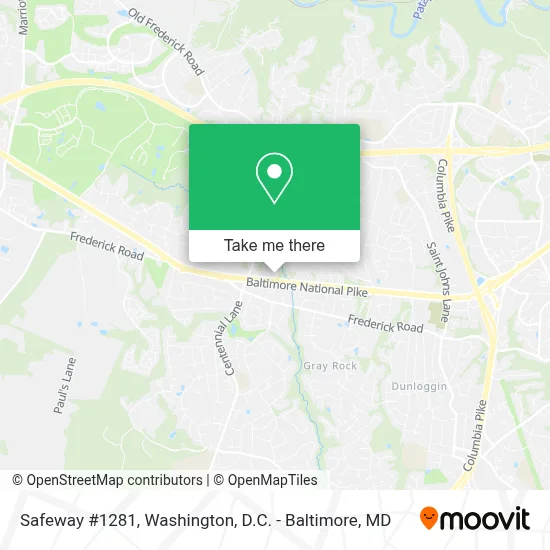
See Safeway #1281, Howard County, on the map
Public Transit to Safeway #1281 in Howard County
Wondering how to get to Safeway #1281 in Howard County? Moovit helps you find the best way to get to Safeway #1281 with step-by-step directions from the nearest public transit station.
Moovit provides free maps and live directions to help you navigate through your city. View schedules, routes, timetables, and find out how long does it take to get to Safeway #1281 in real time.
Looking for the nearest stop or station to Safeway #1281? Check out this list of stops closest to your destination: Pine Orchard Ln / Corporate Ct.
Bus: 405.
Want to see if there’s another route that gets you there at an earlier time? Moovit helps you find alternative routes or times. Get directions from and directions to Safeway #1281 easily from the Moovit App or Website.
We make riding to Safeway #1281 easy, which is why over 1.7 million users, including users in Howard County, trust Moovit as the best app for public transit. You don’t need to download an individual bus app or train app, Moovit is your all-in-one transit app that helps you find the best bus time or train time available.
For information on prices of bus, costs and ride fares to Safeway #1281, please check the Moovit app.
Get to Safeway #1281 with public transit and pay for the ride in the Moovit app. In addition to all info you may need for your trip to Safeway #1281, including live directions, real-time arrivals and fare prices, you can also buy public transit passes for your rides. No need for cash or paper tickets to get to Safeway #1281 - everything you need is accessible in the app with a click of the button.
Use the app to navigate to popular places including to the airport, hospital, stadium, grocery store, mall, coffee shop, school, college, and university.
Safeway #1281 Address: 10000 Baltimore National Pike street in Howard County
- Bethany & US-40,
- U.S. Utility Corporation,
- Jael Health Services/ Ellicott City Health Llc,
- Family Karaoke,
- Brooks Zentgraf-Insurance Agent,
- Kimko,
- Siroo And Juk Story,
- Magda Johnson Hair Stylist,
- Pristine Medical Equipment & Accessories Inc,
- Everpresent Ellicott City, Md,
- Keechun Hong, Dmd,
- Creative Weddings & Events Llc,
- Icore Infotech,
- Lice Clinics Of America - Ellicott City,
- Classic Remodeling Inc.,
- I Do Glam Crew,
- The I Do Glam Crew,
- Cecilia Medical Center,
- Royalway Christian Center,
- Ihc World Llc
Places Near Safeway #1281 (Howard County)
- Georgetown, Washington,
- National Zoo, Washington,
- Museum Of The Bible, Washington,
- Amazon Hq2, Arlington County,
- Westfield Montgomery Mall, Montgomery County,
- M&T Bank Stadium, Baltimore,
- Warner Theatre, Washington,
- Rock Creek Tennis Center, Washington,
- Washington DC VA Medical Center, Washington,
- National Museum of African American History and Culture, Washington,
- Sibley Memorial Hospital, Washington,
- Camden Yards, Baltimore,
- Capital One Arena, Washington,
- The Anthem, Washington,
- Basilica of the National Shrine, Washington,
- Marriott Marquis Washington, DC, Washington,
- Washington National Cathedral, Washington,
- National Theatre, Washington,
- PG Mall, Prince George's County,
- Pennsylvania Ave NW (3rd st and pennsylvania), Washington
How to get to popular places in Washington, D.C. - Baltimore, MD with public transit
Get around Howard County by public transit!
Traveling around Howard County has never been so easy. See step by step directions as you travel to any attraction, street or major public transit station. View bus and train schedules, arrival times, service alerts and detailed routes on a map, so you know exactly how to get to anywhere in Howard County.
When traveling to any destination around Howard County use Moovit's Live Directions with Get Off Notifications to know exactly where and how far to walk, how long to wait for your line, and how many stops are left. Moovit will alert you when it's time to get off — no need to constantly re-check whether yours is the next stop.
Wondering how to use public transit in Howard County or how to pay for public transit in Howard County? Moovit public transit app can help you navigate your way with public transit easily, and at minimum cost. It includes public transit fees, ticket prices, and costs. Looking for a map of Howard County public transit lines? Moovit public transit app shows all public transit maps in Howard County with all Bus, Train, Metro, Light Rail and Ferry routes and stops on an interactive map.
Washington, D.C. - Baltimore, MD has 5 transit type(s), including: Bus, Train, Metro, Light Rail and Ferry, operated by several transit agencies, including WMATA, Montgomery County Ride On, Fairfax Connector, TheBus, PRTC, DASH - Alexandria, Arlington Transit (ART), RTA of Central Maryland, MDOT MTA, MDOT MTA Light RailLink, MDOT MTA Commuter Bus, MDOT MTA Local Bus, FXBGO!, Virginia Railway Express (VRE) and MARC