How to get to Safeway Moving by bus?
Click on the bus route to see step by step directions with maps, line arrival times and updated time schedules.
From Broward General Hospital, Fort Lauderdale
66 minFrom North Area Transportation Terminal, Pompano Beach
69 minFrom Westfield Broward Mall, Plantation
83 minFrom Mai-Kai Restaurant And Polynesian Show, Fort Lauderdale
50 minFrom Florida Turnpike Sunrise Blvd. Toll Plaza, Plantation
81 minFrom State Road 7 & West Sunrise Boulevard, Plantation
47 minFrom Happy Skipper, Fort Lauderdale
64 minFrom Tri-Rail-Fort Lauderdale Station, Fort Lauderdale
63 minFrom Sample Rd, Deerfield Beach
69 minFrom Sawgrass Recreation Park, Fort Lauderdale
83 min
Bus stops near Safeway Moving in Fort Lauderdale
Bus lines to Safeway Moving in Fort Lauderdale
What are the closest stations to Safeway Moving?
The closest stations to Safeway Moving are:
- Northwest 33rd Avenue/Commercial Boulevard is 132 yards away, 2 min walk.
- Commercial Boulevard/Northwest 33rd Avenue is 421 yards away, 6 min walk.
- Northwest 31st Avenue/Commercial Boulevard (North) is 623 yards away, 8 min walk.
Which bus lines stop near Safeway Moving?
These bus lines stop near Safeway Moving: 11, 31, 55.
What’s the nearest bus station to Safeway Moving in Fort Lauderdale?
The nearest bus station to Safeway Moving in Fort Lauderdale is Northwest 33rd Avenue/Commercial Boulevard. It’s a 2 min walk away.
What time is the first bus to Safeway Moving in Fort Lauderdale?
The 55 is the first bus that goes to Safeway Moving in Fort Lauderdale. It stops nearby at 5:00 AM.
What time is the last bus to Safeway Moving in Fort Lauderdale?
The 11 is the last bus that goes to Safeway Moving in Fort Lauderdale. It stops nearby at 12:45 AM.
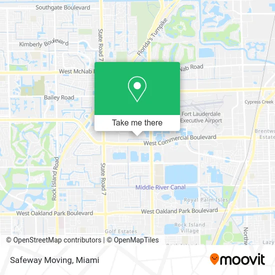
See Safeway Moving, Fort Lauderdale, on the map
Public Transit to Safeway Moving in Fort Lauderdale
Wondering how to get to Safeway Moving in Fort Lauderdale? Moovit helps you find the best way to get to Safeway Moving with step-by-step directions from the nearest public transit station.
Moovit provides free maps and live directions to help you navigate through your city. View schedules, routes, timetables, and find out how long does it take to get to Safeway Moving in real time.
Looking for the nearest stop or station to Safeway Moving? Check out this list of stops closest to your destination: Northwest 33rd Avenue/Commercial Boulevard; Commercial Boulevard/Northwest 33rd Avenue; Northwest 31st Avenue/Commercial Boulevard (North).
Bus: 11, 31, 55.
Want to see if there’s another route that gets you there at an earlier time? Moovit helps you find alternative routes or times. Get directions from and directions to Safeway Moving easily from the Moovit App or Website.
We make riding to Safeway Moving easy, which is why over 1.5 million users, including users in Fort Lauderdale, trust Moovit as the best app for public transit. You don’t need to download an individual bus app or train app, Moovit is your all-in-one transit app that helps you find the best bus time or train time available.
For information on prices of bus, costs and ride fares to Safeway Moving, please check the Moovit app.
Use the app to navigate to popular places including to the airport, hospital, stadium, grocery store, mall, coffee shop, school, college, and university.
Safeway Moving Address: 5217 NW 33rd Ave Fort Lauderdale, FL 33309 street in Fort Lauderdale
- Interlink Telecommunications,
- Flite Center,
- South Florida Wellness Network,
- Florida Engineering and Design Group,
- Heart2heart Outreach,
- 50 State Insurance & Tax Services,
- Standard Register,
- American Forwarding & Logistics,
- Bittencourt Property,
- D1 Waterproofing and Painting,
- Lexo Executive Suites,
- Caza Estate Sales Services,
- BNB Coast,
- Check Cashing Store,
- Our Pharmacy Network,
- Burton Claim Service,
- Starman Auctions,
- Dougherty Law Firm, P.A.,
- Dr. Jorge A. Gonzalez MD,
- The Otto Law Group
Places Near Safeway Moving (Fort Lauderdale)
- Wynwood, Miami,
- Keiser University Flagship Campus, West Palm Beach,
- Richard E. Gerstein Justice Building, Miami,
- Bayside Marketplace, Miami,
- Hard Rock Stadium, Miami Gardens,
- Miami Design District, Miami,
- Sawgrass mall ( FL ), Miami Beach,
- Aventura Mall, Miami,
- Zoo Miami, Miami,
- Little Havana, Miami,
- Brickell City Centre, Miami,
- Port of Miami Cruise Terminal, Miami,
- Marlins Park, Miami,
- Dolphin Mall, Miami,
- Miami VA Hospital, Miami,
- Sawgrass Mall, Miami,
- Miami Freedom Park, Miami,
- Miami-Dade County Courthouse, Miami,
- Dolphin Mall Bus, Miami,
- Aventura Mall, Miami Beach
How to get to popular places in Miami with public transit
Get around Fort Lauderdale by public transit!
Traveling around Fort Lauderdale has never been so easy. See step by step directions as you travel to any attraction, street or major public transit station. View bus and train schedules, arrival times, service alerts and detailed routes on a map, so you know exactly how to get to anywhere in Fort Lauderdale.
When traveling to any destination around Fort Lauderdale use Moovit's Live Directions with Get Off Notifications to know exactly where and how far to walk, how long to wait for your line, and how many stops are left. Moovit will alert you when it's time to get off — no need to constantly re-check whether yours is the next stop.
Wondering how to use public transit in Fort Lauderdale or how to pay for public transit in Fort Lauderdale? Moovit public transit app can help you navigate your way with public transit easily, and at minimum cost. It includes public transit fees, ticket prices, and costs. Looking for a map of Fort Lauderdale public transit lines? Moovit public transit app shows all public transit maps in Fort Lauderdale with all Bus, Train, Light Rail and Ferry routes and stops on an interactive map.
Miami has 4 transit type(s), including: Bus, Train, Light Rail and Ferry, operated by several transit agencies, including Broward County Transit, Miami-Dade Transit, Metrorail, Palm Tran, Tri-Rail, Brightline, MARTY, City of Homestead Trolley, Key West Transit, Treasure Coast Connector, GoLine IRT, Amtrak, Greyhound-us, FlixBus-us and Aventura Express Shuttle Bus