Directions to Sahebe Financial Services "Sfs" (Alexandria) with public transportation
The following transit lines have routes that pass near Sahebe Financial Services "Sfs"
 Bus: 32, F1X, P90, 109, 301.
- Train: FREDERICKSBURG LINE, MANASSAS LINE, CARDINAL, CAROLINIAN, CRESCENT.
- Metro: YELLOW, BLUE.
How to get to Sahebe Financial Services "Sfs" by bus?
Click on the bus route to see step by step directions with maps, line arrival times and updated time schedules.
From Bureau of Engraving and Printing, Washington
111 minFrom Springfield Mall (franconia / Springfield Mall), Fairfax County
43 minFrom Lincoln Memorial Reflecting Pool, Washington
116 minFrom The Bullpen, Washington
89 minFrom L'Enfant Plaza, Washington
96 minFrom Pentagon City Mall, Arlington County
59 minFrom US Department of Homeland Security (DHS), Washington
99 minFrom Springfield Mall, Fairfax County
43 minFrom Holiday Inn National Airport/Crystal City, Arlington County
49 minFrom Ronald Reagan Washington National Airport (Dca), Arlington County
60 min
How to get to Sahebe Financial Services "Sfs" by train?
Click on the train route to see step by step directions with maps, line arrival times and updated time schedules.
From Bureau of Engraving and Printing, Washington
51 minFrom Springfield Mall (franconia / Springfield Mall), Fairfax County
59 minFrom L'Enfant Plaza, Washington
42 minFrom Pentagon City Mall, Arlington County
50 minFrom US Department of Homeland Security (DHS), Washington
45 minFrom Springfield Mall, Fairfax County
59 minFrom Holiday Inn National Airport/Crystal City, Arlington County
47 minFrom Ronald Reagan Washington National Airport (Dca), Arlington County
54 min
How to get to Sahebe Financial Services "Sfs" by metro?
Click on the metro route to see step by step directions with maps, line arrival times and updated time schedules.
From Bureau of Engraving and Printing, Washington
41 minFrom Springfield Mall (franconia / Springfield Mall), Fairfax County
49 minFrom Lincoln Memorial Reflecting Pool, Washington
52 minFrom The Bullpen, Washington
39 minFrom L'Enfant Plaza, Washington
32 minFrom Pentagon City Mall, Arlington County
26 minFrom US Department of Homeland Security (DHS), Washington
35 minFrom Springfield Mall, Fairfax County
49 minFrom Holiday Inn National Airport/Crystal City, Arlington County
34 minFrom Ronald Reagan Washington National Airport (Dca), Arlington County
15 min
Bus stops near Sahebe Financial Services "Sfs" in Alexandria
Metro station near Sahebe Financial Services "Sfs" in Alexandria
- Braddock Rd - North Side Braddock Rd. at West St., 30 min walk,VIEW
Train station near Sahebe Financial Services "Sfs" in Alexandria
- Alexandria, 36 min walk,VIEW
Bus lines to Sahebe Financial Services "Sfs" in Alexandria
What are the closest stations to Sahebe Financial Services "Sfs"?
The closest stations to Sahebe Financial Services "Sfs" are:
- Mill Rd + Jamieson Ave is 588 yards away, 7 min walk.
- Mill Rd+Eisenhower Av is 698 yards away, 9 min walk.
- Huntington Ave@ Metroview Pkwy is 705 yards away, 9 min walk.
- Duke St + Moncure Dr is 823 yards away, 10 min walk.
- Braddock Rd - North Side Braddock Rd. at West St. is 2457 yards away, 30 min walk.
- Alexandria is 3010 yards away, 36 min walk.
Which bus lines stop near Sahebe Financial Services "Sfs"?
These bus lines stop near Sahebe Financial Services "Sfs": 32, F1X, P90.
Which train lines stop near Sahebe Financial Services "Sfs"?
These train lines stop near Sahebe Financial Services "Sfs": FREDERICKSBURG LINE, MANASSAS LINE.
Which metro line stops near Sahebe Financial Services "Sfs"?
YELLOW (Huntington)
What’s the nearest metro station to Sahebe Financial Services "Sfs" in Alexandria?
The nearest metro station to Sahebe Financial Services "Sfs" in Alexandria is Braddock Rd - North Side Braddock Rd. at West St.. It’s a 30 min walk away.
What’s the nearest bus station to Sahebe Financial Services "Sfs" in Alexandria?
The nearest bus station to Sahebe Financial Services "Sfs" in Alexandria is Mill Rd + Jamieson Ave. It’s a 7 min walk away.
What time is the first metro to Sahebe Financial Services "Sfs" in Alexandria?
The YELLOW is the first metro that goes to Sahebe Financial Services "Sfs" in Alexandria. It stops nearby at 5:00 AM.
What time is the last metro to Sahebe Financial Services "Sfs" in Alexandria?
The YELLOW is the last metro that goes to Sahebe Financial Services "Sfs" in Alexandria. It stops nearby at 12:39 AM.
What time is the first train to Sahebe Financial Services "Sfs" in Alexandria?
The SILVER METEOR is the first train that goes to Sahebe Financial Services "Sfs" in Alexandria. It stops nearby at 5:54 AM.
What time is the last train to Sahebe Financial Services "Sfs" in Alexandria?
The SILVER METEOR is the last train that goes to Sahebe Financial Services "Sfs" in Alexandria. It stops nearby at 5:54 AM.
What time is the first bus to Sahebe Financial Services "Sfs" in Alexandria?
The 310 is the first bus that goes to Sahebe Financial Services "Sfs" in Alexandria. It stops nearby at 4:22 AM.
What time is the last bus to Sahebe Financial Services "Sfs" in Alexandria?
The 30 is the last bus that goes to Sahebe Financial Services "Sfs" in Alexandria. It stops nearby at 1:39 AM.
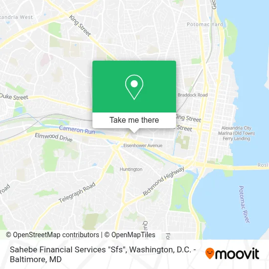
See Sahebe Financial Services "Sfs", Alexandria, on the map
Public Transit to Sahebe Financial Services "Sfs" in Alexandria
Wondering how to get to Sahebe Financial Services "Sfs" in Alexandria? Moovit helps you find the best way to get to Sahebe Financial Services "Sfs" with step-by-step directions from the nearest public transit station.
Moovit provides free maps and live directions to help you navigate through your city. View schedules, routes, timetables, and find out how long does it take to get to Sahebe Financial Services "Sfs" in real time.
Looking for the nearest stop or station to Sahebe Financial Services "Sfs"? Check out this list of stops closest to your destination: Mill Rd + Jamieson Ave; Mill Rd+Eisenhower Av; Huntington Ave@ Metroview Pkwy; Duke St + Moncure Dr; Braddock Rd - North Side Braddock Rd. at West St.; Alexandria.
Bus: 32, F1X, P90, 109, 301, 310, 30.Train: FREDERICKSBURG LINE, MANASSAS LINE, CARDINAL, CAROLINIAN, CRESCENT, FLORIDIAN, NORTHEAST REGIONAL.Metro: YELLOW, BLUE.
Want to see if there’s another route that gets you there at an earlier time? Moovit helps you find alternative routes or times. Get directions from and directions to Sahebe Financial Services "Sfs" easily from the Moovit App or Website.
We make riding to Sahebe Financial Services "Sfs" easy, which is why over 1.7 million users, including users in Alexandria, trust Moovit as the best app for public transit. You don’t need to download an individual bus app or train app, Moovit is your all-in-one transit app that helps you find the best bus time or train time available.
For information on prices of bus, metro and train, costs and ride fares to Sahebe Financial Services "Sfs", please check the Moovit app.
Use the app to navigate to popular places including to the airport, hospital, stadium, grocery store, mall, coffee shop, school, college, and university.
Sahebe Financial Services "Sfs" Address: 2641 Eisenhower Ave street in Alexandria
- Holiday Inn Alexandria- Carlyle,
- Marvella Construction,
- Beyond Dental,
- Wegmans,
- VA Lottery - Wegmans,
- AMC Hoffman Center 22,
- AMC Theatres-Hoffman Center 22,
- Cvs Pharmacy,
- Hoffman Town Center Blocks 4 & 5,
- AMC Hoffman Center 22 (Amc Theaters),
- Eisenhower Avenue Metro Station,
- Virginia,
- I-95,
- San Antonio Bar and Grill (San Antonio Bar A),
- Courtyard Alexandria Old Town / Southwest (Alexandria Marriott),
- DMV,
- Residence Inn Alexandria Old Town South at Carlyle,
- Huntington Metrorail Station-Parking Lot,
- Practical Speech Solutions, PLC,
- Uscis Service and Office
Places Near Sahebe Financial Services "Sfs" (Alexandria)
- Warner Theatre, Washington,
- National Zoo, Washington,
- Georgetown, Washington,
- National Theatre, Washington,
- M&T Bank Stadium, Baltimore,
- Rock Creek Tennis Center, Washington,
- Basilica of the National Shrine, Washington,
- Amazon Hq2, Arlington County,
- National Museum of African American History and Culture, Washington,
- Washington National Cathedral, Washington,
- Pennsylvania Ave NW (3rd st and pennsylvania), Washington,
- Washington DC VA Medical Center, Washington,
- The Anthem, Washington,
- Museum Of The Bible, Washington,
- PG Mall, Prince George's County,
- Sibley Memorial Hospital, Washington,
- Westfield Montgomery Mall, Montgomery County,
- Marriott Marquis Washington, DC, Washington,
- Camden Yards, Baltimore,
- Capital One Arena, Washington
How to get to popular places in Washington, D.C. - Baltimore, MD with public transit
Get around Alexandria by public transit!
Traveling around Alexandria has never been so easy. See step by step directions as you travel to any attraction, street or major public transit station. View bus and train schedules, arrival times, service alerts and detailed routes on a map, so you know exactly how to get to anywhere in Alexandria.
When traveling to any destination around Alexandria use Moovit's Live Directions with Get Off Notifications to know exactly where and how far to walk, how long to wait for your line, and how many stops are left. Moovit will alert you when it's time to get off — no need to constantly re-check whether yours is the next stop.
Wondering how to use public transit in Alexandria or how to pay for public transit in Alexandria? Moovit public transit app can help you navigate your way with public transit easily, and at minimum cost. It includes public transit fees, ticket prices, and costs. Looking for a map of Alexandria public transit lines? Moovit public transit app shows all public transit maps in Alexandria with all Bus, Train, Metro, Light Rail and Ferry routes and stops on an interactive map.
Washington, D.C. - Baltimore, MD has 5 transit type(s), including: Bus, Train, Metro, Light Rail and Ferry, operated by several transit agencies, including WMATA, Montgomery County Ride On, Fairfax Connector, TheBus, PRTC, DASH - Alexandria, Arlington Transit (ART), RTA of Central Maryland, MDOT MTA, MDOT MTA Light RailLink, MDOT MTA Commuter Bus, MDOT MTA Local Bus, FXBGO!, Virginia Railway Express (VRE) and MARC