Directions to Sail Boat Charter (Manhattan) with public transportation
The following transit lines have routes that pass near Sail Boat Charter
 Bus: BM2, BXM18, M20, M9, X28.
- Train: BLU, GRE, RED.
- Subway: 2, 3, 4, J, R.
- Ferry: EDGEWATER - BROOKFIELD PLACE, HOBOKEN / NJ TRANSIT TERMINAL - BROOKFIELD PLACE, PAULUS HOOK - BROOKFIELD PLACE, PORT IMPERIAL - BROOKFIELD PLACE, SOUTH AMBOY - PIER 11/WALL ST..
How to get to Sail Boat Charter by bus?
Click on the bus route to see step by step directions with maps, line arrival times and updated time schedules.
From Metropolitan Hospital, Manhattan
57 minFrom 5 East 98th Street, Manhattan
46 minFrom Mt Sinai, Manhattan
48 minFrom 5 E 98th St, Manhattan
46 minFrom 70th St and York Ave, Manhattan
64 minFrom E 66th St (2nd Ave & 66th), Manhattan
63 minFrom Consulado General De La Republica Dominicana, Manhattan
44 minFrom Bloomingdale's, Manhattan
70 min
How to get to Sail Boat Charter by train?
Click on the train route to see step by step directions with maps, line arrival times and updated time schedules.
How to get to Sail Boat Charter by subway?
Click on the subway route to see step by step directions with maps, line arrival times and updated time schedules.
From Metropolitan Hospital, Manhattan
45 minFrom 5 East 98th Street, Manhattan
50 minFrom Mt Sinai, Manhattan
47 minFrom 5 E 98th St, Manhattan
50 minFrom 70th St and York Ave, Manhattan
44 minFrom E 66th St (2nd Ave & 66th), Manhattan
42 minFrom Consulado General De La Republica Dominicana, Manhattan
29 minFrom Bloomingdale's, Manhattan
31 min
Bus stops near Sail Boat Charter in Manhattan
Subway station near Sail Boat Charter in Manhattan
- Wtc Cortlandt, 3 min walk,VIEW
Train station near Sail Boat Charter in Manhattan
- World Trade Center, 4 min walk,VIEW
Ferry stations near Sail Boat Charter in Manhattan
Bus lines to Sail Boat Charter in Manhattan
What are the closest stations to Sail Boat Charter?
The closest stations to Sail Boat Charter are:
- South End Ave & Gateway Plz is 114 yards away, 2 min walk.
- South End Av/Gateway Plaza is 137 yards away, 2 min walk.
- Wtc Cortlandt is 143 yards away, 3 min walk.
- South End Av/Albany St is 250 yards away, 4 min walk.
- World Trade Center is 287 yards away, 4 min walk.
- West St/Carlisle St is 389 yards away, 5 min walk.
- Vesey St/North End Av is 634 yards away, 8 min walk.
- Brookfield Place/Battery Park City is 642 yards away, 8 min walk.
- Battery Park City/Vesey St. is 677 yards away, 9 min walk.
- Brookfield Place, NY is 696 yards away, 9 min walk.
Which bus lines stop near Sail Boat Charter?
These bus lines stop near Sail Boat Charter: BM2, BXM18, M20, M9, X28.
Which train lines stop near Sail Boat Charter?
These train lines stop near Sail Boat Charter: BLU, GRE.
Which subway lines stop near Sail Boat Charter?
These subway lines stop near Sail Boat Charter: 2, 3, 4, J, R.
What’s the nearest subway station to Sail Boat Charter in Manhattan?
The nearest subway station to Sail Boat Charter in Manhattan is Wtc Cortlandt. It’s a 3 min walk away.
What’s the nearest train station to Sail Boat Charter in Manhattan?
The nearest train station to Sail Boat Charter in Manhattan is World Trade Center. It’s a 4 min walk away.
What’s the nearest bus station to Sail Boat Charter in Manhattan?
The nearest bus stations to Sail Boat Charter in Manhattan are South End Ave & Gateway Plz and South End Av/Gateway Plaza. The closest one is a 2 min walk away.
What’s the nearest ferry station to Sail Boat Charter in Manhattan?
The nearest ferry station to Sail Boat Charter in Manhattan is Brookfield Place/Battery Park City. It’s a 8 min walk away.
What time is the first subway to Sail Boat Charter in Manhattan?
The 1 is the first subway that goes to Sail Boat Charter in Manhattan. It stops nearby at 3:17 AM.
What time is the last subway to Sail Boat Charter in Manhattan?
The 1 is the last subway that goes to Sail Boat Charter in Manhattan. It stops nearby at 3:39 AM.
What time is the first train to Sail Boat Charter in Manhattan?
The RED is the first train that goes to Sail Boat Charter in Manhattan. It stops nearby at 3:10 AM.
What time is the last train to Sail Boat Charter in Manhattan?
The RED is the last train that goes to Sail Boat Charter in Manhattan. It stops nearby at 2:55 AM.
What time is the first bus to Sail Boat Charter in Manhattan?
The M22 is the first bus that goes to Sail Boat Charter in Manhattan. It stops nearby at 5:00 AM.
What time is the last bus to Sail Boat Charter in Manhattan?
The M22 is the last bus that goes to Sail Boat Charter in Manhattan. It stops nearby at 1:18 AM.
What time is the first ferry to Sail Boat Charter in Manhattan?
The PAULUS HOOK - BROOKFIELD PLACE is the first ferry that goes to Sail Boat Charter in Manhattan. It stops nearby at 6:07 AM.
What time is the last ferry to Sail Boat Charter in Manhattan?
The PAULUS HOOK - BROOKFIELD PLACE is the last ferry that goes to Sail Boat Charter in Manhattan. It stops nearby at 10:52 PM.
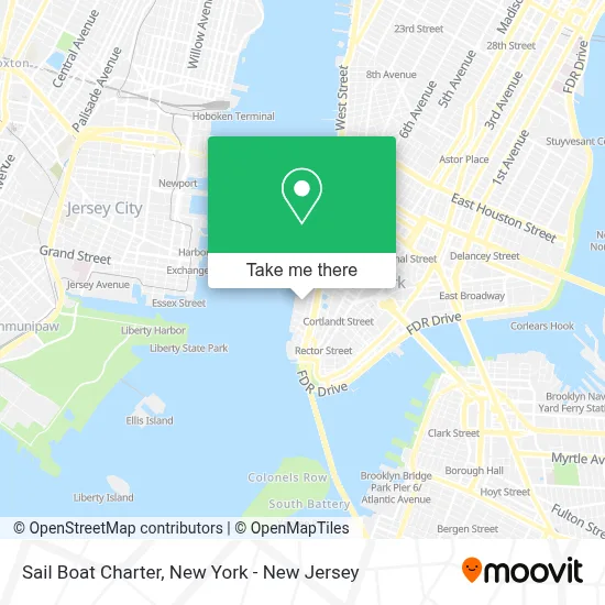
See Sail Boat Charter, Manhattan, on the map
Public Transit to Sail Boat Charter in Manhattan
Wondering how to get to Sail Boat Charter in Manhattan? Moovit helps you find the best way to get to Sail Boat Charter with step-by-step directions from the nearest public transit station.
Moovit provides free maps and live directions to help you navigate through your city. View schedules, routes, timetables, and find out how long does it take to get to Sail Boat Charter in real time.
Looking for the nearest stop or station to Sail Boat Charter? Check out this list of stops closest to your destination: South End Ave & Gateway Plz; South End Av/Gateway Plaza; Wtc Cortlandt; South End Av/Albany St; World Trade Center; West St/Carlisle St; Vesey St/North End Av; Brookfield Place/Battery Park City; Battery Park City/Vesey St.; Brookfield Place.
Bus: BM2, BXM18, M20, M9, X28, DOWNTOWN CONNECTION.Train: BLU, GRE, RED.Subway: 2, 3, 4, J, R, 1.Ferry: EDGEWATER - BROOKFIELD PLACE, HOBOKEN / NJ TRANSIT TERMINAL - BROOKFIELD PLACE, PAULUS HOOK - BROOKFIELD PLACE, PORT IMPERIAL - BROOKFIELD PLACE, SOUTH AMBOY - PIER 11/WALL ST..
Want to see if there’s another route that gets you there at an earlier time? Moovit helps you find alternative routes or times. Get directions from and directions to Sail Boat Charter easily from the Moovit App or Website.
We make riding to Sail Boat Charter easy, which is why over 1.5 million users, including users in Manhattan, trust Moovit as the best app for public transit. You don’t need to download an individual bus app or train app, Moovit is your all-in-one transit app that helps you find the best bus time or train time available.
For information on prices of subway, bus and train, costs and ride fares to Sail Boat Charter, please check the Moovit app.
Use the app to navigate to popular places including to the airport, hospital, stadium, grocery store, mall, coffee shop, school, college, and university.
Sail Boat Charter Address: 385 S End Ave street in Manhattan
- Kd Event Group,
- Honorable William Wall (Piece of the Berlin Wall),
- Berlin Wall,
- Gateway Apartments,
- Gateway Plaza,
- Kumon,
- Children's Warehouse,
- Battery Park Pediatric and Orthodontic Dentists,
- Professors Of Pop,
- Dollar Car Rental,
- Yoni's Krav Maga,
- Iren Juran Design,
- Club at Gateway,
- Zeus's Penthouse,
- Dreamwake Academy,
- NY Preschool - Battery Park,
- Gateway NY,
- Battery Park City,
- Glenn J. Chiarello Dds,
- Taurus Communications
Places Near Sail Boat Charter (Manhattan)
- Katz's Deli, Manhattan,
- Chinatown, Manhattan,
- SoHo, Manhattan,
- Rockefeller Center, Manhattan,
- 66 John Street, Manhattan,
- Queens Center Mall, Queens,
- Times Square, Manhattan,
- Hudson Yards, Manhattan,
- 26 Federal Plaza, Manhattan,
- San Gennaro Feast, Manhattan,
- 911 Memorial, Manhattan,
- Bellevue Hospital, Manhattan,
- 111 Centre New York City Supreme Court, Manhattan,
- Wall Street, Manhattan,
- 376 Hudson Street, Manhattan,
- Mountainside Hospital, Glen Ridge,
- Pier 83, Manhattan,
- qqqq, Manhattan,
- 3 Stone St, Manhattan,
- 1 Police Plaza, Manhattan
How to get to popular places in New York - New Jersey with public transit
Get around Manhattan by public transit!
Traveling around Manhattan has never been so easy. See step by step directions as you travel to any attraction, street or major public transit station. View bus and train schedules, arrival times, service alerts and detailed routes on a map, so you know exactly how to get to anywhere in Manhattan.
When traveling to any destination around Manhattan use Moovit's Live Directions with Get Off Notifications to know exactly where and how far to walk, how long to wait for your line, and how many stops are left. Moovit will alert you when it's time to get off — no need to constantly re-check whether yours is the next stop.
Wondering how to use public transit in Manhattan or how to pay for public transit in Manhattan? Moovit public transit app can help you navigate your way with public transit easily, and at minimum cost. It includes public transit fees, ticket prices, and costs. Looking for a map of Manhattan public transit lines? Moovit public transit app shows all public transit maps in Manhattan with all Bus, Train, Subway, Light Rail, Ferry and Cable Car routes and stops on an interactive map.
New York - New Jersey has 6 transit type(s), including: Bus, Train, Subway, Light Rail, Ferry and Cable Car, operated by several transit agencies, including MTA Subway, Metro-North Railroad, LIRR, PATH, MTA New York City Transit - Express routes, MTA Bus, NJ Transit, NYC Ferry, NICE bus, Bee-Line Bus, NJ Transit Rail, Norwalk Transit District, Hartford Line, River Valley Transit and HART
Public transit lines with stations closest to Sail Boat Charter in Manhattan
Subway lines with stations closest to Sail Boat Charter in Manhattan
Train lines with stations closest to Sail Boat Charter in Manhattan
Bus lines with stations closest to Sail Boat Charter in Manhattan
Ferry lines with stations closest to Sail Boat Charter in Manhattan
Brookfield Place/Battery Park City
- EDGEWATER - BROOKFIELD PLACEEdgewater - Brookfield Place
- HOBOKEN / NJ TRANSIT TERMINAL - BROOKFIELD PLACEHoboken / NJ Transit Terminal - Brookfield Place
- PAULUS HOOK - BROOKFIELD PLACEPaulus Hook - Brookfield Place
- PORT IMPERIAL - BROOKFIELD PLACEPort Imperial - Brookfield Place
- SOUTH AMBOY - PIER 11/WALL ST.South Amboy - Pier 11/Wall St.