How to get to Saint-Pathus Center Saint Pathus Center by bus?
Click on the bus route to see step by step directions with maps, line arrival times and updated time schedules.
Bus stop near Saint-Pathus Center Saint Pathus Center
- Centre Commercial, 1 min walk,VIEW
Bus lines to Saint-Pathus Center Saint Pathus Center
What are the closest stations to Saint-Pathus Center Saint Pathus Center?
The closest stations to Saint-Pathus Center Saint Pathus Center are:
- Centre Commercial is 26 meters away, 1 min walk.
Which bus line stops near Saint-Pathus Center Saint Pathus Center?
FILÉO SP (Les Frênes)
What’s the nearest bus station to Saint-Pathus Center Saint Pathus Center?
The nearest bus station to Saint-Pathus Center Saint Pathus Center is Centre Commercial. It’s a 1 min walk away.
What time is the first bus to Saint-Pathus Center Saint Pathus Center?
The FILÉO SP is the first bus that goes to Saint-Pathus Center Saint Pathus Center. It stops nearby at 3:50 AM.
What time is the last bus to Saint-Pathus Center Saint Pathus Center?
The FILÉO SP is the last bus that goes to Saint-Pathus Center Saint Pathus Center. It stops nearby at 1:32 AM.
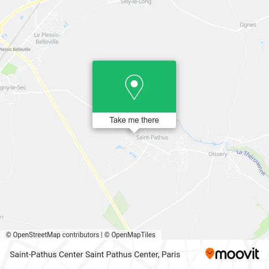
See Saint-Pathus Center Saint Pathus Center on the map
Public Transportation to Saint-Pathus Center Saint Pathus Center
Wondering how to get to Saint-Pathus Center Saint Pathus Center? Moovit helps you find the best way to get to Saint-Pathus Center Saint Pathus Center with step-by-step directions from the nearest public transit station.
Moovit provides free maps and live directions to help you navigate through your city. View schedules, routes, timetables, and find out how long does it take to get to Saint-Pathus Center Saint Pathus Center in real time.
Looking for the nearest stop or station to Saint-Pathus Center Saint Pathus Center? Check out this list of stops closest to your destination: Centre Commercial.
Bus: FILÉO SP, 2103, 2104, 2156, 2157, 2158.
Want to see if there’s another route that gets you there at an earlier time? Moovit helps you find alternative routes or times. Get directions from and directions to Saint-Pathus Center Saint Pathus Center easily from the Moovit App or Website.
We make riding to Saint-Pathus Center Saint Pathus Center easy, which is why over 1.5 million users, including users in Saint-Pathus, trust Moovit as the best app for public transit. You don’t need to download an individual bus app or train app, Moovit is your all-in-one transit app that helps you find the best bus time or train time available.
For information on prices of bus and train, costs and ride fares to Saint-Pathus Center Saint Pathus Center, please check the Moovit app.
Use the app to navigate to popular places including to the airport, hospital, stadium, grocery store, mall, coffee shop, school, college, and university.
Saint-Pathus Center Saint Pathus Center Address: Rue du Plessis 77178 Saint-Pathus street in Saint-Pathus
- FedEx,
- Riya Supermarché,
- Les Délices d'Istanbul,
- Sk Diag,
- Tamimi Miloud,
- Sarl Jacky,
- L'Authentique Corbeille,
- Coccimarket,
- La Maison Neuve,
- Stanczak,
- Latelier Cycl,
- St Pathus Saint Pathus,
- 77178,
- Eco Charge 77,
- Pierrette&Pierre,
- Pizza Box,
- Aqua Saint-Pat,
- Archiplantravaux,
- Le Gros Merisier,
- Clim-Pac Elite
Places Near Saint-Pathus Center Saint Pathus Center
- Galeries Lafayette, Paris,
- Hopital Foch, Suresnes,
- Atelier Des Lumieres, Paris,
- Gare Routière Flixbus, Paris,
- Marché Saint-Pierre, Paris,
- Hôpital Beaujon, Clichy,
- 29 Rue Manin, Paris,
- Centre Hospitalier des 15/20, Paris,
- Théâtre Mogador, Paris,
- Hôpital Saint-Joseph, Paris,
- Créteil Soleil, Creteil,
- Galeries Lafayette Haussmann, Paris,
- Hôpital Henri Mondor, Creteil,
- Beaugrenelle, Paris,
- Hôpital Pitié Salpêtrière, Paris,
- Hôpital Necker, Paris,
- Hôpital Cochin, Paris,
- Hôpital de la Pitié-Salpêtrière, Paris,
- Hopital Lariboisière, Paris,
- Fondation Louis Vuitton, Paris
How to get to popular places in Paris with public transit
Get around Saint-Pathus by public transit!
Traveling around Saint-Pathus has never been so easy. See step by step directions as you travel to any attraction, street or major public transit station. View bus and train schedules, arrival times, service alerts and detailed routes on a map, so you know exactly how to get to anywhere in Saint-Pathus.
When traveling to any destination around Saint-Pathus use Moovit's Live Directions with Get Off Notifications to know exactly where and how far to walk, how long to wait for your line, and how many stops are left. Moovit will alert you when it's time to get off — no need to constantly re-check whether yours is the next stop.
Wondering how to use public transit in Saint-Pathus or how to pay for public transit in Saint-Pathus? Moovit public transit app can help you navigate your way with public transit easily, and at minimum cost. It includes public transit fees, ticket prices, and costs. Looking for a map of Saint-Pathus public transit lines? Moovit public transit app shows all public transit maps in Saint-Pathus with all Bus, Train, Metro, Light Rail, RER, Funicular and Gondola routes and stops on an interactive map.
Paris has 7 transit type(s), including: Bus, Train, Metro, Light Rail, RER, Funicular and Gondola, operated by several transit agencies, including RATP, RER, RER Bus de remplacement, Train, Train Bus de remplacement, Tramway Bus de remplacement, TER, ADP, Magical Shuttle, Argenteuil - Boucles de Seine, Autocars Dominique, Bièvre, Brie et 2 Morin, Le Bus - C.C. du Clermontois and Cœur d’Essonne