How to get to Saltans by bus?
Click on the bus route to see step by step directions with maps, line arrival times and updated time schedules.
From Marie-Baum-Schule Heidelberg, Wieblingen
160 minFrom GRN-Klinik Schwetzingen, Schwetzingen
116 minFrom Thoraxklinik Heidelberg, Neuenheim
140 minFrom Hans-Warsch-Platz,Ludwigshafen Oggersheim, Ludwigshafen-Oggersheim
82 minFrom Berufsbildende Schule Technik 2, Ludwigshafen-Mundenheim
56 minFrom Globus Getränkemarkt, Ludwigshafen-Oggersheim
108 minFrom Möbel Höffner, Schwetzingen
74 minFrom Universitätsklinikum Heidelberg-Notaufnahme, Neuenheim
136 minFrom Globus Getränkecenter, Ludwigshafen-Oggersheim
107 min
How to get to Saltans by train?
Click on the train route to see step by step directions with maps, line arrival times and updated time schedules.
From Marie-Baum-Schule Heidelberg, Wieblingen
73 minFrom GRN-Klinik Schwetzingen, Schwetzingen
66 minFrom Hans-Warsch-Platz,Ludwigshafen Oggersheim, Ludwigshafen-Oggersheim
63 minFrom Berufsbildende Schule Technik 2, Ludwigshafen-Mundenheim
73 minFrom Möbel Höffner, Schwetzingen
62 minFrom Krankenhaus GRN, Weinheim
82 min
Bus stops near Saltans in Neckarstadt-Ost/Wohlgelegen
Light Rail stations near Saltans in Neckarstadt-Ost/Wohlgelegen
- Mannheim, Carl-Benz-Straße, 3 min walk,VIEW
Bus lines to Saltans in Neckarstadt-Ost/Wohlgelegen
What are the closest stations to Saltans?
The closest stations to Saltans are:
- Mannheim, Max-Joseph-Straße is 189 meters away, 3 min walk.
- Mannheim, Carl-Benz-Straße is 211 meters away, 3 min walk.
- Mannheim, Lange Rötterstraße is 529 meters away, 7 min walk.
Which train lines stop near Saltans?
These train lines stop near Saltans: RB35, RE60, S9.
Which light rail lines stop near Saltans?
These light rail lines stop near Saltans: 1, 15, 4, 4A, RNV 5.
Which bus lines stop near Saltans?
These bus lines stop near Saltans: 710, 74, 76, RNV 60, RNV 61, RNV 63.
What’s the nearest light rail station to Saltans in Neckarstadt-Ost/Wohlgelegen?
The nearest light rail station to Saltans in Neckarstadt-Ost/Wohlgelegen is Mannheim, Carl-Benz-Straße. It’s a 3 min walk away.
What’s the nearest bus station to Saltans in Neckarstadt-Ost/Wohlgelegen?
The nearest bus station to Saltans in Neckarstadt-Ost/Wohlgelegen is Mannheim, Max-Joseph-Straße. It’s a 3 min walk away.
What time is the first light rail to Saltans in Neckarstadt-Ost/Wohlgelegen?
The 1 is the first light rail that goes to Saltans in Neckarstadt-Ost/Wohlgelegen. It stops nearby at 3:06 AM.
What time is the last light rail to Saltans in Neckarstadt-Ost/Wohlgelegen?
The RNV 1 is the last light rail that goes to Saltans in Neckarstadt-Ost/Wohlgelegen. It stops nearby at 3:07 AM.
What time is the first bus to Saltans in Neckarstadt-Ost/Wohlgelegen?
The E is the first bus that goes to Saltans in Neckarstadt-Ost/Wohlgelegen. It stops nearby at 4:15 AM.
What time is the last bus to Saltans in Neckarstadt-Ost/Wohlgelegen?
The 2 is the last bus that goes to Saltans in Neckarstadt-Ost/Wohlgelegen. It stops nearby at 1:08 AM.
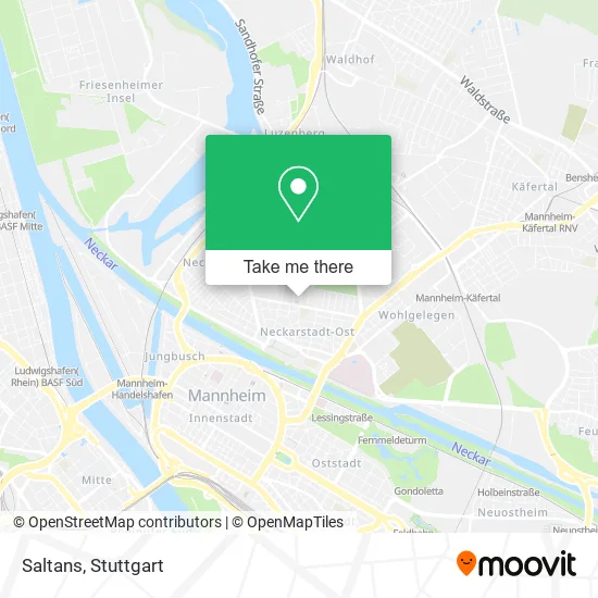
See Saltans, Neckarstadt-Ost/Wohlgelegen, on the map
Public Transit to Saltans in Neckarstadt-Ost/Wohlgelegen
Wondering how to get to Saltans in Neckarstadt-Ost/Wohlgelegen? Moovit helps you find the best way to get to Saltans with step-by-step directions from the nearest public transit station.
Moovit provides free maps and live directions to help you navigate through your city. View schedules, routes, timetables, and find out how long does it take to get to Saltans in real time.
Looking for the nearest stop or station to Saltans? Check out this list of stops closest to your destination: Mannheim; Mannheim; Mannheim.
Train: RB35, RE60, S9.Light Rail: 1, 15, 4, 4A, RNV 5.Bus: 710, 74, 76, RNV 60, RNV 61, RNV 63, RNV 5.
Want to see if there’s another route that gets you there at an earlier time? Moovit helps you find alternative routes or times. Get directions from and directions to Saltans easily from the Moovit App or Website.
We make riding to Saltans easy, which is why over 1.5 million users, including users in Neckarstadt-Ost/Wohlgelegen, trust Moovit as the best app for public transit. You don’t need to download an individual bus app or train app, Moovit is your all-in-one transit app that helps you find the best bus time or train time available.
For information on prices of bus, light rail and train, costs and ride fares to Saltans, please check the Moovit app.
Use the app to navigate to popular places including to the airport, hospital, stadium, grocery store, mall, coffee shop, school, college, and university.
Saltans Address: Geibelstraße 17 68167 Mannheim street in Neckarstadt-Ost/Wohlgelegen
- Roll in E. V. Pflegedienst & Tagespflege,
- Bitmap Kartografie und Infografik,
- Taxibetrieb,
- Ergotherapiepraxis Katharina Werding,
- Massage Praxis Wasanthara,
- SV Waldhof Mannheim,
- Otto Siffling,
- Haus Der Awo,
- Floh / Koordinations- und Informationsstelle, Erziehungshilfe,
- Gemeinschaftswerk Mannheim,
- Männerwohnheim,
- AWO Mannheim,
- Cafeh Vogelstang,
- AWO Hessen-Süd,
- Carsten Otmar Bach,
- Arbeitnehmer-Wohnheim,
- Stadtmobil,
- Bäcker Görtz,
- Pohl Sanitär und Heizung Heizung- und Sanitärmeisterbetrieb,
- Rohrbach Heizung
Places Near Saltans (Neckarstadt-Ost/Wohlgelegen)
- Hanns-Martin-Schleyer-Halle, Bad Cannstatt,
- Marmorsaal Im Weissenburgpark, Stuttgart-Süd,
- FlixBus Haltestelle, Stuttgart,
- Waldfriedhof, Degerloch,
- Hauptbahnhof Stuttgart, Stuttgart-Mitte,
- Pariser Platz Stuttgart, Stuttgart-Mitte,
- Gleis 101/102 (tief), Stuttgart-Mitte,
- Mercedes-Benz Museum, Bad Cannstatt,
- Im Wizemann (Halle), Bad Cannstatt,
- Klinikum Stuttgart - Katharinenhospital, Stuttgart-Mitte,
- Gasometer Pforzheim, Pforzheim,
- Wilhelma (U-Bahn Wilhelma), Bad Cannstatt,
- Porsche Museum, Zuffenhausen,
- Geilhaus Haus 33a, Reutlingen-Betzingen,
- Mercedes-Benz Museum (Mercedes Museum Stuttgart), Bad Cannstatt,
- Hanns-Martin-Schleyer-Halle (Stuttgart Hans-Martin-Schleyerhalle), Bad Cannstatt,
- Schleyerhalle, Bad Cannstatt,
- Porsche-Arena, Bad Cannstatt,
- SI-Centrum, Möhringen,
- Mettingen Eros-Center Puff Laufhaus, Esslingen Am Neckar
How to get to popular places in Stuttgart with public transit
Get around Neckarstadt-Ost/Wohlgelegen by public transit!
Traveling around Neckarstadt-Ost/Wohlgelegen has never been so easy. See step by step directions as you travel to any attraction, street or major public transit station. View bus and train schedules, arrival times, service alerts and detailed routes on a map, so you know exactly how to get to anywhere in Neckarstadt-Ost/Wohlgelegen.
When traveling to any destination around Neckarstadt-Ost/Wohlgelegen use Moovit's Live Directions with Get Off Notifications to know exactly where and how far to walk, how long to wait for your line, and how many stops are left. Moovit will alert you when it's time to get off — no need to constantly re-check whether yours is the next stop.
Wondering how to use public transit in Neckarstadt-Ost/Wohlgelegen or how to pay for public transit in Neckarstadt-Ost/Wohlgelegen? Moovit public transit app can help you navigate your way with public transit easily, and at minimum cost. It includes public transit fees, ticket prices, and costs. Looking for a map of Neckarstadt-Ost/Wohlgelegen public transit lines? Moovit public transit app shows all public transit maps in Neckarstadt-Ost/Wohlgelegen with all Bus, Train, Subway, Light Rail, Ferry, S-Bahn and Funicular routes and stops on an interactive map.
Stuttgart has 7 transit type(s), including: Bus, Train, Subway, Light Rail, Ferry, S-Bahn and Funicular, operated by several transit agencies, including SSB - Stadtbahn, SSB, SSB - Seilbahn / Zacke, S-Bahn Stuttgart, Rhein-Neckar-Verkehr GmbH (rnv), Karlsruher Verkehrsverbund, DB AG, DB Regiobus BW, Arverio Baden-Württemberg GmbH, DB RegioNetz Verkehrs GmbH Westfrankenbahn, DB Regio AG Baden-Württemberg, Südwestdeutsche Verkehrs-AG, DB Regio AG Mitte Region Hessen, DB and Bodensee-Oberschwaben-Bahn