See Saltfleet High School, Hamilton, on the map
Directions to Saltfleet High School (Hamilton) with public transportation
The following transit lines have routes that pass near Saltfleet High School
 Bus:
Bus:
How to get to Saltfleet High School by bus?
Click on the bus route to see step by step directions with maps, line arrival times and updated time schedules.
Bus stations near Saltfleet High School in Hamilton
- Highland at Saltfleet High School,4 min walk,
- Upper Centennial at Highland,10 min walk,
Bus lines to Saltfleet High School in Hamilton
- 43,Lime Ridge Mall Only,
- 44,Ancaster Business Park,
What are the closest stations to Saltfleet High School?
The closest stations to Saltfleet High School are:
- Highland at Saltfleet High School is 243 meters away, 4 min walk.
- Upper Centennial at Highland is 756 meters away, 10 min walk.
Which bus lines stop near Saltfleet High School?
These bus lines stop near Saltfleet High School: 43, 44.
What’s the nearest bus stop to Saltfleet High School in Hamilton?
The nearest bus stop to Saltfleet High School in Hamilton is Highland at Saltfleet High School. It’s a 4 min walk away.
What time is the first bus to Saltfleet High School in Hamilton?
The 44 is the first bus that goes to Saltfleet High School in Hamilton. It stops nearby at 4:41 AM.
What time is the last bus to Saltfleet High School in Hamilton?
The 44 is the last bus that goes to Saltfleet High School in Hamilton. It stops nearby at 2:12 AM.
How much is the bus fare to Saltfleet High School?
The bus fare to Saltfleet High School costs about $2.50.
See Saltfleet High School, Hamilton, on the map
Public Transit to Saltfleet High School in Hamilton
Wondering how to get to Saltfleet High School in Hamilton, Canada? Moovit helps you find the best way to get to Saltfleet High School with step-by-step directions from the nearest public transit station.
Moovit provides free maps and live directions to help you navigate through your city. View schedules, routes, timetables, and find out how long does it take to get to Saltfleet High School in real time.
Looking for the nearest stop or station to Saltfleet High School? Check out this list of stops closest to your destination: Highland at Saltfleet High School; Upper Centennial at Highland.
Bus:
Want to see if there’s another route that gets you there at an earlier time? Moovit helps you find alternative routes or times. Get directions from and directions to Saltfleet High School easily from the Moovit App or Website.
We make riding to Saltfleet High School easy, which is why over 1.5 million users, including users in Hamilton, trust Moovit as the best app for public transit. You don’t need to download an individual bus app or train app, Moovit is your all-in-one transit app that helps you find the best bus time or train time available.
For information on prices of bus, costs and ride fares to Saltfleet High School, please check the Moovit app.
Use the app to navigate to popular places including to the airport, hospital, stadium, grocery store, mall, coffee shop, school, college, and university.
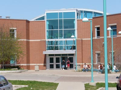
Saltfleet High School Address: Highbury Drive street in Hamilton
Attractions near Saltfleet High School
Stoney Creek Camels Rugby Club,Saltfleet's Social Justice Commitee,Saltfleet District High School,Rooted in Nutrition,Detour Property Development Inc,KPS Building & Construction,131-135 Upper Centennial Parkway,Turtle Jack's Upper Centennial,Crunch Fitness,Ky Co Barbershop,Amazon Counter-Hasty Market (Pudo),Western Union,Beattie Pet Hospital - Stoney Creek,Essentially Oil Obsessed with Jess,Upper Centennial at Highland,Aldo's Shutters & Blinds,Sechomage Integrated Resources,Manor Management,Against the Grain,FortinosHow to get to popular attractions in Hamilton with public transit
Mcmaster University, Hamilton,Earls Kitchen & Bar, Toronto,Cambridge, Ontario, Cambridge,Yorkdale Shopping Centre, Toronto,Starbucks, Toronto,Outlet Collection at Niagara, Niagara-On-The-Lake,TTC 512 St. Clair Streetcar, Toronto,Landmark Cinemas, Waterloo,Square One Bus Terminal, Mississauga,Phoenix Restaurant 金鳳餐廳, Markham,GoodLife Fitness Centres, Toronto,Humber College - Lakeshore Campus, Toronto,Jane & Finch, Toronto,Pizzeria Libretto, Toronto,Insomnia Restaurant and Lounge, Toronto,Kinka Izakaya, Toronto,Meadowvale Town Centre, Mississauga,Rogers Centre, Toronto,Pacific Mall, Markham,Toronto Eaton Centre, TorontoGet around Hamilton by public transit!
Traveling around Hamilton has never been so easy. See step by step directions as you travel to any attraction, street or major public transit station. View bus and train schedules, arrival times, service alerts and detailed routes on a map, so you know exactly how to get to anywhere in Hamilton.
When traveling to any destination around Hamilton use Moovit's Live Directions with Get Off Notifications to know exactly where and how far to walk, how long to wait for your line, and how many stops are left. Moovit will alert you when it's time to get off — no need to constantly re-check whether yours is the next stop.
Wondering how to use public transit in Hamilton or how to pay for public transit in Hamilton? Moovit public transit app can help you navigate your way with public transit easily, and at minimum cost. It includes public transit fees, ticket prices, and costs. Looking for a map of Hamilton public transit lines? Moovit public transit app shows all public transit maps in Hamilton with all bus routes and stops on an interactive map.
Hamilton has 1 transit type(s), including: bus, operated by several transit agencies, including TTC, TTC Streetcar, Toronto Subway, GO Transit Bus, GO Transit, Amtrak, York Region Transit, Grand River Transit, Guelph Transit, grt, Hamilton Street Railway, MiWay, Brampton Transit, Burlington Transit and Oakville Transit