How to get to Samaratech by bus?
Click on the bus route to see step by step directions with maps, line arrival times and updated time schedules.
From Sibley Memorial Hospital, Washington
144 minFrom Clyde's of Chevy Chase, Montgomery County
114 minFrom Embassy Suites at the Chevy Chase Pavilion, Washington
137 minFrom Massachusetts Ave NW, Washington
126 minFrom Falls Church, VA, Falls Church
52 minFrom 5454 Wisconsin, Montgomery County
114 minFrom Chevy Chase Metro Plaza, Washington
120 minFrom The Cheesecake Factory, Washington
115 minFrom Inova Fairfax Hospital North Tower Building, Fairfax County
71 minFrom George H.W. Bush Center For Intelligence (CIA Headquarters), Fairfax County
51 min
How to get to Samaratech by metro?
Click on the metro route to see step by step directions with maps, line arrival times and updated time schedules.
From Clyde's of Chevy Chase, Montgomery County
69 minFrom Embassy Suites at the Chevy Chase Pavilion, Washington
66 minFrom Massachusetts Ave NW, Washington
82 minFrom Falls Church, VA, Falls Church
53 minFrom 5454 Wisconsin, Montgomery County
72 minFrom Chevy Chase Metro Plaza, Washington
67 minFrom The Cheesecake Factory, Washington
66 min
Bus stops near Samaratech in Fairfax County
Metro station near Samaratech in Fairfax County
- Tysons Corner Metro, 21 min walk,VIEW
Bus lines to Samaratech in Fairfax County
What are the closest stations to Samaratech?
The closest stations to Samaratech are:
- Lewinsville Rd @ Farm Credit Dr is 302 yards away, 4 min walk.
- Lewinsville Rd @ Tysons Mclean Dr is 362 yards away, 5 min walk.
- Chain Bridge Rd @ Hunting Ave is 930 yards away, 12 min walk.
- Tysons Corner Metro is 1724 yards away, 21 min walk.
Which bus lines stop near Samaratech?
These bus lines stop near Samaratech: 427, 721, A70.
Which metro line stops near Samaratech?
SILVER (Ashburn)
What’s the nearest metro station to Samaratech in Fairfax County?
The nearest metro station to Samaratech in Fairfax County is Tysons Corner Metro. It’s a 21 min walk away.
What’s the nearest bus station to Samaratech in Fairfax County?
The nearest bus station to Samaratech in Fairfax County is Lewinsville Rd @ Farm Credit Dr. It’s a 4 min walk away.
What time is the first metro to Samaratech in Fairfax County?
The SILVER is the first metro that goes to Samaratech in Fairfax County. It stops nearby at 5:07 AM.
What time is the last metro to Samaratech in Fairfax County?
The SILVER is the last metro that goes to Samaratech in Fairfax County. It stops nearby at 12:43 AM.
What time is the first bus to Samaratech in Fairfax County?
The 432 is the first bus that goes to Samaratech in Fairfax County. It stops nearby at 5:31 AM.
What time is the last bus to Samaratech in Fairfax County?
The 721 is the last bus that goes to Samaratech in Fairfax County. It stops nearby at 10:44 PM.
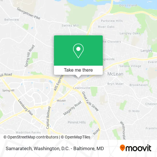
See Samaratech, Fairfax County, on the map
Public Transit to Samaratech in Fairfax County
Wondering how to get to Samaratech in Fairfax County? Moovit helps you find the best way to get to Samaratech with step-by-step directions from the nearest public transit station.
Moovit provides free maps and live directions to help you navigate through your city. View schedules, routes, timetables, and find out how long does it take to get to Samaratech in real time.
Looking for the nearest stop or station to Samaratech? Check out this list of stops closest to your destination: Lewinsville Rd @ Farm Credit Dr; Lewinsville Rd @ Tysons Mclean Dr; Chain Bridge Rd @ Hunting Ave; Tysons Corner Metro.
Bus: 427, 721, A70, 432.Metro: SILVER.
Want to see if there’s another route that gets you there at an earlier time? Moovit helps you find alternative routes or times. Get directions from and directions to Samaratech easily from the Moovit App or Website.
We make riding to Samaratech easy, which is why over 1.5 million users, including users in Fairfax County, trust Moovit as the best app for public transit. You don’t need to download an individual bus app or train app, Moovit is your all-in-one transit app that helps you find the best bus time or train time available.
For information on prices of bus and metro, costs and ride fares to Samaratech, please check the Moovit app.
Use the app to navigate to popular places including to the airport, hospital, stadium, grocery store, mall, coffee shop, school, college, and university.
Samaratech Address: 7423 Old Maple Sq McLean, VA 22102 street in Fairfax County
- The Langley Oaks Homeowners Association,
- Outspoken Autocare,
- Liberty Crossing,
- DNI,
- The Analysis Corporation,
- National Counterterrorism Center (NCTC),
- Office of the Director of National Intelligence (DNI),
- Al Tax Service,
- Hackney Food,
- Burger 21,
- Foulger-Pratt Companies,
- Furrow Diana LPC,
- Nancy Dutton Potter PH.D.,
- World Tree Partners,
- Lewinsville, Virginia,
- 1500 Tysons McLean Dr,
- Great Falls McLean,
- Virginia Advanced Surgical Arts,
- Washington Breast Reconstruction,
- TD Ameritrade Client Portal
Places Near Samaratech (Fairfax County)
- Amazon Hq2, Arlington County,
- Rock Creek Tennis Center, Washington,
- Westfield Montgomery Mall, Montgomery County,
- The Anthem, Washington,
- Warner Theatre, Washington,
- Capital One Arena, Washington,
- Washington National Cathedral, Washington,
- National Zoo, Washington,
- Washington DC VA Medical Center, Washington,
- National Museum of African American History and Culture, Washington,
- PG Mall, Prince George's County,
- Sibley Memorial Hospital, Washington,
- Marriott Marquis Washington, DC, Washington,
- Museum Of The Bible, Washington,
- M&T Bank Stadium, Baltimore,
- Pennsylvania Ave NW (3rd st and pennsylvania), Washington,
- Camden Yards, Baltimore,
- Basilica of the National Shrine, Washington,
- National Mall, Washington,
- Georgetown, Washington
How to get to popular places in Washington, D.C. - Baltimore, MD with public transit
Get around Fairfax County by public transit!
Traveling around Fairfax County has never been so easy. See step by step directions as you travel to any attraction, street or major public transit station. View bus and train schedules, arrival times, service alerts and detailed routes on a map, so you know exactly how to get to anywhere in Fairfax County.
When traveling to any destination around Fairfax County use Moovit's Live Directions with Get Off Notifications to know exactly where and how far to walk, how long to wait for your line, and how many stops are left. Moovit will alert you when it's time to get off — no need to constantly re-check whether yours is the next stop.
Wondering how to use public transit in Fairfax County or how to pay for public transit in Fairfax County? Moovit public transit app can help you navigate your way with public transit easily, and at minimum cost. It includes public transit fees, ticket prices, and costs. Looking for a map of Fairfax County public transit lines? Moovit public transit app shows all public transit maps in Fairfax County with all Bus, Train, Metro, Light Rail and Ferry routes and stops on an interactive map.
Washington, D.C. - Baltimore, MD has 5 transit type(s), including: Bus, Train, Metro, Light Rail and Ferry, operated by several transit agencies, including WMATA, Montgomery County Ride On, Fairfax Connector, TheBus, PRTC, DASH - Alexandria, Arlington Transit (ART), RTA of Central Maryland, MDOT MTA, MDOT MTA Light RailLink, MDOT MTA Commuter Bus, MDOT MTA Local Bus, FXBGO!, Virginia Railway Express (VRE) and MARC