How to get to Samsonite by bus?
Click on the bus route to see step by step directions with maps, line arrival times and updated time schedules.
From Weston, Davie
31 minFrom JP Taravella High School, Coral Springs-Margate
56 minFrom N University Dr, Plantation
44 minFrom Westfield Broward Mall, Plantation
34 minFrom Oakland Park Boulevard & University Drive, Plantation
29 minFrom Florida Turnpike Sunrise Blvd. Toll Plaza, Plantation
44 minFrom AAA Century Appliance, Plantation
53 minFrom Archbishop Edward A McCrthy HGH Sch (Archbishop McCarthy High School), Davie
81 minFrom 595 Express, Davie
76 minFrom Archbishop Edward A. Mccarthy High School, Davie
82 min
Bus stops near Samsonite in Plantation
Bus lines to Samsonite in Plantation
What are the closest stations to Samsonite?
The closest stations to Samsonite are:
- Sawgrass Mills Mall is 638 yards away, 8 min walk.
- BB&T Park & Ride is 1514 yards away, 18 min walk.
Which bus lines stop near Samsonite?
These bus lines stop near Samsonite: 22, 23, 36, 72.
What’s the nearest bus station to Samsonite in Plantation?
The nearest bus station to Samsonite in Plantation is Sawgrass Mills Mall. It’s a 8 min walk away.
What time is the first bus to Samsonite in Plantation?
The 114 is the first bus that goes to Samsonite in Plantation. It stops nearby at 5:00 AM.
What time is the last bus to Samsonite in Plantation?
The 72 is the last bus that goes to Samsonite in Plantation. It stops nearby at 12:37 AM.
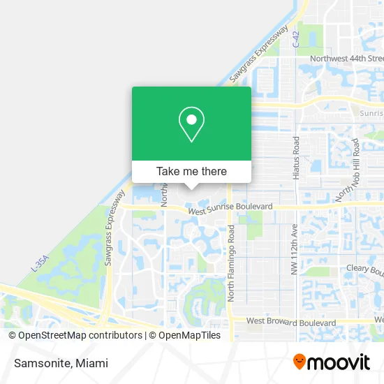
See Samsonite, Plantation, on the map
Public Transit to Samsonite in Plantation
Wondering how to get to Samsonite in Plantation? Moovit helps you find the best way to get to Samsonite with step-by-step directions from the nearest public transit station.
Moovit provides free maps and live directions to help you navigate through your city. View schedules, routes, timetables, and find out how long does it take to get to Samsonite in real time.
Looking for the nearest stop or station to Samsonite? Check out this list of stops closest to your destination: Sawgrass Mills Mall; BB&T Park & Ride.
Bus: 22, 23, 36, 72, 110, 114.
Want to see if there’s another route that gets you there at an earlier time? Moovit helps you find alternative routes or times. Get directions from and directions to Samsonite easily from the Moovit App or Website.
We make riding to Samsonite easy, which is why over 1.5 million users, including users in Plantation, trust Moovit as the best app for public transit. You don’t need to download an individual bus app or train app, Moovit is your all-in-one transit app that helps you find the best bus time or train time available.
For information on prices of bus, costs and ride fares to Samsonite, please check the Moovit app.
Use the app to navigate to popular places including to the airport, hospital, stadium, grocery store, mall, coffee shop, school, college, and university.
Samsonite Address: 12801 W Sunrise Blvd Fort Lauderdale, FL 33323 street in Plantation
- Amazon Locker-Matia,
- Cache,
- GUCCI,
- Perfumes 4 U,
- Movado Company Store,
- Sawgrass Mills Food Court,
- Sawgrass Mills Green Toad Entrance / Bus Stop,
- Boca Sawgrass Mills Mall,
- Crystal Laser Gifts.Com (3D Laser Art Sawgrass Mills),
- Sawgrass Mills Mall Commercial Center,
- Primark,
- Sawgrass Mills,
- Ecko Unlimited Company Annex,
- Sawgrass Mills Shuttle,
- Ross Dress For Less,
- Five Below,
- Sawgrass Mills Mall,
- Gant Sawgrass Mills Outlet,
- Wilsons Leather Sawgrass Mills,
- Sawgrass Mills, Florida
Places Near Samsonite (Plantation)
- Dolphin Mall, Miami,
- Little Havana, Miami,
- Miami Design District, Miami,
- Richard E. Gerstein Justice Building, Miami,
- Dolphin Mall Bus, Miami,
- Miami-Dade County Courthouse, Miami,
- Miami VA Hospital, Miami,
- Marlins Park, Miami,
- Hard Rock Stadium, Miami Gardens,
- Sawgrass mall ( FL ), Miami Beach,
- Port of Miami Cruise Terminal, Miami,
- Aventura Mall, Miami Beach,
- Wynwood, Miami,
- Sawgrass Mall, Miami,
- Zoo Miami, Miami,
- Keiser University Flagship Campus, West Palm Beach,
- Brickell City Centre, Miami,
- Bayside Marketplace, Miami,
- Aventura Mall, Miami,
- Miami Freedom Park, Miami
How to get to popular places in Miami with public transit
Get around Plantation by public transit!
Traveling around Plantation has never been so easy. See step by step directions as you travel to any attraction, street or major public transit station. View bus and train schedules, arrival times, service alerts and detailed routes on a map, so you know exactly how to get to anywhere in Plantation.
When traveling to any destination around Plantation use Moovit's Live Directions with Get Off Notifications to know exactly where and how far to walk, how long to wait for your line, and how many stops are left. Moovit will alert you when it's time to get off — no need to constantly re-check whether yours is the next stop.
Wondering how to use public transit in Plantation or how to pay for public transit in Plantation? Moovit public transit app can help you navigate your way with public transit easily, and at minimum cost. It includes public transit fees, ticket prices, and costs. Looking for a map of Plantation public transit lines? Moovit public transit app shows all public transit maps in Plantation with all Bus, Train, Light Rail and Ferry routes and stops on an interactive map.
Miami has 4 transit type(s), including: Bus, Train, Light Rail and Ferry, operated by several transit agencies, including Broward County Transit, Miami-Dade Transit, Metrorail, Palm Tran, Tri-Rail, Brightline, MARTY, City of Homestead Trolley, Key West Transit, Treasure Coast Connector, GoLine IRT, Amtrak, Greyhound-us, FlixBus-us and Aventura Express Shuttle Bus