How to get to Samsonite by bus?
Click on the bus route to see step by step directions with maps, line arrival times and updated time schedules.
Bus stops near Samsonite in South Portland
Bus lines to Samsonite in South Portland
What are the closest stations to Samsonite?
The closest stations to Samsonite are:
- Maine Mall Rd + Goodwill is 141 yards away, 2 min walk.
- Philbrook Ave And Hampton Inn is 1048 yards away, 13 min walk.
- Target O/B is 1402 yards away, 17 min walk.
Which bus lines stop near Samsonite?
These bus lines stop near Samsonite: 24A, 24B, 5.
What’s the nearest bus station to Samsonite in South Portland?
The nearest bus station to Samsonite in South Portland is Maine Mall Rd + Goodwill. It’s a 2 min walk away.
What time is the first bus to Samsonite in South Portland?
The 3 is the first bus that goes to Samsonite in South Portland. It stops nearby at 5:55 AM.
What time is the last bus to Samsonite in South Portland?
The 3 is the last bus that goes to Samsonite in South Portland. It stops nearby at 10:25 PM.
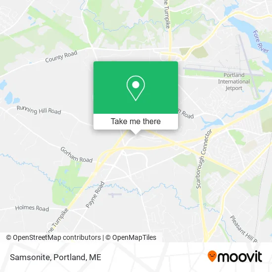
See Samsonite, South Portland, on the map
Public Transit to Samsonite in South Portland
Wondering how to get to Samsonite in South Portland? Moovit helps you find the best way to get to Samsonite with step-by-step directions from the nearest public transit station.
Moovit provides free maps and live directions to help you navigate through your city. View schedules, routes, timetables, and find out how long does it take to get to Samsonite in real time.
Looking for the nearest stop or station to Samsonite? Check out this list of stops closest to your destination: Maine Mall Rd + Goodwill; Philbrook Ave And Hampton Inn; Target O/B.
Bus: 24A, 24B, 5, 60, 3.
Want to see if there’s another route that gets you there at an earlier time? Moovit helps you find alternative routes or times. Get directions from and directions to Samsonite easily from the Moovit App or Website.
We make riding to Samsonite easy, which is why over 1.5 million users, including users in South Portland, trust Moovit as the best app for public transit. You don’t need to download an individual bus app or train app, Moovit is your all-in-one transit app that helps you find the best bus time or train time available.
For information on prices of bus, costs and ride fares to Samsonite, please check the Moovit app.
Use the app to navigate to popular places including to the airport, hospital, stadium, grocery store, mall, coffee shop, school, college, and university.
Samsonite Address: 700 Maine Mall Rd South Portland, ME 04106 street in South Portland
- JCPenney Home Furnishings,
- Sunglass Hut,
- South Portland Goodwill Store & Donation Center,
- Christmas Tree Shops,
- Fresco del Forno,
- Supplemental Health,
- Gorrill Palmer,
- 482 Payne Rd Parking,
- I-295 N Scarborough,
- Exit 45 Gold Star Memorial Hwy South Portland,
- TACO BELL,
- 400 Gallery Blvd Parking,
- Prime Nails and Spa,
- Fairfield Inn Portland Maine Mall Scarborough,
- Western Union,
- Walmart Scarborough Supercenter,
- Marshalls & Homegoods (Home Goods),
- Dr Stephen D Rioux MD,
- Maine Neurology (Kleinman Michael MMP Neurology Mri Scarborough),
- Scarborough LG Certified Appliance Repair
Places Near Samsonite (South Portland)
- Clarion Hotel Portland,
- Maine Medical Center,
- ZzZzZzZzZzZ, Westbrook,
- Fort Williams Park, Cape Elizabeth,
- Jewell Island,
- On a bus to Kennebunkport,
- Walmart Scarborough Supercenter,
- Fort Gorges,
- House Island,
- Exit 45 Park And Ride, South Portland,
- Southern Maine Community College, South Portland,
- L. L. Bean Outlet,
- The Old Port,
- Walmart,
- Mercy Hospital - Fore River Campus,
- Casco Bay Ferry Terminal,
- Portland International Jetport (PWM) (Portland International Jetport),
- Portland Transportation Center,
- Cape Elizabeth, ME, Cape Elizabeth,
- Cross Insurance Arena
How to get to popular places in Portland, ME with public transit
Get around South Portland by public transit!
Traveling around South Portland has never been so easy. See step by step directions as you travel to any attraction, street or major public transit station. View bus and train schedules, arrival times, service alerts and detailed routes on a map, so you know exactly how to get to anywhere in South Portland.
When traveling to any destination around South Portland use Moovit's Live Directions with Get Off Notifications to know exactly where and how far to walk, how long to wait for your line, and how many stops are left. Moovit will alert you when it's time to get off — no need to constantly re-check whether yours is the next stop.
Wondering how to use public transit in South Portland or how to pay for public transit in South Portland? Moovit public transit app can help you navigate your way with public transit easily, and at minimum cost. It includes public transit fees, ticket prices, and costs. Looking for a map of South Portland public transit lines? Moovit public transit app shows all public transit maps in South Portland with all Bus, Train and Ferry routes and stops on an interactive map.
Portland, ME has 3 transit type(s), including: Bus, Train and Ferry, operated by several transit agencies, including Greater Portland Metro, City of South Portland, Biddeford Saco Old Orchard Beach Transit, Casco Bay Lines, Amtrak, Greyhound-us and FlixBus-us