Directions to Samuel Cumin (Orleans) with public transportation
The following transit lines have routes that pass near Samuel Cumin
How to get to Samuel Cumin by bus?
Click on the bus route to see step by step directions with maps, line arrival times and updated time schedules.
From Parque São Lourenço, São Lourenço
47 minFrom Alto Da Rua XV, Alto Da Rua XV
36 minFrom Rua Chile, Rebouças
40 minFrom Avenida Senador Souza Naves, Alto Da Rua XV
44 minFrom Estação Tubo Praça Carlos Gomes, Centro
27 minFrom Rua Coronel Dulcídio, Batel
31 minFrom Tribunal Regional Eleitoral do Paraná, Prado Velho
43 minFrom 11º Distrito Policial, Cic
56 minFrom hospital das clínicas, Centro
29 minFrom Parque Tanguá, Taboão
53 min
Bus stops near Samuel Cumin in Orleans
Bus lines to Samuel Cumin in Orleans
- 040 INTERBAIRROS IV, Terminal Pinheirinho → Terminal Santa Felicidade,VIEW
- 870 SÃO BRAZ, São Braz → Praça Tiradentes,VIEW
- 889 MAD. SÃO BRAZ, Praça Rui Barbosa ↺ São Braz (Circular),VIEW
- 821 FERNÃO DIAS, Terminal Campo Comprido → Terminal Santa Felicidade,VIEW
- J17 DOM PEDRO II / CAMPO COMPRIDO, Terminal Campo Comprido → Vila Dom Pedro,VIEW
- J62 CAMPO LARGO / GUADALUPE, Garagem / Terminal Campo Largo → Terminal Guadalupe,VIEW
- 822 GABINETO, Terminal Campo Comprido → Gabineto (via Plásticos Paraná),VIEW
- 817 SATURNO / VENEZA, Terminal Santa Felicidade → Terminal Campina do Siqueira,VIEW
What are the closest stations to Samuel Cumin?
The closest stations to Samuel Cumin are:
- Av. Vereador Toaldo Túlio, 4265 is 45 meters away, 1 min walk.
- Viaduto Toaldo Túlio (Av. Vereador Toaldo Túlio, 4730) is 433 meters away, 6 min walk.
- Marginal da Rod. BR-277, 4158 is 539 meters away, 8 min walk.
- R. Professor João Falarz, 265 is 613 meters away, 9 min walk.
- Rua Luiz Sperandio, 172 is 824 meters away, 11 min walk.
Which bus lines stop near Samuel Cumin?
These bus lines stop near Samuel Cumin: 040 INTERBAIRROS IV, J62 CAMPO LARGO / GUADALUPE.
What’s the nearest bus station to Samuel Cumin in Orleans?
The nearest bus station to Samuel Cumin in Orleans is Av. Vereador Toaldo Túlio, 4265. It’s a 1 min walk away.
What time is the first bus to Samuel Cumin in Orleans?
The 889 MAD. SÃO BRAZ is the first bus that goes to Samuel Cumin in Orleans. It stops nearby at 3:22 AM.
What time is the last bus to Samuel Cumin in Orleans?
The 889 MAD. SÃO BRAZ is the last bus that goes to Samuel Cumin in Orleans. It stops nearby at 2:42 AM.
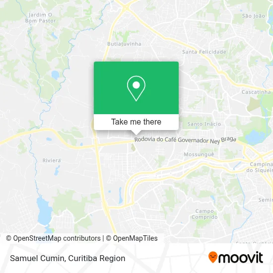
See Samuel Cumin, Orleans, on the map
Public Transit to Samuel Cumin in Orleans
Wondering how to get to Samuel Cumin in Orleans? Moovit helps you find the best way to get to Samuel Cumin with step-by-step directions from the nearest public transit station.
Moovit provides free maps and live directions to help you navigate through your city. View schedules, routes, timetables, and find out how long does it take to get to Samuel Cumin in real time.
Looking for the nearest stop or station to Samuel Cumin? Check out this list of stops closest to your destination: Av. Vereador Toaldo Túlio; Viaduto Toaldo Túlio (Av. Vereador Toaldo Túlio; Marginal da Rod. BR-277; R. Professor João Falarz; Rua Luiz Sperandio.
Bus: 040 INTERBAIRROS IV, J62 CAMPO LARGO / GUADALUPE, 870 SÃO BRAZ, 889 MAD. SÃO BRAZ, 821 FERNÃO DIAS, J17 DOM PEDRO II / CAMPO COMPRIDO, 822 GABINETO, 817 SATURNO / VENEZA.
Want to see if there’s another route that gets you there at an earlier time? Moovit helps you find alternative routes or times. Get directions from and directions to Samuel Cumin easily from the Moovit App or Website.
We make riding to Samuel Cumin easy, which is why over 1.5 million users, including users in Orleans, trust Moovit as the best app for public transit. You don’t need to download an individual bus app or train app, Moovit is your all-in-one transit app that helps you find the best bus time or train time available.
For information on prices of bus, costs and ride fares to Samuel Cumin, please check the Moovit app.
Use the app to navigate to popular places including to the airport, hospital, stadium, grocery store, mall, coffee shop, school, college, and university.
Samuel Cumin Address: Rua Ubaldo Brunatti, 135 Orleans Curitiba-PR 82310-352 street in Orleans
- 8d Soluções Digitais,
- Banco Santander,
- Strong Muscle Gym,
- L a Motors,
- Laguna Veículos,
- Contabilidade Nova Orleans,
- Maienge Serviços Mecanicos,
- Rua Adir Dalabona 95,
- Obrzut Bar,
- Vicelli Barbershop,
- Bradesco,
- Uplay Fitness,
- Ponto Interbairros IV,
- Unidade De Saúde Nova Orleans,
- Condomínio Residencial Montechiaro,
- Rua Alberto Panek 528,
- Janaína Mariane Machado dos Santos,
- Hockey Town Cwb - Associação Paranaense de Patins e Hockey,
- Martins & Gomes Instalações Eletricas e Hidraulicas,
- Linha 040 Interbairros IV
Places Near Samuel Cumin (Orleans)
- Jockey Plaza Shopping Center, Tarumã,
- Hospital Angelina Caron, Campina Grande Do Sul,
- Parque Barigui, Mercês,
- Pontifícia Universidade Católica do Paraná (PUCPR), Prado Velho,
- Jardim Botânico de Curitiba PR, Centro,
- Hospital Universitário Evangélico de Curitiba, Bigorrilho,
- Hospital do Rocio, Campo,
- Park Shopping Barigüi, Mossunguê,
- Shopping Estação, Rebouças,
- Hospital Do Senhor - Madre Virgínia, São José Dos Pinhais,
- Arena Da Baixada - Curitiba,
- Hhhhh, Fazendinha,
- Rua General Mário Tourinho, Campina Do Siqueira,
- Shopping Palladium, Portão,
- Hospital de Clínicas (HC - UFPR), Centro,
- Hospital Erasto Gaertner, Jardim Das Américas,
- Rua Martim Afonso 558, Mercês,
- Hospital Nossa Senhora Das Graças, Mercês,
- Hospital Madalena Sofia, Bairro Alto,
- Hospital Da Cruz Vermelha, Batel
How to get to popular places in Curitiba Region with public transit
Get around Orleans by public transit!
Traveling around Orleans has never been so easy. See step by step directions as you travel to any attraction, street or major public transit station. View bus and train schedules, arrival times, service alerts and detailed routes on a map, so you know exactly how to get to anywhere in Orleans.
When traveling to any destination around Orleans use Moovit's Live Directions with Get Off Notifications to know exactly where and how far to walk, how long to wait for your line, and how many stops are left. Moovit will alert you when it's time to get off — no need to constantly re-check whether yours is the next stop.
Wondering how to use public transit in Orleans or how to pay for public transit in Orleans? Moovit public transit app can help you navigate your way with public transit easily, and at minimum cost. It includes public transit fees, ticket prices, and costs. Looking for a map of Orleans public transit lines? Moovit public transit app shows all public transit maps in Orleans with all Bus and Cable Car routes and stops on an interactive map.
Curitiba Region has 2 transit type(s), including: Bus and Cable Car, operated by several transit agencies, including Sistema Integrado de Mobilidade (URBS), Sistema Integrado de Mobilidade (AMEP), URBS (Cartões bancários e Dinheiro), URBS (Cartões bancários / Cartão URBS), AMEP (Cartões bancários / Cartão MetroCard), AMEP (Cartões bancários / Cartão MetroCard / Dinheiro), Viação Colombo (Dinheiro), TRIAR (Cartão TRIAR / Dinheiro), Empresa Curitiba Cerro Azul (Dinheiro), Expresso Nossa Senhora da Penha (Dinheiro), Empresa Campo Alto Tijucas (Dinheiro), Auto Viação São José (Cartão VEM / Dinheiro), BRT S/A (Cartão VEM / Dinheiro), TransPiedade (Cartão Cidadão / Dinheiro) and Oceânica Sul (Cartão Transporte / Dinheiro)