How to get to Samuel Rodriguez, Md - Kaiser Permanente by bus?
Click on the bus route to see step by step directions with maps, line arrival times and updated time schedules.
From Olney MD USA, Montgomery County
71 minFrom Clarksburg Premium Outlets, Montgomery County
69 minFrom HJF, Montgomery County
55 minFrom Clarksburg Premium Outlets, Montgomery County
62 minFrom Georgia Ave & Icc Park & Ride Lot, Montgomery County
92 minFrom Glenstone Museum, Montgomery County
82 minFrom Park Potomac Place, Montgomery County
81 minFrom Walmart Supercenter, Montgomery County
29 minFrom Montgomery College-Rockville, Montgomery County
40 minFrom Rockville, MD, Montgomery County
47 min
How to get to Samuel Rodriguez, Md - Kaiser Permanente by train?
Click on the train route to see step by step directions with maps, line arrival times and updated time schedules.
Bus stops near Samuel Rodriguez, Md - Kaiser Permanente in Montgomery County
Train station near Samuel Rodriguez, Md - Kaiser Permanente in Montgomery County
- Gaithersburg Marc Eb, 17 min walk,VIEW
Bus lines to Samuel Rodriguez, Md - Kaiser Permanente in Montgomery County
What are the closest stations to Samuel Rodriguez, Md - Kaiser Permanente?
The closest stations to Samuel Rodriguez, Md - Kaiser Permanente are:
- Watkins Mill Rd & Forest Preserve Dr is 210 yards away, 3 min walk.
- Russell Ave & Christopher Ave is 471 yards away, 6 min walk.
- Gaithersburg Marc Eb is 1404 yards away, 17 min walk.
Which bus lines stop near Samuel Rodriguez, Md - Kaiser Permanente?
These bus lines stop near Samuel Rodriguez, Md - Kaiser Permanente: 55, 56, 61.
Which train line stops near Samuel Rodriguez, Md - Kaiser Permanente?
MARC (Inbound - Brunswick)
What’s the nearest train station to Samuel Rodriguez, Md - Kaiser Permanente in Montgomery County?
The nearest train station to Samuel Rodriguez, Md - Kaiser Permanente in Montgomery County is Gaithersburg Marc Eb. It’s a 17 min walk away.
What’s the nearest bus station to Samuel Rodriguez, Md - Kaiser Permanente in Montgomery County?
The nearest bus station to Samuel Rodriguez, Md - Kaiser Permanente in Montgomery County is Watkins Mill Rd & Forest Preserve Dr. It’s a 3 min walk away.
What time is the first train to Samuel Rodriguez, Md - Kaiser Permanente in Montgomery County?
The MARC is the first train that goes to Samuel Rodriguez, Md - Kaiser Permanente in Montgomery County. It stops nearby at 5:27 AM.
What time is the last train to Samuel Rodriguez, Md - Kaiser Permanente in Montgomery County?
The MARC is the last train that goes to Samuel Rodriguez, Md - Kaiser Permanente in Montgomery County. It stops nearby at 8:00 PM.
What time is the first bus to Samuel Rodriguez, Md - Kaiser Permanente in Montgomery County?
The 55 is the first bus that goes to Samuel Rodriguez, Md - Kaiser Permanente in Montgomery County. It stops nearby at 4:30 AM.
What time is the last bus to Samuel Rodriguez, Md - Kaiser Permanente in Montgomery County?
The 55 is the last bus that goes to Samuel Rodriguez, Md - Kaiser Permanente in Montgomery County. It stops nearby at 1:23 AM.
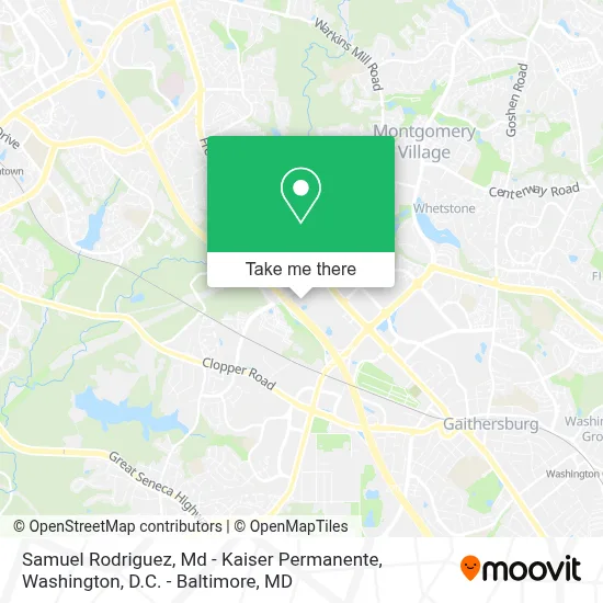
See Samuel Rodriguez, Md - Kaiser Permanente, Montgomery County, on the map
Public Transit to Samuel Rodriguez, Md - Kaiser Permanente in Montgomery County
Wondering how to get to Samuel Rodriguez, Md - Kaiser Permanente in Montgomery County? Moovit helps you find the best way to get to Samuel Rodriguez, Md - Kaiser Permanente with step-by-step directions from the nearest public transit station.
Moovit provides free maps and live directions to help you navigate through your city. View schedules, routes, timetables, and find out how long does it take to get to Samuel Rodriguez, Md - Kaiser Permanente in real time.
Looking for the nearest stop or station to Samuel Rodriguez, Md - Kaiser Permanente? Check out this list of stops closest to your destination: Watkins Mill Rd & Forest Preserve Dr; Russell Ave & Christopher Ave; Gaithersburg Marc Eb.
Bus: 55, 56, 61.Train: MARC.
Want to see if there’s another route that gets you there at an earlier time? Moovit helps you find alternative routes or times. Get directions from and directions to Samuel Rodriguez, Md - Kaiser Permanente easily from the Moovit App or Website.
We make riding to Samuel Rodriguez, Md - Kaiser Permanente easy, which is why over 1.7 million users, including users in Montgomery County, trust Moovit as the best app for public transit. You don’t need to download an individual bus app or train app, Moovit is your all-in-one transit app that helps you find the best bus time or train time available.
For information on prices of bus, metro and train, costs and ride fares to Samuel Rodriguez, Md - Kaiser Permanente, please check the Moovit app.
Use the app to navigate to popular places including to the airport, hospital, stadium, grocery store, mall, coffee shop, school, college, and university.
Samuel Rodriguez, Md - Kaiser Permanente Address: 655 Watkins Mill Rd street in Montgomery County
- Kaiser Permanente - Gaithersburg Medical Center,
- Kaiser Permanente Pharmacy,
- Exit 11 I-270,
- Entrance I-270 N,
- Quick Lane at Sheehy Ford of Gaithersburg,
- Costco Wholesale,
- Metropolitan Grove,
- Vaani Salon,
- Costco,
- MINI of Montgomery County,
- Frederick MD-355,
- RT-355,
- Sam's Club,
- I-270 Exit 11 (Montgomery Village Ave. / Quince Orchard Rd.),
- Chick-fil-A,
- Motor Vehicle Administration (MVA),
- Mva - Gaithersburg,
- Sam's Club Gas,
- Gaithersburg Park & Ride,
- RT 124 Park and Ride Lot & Bus Bay A
Places Near Samuel Rodriguez, Md - Kaiser Permanente (Montgomery County)
- National Museum of African American History and Culture, Washington,
- The Anthem, Washington,
- Museum Of The Bible, Washington,
- Pennsylvania Ave NW (3rd st and pennsylvania), Washington,
- National Theatre, Washington,
- Westfield Montgomery Mall, Montgomery County,
- PG Mall, Prince George's County,
- Washington National Cathedral, Washington,
- Camden Yards, Baltimore,
- M&T Bank Stadium, Baltimore,
- Washington DC VA Medical Center, Washington,
- Georgetown, Washington,
- Basilica of the National Shrine, Washington,
- Rock Creek Tennis Center, Washington,
- Marriott Marquis Washington, DC, Washington,
- National Zoo, Washington,
- Capital One Arena, Washington,
- Amazon Hq2, Arlington County,
- Warner Theatre, Washington,
- Sibley Memorial Hospital, Washington
How to get to popular places in Washington, D.C. - Baltimore, MD with public transit
Get around Montgomery County by public transit!
Traveling around Montgomery County has never been so easy. See step by step directions as you travel to any attraction, street or major public transit station. View bus and train schedules, arrival times, service alerts and detailed routes on a map, so you know exactly how to get to anywhere in Montgomery County.
When traveling to any destination around Montgomery County use Moovit's Live Directions with Get Off Notifications to know exactly where and how far to walk, how long to wait for your line, and how many stops are left. Moovit will alert you when it's time to get off — no need to constantly re-check whether yours is the next stop.
Wondering how to use public transit in Montgomery County or how to pay for public transit in Montgomery County? Moovit public transit app can help you navigate your way with public transit easily, and at minimum cost. It includes public transit fees, ticket prices, and costs. Looking for a map of Montgomery County public transit lines? Moovit public transit app shows all public transit maps in Montgomery County with all Bus, Train, Metro, Light Rail and Ferry routes and stops on an interactive map.
Washington, D.C. - Baltimore, MD has 5 transit type(s), including: Bus, Train, Metro, Light Rail and Ferry, operated by several transit agencies, including WMATA, Montgomery County Ride On, Fairfax Connector, TheBus, PRTC, DASH - Alexandria, Arlington Transit (ART), RTA of Central Maryland, MDOT MTA, MDOT MTA Light RailLink, MDOT MTA Commuter Bus, MDOT MTA Local Bus, FXBGO!, Virginia Railway Express (VRE) and MARC