Directions to San Cesareo in Palatio (Roma) with public transportation
The following transit lines have routes that pass near San Cesareo in Palatio
 Bus: 118, 628, 671, 714, 792.
- Train: FL1, FL3.
- Metro: B, C.
How to get to San Cesareo in Palatio by bus?
Click on the bus route to see step by step directions with maps, line arrival times and updated time schedules.
How to get to San Cesareo in Palatio by train?
Click on the train route to see step by step directions with maps, line arrival times and updated time schedules.
How to get to San Cesareo in Palatio by metro?
Click on the metro route to see step by step directions with maps, line arrival times and updated time schedules.
Bus stops near San Cesareo in Palatio in Roma
- Porta San Sebastiano/Numa Pompilio, 1 min walk,
- Caracalla Baths, 2 min walk,
- Caracalla Baths/Valle Camene, 3 min walk,
- Navicella/Porta Metronia, 6 min walk,
- Baccelli, 7 min walk,
Metro stations near San Cesareo in Palatio in Roma
- Pyramid, 6 min walk,
- Porta Metronia, 11 min walk,
Light Rail stations near San Cesareo in Palatio in Roma
- Aventino/Albania, 14 min walk,
Bus lines to San Cesareo in Palatio in Roma
- 118, Appia/Villa Dei Quintili,
- 671, Palazzo dello Sport - Arco di Travertino (MA),
- 714, Termini (MA-MB-FS) - Sports Palace,
- 792, San Giovanni (MA-MC) - Garbatella - Q.re Portuense - La Pisana,
- 628, Volpi/Farnesina,
- NMC, Piazza Venezia,
- 81, Crescenzio/Risorgimento,
- 160, Montagnola,
What are the closest stations to San Cesareo in Palatio?
The closest stations to San Cesareo in Palatio are:
- Porta San Sebastiano/Numa Pompilio stop is 5 meters away, 1 min walk.
- Caracalla Baths stop is 160 meters away, 2 min walk.
- Caracalla Baths/Valle Camene stop is 200 meters away, 3 min walk.
- Navicella/Porta Metronia stop is 389 meters away, 6 min walk.
- Pyramid station is 407 meters away, 6 min walk.
- Baccelli stop is 486 meters away, 7 min walk.
- Porta Metronia station is 819 meters away, 11 min walk.
- Aventino/Albania station is 1088 meters away, 14 min walk.
Which bus lines stop near San Cesareo in Palatio?
These bus lines stop near San Cesareo in Palatio: 118, 628, 671, 714.
Which train lines stop near San Cesareo in Palatio?
These train lines stop near San Cesareo in Palatio: FL1, FL3.
Which metro lines stop near San Cesareo in Palatio?
These metro lines stop near San Cesareo in Palatio: B, C.
What’s the nearest light rail station to San Cesareo in Palatio in Roma?
The nearest light rail station to San Cesareo in Palatio in Roma is Aventino/Albania. It’s a 14 min walk away.
What’s the nearest metro station to San Cesareo in Palatio in Roma?
The nearest metro station to San Cesareo in Palatio in Roma is Pyramid. It’s a 6 min walk away.
What’s the nearest bus station to San Cesareo in Palatio in Roma?
The nearest bus station to San Cesareo in Palatio in Roma is Porta San Sebastiano/Numa Pompilio. It’s a 1 min walk away.
What time is the first light rail to San Cesareo in Palatio in Roma?
The 3 is the first light rail that goes to San Cesareo in Palatio in Roma. It stops nearby at 5:22 AM.
What time is the last light rail to San Cesareo in Palatio in Roma?
The 3 is the last light rail that goes to San Cesareo in Palatio in Roma. It stops nearby at 1:19 AM.
What time is the first metro to San Cesareo in Palatio in Roma?
The C is the first metro that goes to San Cesareo in Palatio in Roma. It stops nearby at 5:32 AM.
What time is the last metro to San Cesareo in Palatio in Roma?
The C is the last metro that goes to San Cesareo in Palatio in Roma. It stops nearby at 12:05 AM.
What time is the first bus to San Cesareo in Palatio in Roma?
The NMC is the first bus that goes to San Cesareo in Palatio in Roma. It stops nearby at 3:00 AM.
What time is the last bus to San Cesareo in Palatio in Roma?
The NMC is the last bus that goes to San Cesareo in Palatio in Roma. It stops nearby at 3:30 AM.
See San Cesareo in Palatio, Roma, on the map
Public Transit to San Cesareo in Palatio in Roma
Wondering how to get to San Cesareo in Palatio in Roma? Moovit helps you find the best way to get to San Cesareo in Palatio with step-by-step directions from the nearest public transit station.
Moovit provides free maps and live directions to help you navigate through your city. View schedules, routes, timetables, and find out how long does it take to get to San Cesareo in Palatio in real time.
Looking for the nearest stop or station to San Cesareo in Palatio? Check out this list of stops closest to your destination: Porta San Sebastiano/Numa Pompilio; Caracalla Baths; Caracalla Baths/Valle Camene; Navicella/Porta Metronia; Pyramid; Baccelli; Porta Metronia; Aventino/Albania.
Bus: 118, 628, 671, 714, 792, NMC, 81.Train: FL1, FL3.Metro: B, C.
Want to see if there’s another route that gets you there at an earlier time? Moovit helps you find alternative routes or times. Get directions from and directions to San Cesareo in Palatio easily from the Moovit App or Website.
We make riding to San Cesareo in Palatio easy, which is why over 1.7 billion users, including users in Roma, trust Moovit as the best app for public transit. You don’t need to download an individual bus app or train app, Moovit is your all-in-one transit app that helps you find the best bus time or train time available.
For information on prices of bus, metro and train, costs and ride fares to San Cesareo in Palatio, please check the Moovit app.
Use the app to navigate to popular places including to the airport, hospital, stadium, grocery store, mall, coffee shop, school, college, and university.
San Cesareo in Palatio Address: 00179 Roma street in Roma
- Restaurant Da Orazio at Porta Latina,
- Numa Pompilio Square / Porta San Sebastiano Street,
- Caracalla Thermal Baths Avenue / Antoniniana Street,
- Alberto Sordi Villa,
- Alberto Sordi Museum,
- Terme di Caracalla Avenue / Druso Street,
- San Sisto Vecchio,
- Food For Thought Bookshop,
- Angelo Mai,
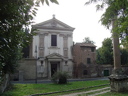
- Church of San Cesareo De Appia,
- Monastery of Dominican Missionary Sisters of San Sisto,
- Church of Saints Nereus and Achilleus,
- St. Mark Evangelist and Pio X Parish,
- Pilgrim House San Sisto,
- Holiday Home,
- Valle delle Camene Street & Caracalla Thermal Baths Avenue,
- San Sebastiano Park,
- Baths of Caracalla,
- Civil Protection Rome Capital - C.O.C.,
- Embassy of Angola
Places Near San Cesareo in Palatio (Roma)
- Auditorium Music Park, Roma,
- Coppedè Quarter, Roma,
- Tiber Island, Roma,
- The Sail, Roma,
- The Wow Side, Fiumicino,
- Scuderie Del Quirinale, Roma,
- Santa Maria Maggiore, Roma,
- Sandro Pertini Hospital, Roma,
- Paths, Roma,
- Roma Est Shopping Center, Roma,
- Gemelli Polyclinic, Roma,
- Tor Vergata, Roma,
- Trastevere Quarter, Roma,
- Termini Station, Roma,
- Olympic Stadium, Rome, Roma,
- Villa Borghese, Roma,
- Cristo Re Hospital, Roma,
- IDI (Dermopatico Dell'Immacolata Institute), Roma,
- Gravity, Roma,
- Casilino Polyclinic, Roma
How to get to popular places in Rome and Lazio with public transit
Get around Roma by public transit!
Traveling around Roma has never been so easy. See step by step directions as you travel to any attraction, street or major public transit station. View bus and train schedules, arrival times, service alerts and detailed routes on a map, so you know exactly how to get to anywhere in Roma.
When traveling to any destination around Roma use Moovit's Live Directions with Get Off Notifications to know exactly where and how far to walk, how long to wait for your line, and how many stops are left. Moovit will alert you when it's time to get off — no need to constantly re-check whether yours is the next stop.
Wondering how to use public transit in Roma or how to pay for public transit in Roma? Moovit public transit app can help you navigate your way with public transit easily, and at minimum cost. It includes public transit fees, ticket prices, and costs. Looking for a map of Roma public transit lines? Moovit public transit app shows all public transit maps in Roma with all Bus, Train, Metro, Light Rail, Ferry, Funicular and Gondola routes and stops on an interactive map.
Rome and Lazio has 7 transit type(s), including: Bus, Train, Metro, Light Rail, Ferry, Funicular and Gondola, operated by several transit agencies, including ATAC, Cotral, Trenitalia, Troiani Transportation Services, BIS, ATR Mobility, Tuscia, Shuttle, Seatour, Troiani Bus Lines, CSC Mobility, Terravision, ATRAL, Tambus and Sitbus