Directions to Sand Springs City Parks & Rec with public transportation
The following transit lines have routes that pass near Sand Springs City Parks & Rec
 Bus: 114.
How to get to Sand Springs City Parks & Rec by bus?
Click on the bus route to see step by step directions with maps, line arrival times and updated time schedules.
From Morton Comprehensive Health
59 minFrom Rate
67 minFrom Firstlight Home Care South Tulsa
69 minFrom Emmaus Community - the Inclusive Celtic Church
73 minFrom USPS
61 minFrom T-Town Marketing
49 minFrom Neok Bankruptcy Center
62 minFrom Mental Health Association Denver House
75 minFrom 120 W 3rd St Garage
61 minFrom Art Emporium 66
99 min
Bus stop near Sand Springs City Parks & Rec
- (8071) 2nd St & Garfield Ave Eb, 1 min walk,VIEW
Bus lines to Sand Springs City Parks & Rec
- 114, To Downtown,VIEW
What are the closest stations to Sand Springs City Parks & Rec?
The closest stations to Sand Springs City Parks & Rec are:
- (8071) 2nd St & Garfield Ave Eb is 27 yards away, 1 min walk.
Which bus line stops near Sand Springs City Parks & Rec?
114 (To SS Walmart)
What’s the nearest bus station to Sand Springs City Parks & Rec?
The nearest bus station to Sand Springs City Parks & Rec is (8071) 2nd St & Garfield Ave Eb. It’s a 1 min walk away.
What time is the first bus to Sand Springs City Parks & Rec?
The 114 is the first bus that goes to Sand Springs City Parks & Rec. It stops nearby at 6:06 AM.
What time is the last bus to Sand Springs City Parks & Rec?
The 114 is the last bus that goes to Sand Springs City Parks & Rec. It stops nearby at 7:48 PM.
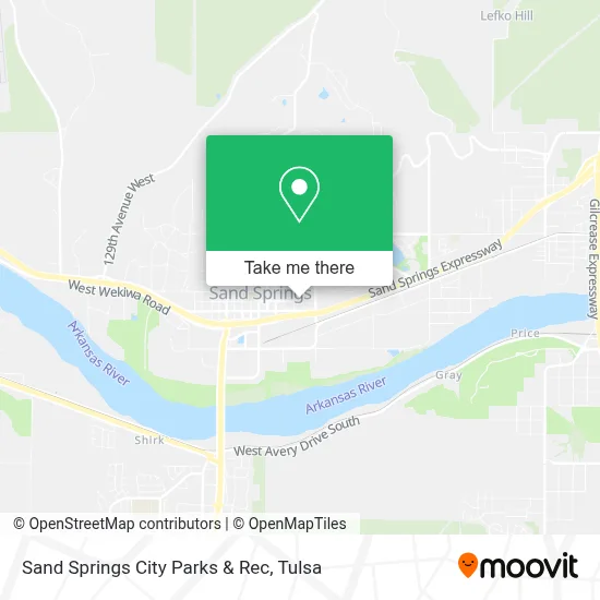
See Sand Springs City Parks & Rec on the map
Public Transportation to Sand Springs City Parks & Rec
Wondering how to get to Sand Springs City Parks & Rec? Moovit helps you find the best way to get to Sand Springs City Parks & Rec with step-by-step directions from the nearest public transit station.
Moovit provides free maps and live directions to help you navigate through your city. View schedules, routes, timetables, and find out how long does it take to get to Sand Springs City Parks & Rec in real time.
Looking for the nearest stop or station to Sand Springs City Parks & Rec? Check out this list of stops closest to your destination: (8071) 2nd St & Garfield Ave Eb.
Bus: 114.
Want to see if there’s another route that gets you there at an earlier time? Moovit helps you find alternative routes or times. Get directions from and directions to Sand Springs City Parks & Rec easily from the Moovit App or Website.
We make riding to Sand Springs City Parks & Rec easy, which is why over 1.5 million users, including users in Sand Springs, trust Moovit as the best app for public transit. You don’t need to download an individual bus app or train app, Moovit is your all-in-one transit app that helps you find the best bus time or train time available.
For information on prices of bus, costs and ride fares to Sand Springs City Parks & Rec, please check the Moovit app.
Use the app to navigate to popular places including to the airport, hospital, stadium, grocery store, mall, coffee shop, school, college, and university.
Sand Springs City Parks & Rec Address: 420 Plaza Ct street in Sand Springs
- Osu Medical Center,
- Eubanks, Kimberly - Osu Medicine Sand Springs,
- Brownies Hamburgers,
- Frost Your Cake,
- Excel Therapy,
- Vapor Maven,
- Libertyx Bitcoin ATM,
- Westreet Credit Union,
- T-Mobile,
- Bill & Ruth's Sandwich Shop (Bill & Ruth's Subs & Grill),
- Lance Lively - Financial Advisor Ameriprise Financial Services,
- Williams Total,
- Hawkeye Custom Concrete,
- Chardale's,
- Mojo Merchandise,
- CK Inspection Company,
- Sakura Japanese Steakhouse,
- ATM,
- John Parri,
- Prime Roofing & Restoration
Places Near Sand Springs City Parks & Rec
- Plaza Santa Cecilia, Tulsa,
- Zavala Plus, Tulsa,
- Fallout Shelter, Tulsa,
- Tulsa State Fair, Tulsa,
- Tulsa Ok, Tulsa,
- Amazon Fulfillment Center-TUL2, Tulsa,
- Alagon Spa (Olympus Spa), Tulsa,
- Walmart, Tulsa,
- Saint Francis Hospital, Tulsa,
- St. Francis Hospital Outpatient Infusion, Tulsa,
- Woodland Hills Mall, Tulsa,
- Osage Casino, Tulsa,
- St Francis South Cardinal Building, Tulsa,
- 71st & Memorial, Tulsa,
- Hard Rock Casino, Tulsa,
- River Spirit Casino, Tulsa,
- Broken Arrow, OK, Broken Arrow,
- S Garnett Rd / E 21st St, Tulsa,
- Tulsa Zoo, Tulsa,
- Bixby, OK, Bixby
How to get to popular places in Tulsa with public transit
Get around Sand Springs by public transit!
Traveling around Sand Springs has never been so easy. See step by step directions as you travel to any attraction, street or major public transit station. View bus and train schedules, arrival times, service alerts and detailed routes on a map, so you know exactly how to get to anywhere in Sand Springs.
When traveling to any destination around Sand Springs use Moovit's Live Directions with Get Off Notifications to know exactly where and how far to walk, how long to wait for your line, and how many stops are left. Moovit will alert you when it's time to get off — no need to constantly re-check whether yours is the next stop.
Wondering how to use public transit in Sand Springs or how to pay for public transit in Sand Springs? Moovit public transit app can help you navigate your way with public transit easily, and at minimum cost. It includes public transit fees, ticket prices, and costs. Looking for a map of Sand Springs public transit lines? Moovit public transit app shows all public transit maps in Sand Springs with all bus routes and stops on an interactive map.
Tulsa has 1 transit type(s), including: bus, operated by several transit agencies, including MetroLink Tulsa and Greyhound-us