How to get to Santa Elisa by bus?
Click on the bus route to see step by step directions with maps, line arrival times and updated time schedules.
From Hospital Nacional Arzobispo Loayza, Lima
40 minFrom Municipalidad Distrital De Los Olivos, Los Olivos
45 minFrom Hospital Nacional Dos De Mayo, Lima
45 minFrom Hospital Nacional Alberto Sabogal, Lima
26 minFrom Larcomar, Miraflores
45 minFrom Universidad Peruana Cayetano Heredia - Campo Central, San Martin
44 minFrom Avenida Carlos Izaguirre, Los Olivos
45 minFrom Policlínico Peruano Japonés, Jesus Mari
30 minFrom San Miguel, Surquillo
41 minFrom AV JAVIER PRADO OESTE, Magdalena
26 min
Bus stops near Santa Elisa in San Miguel
Bus lines to Santa Elisa in San Miguel
- 1030, Canta Callao (San Martin De Porres) - San Diego (San Martin De Porres),VIEW
- CR43, Ventanilla - Carabayllo,VIEW
- 1304, Pachacamac - Callao,VIEW
- 1315, Jose Galvez (Pachacamac) - Óvalo Centenario (Callao),VIEW
- OM19, Chepen (Villa El Salvador),VIEW
- 201, Ovalo La Perla (Callao) - Ceres (Ate),VIEW
- 1317, Manchay (Pachacamac) - Miguel Grau (Callao),VIEW
- 1435, Minka (Callao) - Torre Blanca (Carabayllo),VIEW
- 1143, Callao - Surco [La 524],VIEW
- 1205, El Agustino - San Miguel [La E],VIEW
- 1207, San Juan de Lurigancho - San Miguel [C1],VIEW
- 1219, Ate - San Miguel [B],VIEW
- 1227, Ate - Callao,VIEW
- 1264, Callao - Surco,VIEW
- 1269, Callao - Ate (X),VIEW
- 1272, Callao - Sta. Anita [22],VIEW
- 1302, San Juan de Lurigancho - Callao [12],VIEW
- 1338, Ventanilla - La Perla [O],VIEW
- 1475, San Juan de Lurigancho - Callao [94],VIEW
- CR39, Callao - Surco [La S],VIEW
What are the closest stations to Santa Elisa?
The closest stations to Santa Elisa are:
- Avenida Los Insurgentes, 298-302 is 43 meters away, 1 min walk.
- Avenida Los Insurgentes, 285 is 59 meters away, 1 min walk.
- Insurgentes is 409 meters away, 6 min walk.
- 28 De Julio is 573 meters away, 8 min walk.
Which bus lines stop near Santa Elisa?
These bus lines stop near Santa Elisa: 1030, 201, CR43.
What’s the nearest bus station to Santa Elisa in San Miguel?
The nearest bus stations to Santa Elisa in San Miguel are Avenida Los Insurgentes, 298-302 and Avenida Los Insurgentes, 285. The closest one is a 1 min walk away.
What time is the first bus to Santa Elisa in San Miguel?
The 1315 is the first bus that goes to Santa Elisa in San Miguel. It stops nearby at 4:12 AM.
What time is the last bus to Santa Elisa in San Miguel?
The 1315 is the last bus that goes to Santa Elisa in San Miguel. It stops nearby at 1:12 AM.
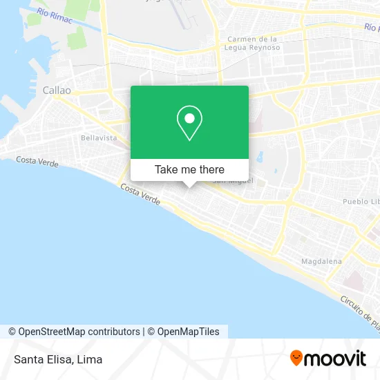
See Santa Elisa, San Miguel, on the map
Public Transit to Santa Elisa in San Miguel
Wondering how to get to Santa Elisa in San Miguel? Moovit helps you find the best way to get to Santa Elisa with step-by-step directions from the nearest public transit station.
Moovit provides free maps and live directions to help you navigate through your city. View schedules, routes, timetables, and find out how long does it take to get to Santa Elisa in real time.
Looking for the nearest stop or station to Santa Elisa? Check out this list of stops closest to your destination: Avenida Los Insurgentes; Avenida Los Insurgentes; Insurgentes; 28 De Julio.
Bus: 1030, 201, CR43, 1304, 1315, OM19, 1317, 1435, 1143, 1205, 1207, 1219, 1227.
Want to see if there’s another route that gets you there at an earlier time? Moovit helps you find alternative routes or times. Get directions from and directions to Santa Elisa easily from the Moovit App or Website.
We make riding to Santa Elisa easy, which is why over 1.5 million users, including users in San Miguel, trust Moovit as the best app for public transit. You don’t need to download an individual bus app or train app, Moovit is your all-in-one transit app that helps you find the best bus time or train time available.
For information on prices of bus, costs and ride fares to Santa Elisa, please check the Moovit app.
Use the app to navigate to popular places including to the airport, hospital, stadium, grocery store, mall, coffee shop, school, college, and university.
Santa Elisa Address: San Miguel, Lima street in San Miguel
- Jiron Carlos Oquendo de Amat 173,
- Betalleluz Aguirre Abrahan Hugo,
- Oquendo De Amat,
- Panadería El Gran Samir,
- Calle Carlos Gonzales Posada Cuadra 1,
- CHONGOYAPE 248 san miguel,
- Calle Xavier Abril N° 115 Urb Arboleda de Maranga,
- Por el cruce Patriotas e Insurgentes,
- Carlos Oquendo De Amat,
- Calle Xavier Abril,
- Tuttos Comida Criolla,
- Calle José Gálvez 143 Maranga,
- Aliaga Urbina Wilson Oscar,
- CALLE CHONGOYAPE ALTURA CUADRA 8 DE AVENIDA PATRIOTAS URBANIZACIÓN MARANGA,
- Ca Juan Parra del Riego,
- Parque Argentina,
- Av La Marina cdra 36 con Insurgentes cuadra 2,
- Parque Medalla Milagrosa,
- SOLITARIO DE SAYAN 733 DPTO 301,
- Calle Carlos Oquendo 173 arboleda de Maranga
Places Near Santa Elisa (San Miguel)
- Centro Comercial Plaza Norte, Independen,
- Paradero Av.Brasil,
- Larcomar, Miraflores,
- Miraflores, Miraflores,
- Aeropuerto Internacional Jorge Chávez, Ventanilla,
- Parque de las Leyendas, San Miguel,
- Real Plaza Salaverry, Jesus Mari,
- Parque Kennedy, Miraflores,
- Circuito Mágico Del Agua, Lima,
- av arequipa, Lima,
- Gamarra,
- Av. La Marina, San Miguel,
- Jockey Plaza, Santiago D,
- Plaza San Miguel, San Miguel,
- Barranco, Barranco,
- Real Plaza Puruchuco, Ate,
- Av. Abancay, Lima,
- Av. Salaverry, Jesus Mari,
- Mall Del Sur,
- Hospital Edgardo Rebagliati Martins, Jesus Mari
How to get to popular places in Lima with public transit
Get around San Miguel by public transit!
Traveling around San Miguel has never been so easy. See step by step directions as you travel to any attraction, street or major public transit station. View bus and train schedules, arrival times, service alerts and detailed routes on a map, so you know exactly how to get to anywhere in San Miguel.
When traveling to any destination around San Miguel use Moovit's Live Directions with Get Off Notifications to know exactly where and how far to walk, how long to wait for your line, and how many stops are left. Moovit will alert you when it's time to get off — no need to constantly re-check whether yours is the next stop.
Wondering how to use public transit in San Miguel or how to pay for public transit in San Miguel? Moovit public transit app can help you navigate your way with public transit easily, and at minimum cost. It includes public transit fees, ticket prices, and costs. Looking for a map of San Miguel public transit lines? Moovit public transit app shows all public transit maps in San Miguel with all Bus, Metro and Ferry routes and stops on an interactive map.
Lima has 3 transit type(s), including: Bus, Metro and Ferry, operated by several transit agencies, including Metro de Lima Línea 2 , Metro de Lima, Corredor Rojo, Metropolitano, Metropolitano - Alimentadores, Corredor Morado, Corredor Azul, Rutas Tradicionales, Transportes y Servicios La Esperanza S.A., Las Flores S.A., Virgen de la Asunción S.A., Consorcio HAM, Transportes y Service Canadá S.A., ETUL4SA and ETUCHISA