How to get to Santa Isabel by bus?
Click on the bus route to see step by step directions with maps, line arrival times and updated time schedules.
From Avenida Proceres de Huandoy, Los Olivos
44 minFrom Av. Las Palmeras, Los Olivos
42 minFrom Urbanización Vipol de Naranjal, San Martin
48 minFrom U. P. N., Los Olivos
32 minFrom ovalo huandoy, Los Olivos
44 minFrom Colectivo a Huaral, Independen
44 minFrom LA ENSENADA PUENTE PIEDRA, Puente Pie
37 minFrom Universidad César Vallejo, Los Olivos
36 minFrom Essalud Hospital Marino Molina, Comas
26 minFrom Paradero Teléfono, Ventanilla
106 min
Bus stops near Santa Isabel in Carabayllo
Bus lines to Santa Isabel in Carabayllo
- 1005, Huánuco (La Victoria) - Punchauca (Carabayllo),VIEW
- 1011, Carabayllo - Pueblo Libre,VIEW
- 1326, Av. San Juan (Puente Piedra) - Plaza San Miguel (San Miguel),VIEW
- 1337, La Marina (San Miguel) - Villa Club (Carabayllo),VIEW
- 1462, Carabayllo - Universitaria - Brasil - Carabayllo,VIEW
- 1013, Jesús María - Carabayllo,VIEW
- 1015, Carabayllo - Lince - Carabayllo,VIEW
- 1021, Mercado (Magdalena Del Mar) - Torre Blanca (Carabayllo),VIEW
- 1177, Torre Blanca (Carabayllo) - Metropolitana (Ate),VIEW
- 1182, San Juan de Miraflores - Carabayllo,VIEW
- 1336, Torreblanca (Carabayllo) - Universitaria (San Miguel),VIEW
- AN09, Terminal Chimpu Ocllo (Carabayllo) - Tokio (Carabayllo),VIEW
- 1008, Sucre (Magdalena Del Mar) - Villa Club (Carabayllo),VIEW
- 1104, Comas - Puente Piedra,VIEW
- 1235, Manchay (Pachacamac) - Santo Domingo (Carabayllo),VIEW
- 1237, Santo Domingo (Carabayllo) - Velasco Alvarado (Villa El Salvador),VIEW
- 1436, Collique (Comas) - Mi Peru (Ventanilla),VIEW
- CR43, Carabayllo - Ventanilla,VIEW
What are the closest stations to Santa Isabel?
The closest stations to Santa Isabel are:
- Orquídeas is 118 meters away, 2 min walk.
- Túpac Amaru is 402 meters away, 6 min walk.
- Chimpu Ocllo is 412 meters away, 6 min walk.
Which bus lines stop near Santa Isabel?
These bus lines stop near Santa Isabel: 1005, 1337, 1436.
What’s the nearest bus station to Santa Isabel in Carabayllo?
The nearest bus station to Santa Isabel in Carabayllo is Orquídeas. It’s a 2 min walk away.
What time is the first bus to Santa Isabel in Carabayllo?
The 1237 is the first bus that goes to Santa Isabel in Carabayllo. It stops nearby at 3:39 AM.
What time is the last bus to Santa Isabel in Carabayllo?
The 1021 is the last bus that goes to Santa Isabel in Carabayllo. It stops nearby at 12:53 AM.
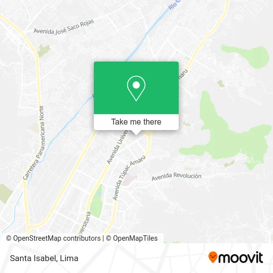
See Santa Isabel, Carabayllo, on the map
Public Transit to Santa Isabel in Carabayllo
Wondering how to get to Santa Isabel in Carabayllo? Moovit helps you find the best way to get to Santa Isabel with step-by-step directions from the nearest public transit station.
Moovit provides free maps and live directions to help you navigate through your city. View schedules, routes, timetables, and find out how long does it take to get to Santa Isabel in real time.
Looking for the nearest stop or station to Santa Isabel? Check out this list of stops closest to your destination: Orquídeas; Túpac Amaru; Chimpu Ocllo.
Bus: 1005, 1337, 1436, 1011, 1326, 1462, 1013, 1015, 1021, 1177, 1182, AN09, 1008, 1104, 1235, 1237.
Want to see if there’s another route that gets you there at an earlier time? Moovit helps you find alternative routes or times. Get directions from and directions to Santa Isabel easily from the Moovit App or Website.
We make riding to Santa Isabel easy, which is why over 1.5 million users, including users in Carabayllo, trust Moovit as the best app for public transit. You don’t need to download an individual bus app or train app, Moovit is your all-in-one transit app that helps you find the best bus time or train time available.
For information on prices of bus, costs and ride fares to Santa Isabel, please check the Moovit app.
Use the app to navigate to popular places including to the airport, hospital, stadium, grocery store, mall, coffee shop, school, college, and university.
Santa Isabel Address: Santa Isabel, Carabayllo, Perú street in Carabayllo
- Mc Pizza,
- Millennium Perú Travel,
- Jr las campanillas 198,
- Parque Señor De Los Milagros,
- Centro De Investigacion Y Capacitacion Tecnologica - Cicat,
- Cetpro Megatec De Carabayllo,
- Fantasy Show Eventos Infantiles,
- M&D Podologia Clinica,
- Forum Disco,
- Gaussito - Estimulación Temprana y Guardería,
- Institución Educativa Inicial 315 Los Angeles Y Maria,
- Academia de Marinera Ritmo y Pasion-Carabayllo,
- Tacuni - Peru,
- Estadio Ricardo Palma Santa Isabel,
- Municipalidad De Carabayllo,
- Centro de Salud,
- Policlinico Santa Isabel E.I.R.L.,
- Sisol Salud Carabayllo,
- Urbanización Santa Isabel,
- Parque Ramón Castilla
Places Near Santa Isabel (Carabayllo)
- Aeropuerto Internacional Jorge Chávez, Ventanilla,
- Mall Del Sur,
- Gamarra,
- Av. Abancay, Lima,
- Miraflores, Miraflores,
- Larcomar, Miraflores,
- Av. Salaverry, Jesus Mari,
- Circuito Mágico Del Agua, Lima,
- Parque de las Leyendas, San Miguel,
- Real Plaza Puruchuco, Ate,
- Jockey Plaza, Santiago D,
- Plaza San Miguel, San Miguel,
- Hospital Edgardo Rebagliati Martins, Jesus Mari,
- Pontificia Universidad Católica del Perú - PUCP, San Miguel,
- Paradero Av.Brasil,
- Parque Kennedy, Miraflores,
- Av. La Marina, San Miguel,
- Centro Comercial Plaza Norte, Independen,
- av arequipa, Lima,
- Barranco, Barranco
How to get to popular places in Lima with public transit
Get around Carabayllo by public transit!
Traveling around Carabayllo has never been so easy. See step by step directions as you travel to any attraction, street or major public transit station. View bus and train schedules, arrival times, service alerts and detailed routes on a map, so you know exactly how to get to anywhere in Carabayllo.
When traveling to any destination around Carabayllo use Moovit's Live Directions with Get Off Notifications to know exactly where and how far to walk, how long to wait for your line, and how many stops are left. Moovit will alert you when it's time to get off — no need to constantly re-check whether yours is the next stop.
Wondering how to use public transit in Carabayllo or how to pay for public transit in Carabayllo? Moovit public transit app can help you navigate your way with public transit easily, and at minimum cost. It includes public transit fees, ticket prices, and costs. Looking for a map of Carabayllo public transit lines? Moovit public transit app shows all public transit maps in Carabayllo with all Bus, Metro and Ferry routes and stops on an interactive map.
Lima has 3 transit type(s), including: Bus, Metro and Ferry, operated by several transit agencies, including Metro de Lima Línea 2 , Metro de Lima, Corredor Rojo, Metropolitano, Metropolitano - Alimentadores, Corredor Morado, Corredor Azul, Rutas Tradicionales, Transportes y Servicios La Esperanza S.A., Las Flores S.A., Virgen de la Asunción S.A., Consorcio HAM, Transportes y Service Canadá S.A., ETUL4SA and ETUCHISA