
Santa Luzia stop - Wednesday schedule
| Line | Direction | Time |
|---|---|---|
| 80 | Terminal Gentileza (Serviço Noturno) | 3:03 AM |
| 42 | Manaceia (Serviço Noturno) | 3:05 AM |
| 80 | Penha (Serviço Noturno) | 3:08 AM |
| 42 | Galeão (Serviço Noturno) | 3:15 AM |
| 42 | Manaceia (Serviço Noturno) | 3:25 AM |
| 80 | Terminal Gentileza (Serviço Noturno) | 3:33 AM |
| 42 | Galeão (Serviço Noturno) | 3:35 AM |
| 80 | Penha (Serviço Noturno) | 3:38 AM |
| 42 | Manaceia (Serviço Noturno) | 3:45 AM |
| 42 | Galeão (Serviço Noturno) | 3:55 AM |
| 80 | Terminal Gentileza | 4:05 AM |
| 80 | Penha | 4:11 AM |
| 80 | Terminal Gentileza | 4:11 AM |
| 42 | Manaceia (Parador) | 4:13 AM |
| 80 | Penha | 4:17 AM |
| 80 | Terminal Gentileza | 4:17 AM |
| 42 | Manaceia (Parador) | 4:21 AM |
| 80 | Penha | 4:23 AM |
| 80 | Terminal Gentileza | 4:23 AM |
| 80 | Penha | 4:29 AM |
| 80 | Terminal Gentileza | 4:29 AM |
| 42 | Manaceia (Parador) | 4:29 AM |
| 42 | Galeão (Parador) | 4:33 AM |
| 80 | Penha | 4:35 AM |
| 80 | Terminal Gentileza | 4:35 AM |
Directions to Santa Luzia stop (Ramos) with public transit
The following transit lines have routes that pass near Santa Luzia
 Bus: 350, 43, 489L, 630, 80.
- Metro: L2.
- Train: RAMAL SARACURUNA.
- Funicular: IGREJA DA PENHA.
How to get to Santa Luzia stop by public transit?
Click on the bus route to see step by step directions with maps, line arrival times and updated time schedules.
How to get to Santa Luzia stop by public transit?
Click on the train route to see step by step directions with maps, line arrival times and updated time schedules.
How to get to Santa Luzia stop by public transit?
Click on the metro route to see step by step directions with maps, line arrival times and updated time schedules.
Bus stops near Santa Luzia stop in Ramos
- Avenida Teixeira De Castro, 450, 4 min walk,
- Rua Barreiros, 277, 4 min walk,
- Avenida Brasil | Passarela BRT - Rubens Vaz (Linhas Municipais Zona Norte / Intermunicipais), 7 min walk,
- Cardoso De Morais (Viúva Garcia), 7 min walk,
- Rua André Pinto, 114, 7 min walk,
- Avenida Brasil | Passarela 9 (Linhas Municipais Para O Centro), 7 min walk,
- Rua Cardoso De Morais, 487, 8 min walk,
Train stations near Santa Luzia station in Ramos
- Ramos, 23 min walk,
Funicular stations near Santa Luzia station in Ramos
- Estação 4, 31 min walk,
Bus lines to Santa Luzia stop in Ramos
- SPB 483, Metrô General Osório,
- 915, Bonsucesso,
- 350, Irajá - Castelo (Brs 4 - Via Praça das Nações),
- 483, Penha - Metrô General Osório (BRS 3 - via Bonsucesso / Aterro),
- SN 483, Penha - Ipanema (Brs 3 - Via Central / Praia do Flamengo),
- 486L, Bar dos Cavaleiros - Largo da Cancela (Via Praça das Nações),
- 489L, Caxias - Saens Peña (Via Praça das Nações),
- 497, Penha - Largo do Machado (Brs 3 - Via Lapa / Laranjeiras),
- 498, Penha Circular - Largo do Machado (BRS 3 - Via Túnel Santa Bárbara),
- 630, Iapi da Penha - Saens Peña (Brs 6 - Via Bonsucesso / Benfica),
- 901, Bananal - Bonsucesso (via Ribeira / Jardim Guanabara),
- 905, Bonsucesso - Irajá (Via Brás de Pina),
- 906, Jardim América - Caju (Via Bonsucesso - Circular),
- 910, Bananal - Irajá (via Olaria / Penha / Largo do Bicão),
- 928, Marechal Hermes - Bonsucesso (Via Penha),
- 718D, Alcântara - Madureira ( Via Praça da Nações/penha ),
- UFRJ - BONSUCESSO, UFRJ - Bonsucesso,
- UFRJ - CASCADURA, UFRJ - Cascadura,
- 101C, Lafaiete - Central (Via Caxias),
- 102C, Gramacho - Central,
What are the closest stations to Santa Luzia?
The closest stations to Santa Luzia are:
- Avenida Teixeira De Castro, 450 stop is 256 meters away, 4 min walk.
- Rua Barreiros, 277 stop is 273 meters away, 4 min walk.
- Avenida Brasil | Passarela BRT - Rubens Vaz (Linhas Municipais Zona Norte / Intermunicipais) stop is 479 meters away, 7 min walk.
- Cardoso De Morais (Viúva Garcia) stop is 490 meters away, 7 min walk.
- Rua André Pinto, 114 stop is 503 meters away, 7 min walk.
- Avenida Brasil | Passarela 9 (Linhas Municipais Para O Centro) stop is 544 meters away, 7 min walk.
- Rua Cardoso De Morais, 487 stop is 582 meters away, 8 min walk.
- Ramos station is 1753 meters away, 23 min walk.
- Estação 4 station is 2396 meters away, 31 min walk.
Which bus lines stop near Santa Luzia?
These bus lines stop near Santa Luzia: 350, 43, 489L, 630, 80.
Which metro line stops near Santa Luzia?
L2 (Pavuna)
Which train line stops near Santa Luzia?
RAMAL SARACURUNA (Gramacho)
What’s the nearest train station to Santa Luzia in Ramos?
The nearest train station to Santa Luzia in Ramos is Ramos. It’s a 23 min walk away.
What’s the nearest bus station to Santa Luzia in Ramos?
The nearest bus stations to Santa Luzia in Ramos are Avenida Teixeira De Castro, 450 and Rua Barreiros, 277. The closest one is a 4 min walk away.
What time is the first train to Santa Luzia in Ramos?
The RAMAL SARACURUNA is the first train that goes to Santa Luzia in Ramos. It stops nearby at 4:51 AM.
What time is the last train to Santa Luzia in Ramos?
The RAMAL SARACURUNA is the last train that goes to Santa Luzia in Ramos. It stops nearby at 11:01 PM.
What time is the first bus to Santa Luzia in Ramos?
The 328 is the first bus that goes to Santa Luzia in Ramos. It stops nearby at 3:06 AM.
What time is the last bus to Santa Luzia in Ramos?
The 388 is the last bus that goes to Santa Luzia in Ramos. It stops nearby at 4:36 AM.
What time is the first funicular to Santa Luzia in Ramos?
The IGREJA DA PENHA is the first funicular that goes to Santa Luzia in Ramos. It stops nearby at 7:00 AM.
What time is the last funicular to Santa Luzia in Ramos?
The IGREJA DA PENHA is the last funicular that goes to Santa Luzia in Ramos. It stops nearby at 6:00 PM.
Santa Luzia station
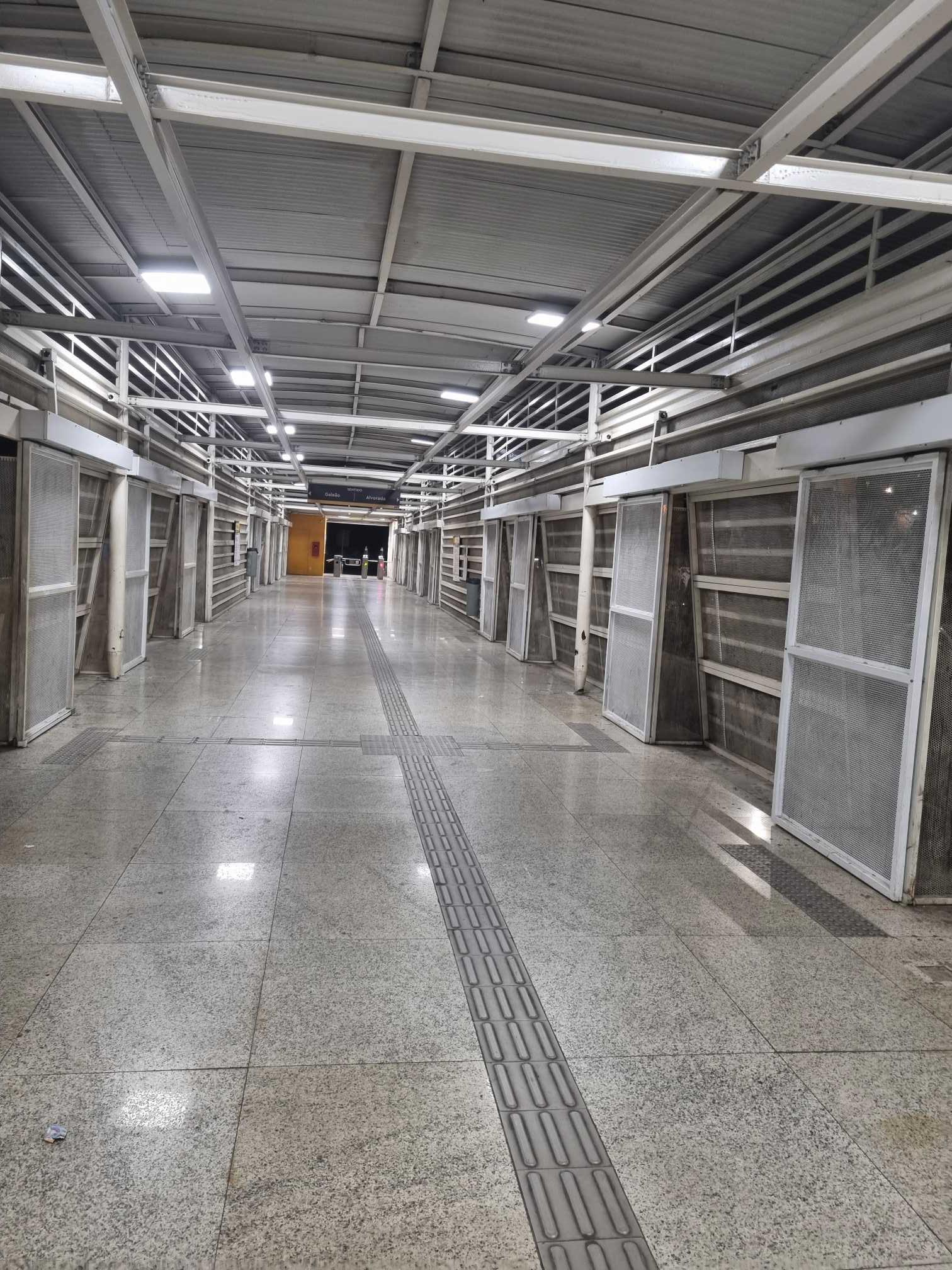 Taken by Anonymous
See Santa Luzia stop, Ramos, on the map
Public transit to Santa Luzia stop in Ramos
Looking for directions to Santa Luzia in Ramos, Brazil?
Download the Moovit App to find the current schedule and step-by-step directions for Bus, Metro, Light Rail or Train routes that pass through Santa Luzia.
Looking for the nearest stops closest to Santa Luzia ? Check out this list of closest stops to your destination: Avenida Teixeira De Castro; Rua Barreiros; Avenida Brasil | Passarela BRT - Rubens Vaz (Linhas Municipais Zona Norte / Intermunicipais); Cardoso De Morais (Viúva Garcia); Rua André Pinto; Avenida Brasil | Passarela 9 (Linhas Municipais Para O Centro); Rua Cardoso De Morais; Ramos; Estação 4.
Bus: 350, 43, 489L, 630, 80, SPB 483, 915, 483, SN 483, 486L, UFRJ - BONSUCESSO, UFRJ - CASCADURA, 101C, 102C, 104C, 42.Metro: L2.Train: RAMAL SARACURUNA.Funicular: IGREJA DA PENHA.
We make riding on public transit to Santa Luzia easy, which is why over 1.7 billion users, including users in Ramos trust Moovit as the best app for public transit.
Use the app to navigate to popular places including to the airport, hospital, stadium, grocery store, mall, coffee shop, school, college, and university.
The stop has the following entrances: Av. Dos Campeões, Av. Dos Campeões, Av. Dos Campeões, Av. Teixeira De Castro and Praça Prof. Mourao Filho
The first line to this stop is 80, at 3:03 AM, and the last line is 42 at 2:55 AM.
700 Avenida Dos Campeões, Rio de Janeiro, Brazil
This stop serves BRT MOBI-Rio’s lines
- Avenida Teixeira De Castro, 450,
- Rua Barreiros, 277,
- Avenida Brasil | Passarela BRT - Rubens Vaz (Linhas Municipais Zona Norte / Intermunicipais),
- Cardoso De Morais (Viúva Garcia),
- Rua André Pinto, 114,
- Avenida Brasil | Passarela 9 (Linhas Municipais Para O Centro),
- Rua Cardoso De Morais, 487
Bus stops near Santa Luzia stop
- Ramos
Train station near Santa Luzia station
- Estação 4
Funicular station near Santa Luzia station
- Ponto Final - Merck (Linhas 636 E 801),
- Rua Argeu De Almeida Soares,
- Avenida Duque De Caxias, 207 (Desativado Aos Domingos),
- BRS 4 - Rio Branco | Pista Central - Sentido Praça Da Bandeira,
- Terminal De Irajá (Rua Hipócrates - Linha 905),
- Ponto Final - Supercentro Carioca (Hospital Do Olho),
- Vicente De Carvalho,
- 1ª Entrada De Maricá,
- BRS 1 / 2 / 3 / 4 / 5 / I - Tribunal De Justiça Do Rio De Janeiro,
- Rua Torres Sobrinho, 46-96,
- Estrada Dos Bandeirantes | BRT Curicica,
- Rua Cândido Benício, 1600-1668,
- Hospital Dr. Ricardo Cruz | Nova Iguaçu Fc | Igreja Sarando A Terra Ferida,
- Vila Militar,
- Estrada Dos Três Rios, 529,
- Avenida Automóvel Clube,
- Rua Ana Barbosa | Pam Do Méier,
- Avenida Brasil | BRT Ceasa-Irajá (Gata De Irajá),
- Hospital São Francisco De Assis Na Providência De Deus,
- Rodovia Washington Luíz (Sentido Rio) | Caxias Shopping - Entrada Principal
Popular public transit stations in Ramos
Get around Ramos by public transit!
Traveling around Ramos has never been so easy. See step by step directions as you travel to any attraction, street or major public transit station. View bus and train schedules, arrival times, service alerts and detailed routes on a map, so you know exactly how to get to anywhere in Ramos.
When traveling to any destination around Ramos use Moovit's Live Directions with Get Off Notifications to know exactly where and how far to walk, how long to wait for your line, and how many stops are left. Moovit will alert you when it's time to get off — no need to constantly re-check whether yours is the next stop.
Wondering how to use public transit in Ramos or how to pay for public transit in Ramos? Moovit public transit app can help you navigate your way with public transit easily, and at minimum cost. It includes public transit fees, ticket prices, and costs. Looking for a map of Ramos public transit lines? Moovit public transit app shows all public transit maps in Ramos with all Bus, Train, Metro, Light Rail, Ferry, Cable Car, Gondola and Funicular routes and stops on an interactive map.
Rio de Janeiro Region has 8 transit type(s), including: Bus, Train, Metro, Light Rail, Ferry, Cable Car, Gondola and Funicular, operated by several transit agencies, including TrensRJ, Metrô Rio, VLT Carioca, Barcas Rio, BRT MOBI-Rio, Auto Viação Alpha, Auto Viação Tijuca, Gire Transportes, Transurb, Viação Nossa Senhora das Graças, Consórcio INTERSUL, Braso Lisboa, Caprichosa Auto Ônibus, Auto Viação Três Amigos and Rodoviária Âncora Matias