How to get to Santa Maria by bus?
Click on the bus route to see step by step directions with maps, line arrival times and updated time schedules.
From Fratta Hospital, Arezzo
95 minFrom Gruccia Hospital, Montevarchi
355 minFrom Antica Querciolaia Thermal Baths, Rapolano Terme
75 minFrom Caprese Michelangelo, Caprese Michelangelo
111 minFrom Monterchi, Monterchi
59 minFrom Arezzo Equestrian Center, Arezzo
37 minFrom Prada - Space Outlet, Arezzo
92 minFrom Valdichiana Outlet Village, Foiano Della Chiana
56 minFrom Rondine, Arezzo
55 minFrom Pieve Santo Stefano, Pieve Santo Stefano
109 min
How to get to Santa Maria by train?
Click on the train route to see step by step directions with maps, line arrival times and updated time schedules.
Bus stops near Santa Maria in Arezzo
Bus lines to Santa Maria in Arezzo
- LS5, Arezzo Terminal (Interior),VIEW
- G, Arezzo G.Monaco (Insurance Side),VIEW
- A+, Oriental Village,VIEW
- LS6, Camucia Junction,VIEW
- 22S, Arezzo G.Monaco (Gallery Side),VIEW
- 138, Arezzo Terminal (Interior),VIEW
- 138, Tozzi Street,VIEW
- B+, New Hospital,VIEW
- LS5, Bettolle People's Square,VIEW
- 21S, Bus Station,VIEW
- Q, Gragnone,VIEW
- SI381, Sansepolcro Marconi Street (Bus Station),VIEW
What are the closest stations to Santa Maria?
The closest stations to Santa Maria are:
- Arno Street No. 32 is 276 meters away, 4 min walk.
- Via Della Robbia 159/C - Crossroads is 631 meters away, 8 min walk.
- Via Veneto 211 - Pallanca is 1100 meters away, 15 min walk.
- Via Veneto 220 Opposite Pallanca is 1130 meters away, 15 min walk.
- Mecenate Avenue Opposite 40 is 1261 meters away, 17 min walk.
- Chiari Street is 2047 meters away, 27 min walk.
- Arezzo is 2823 meters away, 37 min walk.
Which bus lines stop near Santa Maria?
These bus lines stop near Santa Maria: 138, 911, B+, BAAS, G, LS5, LS6, SI381, T.
Which train line stops near Santa Maria?
R (Arezzo/Chiusi)
What’s the nearest train station to Santa Maria in Arezzo?
The nearest train station to Santa Maria in Arezzo is Chiari Street. It’s a 27 min walk away.
What’s the nearest bus station to Santa Maria in Arezzo?
The nearest bus station to Santa Maria in Arezzo is Arno Street No. 32. It’s a 4 min walk away.
What time is the first train to Santa Maria in Arezzo?
The R is the first train that goes to Santa Maria in Arezzo. It stops nearby at 5:43 AM.
What time is the last train to Santa Maria in Arezzo?
The R is the last train that goes to Santa Maria in Arezzo. It stops nearby at 12:50 AM.
What time is the first bus to Santa Maria in Arezzo?
The 138 is the first bus that goes to Santa Maria in Arezzo. It stops nearby at 8:09 AM.
What time is the last bus to Santa Maria in Arezzo?
The B+ is the last bus that goes to Santa Maria in Arezzo. It stops nearby at 8:35 PM.
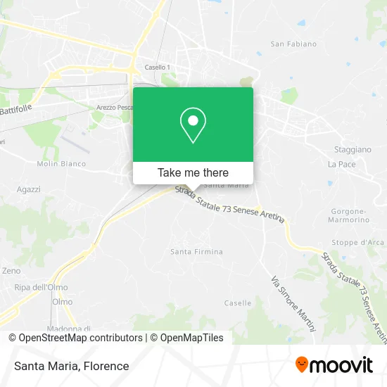
See Santa Maria, Arezzo, on the map
Public Transit to Santa Maria in Arezzo
Wondering how to get to Santa Maria in Arezzo? Moovit helps you find the best way to get to Santa Maria with step-by-step directions from the nearest public transit station.
Moovit provides free maps and live directions to help you navigate through your city. View schedules, routes, timetables, and find out how long does it take to get to Santa Maria in real time.
Looking for the nearest stop or station to Santa Maria? Check out this list of stops closest to your destination: Arno Street No. 32; Via Della Robbia 159/C - Crossroads; Via Veneto 211 - Pallanca; Via Veneto 220 Opposite Pallanca; Mecenate Avenue Opposite 40; Chiari Street; Arezzo.
Bus: 138, 911, B+, BAAS, G, LS5, LS6, SI381, T, A+, 22S, 21S.Train: R, RL, RL.
Want to see if there’s another route that gets you there at an earlier time? Moovit helps you find alternative routes or times. Get directions from and directions to Santa Maria easily from the Moovit App or Website.
We make riding to Santa Maria easy, which is why over 1.5 million users, including users in Arezzo, trust Moovit as the best app for public transit. You don’t need to download an individual bus app or train app, Moovit is your all-in-one transit app that helps you find the best bus time or train time available.
For information on prices of bus and train, costs and ride fares to Santa Maria, please check the Moovit app.
Use the app to navigate to popular places including to the airport, hospital, stadium, grocery store, mall, coffee shop, school, college, and university.
Santa Maria Address: 52100 Arezzo street in Arezzo
- Geopos,
- Livero Giuseppe,
- Holmo,
- Phon Magic by Fabrizia Bianchi,
- Rossoblu Pizzeria and Spaghetti Restaurant,
- Blu Phoenix Yacht by Fabio Giannotti,
- Cate Aretino Vintage Tractor Committee,
- Orbati Brothers,
- ESSELUNGA,
- G.S. Olmoponte,
- Olimpia Beaute Perfumery at Eelunga,
- Via della Robbia 98 - S. Maria,
- Arnold's,
- The Tuscan,
- Santa Maria of Graces,
- Luna Park Parking Zone,
- Dr. Ilaria Lazzeroni,
- Pranopratica School - Risvegli di Luce,
- Iconic Resort,
- CONAD
Places Near Santa Maria (Arezzo)
- I Gigli, Campi Bisenzio,
- Artemio Franchi Municipal Stadium, Florence,
- IKEA Florence, Sesto Fiorentino,
- Santa Maria Novella Station, Florence,
- Wanny Palace, Florence,
- Michelangelo Square, Florence,
- Michelangelo Square, Florence,
- Field of Mars, Florence,
- Cascine Park, Florence,
- OOO, Florence,
- Viola Park, Bagno a Ripoli,
- Campi Bisenzio, Campi Bisenzio,
- Asmana, Campi Bisenzio,
- Nelson Mandela Forum, Florence,
- Verdi Theater, Florence,
- Mandela Forum (Nelson Mandela Forum), Florence,
- Tobacco Manufacture, Florence,
- Santa Maria Nuova Hospital, Florence,
- Torregalli Hospital Scandicci *, Scandicci,
- Piero Palagi Hospital Facility-Florence, Florence
How to get to popular places in Florence with public transit
Get around Arezzo by public transit!
Traveling around Arezzo has never been so easy. See step by step directions as you travel to any attraction, street or major public transit station. View bus and train schedules, arrival times, service alerts and detailed routes on a map, so you know exactly how to get to anywhere in Arezzo.
When traveling to any destination around Arezzo use Moovit's Live Directions with Get Off Notifications to know exactly where and how far to walk, how long to wait for your line, and how many stops are left. Moovit will alert you when it's time to get off — no need to constantly re-check whether yours is the next stop.
Wondering how to use public transit in Arezzo or how to pay for public transit in Arezzo? Moovit public transit app can help you navigate your way with public transit easily, and at minimum cost. It includes public transit fees, ticket prices, and costs. Looking for a map of Arezzo public transit lines? Moovit public transit app shows all public transit maps in Arezzo with all Bus, Train, Light Rail, Ferry and Funicular routes and stops on an interactive map.
Florence has 5 transit type(s), including: Bus, Train, Light Rail, Ferry and Funicular, operated by several transit agencies, including Florence Urban - Tuscan Bus Lines, GEST, Livorno and Province - Tuscan Bus Lines, Arezzo, Florence and Provinces - Tuscan Bus Lines, Prato and Province - Tuscan Bus Lines, Lucca and Province - Tuscan Bus Lines, Massa, Carrara and Province - Tuscan Bus Lines, Pisa and Province - Tuscan Bus Lines, Grosseto, Siena and Provinces - Tuscan Bus Lines, Arezzo, Siena and Provinces - Tuscan Bus Lines, Florence and Province - Tuscan Bus Lines, Pistoia and Province - Tuscan Bus Lines, Siena and Province - Tuscan Bus Lines, Arezzo and Province - Tuscan Bus Lines and Trenitalia