How to get to Santa Molina-Marshall by bus?
Click on the bus route to see step by step directions with maps, line arrival times and updated time schedules.
From Nova- Alexandria Campus, Alexandria
72 minFrom Sheraton Suites Old Town Alexandria, Alexandria
39 minFrom Shirlington, Arlington County
40 minFrom Prince George's Plaza Metro Station, Prince George's County
70 minFrom Knollwood, Washington
51 minFrom Courtyard Alexandria Pentagon South, Alexandria
43 minFrom PG Mall, Prince George's County
77 minFrom Rock Creek Tennis Center, Washington
30 minFrom Saint Elizabeth's West Campus (DHS/USCG), Washington
58 minFrom The Mall at Prince Georges, Prince George's County
88 min
How to get to Santa Molina-Marshall by train?
Click on the train route to see step by step directions with maps, line arrival times and updated time schedules.
How to get to Santa Molina-Marshall by metro?
Click on the metro route to see step by step directions with maps, line arrival times and updated time schedules.
Metro stations near Santa Molina-Marshall in Washington
Bus stops near Santa Molina-Marshall in Washington
- K Street And Connecticut Avenue Nw, 2 min walk,VIEW
- K St & 17th St & Connecticut NW Wb, 2 min walk,VIEW
- 17 St Nw+I St NW, 2 min walk,VIEW
- I St Nw+17 St NW, 3 min walk,VIEW
- Connecticut Av Nw+L St NW, 3 min walk,VIEW
- K St & 18th St NW Wb, 3 min walk,VIEW
- 17th St Nw (East) & I St Nw, 3 min walk,VIEW
- K St NW & 17th St NW (Main) West, 3 min walk,VIEW
Bus lines to Santa Molina-Marshall in Washington
- A49, East To Metro Center,VIEW
- 715, 715/9 Golden Beach Park & Ride,VIEW
- 725, 725/4 California,VIEW
- 810, 810/2 Washington Dc,VIEW
- 820, 820/2 Washington Dc,VIEW
- 830, 830/3 Washington Dc,VIEW
- 840, 840/7 Prince Frederick / St Leonard,VIEW
- D72, North To Mt Pleasant,VIEW
- D10, West To Foggy Bottom,VIEW
- F19, North To Potomac Park,VIEW
- D20, West To Farragut Sq,VIEW
- D80, North To Friendship Hts,VIEW
- D94, West To Sibley Hospital,VIEW
- D70, South To Farragut Sq,VIEW
- 220, 220/8 Kent Island,VIEW
- 240, 240/4 Kent Island,VIEW
- 260, 260/1 Washington Dc,VIEW
- 620, 620/6 Washington Dc,VIEW
- 640, 640/7 Waldorf,VIEW
- 650, 650/2 Washington Dc,VIEW
What are the closest stations to Santa Molina-Marshall?
The closest stations to Santa Molina-Marshall are:
- Farragut West is 42 yards away, 1 min walk.
- K Street And Connecticut Avenue Nw is 70 yards away, 2 min walk.
- K St & 17th St & Connecticut NW Wb is 78 yards away, 2 min walk.
- 17 St Nw+I St NW is 110 yards away, 2 min walk.
- I St Nw+17 St NW is 173 yards away, 3 min walk.
- Connecticut Av Nw+L St NW is 185 yards away, 3 min walk.
- K St & 18th St NW Wb is 194 yards away, 3 min walk.
- 17th St Nw (East) & I St Nw is 225 yards away, 3 min walk.
- K St NW & 17th St NW (Main) West is 233 yards away, 3 min walk.
- Farragut North - NE Corner Connecticut Ave. &Amp; K St., NW (Elevator) is 299 yards away, 4 min walk.
Which bus lines stop near Santa Molina-Marshall?
These bus lines stop near Santa Molina-Marshall: 315, 981, A49, D10, D50, D6X, D70, D94, F19.
Which train line stops near Santa Molina-Marshall?
MARC (Outbound - Washington)
Which metro lines stop near Santa Molina-Marshall?
These metro lines stop near Santa Molina-Marshall: BLUE, ORANGE, RED.
What’s the nearest metro station to Santa Molina-Marshall in Washington?
The nearest metro station to Santa Molina-Marshall in Washington is Farragut West. It’s a 1 min walk away.
What’s the nearest bus station to Santa Molina-Marshall in Washington?
The nearest bus stations to Santa Molina-Marshall in Washington are K Street And Connecticut Avenue Nw, K St & 17th St & Connecticut NW Wb and 17 St Nw+I St NW. The closest one is a 2 min walk away.
What time is the first metro to Santa Molina-Marshall in Washington?
The BLUE is the first metro that goes to Santa Molina-Marshall in Washington. It stops nearby at 5:23 AM.
What time is the last metro to Santa Molina-Marshall in Washington?
The RED is the last metro that goes to Santa Molina-Marshall in Washington. It stops nearby at 12:10 AM.
What time is the first bus to Santa Molina-Marshall in Washington?
The D80 is the first bus that goes to Santa Molina-Marshall in Washington. It stops nearby at 3:02 AM.
What time is the last bus to Santa Molina-Marshall in Washington?
The D10 is the last bus that goes to Santa Molina-Marshall in Washington. It stops nearby at 3:16 AM.
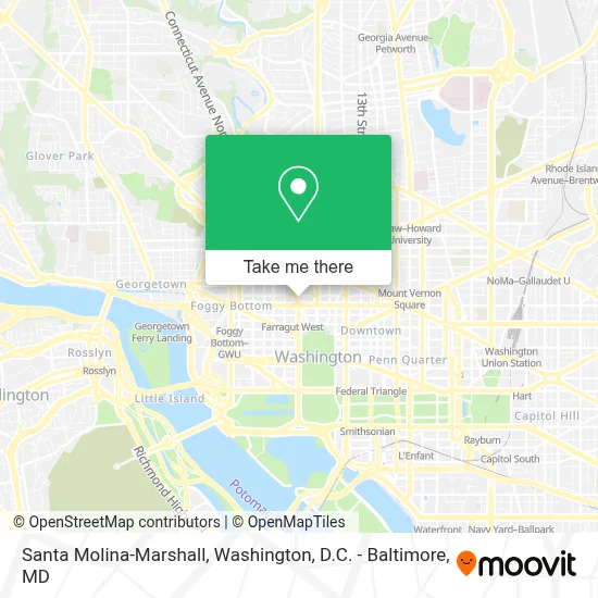
See Santa Molina-Marshall, Washington, on the map
Public Transit to Santa Molina-Marshall in Washington
Wondering how to get to Santa Molina-Marshall in Washington? Moovit helps you find the best way to get to Santa Molina-Marshall with step-by-step directions from the nearest public transit station.
Moovit provides free maps and live directions to help you navigate through your city. View schedules, routes, timetables, and find out how long does it take to get to Santa Molina-Marshall in real time.
Looking for the nearest stop or station to Santa Molina-Marshall? Check out this list of stops closest to your destination: Farragut West; K Street And Connecticut Avenue Nw; K St & 17th St & Connecticut NW Wb; 17 St Nw+I St NW; I St Nw+17 St NW; Connecticut Av Nw+L St NW; K St & 18th St NW Wb; 17th St Nw (East) & I St Nw; K St NW & 17th St NW (Main) West; Farragut North - NE Corner Connecticut Ave. &Amp; K St..
Bus: 315, 981, A49, D10, D50, D6X, D70, D94, F19, 715, 725, 810, 820, 830, D72, D20, D80.Train: MARC.Metro: BLUE, ORANGE, RED, SILVER.
Want to see if there’s another route that gets you there at an earlier time? Moovit helps you find alternative routes or times. Get directions from and directions to Santa Molina-Marshall easily from the Moovit App or Website.
We make riding to Santa Molina-Marshall easy, which is why over 1.7 million users, including users in Washington, trust Moovit as the best app for public transit. You don’t need to download an individual bus app or train app, Moovit is your all-in-one transit app that helps you find the best bus time or train time available.
For information on prices of metro, bus and train, costs and ride fares to Santa Molina-Marshall, please check the Moovit app.
Use the app to navigate to popular places including to the airport, hospital, stadium, grocery store, mall, coffee shop, school, college, and university.
Santa Molina-Marshall Address: 1025 Connecticut Ave NW street in Washington
- National Fallen Officer Foundation,
- Third Way Climate And Energy,
- Africa Harvest,
- District Offices Coworking And Office Space,
- American Antitrust Institute,
- Atlantic Union Bank,
- Ups Access Point Location,
- Sterling Martin Associates,
- Ww (Weight Watchers),
- Asian Pacific Islander American Vote (Apiavote),
- George Teitelbaum Law Offices,
- Aquent Talent Recruiting Experts,
- Dipietro Law Group, Pllc,
- Dc Handyman - Remodeling,
- Davinci Meeting Rooms,
- Oceana,
- Isonah,
- Bioone,
- Rock Solid District Group Llc,
- Nemets
Places Near Santa Molina-Marshall (Washington)
- M&T Bank Stadium, Baltimore,
- Washington National Cathedral, Washington,
- National Theatre, Washington,
- The Anthem, Washington,
- Washington DC VA Medical Center, Washington,
- National Museum of African American History and Culture, Washington,
- Georgetown, Washington,
- Basilica of the National Shrine, Washington,
- National Zoo, Washington,
- Camden Yards, Baltimore,
- Capital One Arena, Washington,
- Amazon Hq2, Arlington County,
- Rock Creek Tennis Center, Washington,
- Museum Of The Bible, Washington,
- Marriott Marquis Washington, DC, Washington,
- Warner Theatre, Washington,
- Westfield Montgomery Mall, Montgomery County,
- Pennsylvania Ave NW (3rd st and pennsylvania), Washington,
- Sibley Memorial Hospital, Washington,
- PG Mall, Prince George's County
How to get to popular places in Washington, D.C. - Baltimore, MD with public transit
Get around Washington by public transit!
Traveling around Washington has never been so easy. See step by step directions as you travel to any attraction, street or major public transit station. View bus and train schedules, arrival times, service alerts and detailed routes on a map, so you know exactly how to get to anywhere in Washington.
When traveling to any destination around Washington use Moovit's Live Directions with Get Off Notifications to know exactly where and how far to walk, how long to wait for your line, and how many stops are left. Moovit will alert you when it's time to get off — no need to constantly re-check whether yours is the next stop.
Wondering how to use public transit in Washington or how to pay for public transit in Washington? Moovit public transit app can help you navigate your way with public transit easily, and at minimum cost. It includes public transit fees, ticket prices, and costs. Looking for a map of Washington public transit lines? Moovit public transit app shows all public transit maps in Washington with all Bus, Train, Metro, Light Rail and Ferry routes and stops on an interactive map.
Washington, D.C. - Baltimore, MD has 5 transit type(s), including: Bus, Train, Metro, Light Rail and Ferry, operated by several transit agencies, including WMATA, Montgomery County Ride On, Fairfax Connector, TheBus, PRTC, DASH - Alexandria, Arlington Transit (ART), RTA of Central Maryland, MDOT MTA, MDOT MTA Light RailLink, MDOT MTA Commuter Bus, MDOT MTA Local Bus, FXBGO!, Virginia Railway Express (VRE) and MARC