How to get to Santo Comal by bus?
Click on the bus route to see step by step directions with maps, line arrival times and updated time schedules.
From Universidad Tecnologica De Aguascalientes, Aguascalientes
46 minFrom Unidad Deportiva Jesús María, Aguascalientes
47 minFrom Maravillas, Jesus Maria, Aguascalientes
32 minFrom Universidad Cuauhtemoc Plantel Aguascalientes, Aguascalientes
22 minFrom Jatco, Aguascalientes
45 minFrom Paseo de la Biznaga, Aguascalientes
34 minFrom Imeco, Aguascalientes
48 minFrom Aeropuerto de Aguascalientes S.A. de C.V., Aguascalientes
46 minFrom Recinto Apalilla 404 113, Aguascalientes
35 min
Bus stops near Santo Comal in Aguascalientes
Bus lines to Santo Comal in Aguascalientes
- RUTA 01, Vicente Guerrero,VIEW
- RUTA 05, La Ribera,VIEW
- RUTA 08, Utma,VIEW
- RUTA 37, Hacienda San Marcos,VIEW
- RUTA 09, Cumbres III - Mahatma Gandhi,VIEW
- RUTA 09, Mahatma Gandhi - Los Laureles,VIEW
- RUTA 34, Villa Montaña - UPA,VIEW
- RUTA 02, Centro (Jardín Carpio),VIEW
- RUTA 47, Clínica 10,VIEW
- RUTA 06, Jesús María - Mahatma Gandhi,VIEW
- RUTA 10, UAA Sur - Paseos de Aguascalientes,VIEW
- RUTA 11, Mahatma Gandhi - Chichimeco,VIEW
- RUTA 38, Vicente Guerrero - Paso Blanco,VIEW
- RUTA 03, La Ribera,VIEW
- RUTA 04, Mahatma Gandhi - Jesús María,VIEW
- RUTA 27, Vicente Guerrero - Valle de los Cactus,VIEW
- RUTA 36, Lunaria - Centro (Mercado Terán),VIEW
- RUTA 43, San Antonio - UTMA,VIEW
- RUTA 43, UTMA - Lomas de New York - San Antonio,VIEW
- RUTA 46, Vicente Guerrero - Calvillito,VIEW
What are the closest stations to Santo Comal?
The closest stations to Santo Comal are:
- Petróleos Mexicanos, 215 is 154 meters away, 3 min walk.
- Petróleos Mexicanos, 326 is 161 meters away, 3 min walk.
- Plateros, 232 is 181 meters away, 3 min walk.
- Avenida Independencia, 3 is 191 meters away, 3 min walk.
- Avenida Independencia, 144 is 204 meters away, 3 min walk.
- 5 De Mayo, 655(Int) is 271 meters away, 4 min walk.
- General Álvaro Obregón, 406 is 484 meters away, 7 min walk.
Which bus lines stop near Santo Comal?
These bus lines stop near Santo Comal: RUTA 02, RUTA 06, RUTA 27, RUTA 34, RUTA 38, RUTA 43.
What’s the nearest bus station to Santo Comal in Aguascalientes?
The nearest bus stations to Santo Comal in Aguascalientes are Petróleos Mexicanos, 215, Petróleos Mexicanos, 326, Plateros, 232, Avenida Independencia, 3 and Avenida Independencia, 144. The closest one is a 3 min walk away.
What time is the first bus to Santo Comal in Aguascalientes?
The RUTA 08 is the first bus that goes to Santo Comal in Aguascalientes. It stops nearby at 6:11 AM.
What time is the last bus to Santo Comal in Aguascalientes?
The RUTA 02 is the last bus that goes to Santo Comal in Aguascalientes. It stops nearby at 10:26 PM.
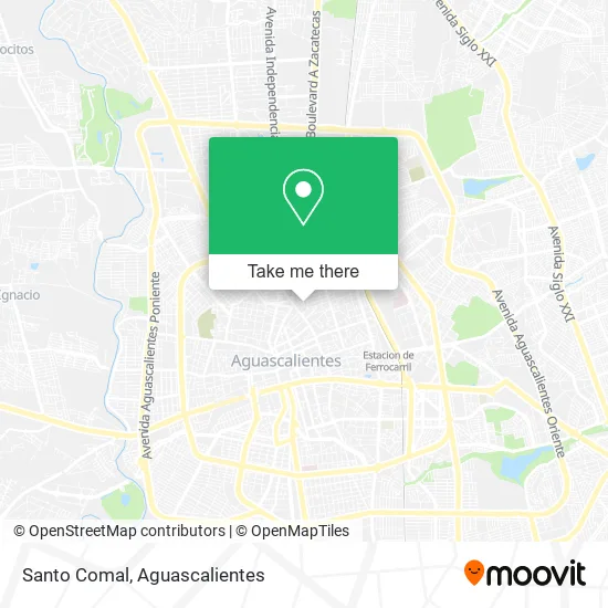
See Santo Comal, Aguascalientes, on the map
Public Transit to Santo Comal in Aguascalientes
Wondering how to get to Santo Comal in Aguascalientes? Moovit helps you find the best way to get to Santo Comal with step-by-step directions from the nearest public transit station.
Moovit provides free maps and live directions to help you navigate through your city. View schedules, routes, timetables, and find out how long does it take to get to Santo Comal in real time.
Looking for the nearest stop or station to Santo Comal? Check out this list of stops closest to your destination: Petróleos Mexicanos; Petróleos Mexicanos; Plateros; Avenida Independencia; Avenida Independencia; 5 De Mayo; General Álvaro Obregón.
Bus: RUTA 02, RUTA 06, RUTA 27, RUTA 34, RUTA 38, RUTA 43, RUTA 01, RUTA 05, RUTA 08, RUTA 37, RUTA 09, RUTA 09, RUTA 47, RUTA 10, RUTA 11, RUTA 03, RUTA 04.
Want to see if there’s another route that gets you there at an earlier time? Moovit helps you find alternative routes or times. Get directions from and directions to Santo Comal easily from the Moovit App or Website.
We make riding to Santo Comal easy, which is why over 1.5 million users, including users in Aguascalientes, trust Moovit as the best app for public transit. You don’t need to download an individual bus app or train app, Moovit is your all-in-one transit app that helps you find the best bus time or train time available.
For information on prices of bus, costs and ride fares to Santo Comal, please check the Moovit app.
Use the app to navigate to popular places including to the airport, hospital, stadium, grocery store, mall, coffee shop, school, college, and university.
Santo Comal Address: Calle México 402, La Fe, 20050 Aguascalientes, Aguascalientes street in Aguascalientes
- Mercado Primavera,
- Barberia Latitud 22,
- Fashion Cel Accesorios,
- Bodega de Municipio,
- Estética,
- Dr. Miguel de Luna,
- Uniformes Hinca,
- Selladores para Concreto,
- Burritos de Pabellón,
- Laboratorio Dental J Carmelo Perez Ascencion,
- Ferretería Api,
- Nelly Lloryet,
- Área de Juegos,
- Sala de Usos Multiples,
- Endemico Underwear,
- Abarrotes Fed,
- Papeleria La Gaviota,
- Plateros 215,
- Venta Jugos,
- Rivera Boxing Club
Places Near Santo Comal (Aguascalientes)
- Agropecuario, Aguascalientes,
- Universidad Autónoma de Aguascalientes, Aguascalientes,
- Blvd. Luis Donaldo Colosio, Aguascalientes,
- Villas de Nuestra Señora de la Asunción, Aguascalientes,
- Nuevo Hospital Hidalgo, Aguascalientes,
- Terminal De Combis, Aguascalientes,
- Aeropuerto de Aguascalientes S.A. de C.V., Aguascalientes,
- Jesús María, Aguascalientes,
- Ciudad industrial, Aguascalientes,
- Isla San Marcos, Aguascalientes,
- La Isla San Marcos, Aguascalientes,
- Hospital Imss No. 3, Aguascalientes,
- Centro Comercial Altaria, Aguascalientes,
- Imss Clinica 1, Aguascalientes,
- Parque Las Tres Centurias, Aguascalientes,
- Villasuncion, Aguascalientes,
- clinica 3 uaa, Aguascalientes,
- Centro, Aguascalientes,
- Central De Autobuses, Aguascalientes,
- ESPACIOS, Aguascalientes
How to get to popular places in Aguascalientes with public transit
Get around Aguascalientes by public transit!
Traveling around Aguascalientes has never been so easy. See step by step directions as you travel to any attraction, street or major public transit station. View bus and train schedules, arrival times, service alerts and detailed routes on a map, so you know exactly how to get to anywhere in Aguascalientes.
When traveling to any destination around Aguascalientes use Moovit's Live Directions with Get Off Notifications to know exactly where and how far to walk, how long to wait for your line, and how many stops are left. Moovit will alert you when it's time to get off — no need to constantly re-check whether yours is the next stop.
Wondering how to use public transit in Aguascalientes or how to pay for public transit in Aguascalientes? Moovit public transit app can help you navigate your way with public transit easily, and at minimum cost. It includes public transit fees, ticket prices, and costs. Looking for a map of Aguascalientes public transit lines? Moovit public transit app shows all public transit maps in Aguascalientes with all bus routes and stops on an interactive map.
Aguascalientes has 1 transit type(s), including: bus, operated by several transit agencies, including Coordinación General de Movilidad