Directions to Santolan (Pasig City) with public transportation
The following transit lines have routes that pass near Santolan
 Bus: JEEP, BUS, BUS.
- Train: LRT 2.
How to get to Santolan by bus?
Click on the bus route to see step by step directions with maps, line arrival times and updated time schedules.
How to get to Santolan by train?
Click on the train route to see step by step directions with maps, line arrival times and updated time schedules.
Bus stops near Santolan in Pasig City
- International Centre Of Information Technology Education, Pasig City, Manila, 14 min walk,
- Amang Rodriguez Ave, Pasig City, Manila, 16 min walk,
- Marcos Hwy, Pasig City, Manila, 22 min walk,
- J. P. Rizal St, Marikina City, Manila, 32 min walk,
Train station near Santolan in Pasig City
- Marikina Station, 17 min walk,
Bus lines to Santolan in Pasig City
- BUS, Pheonix Sun Business Park, Quezon City, Manila,
- JEEP, M. Almeda, Pateros, Manila,
- JEEP, Caruncho Ave / Market Ave Intersection, Pasig City, Manila,
- JEEP, Sumulong Hwy, Marikina City, Manila,
- JEEP, Shoe Ave / W Paz Intersection, Marikina City, Manila,
- BUS, Baclaran - Montalban via EDSA,
- JEEP, Cainta Junction - Cubao via Ortigas Ave. Ext.,
- JEEP, Cogeo - Cubao via Marcos Hi-way,
- JEEP, Cainta Junction Cubao via Imelda Avenue,
- JEEP, CAINTA - CUBAO,
- JEEP, CUBAO - MONTALBAN,
- JEEP, Antipolo - Cubao via Marcos Highway,
- JEEP, CUBAO PADILLA via MARCOS HIWAY,
- JEEP, ANTIPOLO - CUBAO via IMELDA AVE,
- JEEP, Antipolo - Cubao via Sumulong,
- JEEP, CUBAO TAYTAY,
- JEEP, CUBAO - PADILLA,
- JEEP, CALUMPANG - KATIPUNAN,
- JEEP, CUBAO - CALUMPANG via H ROXAS,
- JEEP, CUBAO - KALUMPANG,
What are the closest stations to Santolan?
The closest stations to Santolan are:
- International Centre Of Information Technology Education, Pasig City, Manila is 1037 meters away, 14 min walk.
- Amang Rodriguez Ave, Pasig City, Manila is 1166 meters away, 16 min walk.
- Marikina Station is 1307 meters away, 17 min walk.
- Marcos Hwy, Pasig City, Manila is 1660 meters away, 22 min walk.
- J. P. Rizal St, Marikina City, Manila is 2448 meters away, 32 min walk.
Which bus line stops near Santolan?
JEEP (Caruncho Ave / Market Ave Intersection, Pasig City, Manila→Shoe Ave / W Paz Intersection, Marikina City, Manila)
Which train line stops near Santolan?
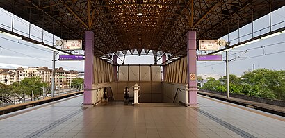
LRT 2 (Santolan)
What’s the nearest train station to Santolan in Pasig City?
The nearest train station to Santolan in Pasig City is Marikina Station. It’s a 17 min walk away.
What’s the nearest bus station to Santolan in Pasig City?
The nearest bus station to Santolan in Pasig City is International Centre Of Information Technology Education, Pasig City, Manila. It’s a 14 min walk away.
What time is the first train to Santolan in Pasig City?
The LRT 2 is the first train that goes to Santolan in Pasig City. It stops nearby at 5:01 AM.
What time is the last train to Santolan in Pasig City?
The LRT 2 is the last train that goes to Santolan in Pasig City. It stops nearby at 9:35 PM.
What time is the first bus to Santolan in Pasig City?
The JEEP is the first bus that goes to Santolan in Pasig City. It stops nearby at 7:00 AM.
What time is the last bus to Santolan in Pasig City?
The BUS is the last bus that goes to Santolan in Pasig City. It stops nearby at 1:29 AM.
See Santolan, Pasig City, on the map
Public Transit to Santolan in Pasig City
Wondering how to get to Santolan in Pasig City? Moovit helps you find the best way to get to Santolan with step-by-step directions from the nearest public transit station.
Moovit provides free maps and live directions to help you navigate through your city. View schedules, routes, timetables, and find out how long does it take to get to Santolan in real time.
Looking for the nearest stop or station to Santolan? Check out this list of stops closest to your destination: International Centre Of Information Technology Education; Amang Rodriguez Ave; Marikina Station; Marcos Hwy; J. P. Rizal St.
Bus: JEEP, BUS, BUS.Train: LRT 2.
Want to see if there’s another route that gets you there at an earlier time? Moovit helps you find alternative routes or times. Get directions from and directions to Santolan easily from the Moovit App or Website.
We make riding to Santolan easy, which is why over 1.5 million users, including users in Pasig City, trust Moovit as the best app for public transit. You don’t need to download an individual bus app or train app, Moovit is your all-in-one transit app that helps you find the best bus time or train time available.
For information on prices of bus and train, costs and ride fares to Santolan, please check the Moovit app.
Use the app to navigate to popular places including to the airport, hospital, stadium, grocery store, mall, coffee shop, school, college, and university.
Location: Pasig City, Manila
- Kambingan N Nanay Juling,
- Econal Builders & Aluminum Glass Supply,
- 21 F. Pasco Ave,
- Satori Residences,
- Trans-Asia Textile Mills Inc.,
- Lucky St / F. Pasco Ave,
- F. Pasco Ave / F. Cruz,
- Mirea Residences Clubhouse,
- Santolan,
- F. Pasco Ave,
- San Lorenzo Ruiz Chapel,
- Windsor Mansion,
- F. Cruz St. (Francisco Cruz Street),
- 102 F. Pasco Ave,
- Doña Aurora Executive Village,
- Eulogio Amang Rodriguez Avenue,
- Pasig Royale Mansion,
- Sto. Tomas,
- Mirea Residences,
- Brentwood Mansion
Places Near Santolan (Pasig City)
- NAIA Terminal 3, Manila,
- CCF Center Main, Pasig City,
- WWW.Youjizz.Com, Antipolo City,
- Parqal Mall, Parañaque,
- Civil Service Commission NCR Office, Quezon City,
- Lemon Square Munoz QC, Quezon City,
- East Avenue Medical Center, Quezon City,
- SB Park, Tandang Sora, Q.C., Quezon City,
- Robinsons Place (Robinsons Place Ermita), Manila,
- DSWD - Central Office, Batasan Complex, Quezon City,
- SM City North EDSA, Quezon City,
- Bridgetowne, Quezon City,
- PSA - East Ave, Quezon City,
- Eton Centris, Quezon City,
- Sm Manila, Manila,
- Dfa Aseana, Parañaque,
- Double Dragon Plaza,
- Jones Bridge, Manila,
- Fisher Mall, Quezon City,
- Ayala Malls Feliz, Pasig City
How to get to popular places in Manila with public transit
Get around Pasig City by public transit!
Traveling around Pasig City has never been so easy. See step by step directions as you travel to any attraction, street or major public transit station. View bus and train schedules, arrival times, service alerts and detailed routes on a map, so you know exactly how to get to anywhere in Pasig City.
When traveling to any destination around Pasig City use Moovit's Live Directions with Get Off Notifications to know exactly where and how far to walk, how long to wait for your line, and how many stops are left. Moovit will alert you when it's time to get off — no need to constantly re-check whether yours is the next stop.
Wondering how to use public transit in Pasig City or how to pay for public transit in Pasig City? Moovit public transit app can help you navigate your way with public transit easily, and at minimum cost. It includes public transit fees, ticket prices, and costs. Looking for a map of Pasig City public transit lines? Moovit public transit app shows all public transit maps in Pasig City with all Bus and Train routes and stops on an interactive map.
Manila has 2 transit type(s), including: Bus and Train, operated by several transit agencies, including MRTC, LRTA, PNR, LTFRB, BGC Bus, P2P and UV Express