How to get to Saturne Project by bus?
Click on the bus route to see step by step directions with maps, line arrival times and updated time schedules.
From Clinique Paris Lilas, Les Lilas
68 minFrom Rue du Quatre Septembre, Paris
46 minFrom Banque de France, Paris
46 minFrom La Géode, Paris
92 minFrom Consulat De Tunisie - Pantin, Pantin
78 minFrom Saint-Cloud, Saint-Cloud
81 minFrom Rue de Cîteaux, Paris
40 minFrom Rue de Charonne, Paris
54 minFrom Belle Épine, Thiais
59 minFrom Suresnes, Suresnes
75 min
How to get to Saturne Project by metro?
Click on the metro route to see step by step directions with maps, line arrival times and updated time schedules.
Bus stops near Saturne Project in Arcueil
RER station near Saturne Project in Arcueil
- Laplace, 3 min walk,VIEW
Metro station near Saturne Project in Arcueil
- Barbara, 17 min walk,VIEW
Light Rail stations near Saturne Project in Arcueil
- Montsouris, 17 min walk,VIEW
Bus lines to Saturne Project in Arcueil
- 193, Mairie,VIEW
- 323, Châtillon - Montrouge - Métro,VIEW
- 380, Villejuif - Louis Aragon,VIEW
- N21, Porte D'Orléans,VIEW
- V4, Hôtel de Ville - Centre,VIEW
- MONTBUS, Châtillon - Montrouge - Métro,VIEW
- V5, Centre de Santé - Place Marcel Cachin,VIEW
- 187, Porte D'orléans - Fresnes Les Groux,VIEW
- 188, Rosenberg - Porte D'orléans,VIEW
- 197, Avenue Saint-Marc - Porte D'orléans,VIEW
- N14, La Croix De Berny Rer - Mairie De Saint-Ouen - République,VIEW
What are the closest stations to Saturne Project?
The closest stations to Saturne Project are:
- Centre de Santé Marcel Cachin is 133 meters away, 2 min walk.
- Laplace is 175 meters away, 3 min walk.
- Lénine is 248 meters away, 4 min walk.
- Centre de Santé - Place Marcel Cachin is 254 meters away, 4 min walk.
- Vanne / Aqueduc is 274 meters away, 4 min walk.
- Vache Noire is 383 meters away, 5 min walk.
- Barbara is 1297 meters away, 17 min walk.
- Montsouris is 1304 meters away, 17 min walk.
Which train line stops near Saturne Project?
L (Cergy-le-Haut/ Versailles-Rive-Droite/ Saint-Nom-la-Bretèche - Forêt de Marly)
Which RER line stops near Saturne Project?
B (Aéroport Charles-de-Gaulle 2 TGV / Mitry - Claye)
Which metro lines stop near Saturne Project?
These metro lines stop near Saturne Project: 14, 4, 5.
Which bus lines stop near Saturne Project?
These bus lines stop near Saturne Project: 187, 188, 57, 68.
What’s the nearest light rail station to Saturne Project in Arcueil?
The nearest light rail station to Saturne Project in Arcueil is Montsouris. It’s a 17 min walk away.
What’s the nearest metro station to Saturne Project in Arcueil?
The nearest metro station to Saturne Project in Arcueil is Barbara. It’s a 17 min walk away.
What’s the nearest bus station to Saturne Project in Arcueil?
The nearest bus station to Saturne Project in Arcueil is Centre de Santé Marcel Cachin. It’s a 2 min walk away.
What’s the nearest RER station to Saturne Project in Arcueil?
The nearest RER station to Saturne Project in Arcueil is Laplace. It’s a 3 min walk away.
What time is the first light rail to Saturne Project in Arcueil?
The T3A is the first light rail that goes to Saturne Project in Arcueil. It stops nearby at 6:24 AM.
What time is the last light rail to Saturne Project in Arcueil?
The T3A is the last light rail that goes to Saturne Project in Arcueil. It stops nearby at 1:30 AM.
What time is the first metro to Saturne Project in Arcueil?
The 4 is the first metro that goes to Saturne Project in Arcueil. It stops nearby at 5:31 AM.
What time is the last metro to Saturne Project in Arcueil?
The 4 is the last metro that goes to Saturne Project in Arcueil. It stops nearby at 1:13 AM.
What time is the first bus to Saturne Project in Arcueil?
The N21 is the first bus that goes to Saturne Project in Arcueil. It stops nearby at 3:01 AM.
What time is the last bus to Saturne Project in Arcueil?
The N21 is the last bus that goes to Saturne Project in Arcueil. It stops nearby at 3:34 AM.
What time is the first RER to Saturne Project in Arcueil?
The B is the first RER that goes to Saturne Project in Arcueil. It stops nearby at 5:12 AM.
What time is the last RER to Saturne Project in Arcueil?
The B is the last RER that goes to Saturne Project in Arcueil. It stops nearby at 1:04 AM.
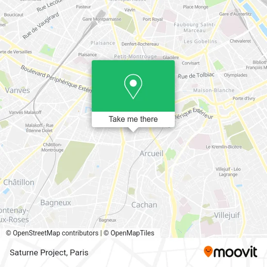
See Saturne Project, Arcueil, on the map
Public Transit to Saturne Project in Arcueil
Wondering how to get to Saturne Project in Arcueil? Moovit helps you find the best way to get to Saturne Project with step-by-step directions from the nearest public transit station.
Moovit provides free maps and live directions to help you navigate through your city. View schedules, routes, timetables, and find out how long does it take to get to Saturne Project in real time.
Looking for the nearest stop or station to Saturne Project? Check out this list of stops closest to your destination: Centre de Santé Marcel Cachin; Laplace; Lénine; Centre de Santé - Place Marcel Cachin; Vanne / Aqueduc; Vache Noire; Barbara; Montsouris.
Train: L.RER: B.Metro: 14, 4, 5.Bus: 187, 188, 57, 68, 193, 323, 380, N21, V4, MONTBUS.
Want to see if there’s another route that gets you there at an earlier time? Moovit helps you find alternative routes or times. Get directions from and directions to Saturne Project easily from the Moovit App or Website.
We make riding to Saturne Project easy, which is why over 1.5 million users, including users in Arcueil, trust Moovit as the best app for public transit. You don’t need to download an individual bus app or train app, Moovit is your all-in-one transit app that helps you find the best bus time or train time available.
For information on prices of metro, bus, RER and train, costs and ride fares to Saturne Project, please check the Moovit app.
Use the app to navigate to popular places including to the airport, hospital, stadium, grocery store, mall, coffee shop, school, college, and university.
Saturne Project Address: 11 Rue Marguerite Lagrange 94110 Arcueil street in Arcueil
- Les Champs Elysee,
- Go Sport,
- La Fontaine,
- Fredac,
- 3 Rue Antoine Marin,
- Cantine Orange Village,
- Bâtiment Lenine,
- Bluelink,
- Orange 67 Avenue Lenine,
- Aubert,
- RER Laplace [B],
- Starbucks,
- Osmose,
- Bershka,
- Rue Alice Milliat,
- Avenue Lénine,
- Promenade de l'Aqueduc de la Vanne,
- Rue Foubert,
- Société Générale,
- Salle 5b 4
Places Near Saturne Project (Arcueil)
- Hopital Foch, Suresnes,
- Galeries Lafayette, Paris,
- Hôpital Beaujon, Clichy,
- Hôpital Henri Mondor, Creteil,
- Créteil Soleil, Creteil,
- Hôpital Necker, Paris,
- Centre Hospitalier des 15/20, Paris,
- Hôpital Saint-Joseph, Paris,
- Atelier Des Lumieres, Paris,
- Hôpital de la Pitié-Salpêtrière, Paris,
- Institut Curie, Paris,
- Fondation Louis Vuitton, Paris,
- Galeries Lafayette Haussmann, Paris,
- Hôpital Pitié Salpêtrière, Paris,
- Marché Saint-Pierre, Paris,
- 29 Rue Manin, Paris,
- Hôpital Cochin, Paris,
- Gare Routière Flixbus, Paris,
- Hopital Lariboisière, Paris,
- Théâtre Mogador, Paris
How to get to popular places in Paris with public transit
Get around Arcueil by public transit!
Traveling around Arcueil has never been so easy. See step by step directions as you travel to any attraction, street or major public transit station. View bus and train schedules, arrival times, service alerts and detailed routes on a map, so you know exactly how to get to anywhere in Arcueil.
When traveling to any destination around Arcueil use Moovit's Live Directions with Get Off Notifications to know exactly where and how far to walk, how long to wait for your line, and how many stops are left. Moovit will alert you when it's time to get off — no need to constantly re-check whether yours is the next stop.
Wondering how to use public transit in Arcueil or how to pay for public transit in Arcueil? Moovit public transit app can help you navigate your way with public transit easily, and at minimum cost. It includes public transit fees, ticket prices, and costs. Looking for a map of Arcueil public transit lines? Moovit public transit app shows all public transit maps in Arcueil with all Bus, Train, Metro, Light Rail, RER, Funicular and Gondola routes and stops on an interactive map.
Paris has 7 transit type(s), including: Bus, Train, Metro, Light Rail, RER, Funicular and Gondola, operated by several transit agencies, including RATP, RER, RER Bus de remplacement, Train, Train Bus de remplacement, Tramway Bus de remplacement, TER, ADP, Magical Shuttle, Argenteuil - Boucles de Seine, Autocars Dominique, Bièvre, Brie et 2 Morin, Le Bus - C.C. du Clermontois and Cœur d’Essonne