How to get to Saveiros Angra by bus?
Click on the bus route to see step by step directions with maps, line arrival times and updated time schedules.
From Centro De Informaçôes Da Usina Nuclear, Mambucaba
63 minFrom Praia Do Laboratorio, Cunhambebe
61 minFrom Iate Clube de Santos-Ics Angra, Cunhambebe
59 minFrom Praia do Laboratorio, Cunhambebe
52 minFrom Hotel Fasano Angra Dos Reis, Cunhambebe
70 minFrom Trilha da Cachoeira do Palmital (Frade), Cunhambebe
74 minFrom Country Club Porto Frade, Cunhambebe
62 minFrom STICPAR - Sindicato dos Trabalhadores Da Indústria Da Construção Pesada De Angra Dos Reis E Parat, Cunhambebe
60 minFrom Frade Laje Mar, Cunhambebe
57 min
Bus stops near Saveiros Angra in Mambucaba
Bus lines to Saveiros Angra in Mambucaba
What are the closest stations to Saveiros Angra?
The closest stations to Saveiros Angra are:
- Rua Um, 2011 is 32 meters away, 1 min walk.
- Rua Dos Bandeirantes, 1-19 is 516 meters away, 7 min walk.
Which bus line stops near Saveiros Angra?
T20 (Parque Mambucaba)
What’s the nearest bus station to Saveiros Angra in Mambucaba?
The nearest bus station to Saveiros Angra in Mambucaba is Rua Um, 2011. It’s a 1 min walk away.
What time is the first bus to Saveiros Angra in Mambucaba?
The L406 is the first bus that goes to Saveiros Angra in Mambucaba. It stops nearby at 3:41 AM.
What time is the last bus to Saveiros Angra in Mambucaba?
The T20 is the last bus that goes to Saveiros Angra in Mambucaba. It stops nearby at 1:50 AM.
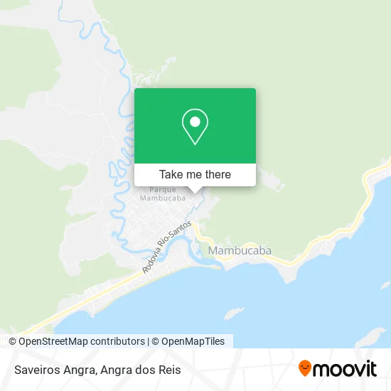
See Saveiros Angra, Mambucaba, on the map
Public Transit to Saveiros Angra in Mambucaba
Wondering how to get to Saveiros Angra in Mambucaba? Moovit helps you find the best way to get to Saveiros Angra with step-by-step directions from the nearest public transit station.
Moovit provides free maps and live directions to help you navigate through your city. View schedules, routes, timetables, and find out how long does it take to get to Saveiros Angra in real time.
Looking for the nearest stop or station to Saveiros Angra? Check out this list of stops closest to your destination: Rua Um; Rua Dos Bandeirantes.
Bus: T20, 227, L406.
Want to see if there’s another route that gets you there at an earlier time? Moovit helps you find alternative routes or times. Get directions from and directions to Saveiros Angra easily from the Moovit App or Website.
We make riding to Saveiros Angra easy, which is why over 1.5 million users, including users in Mambucaba, trust Moovit as the best app for public transit. You don’t need to download an individual bus app or train app, Moovit is your all-in-one transit app that helps you find the best bus time or train time available.
For information on prices of bus, costs and ride fares to Saveiros Angra, please check the Moovit app.
Use the app to navigate to popular places including to the airport, hospital, stadium, grocery store, mall, coffee shop, school, college, and university.
Saveiros Angra Address: Rua Júlio Maria, Parque Mambucaba Angra dos Reis-RJ 23955-480 street in Mambucaba
- Lc do Corte,
- Bibicletaria Mambucaba,
- Dayvissonecleidescosmeticosper,
- Farias Club,
- Preta Miller,
- Posto,
- Construtora Silveira,
- Raffa Beleza,
- Angelica Acai,
- Linguica Artesanal Pig-Bom,
- Davifabioplateano,
- R.M Pintura Automotiva e Polimento Cristalizado,
- Luks Henryq Mkt Digital,
- Reforco Escolar Caminho das Letras,
- Pousada Flor de Liz,
- Vroliveira,
- Salão da Damy,
- Catia Bar,
- PSF Módulo VI,
- Amigas De Angra E Cosmeticos
Places Near Saveiros Angra (Mambucaba)
- Verolme, Jacuecanga,
- Rua Prefeito João Gregório Galindo, Cunhambebe,
- Praia de Paraty Mirim, Parati,
- Vila Galé Eco Resort De Angra, Angra Dos Reis,
- Praia do Laboratório, Angra Dos Reis,
- Rua Prefeito João Gregório Galindo 2487, Angra Dos Reis,
- Avenida Almirante Jair Carneiro Toscano de Brito 110, Angra Dos Reis,
- Condominio Laranjeiras, Parati Mirim,
- Centro Histórico de Paraty, Parati,
- BR 101, Km 508 s/n, Cunhambebe,
- Avenida Antônio Bertholdo da Silva Jordão 7346, Jacuecanga,
- Rodovia Procurador Haroldo Fernandes Duarte, Km 513,5 s / n, Cunhambebe,
- Vila Residencial De Mambucaba, Mambucaba,
- praia jabaquara - parati, Parati,
- Cachoeira do Tobogã, Parati,
- Rodovia BR 101, Km 533 s/n, Mambucaba,
- Garatucaia, Angra Dos Reis,
- Mambucaba, Mambucaba,
- Alambique Engenho D'Ouro, Parati,
- Rua Cônegos Bittencourt, Angra Dos Reis
How to get to popular places in Angra dos Reis with public transit
Get around Mambucaba by public transit!
Traveling around Mambucaba has never been so easy. See step by step directions as you travel to any attraction, street or major public transit station. View bus and train schedules, arrival times, service alerts and detailed routes on a map, so you know exactly how to get to anywhere in Mambucaba.
When traveling to any destination around Mambucaba use Moovit's Live Directions with Get Off Notifications to know exactly where and how far to walk, how long to wait for your line, and how many stops are left. Moovit will alert you when it's time to get off — no need to constantly re-check whether yours is the next stop.
Wondering how to use public transit in Mambucaba or how to pay for public transit in Mambucaba? Moovit public transit app can help you navigate your way with public transit easily, and at minimum cost. It includes public transit fees, ticket prices, and costs. Looking for a map of Mambucaba public transit lines? Moovit public transit app shows all public transit maps in Mambucaba with all Bus and Ferry routes and stops on an interactive map.
Angra dos Reis has 2 transit type(s), including: Bus and Ferry, operated by several transit agencies, including Viação Senhor do Bonfim, Colitur Transportes Rodoviários, Cooparatyense (Vans), Costa Verde Transportes, Barcas Rio, Objetiva Tour, Vilanova Tour, Rodoviário Oceano, BusUFF and Colitur (Tarifa Zero - Paraty)