How to get to Saviar by bus?
Click on the bus route to see step by step directions with maps, line arrival times and updated time schedules.
From Sheraton Suites Old Town Alexandria, Alexandria
52 minFrom St. Albans School, Washington
43 minFrom Arlington County Courthouse, Arlington County
54 minFrom The Westin Arlington Gateway, Arlington County
75 minFrom Ellsworth Place, Montgomery County
74 minFrom Landover, Maryland, Prince George's County
88 minFrom Embassy Of Russia, Washington
47 minFrom College Park Marriott Hotel & Conference Center, Prince George's County
78 minFrom National Hall / Reagan National Airport (DCA), Arlington County
98 minFrom Regal Majestic Stadium 20 and IMAX, Montgomery County
74 min
How to get to Saviar by train?
Click on the train route to see step by step directions with maps, line arrival times and updated time schedules.
How to get to Saviar by metro?
Click on the metro route to see step by step directions with maps, line arrival times and updated time schedules.
From Sheraton Suites Old Town Alexandria, Alexandria
49 minFrom St. Albans School, Washington
45 minFrom Arlington County Courthouse, Arlington County
36 minFrom The Westin Arlington Gateway, Arlington County
40 minFrom Ellsworth Place, Montgomery County
27 minFrom Landover, Maryland, Prince George's County
51 minFrom National Hall / Reagan National Airport (DCA), Arlington County
32 minFrom Regal Majestic Stadium 20 and IMAX, Montgomery County
28 min
Bus stops near Saviar in Washington
Train stations near Saviar in Washington
Metro station near Saviar in Washington
- Union Station, 11 min walk,VIEW
Bus lines to Saviar in Washington
What are the closest stations to Saviar?
The closest stations to Saviar are:
- N Capitol St Ne+M St NE is 346 yards away, 5 min walk.
- K St Ne+N Capitol St NE is 411 yards away, 6 min walk.
- K St & 2nd St NE Wb is 435 yards away, 6 min walk.
- Union Station is 733 yards away, 9 min walk.
- Union Station Marc Washington is 1173 yards away, 15 min walk.
Which bus lines stop near Saviar?
These bus lines stop near Saviar: C71, D20, D30, D36.
Which train lines stop near Saviar?
These train lines stop near Saviar: MARC, NORTHEAST REGIONAL.
Which metro line stops near Saviar?
RED (Glenmont)
What’s the nearest metro station to Saviar in Washington?
The nearest metro station to Saviar in Washington is Union Station. It’s a 11 min walk away.
What’s the nearest train station to Saviar in Washington?
The nearest train station to Saviar in Washington is Union Station. It’s a 9 min walk away.
What’s the nearest bus station to Saviar in Washington?
The nearest bus station to Saviar in Washington is N Capitol St Ne+M St NE. It’s a 5 min walk away.
What time is the first metro to Saviar in Washington?
The RED is the first metro that goes to Saviar in Washington. It stops nearby at 5:21 AM.
What time is the last metro to Saviar in Washington?
The RED is the last metro that goes to Saviar in Washington. It stops nearby at 12:12 AM.
What time is the first train to Saviar in Washington?
The ACELA is the first train that goes to Saviar in Washington. It stops nearby at 5:00 AM.
What time is the last train to Saviar in Washington?
The SILVER METEOR is the last train that goes to Saviar in Washington. It stops nearby at 7:10 AM.
What time is the first bus to Saviar in Washington?
The D30 is the first bus that goes to Saviar in Washington. It stops nearby at 3:06 AM.
What time is the last bus to Saviar in Washington?
The D30 is the last bus that goes to Saviar in Washington. It stops nearby at 3:07 AM.
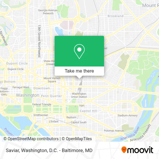
See Saviar, Washington, on the map
Public Transit to Saviar in Washington
Wondering how to get to Saviar in Washington? Moovit helps you find the best way to get to Saviar with step-by-step directions from the nearest public transit station.
Moovit provides free maps and live directions to help you navigate through your city. View schedules, routes, timetables, and find out how long does it take to get to Saviar in real time.
Looking for the nearest stop or station to Saviar? Check out this list of stops closest to your destination: N Capitol St Ne+M St NE; K St Ne+N Capitol St NE; K St & 2nd St NE Wb; Union Station; Union Station Marc Washington.
Bus: C71, D20, D30, D36, 220, 240, 260.Train: MARC, NORTHEAST REGIONAL, ACELA, CARDINAL, CAROLINIAN, CRESCENT, FLORIDIAN.Metro: RED.
Want to see if there’s another route that gets you there at an earlier time? Moovit helps you find alternative routes or times. Get directions from and directions to Saviar easily from the Moovit App or Website.
We make riding to Saviar easy, which is why over 1.7 million users, including users in Washington, trust Moovit as the best app for public transit. You don’t need to download an individual bus app or train app, Moovit is your all-in-one transit app that helps you find the best bus time or train time available.
For information on prices of bus, metro and train, costs and ride fares to Saviar, please check the Moovit app.
Use the app to navigate to popular places including to the airport, hospital, stadium, grocery store, mall, coffee shop, school, college, and university.
Saviar Address: 1005 1st St NE street in Washington
- Greyhound-Washington (Greyhound Bus Lines),
- Wunder Garten,
- Moi,
- Federal Retirement Thrift Investment Board,
- Kaiser Permanente,
- 1st St NE & M,
- Ava Noma,
- EEOC,
- Union Station | Track 17,
- Harris Teeter,
- Andy's Pizza,
- NPR News Headquarters,
- DCPS Central Office,
- 1200 first street,
- NPR Studio 1,
- NoMA,
- REI,
- Laos In Town,
- WELLS FARGO BANK,
- Uline Arena
Places Near Saviar (Washington)
- Georgetown, Washington,
- Sibley Memorial Hospital, Washington,
- Marriott Marquis Washington, DC, Washington,
- National Zoo, Washington,
- Warner Theatre, Washington,
- Basilica of the National Shrine, Washington,
- Washington DC VA Medical Center, Washington,
- The Anthem, Washington,
- Washington National Cathedral, Washington,
- Capital One Arena, Washington,
- Pennsylvania Ave NW (3rd st and pennsylvania), Washington,
- Westfield Montgomery Mall, Montgomery County,
- Camden Yards, Baltimore,
- National Theatre, Washington,
- Rock Creek Tennis Center, Washington,
- Amazon Hq2, Arlington County,
- PG Mall, Prince George's County,
- National Museum of African American History and Culture, Washington,
- M&T Bank Stadium, Baltimore,
- Museum Of The Bible, Washington
How to get to popular places in Washington, D.C. - Baltimore, MD with public transit
Get around Washington by public transit!
Traveling around Washington has never been so easy. See step by step directions as you travel to any attraction, street or major public transit station. View bus and train schedules, arrival times, service alerts and detailed routes on a map, so you know exactly how to get to anywhere in Washington.
When traveling to any destination around Washington use Moovit's Live Directions with Get Off Notifications to know exactly where and how far to walk, how long to wait for your line, and how many stops are left. Moovit will alert you when it's time to get off — no need to constantly re-check whether yours is the next stop.
Wondering how to use public transit in Washington or how to pay for public transit in Washington? Moovit public transit app can help you navigate your way with public transit easily, and at minimum cost. It includes public transit fees, ticket prices, and costs. Looking for a map of Washington public transit lines? Moovit public transit app shows all public transit maps in Washington with all Bus, Train, Metro, Light Rail and Ferry routes and stops on an interactive map.
Washington, D.C. - Baltimore, MD has 5 transit type(s), including: Bus, Train, Metro, Light Rail and Ferry, operated by several transit agencies, including WMATA, Montgomery County Ride On, Fairfax Connector, TheBus, PRTC, DASH - Alexandria, Arlington Transit (ART), RTA of Central Maryland, MDOT MTA, MDOT MTA Light RailLink, MDOT MTA Commuter Bus, MDOT MTA Local Bus, FXBGO!, Virginia Railway Express (VRE) and MARC