How to get to Saving Tech by bus?
Click on the bus route to see step by step directions with maps, line arrival times and updated time schedules.
From Praia De Calhetas, Santo Agostinho
78 minFrom Hospital Dom Helder Câmara-PS, Ponte Dos Carvalhos
27 minFrom Praia do Paiva, Santo Agostinho
72 minFrom Gaibu, Santo Agostinho
59 minFrom Rua do Poeta, Santo Agostinho
60 minFrom Paiva, Santo Agostinho
76 minFrom Rodovia BR-101, Km 87 s/n, Jaboatão Dos Guararapes
57 minFrom Enseada dos Corais, Santo Agostinho
51 minFrom Praia Do Xaréu, Santo Agostinho
68 minFrom Escola Modelo de Gaibu., Santo Agostinho
44 min
Bus stops near Saving Tech in Cabo De Santo Agostinho
Train station near Saving Tech in Cabo De Santo Agostinho
- Estação Santo Inácio - Metrorec, 21 min walk,VIEW
Bus lines to Saving Tech in Cabo De Santo Agostinho
- 181, Cabo Cohab/Ti Cajueiro,VIEW
- 184, Cabo (Bacurau),VIEW
- 185, Cabo/ Recife (Cohab),VIEW
- 158, Garapu/Vila Claudete,VIEW
- 103 CABO / ITAPUAMA, Terminal Mercadão,VIEW
- 123 CABO / GAIBU / SUAPE, Via Por Baixo,VIEW
- 157, Gaibu / Ti Cabo,VIEW
- 191, Recife - Boa Vista.,VIEW
- 178, Porto De Suape / Ti Cabo,VIEW
- 196, Porto De Galinhas (Nossa Senhora Do Ó),VIEW
- 198, Atend. A Vila Do Estaleiro,VIEW
- 199, Camela / Ti Cabo,VIEW
- 129, Paiva / Ti Cabo,VIEW
- 195, Recife - Porto De Galinhas,VIEW
What are the closest stations to Saving Tech?
The closest stations to Saving Tech are:
- Terminal Da Cohab is 249 meters away, 4 min walk.
- Rua 4 1 is 439 meters away, 6 min walk.
- Paralela Rodovia Pe-060 66f is 837 meters away, 11 min walk.
- Rua Vinte E Sete 2a Cohab Cabo De Santo Agostinho - Pernambuco 54520 Brasil is 876 meters away, 12 min walk.
- Rua Setenta E Sete 5 is 914 meters away, 12 min walk.
- Rodovia Armínio Guilherme 08 is 1203 meters away, 16 min walk.
- Estação Santo Inácio - Metrorec is 1597 meters away, 21 min walk.
Which bus lines stop near Saving Tech?
These bus lines stop near Saving Tech: 129, 181.
What’s the nearest train station to Saving Tech in Cabo De Santo Agostinho?
The nearest train station to Saving Tech in Cabo De Santo Agostinho is Estação Santo Inácio - Metrorec. It’s a 21 min walk away.
What’s the nearest bus station to Saving Tech in Cabo De Santo Agostinho?
The nearest bus station to Saving Tech in Cabo De Santo Agostinho is Terminal Da Cohab. It’s a 4 min walk away.
What time is the first train to Saving Tech in Cabo De Santo Agostinho?
The VLT SUL is the first train that goes to Saving Tech in Cabo De Santo Agostinho. It stops nearby at 5:26 AM.
What time is the last train to Saving Tech in Cabo De Santo Agostinho?
The VLT SUL is the last train that goes to Saving Tech in Cabo De Santo Agostinho. It stops nearby at 9:21 PM.
What time is the first bus to Saving Tech in Cabo De Santo Agostinho?
The 184 is the first bus that goes to Saving Tech in Cabo De Santo Agostinho. It stops nearby at 3:00 AM.
What time is the last bus to Saving Tech in Cabo De Santo Agostinho?
The 184 is the last bus that goes to Saving Tech in Cabo De Santo Agostinho. It stops nearby at 2:55 AM.
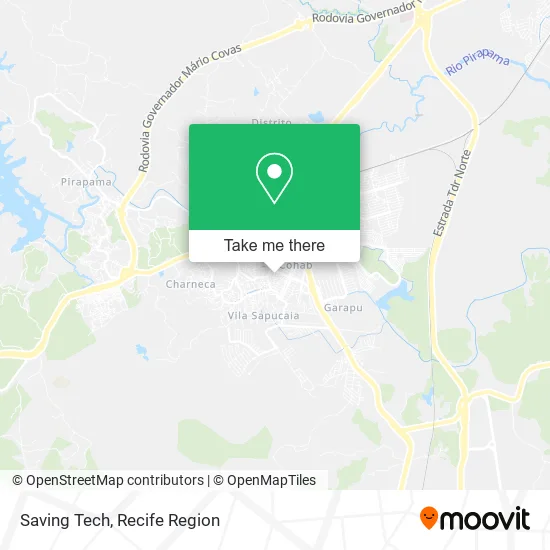
See Saving Tech, Cabo De Santo Agostinho, on the map
Public Transit to Saving Tech in Cabo De Santo Agostinho
Wondering how to get to Saving Tech in Cabo De Santo Agostinho? Moovit helps you find the best way to get to Saving Tech with step-by-step directions from the nearest public transit station.
Moovit provides free maps and live directions to help you navigate through your city. View schedules, routes, timetables, and find out how long does it take to get to Saving Tech in real time.
Looking for the nearest stop or station to Saving Tech? Check out this list of stops closest to your destination: Terminal Da Cohab; Rua 4 1; Paralela Rodovia Pe-060 66f; Rua Vinte E Sete 2a Cohab Cabo De Santo Agostinho - Pernambuco 54520 Brasil; Rua Setenta E Sete 5; Rodovia Armínio Guilherme 08; Estação Santo Inácio - Metrorec.
Bus: 129, 181, 184, 185, 158, 103 CABO / ITAPUAMA, 123 CABO / GAIBU / SUAPE, 157, 191, 178, 196, 198, 199.Train: VLT SUL.
Want to see if there’s another route that gets you there at an earlier time? Moovit helps you find alternative routes or times. Get directions from and directions to Saving Tech easily from the Moovit App or Website.
We make riding to Saving Tech easy, which is why over 1.5 million users, including users in Cabo De Santo Agostinho, trust Moovit as the best app for public transit. You don’t need to download an individual bus app or train app, Moovit is your all-in-one transit app that helps you find the best bus time or train time available.
For information on prices of bus, costs and ride fares to Saving Tech, please check the Moovit app.
Use the app to navigate to popular places including to the airport, hospital, stadium, grocery store, mall, coffee shop, school, college, and university.
Saving Tech Address: Rua Antônio Cabral de Lima, 65 Cohab Cabo de Santo Agostinho-PE 54535-380 street in Cabo De Santo Agostinho
- Rua João Barros de Lima,
- Centro Educacional Machado de Assis - Cema,
- Be Salt,
- Fashion Pet,
- La Belle de Jour Accessoires,
- J Grillo Assistencia Tecnica,
- Cohab Rua 38 Em Netinho Bebidas,
- Policlinica Vicente Mendes,
- smart Net Fibra,
- Pizzaria Massa Kent,
- Igreja Assembléia de Deus Rosa de Saron Em Pernambuco,
- Bar do Galego - Terminal Cohab,
- Nossa Barba - Barbearia,
- Terminal de ônibus da Cohab,
- Terminal Cabo-Cohab,
- Rua Roberval Bandeira Da Silva 7,
- rua 51 cohab,
- Mauriti,
- Nordestino N9,
- Escola jose rodrigues de carvalho
Places Near Saving Tech (Cabo De Santo Agostinho)
- Imip (Instituto Materno-Infantil De Pernambuco), Coelhos,
- Imbiribeira, Imbiribeira,
- Hospital Geral De Areias, Areias,
- Hospital Universitário Oswaldo Cruz, Santo Amaro,
- Centro de Convenções de Pernambuco, Olinda,
- Shopping Recife, Boa Viagem,
- Hospital Maria Lucinda, Parnamirim,
- Hospital Altino Ventura, Iputinga,
- Hospital Eduardo Campus Da Pessoa Idosa, Areias,
- hospital otavio de freitas - UTI, Tejipió,
- tuuuuu, Olinda,
- Shopping Patteo Olinda, Olinda,
- Hospital Agamenon Magalhães, Tamarineira,
- Marco Zero, Bairro Do Recife,
- llll, Fundão,
- Arena de Pernambuco, São Lourenço Da Mata,
- SHOPPING GUARARAPES, Jaboatão Dos Guararapes,
- Shopping RioMar Recife, Pina,
- SHOPPING TACARUNA, Santo Amaro,
- Parque da Jaqueira, Jaqueira
How to get to popular places in Recife Region with public transit
Get around Cabo De Santo Agostinho by public transit!
Traveling around Cabo De Santo Agostinho has never been so easy. See step by step directions as you travel to any attraction, street or major public transit station. View bus and train schedules, arrival times, service alerts and detailed routes on a map, so you know exactly how to get to anywhere in Cabo De Santo Agostinho.
When traveling to any destination around Cabo De Santo Agostinho use Moovit's Live Directions with Get Off Notifications to know exactly where and how far to walk, how long to wait for your line, and how many stops are left. Moovit will alert you when it's time to get off — no need to constantly re-check whether yours is the next stop.
Wondering how to use public transit in Cabo De Santo Agostinho or how to pay for public transit in Cabo De Santo Agostinho? Moovit public transit app can help you navigate your way with public transit easily, and at minimum cost. It includes public transit fees, ticket prices, and costs. Looking for a map of Cabo De Santo Agostinho public transit lines? Moovit public transit app shows all public transit maps in Cabo De Santo Agostinho with all Bus, Train, Subway and Ferry routes and stops on an interactive map.
Recife Region has 4 transit type(s), including: Bus, Train, Subway and Ferry, operated by several transit agencies, including CBTU (Metrorec), BRT (Via Livre), Grande Recife, BORBOREMA IMPERIAL (TIP), BORBOREMA IMPERIAL (B.V), RODOVIÁRIA POTENGY, EMPRESA METROPOLITANA, CONSÓRCIO RECIFE, SÃO JUDAS TADEU, Expresso 1002, Rodotur Turismo, Complementar Recife, Sistema Municipal - Jaboatão, Sistema Municipal - Cabo and Sistema Municipal - Ipojuca