How to get to Sayon by bus?
Click on the bus route to see step by step directions with maps, line arrival times and updated time schedules.
From Avenida Universitaria, Lima
63 minFrom Parque Andrés Avelino Cáceres, San Isidro, San Isidro
29 minFrom Centro Histórico de Lima, Lima
31 minFrom Avenida Perú, San Martin
54 minFrom Calle Germán Amézaga 375, Lima
58 minFrom Parque De Los Próceres De La Independencia, Lince
32 minFrom Parque María Reiche Miraflores, Miraflores
58 minFrom Av. Universitaria / Av. Morales Duarez, Lima
62 min
How to get to Sayon by metro?
Click on the metro route to see step by step directions with maps, line arrival times and updated time schedules.
Bus stops near Sayon in San Luis
Metro stations near Sayon in San Luis
Bus lines to Sayon in San Luis
- 1064, Lurigancho - San Juan de Lurigancho [49],VIEW
- 1066, Ate - Lima,VIEW
- 1068, Ate - Lima,VIEW
- 1069, Chosica - Lima,VIEW
- 1085, Lima - Chosica,VIEW
- 1194, San Martín de Porres - Ate [B],VIEW
- 1218, Chosica- San Miguel,VIEW
- 1222, Lurigancho - Jesús María [19N],VIEW
- 1224, Ate - Jesús María [19],VIEW
- 1227, Ate - Callao,VIEW
- 1288, Ate - San Miguel [La 19],VIEW
- 1319, Chosica - La Perla,VIEW
- 1479, Chosica - San Miguel [78],VIEW
- 1480, Chosica - San Miguel,VIEW
- 2407, Independencia - Ate,VIEW
- 1080, Ate - La Victoria - Ate,VIEW
- 1081, Ate - La Victoria - Ate,VIEW
- 1112, Pachacamac - La Victoria - Pachacamac,VIEW
- 1221, Ramiro Priale (Ate) - Mexico (Lince) ,VIEW
- 1304, Pachacamac - Callao,VIEW
What are the closest stations to Sayon?
The closest stations to Sayon are:
- Intercambio Nicolás Arriola is 58 meters away, 1 min walk.
- Nicolás De Ayllón / Las Torres is 340 meters away, 5 min walk.
- Paradero Final is 470 meters away, 7 min walk.
- Miguel Grau is 1901 meters away, 25 min walk.
- Estación Evitamiento is 2291 meters away, 30 min walk.
Which bus lines stop near Sayon?
These bus lines stop near Sayon: 1069, 1161, 1227, 1304, 1480.
Which metro line stops near Sayon?
LINEA 1 (Separadora Industrial (Villa El Salvador) - Bayóvar (San Juan De Lurigancho))
What’s the nearest metro station to Sayon in San Luis?
The nearest metro station to Sayon in San Luis is Miguel Grau. It’s a 25 min walk away.
What’s the nearest bus station to Sayon in San Luis?
The nearest bus station to Sayon in San Luis is Intercambio Nicolás Arriola. It’s a 1 min walk away.
What time is the first metro to Sayon in San Luis?
The LINEA 1 is the first metro that goes to Sayon in San Luis. It stops nearby at 5:19 AM.
What time is the last metro to Sayon in San Luis?
The LINEA 2 is the last metro that goes to Sayon in San Luis. It stops nearby at 11:02 PM.
What time is the first bus to Sayon in San Luis?
The 1479 is the first bus that goes to Sayon in San Luis. It stops nearby at 3:00 AM.
What time is the last bus to Sayon in San Luis?
The 1319 is the last bus that goes to Sayon in San Luis. It stops nearby at 4:18 AM.
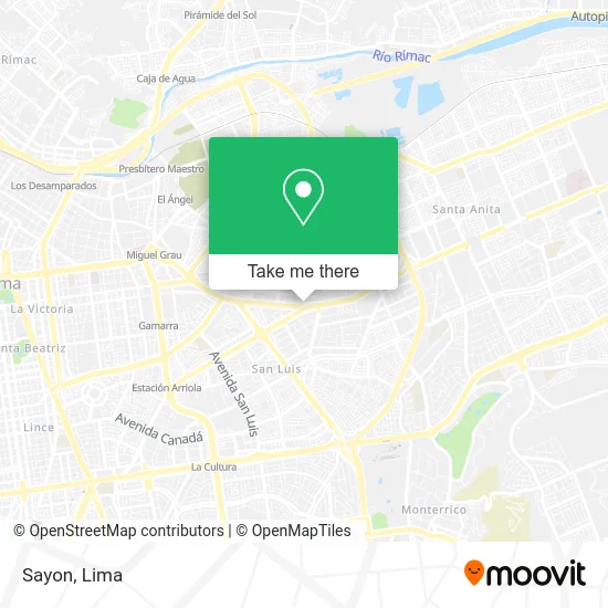
See Sayon, San Luis, on the map
Public Transit to Sayon in San Luis
Wondering how to get to Sayon in San Luis? Moovit helps you find the best way to get to Sayon with step-by-step directions from the nearest public transit station.
Moovit provides free maps and live directions to help you navigate through your city. View schedules, routes, timetables, and find out how long does it take to get to Sayon in real time.
Looking for the nearest stop or station to Sayon? Check out this list of stops closest to your destination: Intercambio Nicolás Arriola; Nicolás De Ayllón / Las Torres; Paradero Final; Miguel Grau; Estación Evitamiento.
Bus: 1069, 1161, 1227, 1304, 1480, 1064, 1066, 1068, 1085, 1080, 1081, 1112, 1221, 1610, 1065.Metro: LINEA 1, LINEA 2.
Want to see if there’s another route that gets you there at an earlier time? Moovit helps you find alternative routes or times. Get directions from and directions to Sayon easily from the Moovit App or Website.
We make riding to Sayon easy, which is why over 1.5 million users, including users in San Luis, trust Moovit as the best app for public transit. You don’t need to download an individual bus app or train app, Moovit is your all-in-one transit app that helps you find the best bus time or train time available.
For information on prices of bus and metro, costs and ride fares to Sayon, please check the Moovit app.
Use the app to navigate to popular places including to the airport, hospital, stadium, grocery store, mall, coffee shop, school, college, and university.
Sayon Address: Av. Nicolas Ayllon 1779 street in San Luis
- Avenida Nicolás Ayllón 1779,
- Grifo,
- Sayon S.A.,
- Clínica San Juan de Dios-Emergencia,
- AUTOESPAR San Luis,
- Avenida Nicolás de Ayllón 3250,
- Av Mariscal Caceres Urb Valdivieso,
- Autoespar,
- Av Nicolás Ayllon,
- yichang,
- Parque Nueva Esperanza,
- Kidsmadehere - outlet,
- Parque Sicaya,
- BANCO DE LA NACION,
- Avenida Nicolás Ayllón,
- Utilmax & Office Market SAC,
- Camiones-Repuestos y Accesorios-ISUZU,
- Colegio Virgen de Chapi Ie 114,
- Institución Educativa 114 Virgen De Chapi,
- Capilla Señor de los Milagros - Valdiviezo
Places Near Sayon (San Luis)
- Av. Abancay, Lima,
- Real Plaza Puruchuco, Ate,
- Paradero Av.Brasil,
- Aeropuerto Internacional Jorge Chávez, Ventanilla,
- Barranco, Barranco,
- Mall Del Sur,
- Circuito Mágico Del Agua, Lima,
- av arequipa, Lima,
- Av. Salaverry, Jesus Mari,
- Hospital Edgardo Rebagliati Martins, Jesus Mari,
- Pontificia Universidad Católica del Perú - PUCP, San Miguel,
- Miraflores, Miraflores,
- Larcomar, Miraflores,
- Parque de las Leyendas, San Miguel,
- Parque Kennedy, Miraflores,
- Jockey Plaza, Santiago D,
- Plaza San Miguel, San Miguel,
- Gamarra,
- Av. La Marina, San Miguel,
- Centro Comercial Plaza Norte, Independen
How to get to popular places in Lima with public transit
Get around San Luis by public transit!
Traveling around San Luis has never been so easy. See step by step directions as you travel to any attraction, street or major public transit station. View bus and train schedules, arrival times, service alerts and detailed routes on a map, so you know exactly how to get to anywhere in San Luis.
When traveling to any destination around San Luis use Moovit's Live Directions with Get Off Notifications to know exactly where and how far to walk, how long to wait for your line, and how many stops are left. Moovit will alert you when it's time to get off — no need to constantly re-check whether yours is the next stop.
Wondering how to use public transit in San Luis or how to pay for public transit in San Luis? Moovit public transit app can help you navigate your way with public transit easily, and at minimum cost. It includes public transit fees, ticket prices, and costs. Looking for a map of San Luis public transit lines? Moovit public transit app shows all public transit maps in San Luis with all Bus, Metro and Ferry routes and stops on an interactive map.
Lima has 3 transit type(s), including: Bus, Metro and Ferry, operated by several transit agencies, including Metro de Lima Línea 2 , Metro de Lima, Corredor Rojo, Metropolitano, Metropolitano - Alimentadores, Corredor Morado, Corredor Azul, Rutas Tradicionales, Transportes y Servicios La Esperanza S.A., Las Flores S.A., Virgen de la Asunción S.A., Consorcio HAM, Transportes y Service Canadá S.A., ETUL4SA and ETUCHISA