How to get to Scacciapensieri by bus?
Click on the bus route to see step by step directions with maps, line arrival times and updated time schedules.
From New Maltraverso Sports Center, Colle Di Val D'Elsa
153 minFrom Antica Querciolaia Thermal Baths, Rapolano Terme
64 minFrom Bruno Ceccarelli Sports Field of Cerchiaia, Siena
41 minFrom Alta Val d'Elsa River Park, Colle Di Val D'Elsa
159 minFrom Colle Di Val D'Elsa, Colle Di Val D'Elsa
59 minFrom Le Pozze Di Lecchi, Gaiole In Chianti
65 minFrom Gaiole In Chianti, Gaiole In Chianti
55 minFrom Siena Eye Laser, Poggibonsi
119 minFrom Rapolano Terme, Rapolano Terme
60 minFrom Greve In Chianti, Greve In Chianti
209 min
How to get to Scacciapensieri by train?
Click on the train route to see step by step directions with maps, line arrival times and updated time schedules.
Bus stops near Scacciapensieri in Siena
Train station near Scacciapensieri in Siena
- Siena, 15 min walk,VIEW
Bus lines to Scacciapensieri in Siena
- 0S3, Massetana-Via Tozzi-Railway-Hospital-Due Ponti,VIEW
- 0S8, Piazza Sale-Scacciapensieri-Station-Piazza Sale,VIEW
- 60N, Gramsci Square - Siena Outskirts,VIEW
- 609, Scacciapensieri-San Miniato-Center,VIEW
- 616, Scacciapensieri-San Minato-Piazza Gramsci-Tufi,VIEW
- 504, Siena Fruit and Vegetable Market,VIEW
- 524, Two Bridges,VIEW
- S10, Fornacelle Parking,VIEW
- S17, San Miniato,VIEW
- S77, Salt Square,VIEW
- S30, Gramsci Square-San Rocco-Castle,VIEW
- 501, Piazza Del Sale-Station-Le Scotte-Coroncina,VIEW
- 507, Porta Pispini - Le Scotte Hospital,VIEW
- 629, Via Tozzi-Hospital,VIEW
- 503, Tozzi Street,VIEW
- 516, Railway,VIEW
- SI91, Bucine Station Street (Newsstand),VIEW
What are the closest stations to Scacciapensieri?
The closest stations to Scacciapensieri are:
- Rossini Junction is 128 meters away, 2 min walk.
- Orlandi Gardens is 262 meters away, 4 min walk.
- Bracci Orlandi Junction is 360 meters away, 5 min walk.
- Mario Bracci is 434 meters away, 6 min walk.
- Siena Viale Bracci is 451 meters away, 6 min walk.
- Siena is 1122 meters away, 15 min walk.
Which bus lines stop near Scacciapensieri?
These bus lines stop near Scacciapensieri: 0S3, 504, GT1, S10.
Which train line stops near Scacciapensieri?
R (Siena)
What’s the nearest train station to Scacciapensieri in Siena?
The nearest train station to Scacciapensieri in Siena is Siena. It’s a 15 min walk away.
What’s the nearest bus station to Scacciapensieri in Siena?
The nearest bus station to Scacciapensieri in Siena is Rossini Junction. It’s a 2 min walk away.
What time is the first train to Scacciapensieri in Siena?
The R is the first train that goes to Scacciapensieri in Siena. It stops nearby at 5:45 AM.
What time is the last train to Scacciapensieri in Siena?
The R is the last train that goes to Scacciapensieri in Siena. It stops nearby at 11:17 PM.
What time is the first bus to Scacciapensieri in Siena?
The S10 is the first bus that goes to Scacciapensieri in Siena. It stops nearby at 5:41 AM.
What time is the last bus to Scacciapensieri in Siena?
The 60N is the last bus that goes to Scacciapensieri in Siena. It stops nearby at 1:51 AM.
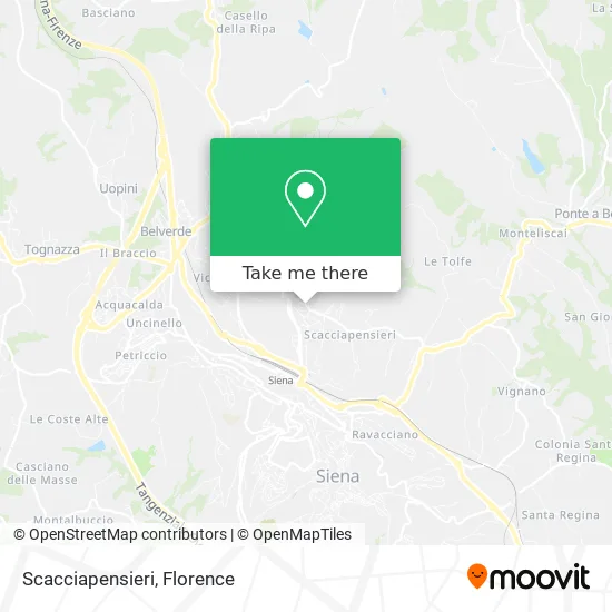
See Scacciapensieri, Siena, on the map
Public Transit to Scacciapensieri in Siena
Wondering how to get to Scacciapensieri in Siena? Moovit helps you find the best way to get to Scacciapensieri with step-by-step directions from the nearest public transit station.
Moovit provides free maps and live directions to help you navigate through your city. View schedules, routes, timetables, and find out how long does it take to get to Scacciapensieri in real time.
Looking for the nearest stop or station to Scacciapensieri? Check out this list of stops closest to your destination: Rossini Junction; Orlandi Gardens; Bracci Orlandi Junction; Mario Bracci; Siena Viale Bracci; Siena.
Bus: 0S3, 504, GT1, S10, 0S8, 60N, 609, 616, 524, S17, S77, S77, S30, 501, 507, 629, 503, 516.Train: R.
Want to see if there’s another route that gets you there at an earlier time? Moovit helps you find alternative routes or times. Get directions from and directions to Scacciapensieri easily from the Moovit App or Website.
We make riding to Scacciapensieri easy, which is why over 1.5 million users, including users in Siena, trust Moovit as the best app for public transit. You don’t need to download an individual bus app or train app, Moovit is your all-in-one transit app that helps you find the best bus time or train time available.
For information on prices of bus and train, costs and ride fares to Scacciapensieri, please check the Moovit app.
Use the app to navigate to popular places including to the airport, hospital, stadium, grocery store, mall, coffee shop, school, college, and university.
Scacciapensieri Address: Via Nazareno Orlandi, 21 53100 Siena street in Siena
- Municipality of Siena,
- Alterego Hairdressers,
- Globo Colle Val Delsa,
- Aladar Sail,
- Macrosoft Service by Franchi Lorenzo & Co.,
- Francesco Siliberto,
- Scacciapensieri Pastry,
- Ernesto Spinello Painting,
- Lazzeroni Filippo,
- Clean Service Cooperative Society,
- Accor Siena degli Ulivi,
- Sergio Fanetti,
- Casa della Lana by Carla Pannini & Co.,
- Monte dei Paschi di Siena - Agency 4 of Siena,
- Dr. Roberto Cuomo,
- Amazon Counter,
- House Constructions,
- The Mad Hatter - Children's and Young People's Bookstore Siena,
- Giancarlo Franci,
- Nazareno Orlandi Gardens
Places Near Scacciapensieri (Siena)
- Nelson Mandela Forum, Florence,
- Wanny Palace, Florence,
- Torregalli Hospital Scandicci *, Scandicci,
- Verdi Theater, Florence,
- Santa Maria Nuova Hospital, Florence,
- Tobacco Manufacture, Florence,
- IKEA Florence, Sesto Fiorentino,
- Campi Bisenzio, Campi Bisenzio,
- I Gigli, Campi Bisenzio,
- Field of Mars, Florence,
- Viola Park, Bagno a Ripoli,
- Michelangelo Square, Florence,
- Asmana, Campi Bisenzio,
- Santa Maria Novella Station, Florence,
- Cascine Park, Florence,
- Michelangelo Square, Florence,
- OOO, Florence,
- Mandela Forum (Nelson Mandela Forum), Florence,
- Piero Palagi Hospital Facility-Florence, Florence,
- Artemio Franchi Municipal Stadium, Florence
How to get to popular places in Florence with public transit
Get around Siena by public transit!
Traveling around Siena has never been so easy. See step by step directions as you travel to any attraction, street or major public transit station. View bus and train schedules, arrival times, service alerts and detailed routes on a map, so you know exactly how to get to anywhere in Siena.
When traveling to any destination around Siena use Moovit's Live Directions with Get Off Notifications to know exactly where and how far to walk, how long to wait for your line, and how many stops are left. Moovit will alert you when it's time to get off — no need to constantly re-check whether yours is the next stop.
Wondering how to use public transit in Siena or how to pay for public transit in Siena? Moovit public transit app can help you navigate your way with public transit easily, and at minimum cost. It includes public transit fees, ticket prices, and costs. Looking for a map of Siena public transit lines? Moovit public transit app shows all public transit maps in Siena with all Bus, Train, Light Rail, Ferry and Funicular routes and stops on an interactive map.
Florence has 5 transit type(s), including: Bus, Train, Light Rail, Ferry and Funicular, operated by several transit agencies, including Florence Urban - Tuscan Bus Lines, GEST, Florence and Province - Tuscan Bus Lines, Livorno and Province - Tuscan Bus Lines, Arezzo, Florence and Provinces - Tuscan Bus Lines, Prato and Province - Tuscan Bus Lines, Massa, Carrara and Province - Tuscan Bus Lines, Pisa and Province - Tuscan Bus Lines, Grosseto, Siena and Provinces - Tuscan Bus Lines, Arezzo, Siena and Provinces - Tuscan Bus Lines, Pistoia and Province - Tuscan Bus Lines, Siena and Province - Tuscan Bus Lines, Arezzo and Province - Tuscan Bus Lines, Lucca and Province - Tuscan Bus Lines and Trenitalia