How to get to Scafide Insurance by bus?
Click on the bus route to see step by step directions with maps, line arrival times and updated time schedules.
From American University, Washington
52 minFrom Holiday Inn Washington Dc - Central / White House, Washington
42 minFrom Players Club, Washington
44 minFrom The Darcy Hotel Washington DC, Washington
42 minFrom 17th St NW, Washington
44 minFrom Duke Ellington School of the Arts, Washington
64 minFrom St. Albans School, Washington
57 minFrom Crew Club, Washington
46 minFrom Roosevelt High School, Washington
39 minFrom District Hotel, Washington
44 min
How to get to Scafide Insurance by metro?
Click on the metro route to see step by step directions with maps, line arrival times and updated time schedules.
From American University, Washington
65 minFrom Holiday Inn Washington Dc - Central / White House, Washington
45 minFrom Players Club, Washington
48 minFrom The Darcy Hotel Washington DC, Washington
44 minFrom 17th St NW, Washington
45 minFrom Duke Ellington School of the Arts, Washington
68 minFrom St. Albans School, Washington
61 minFrom Crew Club, Washington
47 minFrom Roosevelt High School, Washington
37 minFrom District Hotel, Washington
46 min
Bus stops near Scafide Insurance in Montgomery County
Train station near Scafide Insurance in Montgomery County
- Silver Spring Marc Wb, 48 min walk,VIEW
Metro station near Scafide Insurance in Montgomery County
- Silver Spring, 49 min walk,VIEW
Bus lines to Scafide Insurance in Montgomery County
What are the closest stations to Scafide Insurance?
The closest stations to Scafide Insurance are:
- Georgia Av+Spring St is 104 yards away, 2 min walk.
- 2nd Ave & Spring St is 274 yards away, 4 min walk.
- Fenwick Ln & 1st Ave is 285 yards away, 4 min walk.
- Silver Spring Marc Wb is 4093 yards away, 48 min walk.
- Silver Spring is 4178 yards away, 49 min walk.
Which bus lines stop near Scafide Insurance?
These bus lines stop near Scafide Insurance: 1, M20.
Which metro line stops near Scafide Insurance?
RED (Glenmont)
What’s the nearest bus station to Scafide Insurance in Montgomery County?
The nearest bus station to Scafide Insurance in Montgomery County is Georgia Av+Spring St. It’s a 2 min walk away.
What time is the first metro to Scafide Insurance in Montgomery County?
The RED is the first metro that goes to Scafide Insurance in Montgomery County. It stops nearby at 5:07 AM.
What time is the last metro to Scafide Insurance in Montgomery County?
The RED is the last metro that goes to Scafide Insurance in Montgomery County. It stops nearby at 12:31 AM.
What time is the first train to Scafide Insurance in Montgomery County?
The MARC is the first train that goes to Scafide Insurance in Montgomery County. It stops nearby at 5:51 AM.
What time is the last train to Scafide Insurance in Montgomery County?
The MARC is the last train that goes to Scafide Insurance in Montgomery County. It stops nearby at 7:37 PM.
What time is the first bus to Scafide Insurance in Montgomery County?
The M20 is the first bus that goes to Scafide Insurance in Montgomery County. It stops nearby at 4:17 AM.
What time is the last bus to Scafide Insurance in Montgomery County?
The 5 is the last bus that goes to Scafide Insurance in Montgomery County. It stops nearby at 2:06 AM.
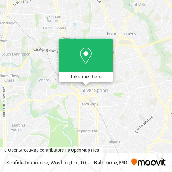
See Scafide Insurance, Montgomery County, on the map
Public Transit to Scafide Insurance in Montgomery County
Wondering how to get to Scafide Insurance in Montgomery County? Moovit helps you find the best way to get to Scafide Insurance with step-by-step directions from the nearest public transit station.
Moovit provides free maps and live directions to help you navigate through your city. View schedules, routes, timetables, and find out how long does it take to get to Scafide Insurance in real time.
Looking for the nearest stop or station to Scafide Insurance? Check out this list of stops closest to your destination: Georgia Av+Spring St; 2nd Ave & Spring St; Fenwick Ln & 1st Ave; Silver Spring Marc Wb; Silver Spring.
Bus: 1, M20, 4, 5, 11, 28, 18.Train: MARC.Metro: RED.
Want to see if there’s another route that gets you there at an earlier time? Moovit helps you find alternative routes or times. Get directions from and directions to Scafide Insurance easily from the Moovit App or Website.
We make riding to Scafide Insurance easy, which is why over 1.5 million users, including users in Montgomery County, trust Moovit as the best app for public transit. You don’t need to download an individual bus app or train app, Moovit is your all-in-one transit app that helps you find the best bus time or train time available.
For information on prices of bus and metro, costs and ride fares to Scafide Insurance, please check the Moovit app.
Use the app to navigate to popular places including to the airport, hospital, stadium, grocery store, mall, coffee shop, school, college, and university.
Scafide Insurance Address: 1300 Spring St Silver Spring, MD 20910 street in Montgomery County
- Lim Joshua Lim Joshua MD Silver Spring,
- St Amant Kim Marie DDS,
- Seec,
- Living & Growing,
- Tacos Way,
- Arrive Silver Spring,
- Nayher Remodeling LLC,
- Execustay Georgian Towers,
- LADO International Institute,
- Katsouprinis Pizza Squared,
- Equus Workforce Solutions,
- Dr Bunnag,
- Corporate Concierg,
- Mom's Organic Market,
- Believe N Bread,
- Painewebber,
- Atwell on Spring,
- Interactive Technology Solutions,
- Bid4assets,
- Harava Group
Places Near Scafide Insurance (Montgomery County)
- National Zoo, Washington,
- Washington National Cathedral, Washington,
- Washington DC VA Medical Center, Washington,
- Basilica of the National Shrine, Washington,
- National Museum of African American History and Culture, Washington,
- Marriott Marquis Washington, DC, Washington,
- Sibley Memorial Hospital, Washington,
- Camden Yards, Baltimore,
- National Mall, Washington,
- Rock Creek Tennis Center, Washington,
- PG Mall, Prince George's County,
- Museum Of The Bible, Washington,
- Pennsylvania Ave NW (3rd st and pennsylvania), Washington,
- Georgetown, Washington,
- Amazon Hq2, Arlington County,
- The Anthem, Washington,
- Westfield Montgomery Mall, Montgomery County,
- M&T Bank Stadium, Baltimore,
- Warner Theatre, Washington,
- Capital One Arena, Washington
How to get to popular places in Washington, D.C. - Baltimore, MD with public transit
Get around Montgomery County by public transit!
Traveling around Montgomery County has never been so easy. See step by step directions as you travel to any attraction, street or major public transit station. View bus and train schedules, arrival times, service alerts and detailed routes on a map, so you know exactly how to get to anywhere in Montgomery County.
When traveling to any destination around Montgomery County use Moovit's Live Directions with Get Off Notifications to know exactly where and how far to walk, how long to wait for your line, and how many stops are left. Moovit will alert you when it's time to get off — no need to constantly re-check whether yours is the next stop.
Wondering how to use public transit in Montgomery County or how to pay for public transit in Montgomery County? Moovit public transit app can help you navigate your way with public transit easily, and at minimum cost. It includes public transit fees, ticket prices, and costs. Looking for a map of Montgomery County public transit lines? Moovit public transit app shows all public transit maps in Montgomery County with all Bus, Train, Metro, Light Rail and Ferry routes and stops on an interactive map.
Washington, D.C. - Baltimore, MD has 5 transit type(s), including: Bus, Train, Metro, Light Rail and Ferry, operated by several transit agencies, including WMATA, Montgomery County Ride On, Fairfax Connector, TheBus, PRTC, DASH - Alexandria, Arlington Transit (ART), RTA of Central Maryland, MDOT MTA, MDOT MTA Light RailLink, MDOT MTA Commuter Bus, MDOT MTA Local Bus, FXBGO!, Virginia Railway Express (VRE) and MARC