How to get to Scanlab by bus?
Click on the bus route to see step by step directions with maps, line arrival times and updated time schedules.
From Rue du Docteur Babinski, Paris
72 minFrom Rue de Longchamp, Paris
44 minFrom Musée Grévin, Paris
74 minFrom Jeu de Paume, Paris
55 minFrom Rue De Penthievre, Paris
48 minFrom L'Ambassade, Paris
68 minFrom Rue d'Anjou, Paris
51 minFrom Fondation Ophtalmologique Adolphe de Rothschild, Paris
73 minFrom 29 Rue Manin, Paris
73 minFrom 25 à 29 Rue Manin, Paris
73 min
How to get to Scanlab by train?
Click on the train route to see step by step directions with maps, line arrival times and updated time schedules.
How to get to Scanlab by metro?
Click on the metro route to see step by step directions with maps, line arrival times and updated time schedules.
From Rue du Docteur Babinski, Paris
56 minFrom Rue de Longchamp, Paris
39 minFrom Musée Grévin, Paris
42 minFrom Jeu de Paume, Paris
34 minFrom Rue De Penthievre, Paris
43 minFrom L'Ambassade, Paris
48 minFrom Rue d'Anjou, Paris
37 minFrom Fondation Ophtalmologique Adolphe de Rothschild, Paris
62 minFrom 29 Rue Manin, Paris
61 minFrom 25 à 29 Rue Manin, Paris
61 min
Bus stops near Scanlab in Issy-Les-Moulineaux
Train station near Scanlab in Issy-Les-Moulineaux
- Clamart, 9 min walk,VIEW
RER station near Scanlab in Issy-Les-Moulineaux
- Issy, 16 min walk,VIEW
Light Rail stations near Scanlab in Issy-Les-Moulineaux
- Jacques-Henri Lartigue, 19 min walk,VIEW
Metro station near Scanlab in Issy-Les-Moulineaux
- Corentin Celton, 20 min walk,VIEW
Bus lines to Scanlab in Issy-Les-Moulineaux
What are the closest stations to Scanlab?
The closest stations to Scanlab are:
- Rue du Fort is 42 meters away, 1 min walk.
- Avenue de la Paix is 271 meters away, 4 min walk.
- Musée is 307 meters away, 5 min walk.
- Général de Gaulle is 387 meters away, 5 min walk.
- Clos Montholon - Larmeroux is 436 meters away, 6 min walk.
- Chevalier de la Barre is 483 meters away, 7 min walk.
- Clamart is 698 meters away, 9 min walk.
- Issy is 1220 meters away, 16 min walk.
- Jacques-Henri Lartigue is 1460 meters away, 19 min walk.
- Corentin Celton is 1507 meters away, 20 min walk.
Which train line stops near Scanlab?
N (Paris-Montparnasse)
Which metro line stops near Scanlab?
12 (Front Populaire)
Which bus lines stop near Scanlab?
These bus lines stop near Scanlab: 169, 59.
What’s the nearest light rail station to Scanlab in Issy-Les-Moulineaux?
The nearest light rail station to Scanlab in Issy-Les-Moulineaux is Jacques-Henri Lartigue. It’s a 19 min walk away.
What’s the nearest metro station to Scanlab in Issy-Les-Moulineaux?
The nearest metro station to Scanlab in Issy-Les-Moulineaux is Corentin Celton. It’s a 20 min walk away.
What’s the nearest train station to Scanlab in Issy-Les-Moulineaux?
The nearest train station to Scanlab in Issy-Les-Moulineaux is Clamart. It’s a 9 min walk away.
What’s the nearest bus station to Scanlab in Issy-Les-Moulineaux?
The nearest bus station to Scanlab in Issy-Les-Moulineaux is Rue du Fort. It’s a 1 min walk away.
What’s the nearest RER station to Scanlab in Issy-Les-Moulineaux?
The nearest RER station to Scanlab in Issy-Les-Moulineaux is Issy. It’s a 16 min walk away.
What time is the first light rail to Scanlab in Issy-Les-Moulineaux?
The T2 is the first light rail that goes to Scanlab in Issy-Les-Moulineaux. It stops nearby at 6:10 AM.
What time is the last light rail to Scanlab in Issy-Les-Moulineaux?
The T2 is the last light rail that goes to Scanlab in Issy-Les-Moulineaux. It stops nearby at 1:31 AM.
What time is the first metro to Scanlab in Issy-Les-Moulineaux?
The 12 is the first metro that goes to Scanlab in Issy-Les-Moulineaux. It stops nearby at 5:30 AM.
What time is the last metro to Scanlab in Issy-Les-Moulineaux?
The 12 is the last metro that goes to Scanlab in Issy-Les-Moulineaux. It stops nearby at 10:41 PM.
What time is the first train to Scanlab in Issy-Les-Moulineaux?
The N is the first train that goes to Scanlab in Issy-Les-Moulineaux. It stops nearby at 5:27 AM.
What time is the last train to Scanlab in Issy-Les-Moulineaux?
The N is the last train that goes to Scanlab in Issy-Les-Moulineaux. It stops nearby at 1:12 AM.
What time is the first bus to Scanlab in Issy-Les-Moulineaux?
The 59 is the first bus that goes to Scanlab in Issy-Les-Moulineaux. It stops nearby at 6:14 AM.
What time is the last bus to Scanlab in Issy-Les-Moulineaux?
The 394 is the last bus that goes to Scanlab in Issy-Les-Moulineaux. It stops nearby at 1:25 AM.
What time is the first RER to Scanlab in Issy-Les-Moulineaux?
The C is the first RER that goes to Scanlab in Issy-Les-Moulineaux. It stops nearby at 5:12 AM.
What time is the last RER to Scanlab in Issy-Les-Moulineaux?
The C is the last RER that goes to Scanlab in Issy-Les-Moulineaux. It stops nearby at 12:20 AM.
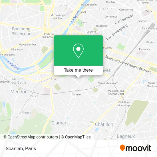
See Scanlab, Issy-Les-Moulineaux, on the map
Public Transit to Scanlab in Issy-Les-Moulineaux
Wondering how to get to Scanlab in Issy-Les-Moulineaux? Moovit helps you find the best way to get to Scanlab with step-by-step directions from the nearest public transit station.
Moovit provides free maps and live directions to help you navigate through your city. View schedules, routes, timetables, and find out how long does it take to get to Scanlab in real time.
Looking for the nearest stop or station to Scanlab? Check out this list of stops closest to your destination: Rue du Fort; Avenue de la Paix; Musée; Général de Gaulle; Clos Montholon - Larmeroux; Chevalier de la Barre; Clamart; Issy; Jacques-Henri Lartigue; Corentin Celton.
Train: N.RER: C.Metro: 12.Bus: 169, 59, 323, TUVIM EP, 290.
Want to see if there’s another route that gets you there at an earlier time? Moovit helps you find alternative routes or times. Get directions from and directions to Scanlab easily from the Moovit App or Website.
We make riding to Scanlab easy, which is why over 1.5 million users, including users in Issy-Les-Moulineaux, trust Moovit as the best app for public transit. You don’t need to download an individual bus app or train app, Moovit is your all-in-one transit app that helps you find the best bus time or train time available.
For information on prices of metro, bus and train, costs and ride fares to Scanlab, please check the Moovit app.
Use the app to navigate to popular places including to the airport, hospital, stadium, grocery store, mall, coffee shop, school, college, and university.
Scanlab Address: 35 Rue Gabriel Péri 92130 Issy-les-Moulineaux street in Issy-Les-Moulineaux
- Faculté de Droit,
- Faculté de Droit D'Issy-Les-Moulineaux,
- Faculté libre de droit,
- Arrêt rue du fort (bus 323),
- 14 Rue Gabriel Péri,
- Generoy Vege,
- 50 ter Rue Baudin,
- Axa Peignard Thierry Agent Général,
- Fauchois Alain,
- Amazon Locker-Bille,
- Couscous d'Issy,
- L'Autre Scène,
- Jc Vision,
- Premium Apartments,
- 3 Rue Pierre Brossolette,
- Maison Saint Ignace Sscc Paris,
- Astrid Bertram,
- École Justin Oudin,
- Refuge LPO,
- avenue de la paix, issy les Moulineaux, France
Places Near Scanlab (Issy-Les-Moulineaux)
- Hôpital Cochin, Paris,
- Hôpital Henri Mondor, Creteil,
- Beaugrenelle, Paris,
- Centre Hospitalier des 15/20, Paris,
- Hopital Lariboisière, Paris,
- Galeries Lafayette, Paris,
- 29 Rue Manin, Paris,
- Atelier Des Lumieres, Paris,
- Marché Saint-Pierre, Paris,
- Hôpital Necker, Paris,
- Hopital Foch, Suresnes,
- Créteil Soleil, Creteil,
- Gare Routière Flixbus, Paris,
- Hôpital Saint-Joseph, Paris,
- Galeries Lafayette Haussmann, Paris,
- Hôpital de la Pitié-Salpêtrière, Paris,
- Théâtre Mogador, Paris,
- Hôpital Pitié Salpêtrière, Paris,
- Fondation Louis Vuitton, Paris,
- Hôpital Beaujon, Clichy
How to get to popular places in Paris with public transit
Get around Issy-Les-Moulineaux by public transit!
Traveling around Issy-Les-Moulineaux has never been so easy. See step by step directions as you travel to any attraction, street or major public transit station. View bus and train schedules, arrival times, service alerts and detailed routes on a map, so you know exactly how to get to anywhere in Issy-Les-Moulineaux.
When traveling to any destination around Issy-Les-Moulineaux use Moovit's Live Directions with Get Off Notifications to know exactly where and how far to walk, how long to wait for your line, and how many stops are left. Moovit will alert you when it's time to get off — no need to constantly re-check whether yours is the next stop.
Wondering how to use public transit in Issy-Les-Moulineaux or how to pay for public transit in Issy-Les-Moulineaux? Moovit public transit app can help you navigate your way with public transit easily, and at minimum cost. It includes public transit fees, ticket prices, and costs. Looking for a map of Issy-Les-Moulineaux public transit lines? Moovit public transit app shows all public transit maps in Issy-Les-Moulineaux with all Bus, Train, Metro, Light Rail, RER, Funicular and Gondola routes and stops on an interactive map.
Paris has 7 transit type(s), including: Bus, Train, Metro, Light Rail, RER, Funicular and Gondola, operated by several transit agencies, including RATP, RER, RER Bus de remplacement, Train, Train Bus de remplacement, Tramway Bus de remplacement, TER, ADP, Magical Shuttle, Argenteuil - Boucles de Seine, Autocars Dominique, Bièvre, Brie et 2 Morin, Le Bus - C.C. du Clermontois and Cœur d’Essonne