Directions to Scarborough Bluffs (Toronto) with public transportation
The following transit lines have routes that pass near Scarborough Bluffs
 Bus: 12A, 12D, 69, 9, 902.
- Train: LE, ST.
- Subway: 2.
How to get to Scarborough Bluffs by bus?
Click on the bus route to see step by step directions with maps, line arrival times and updated time schedules.
Train stations near Scarborough Bluffs in Toronto
- Scarborough Go, 7 min walk,
- Kennedy Go, 19 min walk,
Subway station near Scarborough Bluffs in Toronto
- Kennedy, 31 min walk,
What are the closest stations to Scarborough Bluffs?
The closest stations to Scarborough Bluffs are:
- Scarborough Go is 504 meters away, 7 min walk.
- Kennedy Go is 1420 meters away, 19 min walk.
- Kennedy is 2424 meters away, 31 min walk.
Which bus lines stop near Scarborough Bluffs?
These bus lines stop near Scarborough Bluffs: 12A, 12D, 69, 9, 902.
What’s the nearest train station to Scarborough Bluffs in Toronto?
The nearest train station to Scarborough Bluffs in Toronto is Scarborough Go. It’s a 7 min walk away.
What time is the first subway to Scarborough Bluffs in Toronto?
The 2 is the first subway that goes to Scarborough Bluffs in Toronto. It stops nearby at 5:40 AM.
What time is the last subway to Scarborough Bluffs in Toronto?
The 2 is the last subway that goes to Scarborough Bluffs in Toronto. It stops nearby at 2:16 AM.
What time is the first train to Scarborough Bluffs in Toronto?
The LE is the first train that goes to Scarborough Bluffs in Toronto. It stops nearby at 5:42 AM.
What time is the last train to Scarborough Bluffs in Toronto?
The LE is the last train that goes to Scarborough Bluffs in Toronto. It stops nearby at 12:43 AM.
What time is the first bus to Scarborough Bluffs in Toronto?
The 302 is the first bus that goes to Scarborough Bluffs in Toronto. It stops nearby at 3:08 AM.
What time is the last bus to Scarborough Bluffs in Toronto?
The 302 is the last bus that goes to Scarborough Bluffs in Toronto. It stops nearby at 3:13 AM.
See Scarborough Bluffs, Toronto, on the map
Public Transit to Scarborough Bluffs in Toronto
Wondering how to get to Scarborough Bluffs in Toronto? Moovit helps you find the best way to get to Scarborough Bluffs with step-by-step directions from the nearest public transit station.
Moovit provides free maps and live directions to help you navigate through your city. View schedules, routes, timetables, and find out how long does it take to get to Scarborough Bluffs in real time.
Looking for the nearest stop or station to Scarborough Bluffs? Check out this list of stops closest to your destination: Scarborough Go; Kennedy Go; Kennedy.
Bus: 12A, 12D, 69, 9, 902.Train: LE, ST.Subway: 2.
Want to see if there’s another route that gets you there at an earlier time? Moovit helps you find alternative routes or times. Get directions from and directions to Scarborough Bluffs easily from the Moovit App or Website.
We make riding to Scarborough Bluffs easy, which is why over 1.5 million users, including users in Toronto, trust Moovit as the best app for public transit. You don’t need to download an individual bus app or train app, Moovit is your all-in-one transit app that helps you find the best bus time or train time available.
For information on prices of bus and subway, costs and ride fares to Scarborough Bluffs, please check the Moovit app.
Use the app to navigate to popular places including to the airport, hospital, stadium, grocery store, mall, coffee shop, school, college, and university.
Location: Toronto
- Bluffers Park,
- Bluffer's Park and Beach,
- Dunker's Flow Basin,
- Bluffers Park Marina,
- Scarborough Bluffs Park,
- Scarborough Crescent Park,
- Bluffer's Sand Beach,
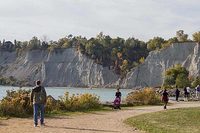
- Scarborough Bluffs,
- St. Augustine's Seminary,
- St John Henry Newman Catholic High School,
- 100 Brimley Road South,
- Realty Leaders,
- 130 Midland Avenue,
- Cubical International,
- A Woman's Touch Landscaping,
- St Theresa's Parish Shrine Little Flower,
- Midland Rd & Kingston Rd,
- Cliffside,
- M1M,
- Midland Avenue
Places Near Scarborough Bluffs (Toronto)
- St Michael s Hospital, Toronto,
- Enercare Centre, Toronto,
- Toronto Eaton Centre, Toronto,
- Exhibition Place, Toronto,
- Toronto General Hospital, Toronto,
- Rogers Centre, Toronto,
- Medieval Times, Toronto,
- Budweiser Stage, Toronto,
- Toronto Western Hospital, Toronto,
- St. Michael's Hospital, Toronto,
- Vaughan Mills Shopping Centre, Vaughan,
- St Lawrence Market, Toronto,
- Toronto zoo, Toronto,
- Great Canadian Casino Resort, Toronto,
- Distillery District Map, Toronto,
- Meridian Hall, Toronto,
- Toronto Courthouse, Toronto,
- Scarborough Town Centre, Toronto,
- Sunnybrook Hospital, Toronto,
- Chelsea Hotel, Toronto, Toronto
How to get to popular places in Toronto with public transit
Get around Toronto by public transit!
Traveling around Toronto has never been so easy. See step by step directions as you travel to any attraction, street or major public transit station. View bus and train schedules, arrival times, service alerts and detailed routes on a map, so you know exactly how to get to anywhere in Toronto.
When traveling to any destination around Toronto use Moovit's Live Directions with Get Off Notifications to know exactly where and how far to walk, how long to wait for your line, and how many stops are left. Moovit will alert you when it's time to get off — no need to constantly re-check whether yours is the next stop.
Wondering how to use public transit in Toronto or how to pay for public transit in Toronto? Moovit public transit app can help you navigate your way with public transit easily, and at minimum cost. It includes public transit fees, ticket prices, and costs. Looking for a map of Toronto public transit lines? Moovit public transit app shows all public transit maps in Toronto with all Bus, Train, Subway, Streetcar and Ferry routes and stops on an interactive map.
Toronto has 5 transit type(s), including: Bus, Train, Subway, Streetcar and Ferry, operated by several transit agencies, including TTC, Toronto Subway, Brampton Transit, MiWay, York Region Transit, GO Transit Bus, GO Transit, Durham Region Transit, UP Express, Grand River Transit, Guelph Transit, Hamilton Street Railway, Burlington Transit, Oakville Transit and Peterborough Transit