How to get to Schaude by bus?
Click on the bus route to see step by step directions with maps, line arrival times and updated time schedules.
From Müller Fleisch, Birkenfeld
219 minFrom Waldbronn Eistreff, Waldbronn
128 minFrom Schloss Neuenbürg, Verwaltungsgemeinschaft Neuenbürg
216 minFrom Grinde-Hütte, Seebach
147 minFrom Epplesee, Rheinstetten
92 minFrom 75217, Birkenfeld
218 minFrom Lotto-Annahmestelle, Vereinbarte Verwaltungsgemeinschaft Sinzheim
68 minFrom Baden-Baden, Karlsruhe/Baden-Baden Airport, Rheinmünster
38 min
How to get to Schaude by train?
Click on the train route to see step by step directions with maps, line arrival times and updated time schedules.
Bus stops near Schaude in Vereinbarte Verwaltungsgemeinschaft Rastatt
Train stations near Schaude in Vereinbarte Verwaltungsgemeinschaft Rastatt
- Rastatt, 20 min walk,VIEW
Light Rail stations near Schaude in Vereinbarte Verwaltungsgemeinschaft Rastatt
- Rastatt Beinle, 32 min walk,VIEW
Bus lines to Schaude in Vereinbarte Verwaltungsgemeinschaft Rastatt
- 222, Karlsruhe Hardecksiedlung,VIEW
- 232, Plittersdorf Bühlstraße,VIEW
- 233, Rastatt Bernhardusbrunnen,VIEW
- 235, Ra Gustav-Heinemann-Schule,VIEW
- 222, Karlsruhe Entenfang,VIEW
- 232, Plittersdorf Schulstraße,VIEW
- 235, Rastatt Danziger Str.,VIEW
- 227, Rastatt Lützowerstraße,VIEW
- 236, Rastatt Bernhardusbrunnen,VIEW
- 239, Rastatt Bahnhof,VIEW
- 227, Rastatt Bahnhof - Durmersheim Raiffeisenplatz,VIEW
- 236, Rastatt Bernhardusbrunnen - Rastatt Kaufland,VIEW
- 239, Rastatt Bahnhof - Rastatt Bahnhof,VIEW
- 231, Rastatt Mercedes-Benz Tor 6,VIEW
- 231, Roeschwoog Gare Sncf,VIEW
What are the closest stations to Schaude?
The closest stations to Schaude are:
- Rastatt Fruchthalle is 126 meters away, 2 min walk.
- Rastatt Ottersdorfer Str. is 501 meters away, 7 min walk.
- Rastatt is 1481 meters away, 20 min walk.
- Rastatt Beinle is 2500 meters away, 32 min walk.
Which train lines stop near Schaude?
These train lines stop near Schaude: RB 44, RB44, S7, S8.
Which bus lines stop near Schaude?
These bus lines stop near Schaude: 212, 222, 234, 235, 239, X34.
What’s the nearest train station to Schaude in Vereinbarte Verwaltungsgemeinschaft Rastatt?
The nearest train station to Schaude in Vereinbarte Verwaltungsgemeinschaft Rastatt is Rastatt. It’s a 20 min walk away.
What’s the nearest bus station to Schaude in Vereinbarte Verwaltungsgemeinschaft Rastatt?
The nearest bus station to Schaude in Vereinbarte Verwaltungsgemeinschaft Rastatt is Rastatt Fruchthalle. It’s a 2 min walk away.
What time is the first light rail to Schaude in Vereinbarte Verwaltungsgemeinschaft Rastatt?
The S8 is the first light rail that goes to Schaude in Vereinbarte Verwaltungsgemeinschaft Rastatt. It stops nearby at 5:05 AM.
What time is the last light rail to Schaude in Vereinbarte Verwaltungsgemeinschaft Rastatt?
The S8 is the last light rail that goes to Schaude in Vereinbarte Verwaltungsgemeinschaft Rastatt. It stops nearby at 12:56 AM.
What time is the first train to Schaude in Vereinbarte Verwaltungsgemeinschaft Rastatt?
The S8 is the first train that goes to Schaude in Vereinbarte Verwaltungsgemeinschaft Rastatt. It stops nearby at 4:55 AM.
What time is the last train to Schaude in Vereinbarte Verwaltungsgemeinschaft Rastatt?
The RB44 is the last train that goes to Schaude in Vereinbarte Verwaltungsgemeinschaft Rastatt. It stops nearby at 1:44 AM.
What time is the first bus to Schaude in Vereinbarte Verwaltungsgemeinschaft Rastatt?
The 222 is the first bus that goes to Schaude in Vereinbarte Verwaltungsgemeinschaft Rastatt. It stops nearby at 5:07 AM.
What time is the last bus to Schaude in Vereinbarte Verwaltungsgemeinschaft Rastatt?
The 231 is the last bus that goes to Schaude in Vereinbarte Verwaltungsgemeinschaft Rastatt. It stops nearby at 11:19 PM.
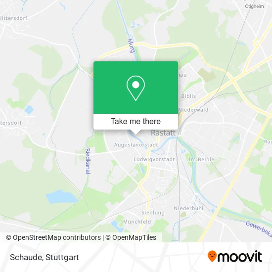
See Schaude, Vereinbarte Verwaltungsgemeinschaft Rastatt, on the map
Public Transit to Schaude in Vereinbarte Verwaltungsgemeinschaft Rastatt
Wondering how to get to Schaude in Vereinbarte Verwaltungsgemeinschaft Rastatt? Moovit helps you find the best way to get to Schaude with step-by-step directions from the nearest public transit station.
Moovit provides free maps and live directions to help you navigate through your city. View schedules, routes, timetables, and find out how long does it take to get to Schaude in real time.
Looking for the nearest stop or station to Schaude? Check out this list of stops closest to your destination: Rastatt Fruchthalle; Rastatt Ottersdorfer Str.; Rastatt; Rastatt Beinle.
Train: RB 44, RB44, S7, S8, RE2, RE7, RE40, S71, S81.Bus: 212, 222, 234, 235, 239, X34, 232, 233, 232, 227, 236, 227, 236.
Want to see if there’s another route that gets you there at an earlier time? Moovit helps you find alternative routes or times. Get directions from and directions to Schaude easily from the Moovit App or Website.
We make riding to Schaude easy, which is why over 1.5 million users, including users in Vereinbarte Verwaltungsgemeinschaft Rastatt, trust Moovit as the best app for public transit. You don’t need to download an individual bus app or train app, Moovit is your all-in-one transit app that helps you find the best bus time or train time available.
For information on prices of bus, train and light rail, costs and ride fares to Schaude, please check the Moovit app.
Use the app to navigate to popular places including to the airport, hospital, stadium, grocery store, mall, coffee shop, school, college, and university.
Schaude Address: Murgstraße 12 76437 Rastatt street in Vereinbarte Verwaltungsgemeinschaft Rastatt
- Stayvisible Pr,
- Vita Spektrum,
- Werderplatz,
- Kerr Gesellschaft mit,
- Lavinia Trifu,
- Gertrud Wertheimer,
- Siegfried Herz,
- Auguste Herz,
- Nathan Herz,
- Konrad Sieber,
- Ebner GmbH Immobilien,
- Amidea - J. Peghini, Dipl.-Ing. Freie Architektin,
- Alexander Weber Steuerberatungs,
- Norcan,
- Pp Gastronomie,
- Karle,
- Alt Rastatt,
- Dauenhauer Wohnbau,
- Evangelisches Pfarramt Michaelsgemeinde,
- Bettina's Fashion Look der Etwas Andere Second-Hand-Laden
Places Near Schaude (Vereinbarte Verwaltungsgemeinschaft Rastatt)
- Wilhelma (U-Bahn Wilhelma), Bad Cannstatt,
- Porsche Museum, Zuffenhausen,
- Hanns-Martin-Schleyer-Halle (Stuttgart Hans-Martin-Schleyerhalle), Bad Cannstatt,
- Mettingen Eros-Center Puff Laufhaus, Esslingen Am Neckar,
- Marmorsaal Im Weissenburgpark, Stuttgart-Süd,
- Pariser Platz Stuttgart, Stuttgart-Mitte,
- Geilhaus Haus 33a, Reutlingen-Betzingen,
- Im Wizemann (Halle), Bad Cannstatt,
- Klinikum Stuttgart - Katharinenhospital, Stuttgart-Mitte,
- FlixBus Haltestelle, Stuttgart,
- Hauptbahnhof Stuttgart, Stuttgart-Mitte,
- Hanns-Martin-Schleyer-Halle, Bad Cannstatt,
- Porsche-Arena, Bad Cannstatt,
- Gleis 101/102 (tief), Stuttgart-Mitte,
- Waldfriedhof, Degerloch,
- Schleyerhalle, Bad Cannstatt,
- Mercedes-Benz Museum (Mercedes Museum Stuttgart), Bad Cannstatt,
- Mercedes-Benz Museum, Bad Cannstatt,
- SI-Centrum, Möhringen,
- Gasometer Pforzheim, Pforzheim
How to get to popular places in Stuttgart with public transit
Get around Vereinbarte Verwaltungsgemeinschaft Rastatt by public transit!
Traveling around Vereinbarte Verwaltungsgemeinschaft Rastatt has never been so easy. See step by step directions as you travel to any attraction, street or major public transit station. View bus and train schedules, arrival times, service alerts and detailed routes on a map, so you know exactly how to get to anywhere in Vereinbarte Verwaltungsgemeinschaft Rastatt.
When traveling to any destination around Vereinbarte Verwaltungsgemeinschaft Rastatt use Moovit's Live Directions with Get Off Notifications to know exactly where and how far to walk, how long to wait for your line, and how many stops are left. Moovit will alert you when it's time to get off — no need to constantly re-check whether yours is the next stop.
Wondering how to use public transit in Vereinbarte Verwaltungsgemeinschaft Rastatt or how to pay for public transit in Vereinbarte Verwaltungsgemeinschaft Rastatt? Moovit public transit app can help you navigate your way with public transit easily, and at minimum cost. It includes public transit fees, ticket prices, and costs. Looking for a map of Vereinbarte Verwaltungsgemeinschaft Rastatt public transit lines? Moovit public transit app shows all public transit maps in Vereinbarte Verwaltungsgemeinschaft Rastatt with all Bus, Train, Subway, Light Rail, Ferry, S-Bahn and Funicular routes and stops on an interactive map.
Stuttgart has 7 transit type(s), including: Bus, Train, Subway, Light Rail, Ferry, S-Bahn and Funicular, operated by several transit agencies, including SSB - Stadtbahn, SSB, SSB - Seilbahn / Zacke, S-Bahn Stuttgart, Rhein-Neckar-Verkehr GmbH (rnv), Karlsruher Verkehrsverbund, DB AG, DB Regiobus BW, Arverio Baden-Württemberg GmbH, DB RegioNetz Verkehrs GmbH Westfrankenbahn, DB Regio AG Baden-Württemberg, Südwestdeutsche Verkehrs-AG, DB Regio AG Mitte Region Hessen, DB and Bodensee-Oberschwaben-Bahn