How to get to Sche by bus?
Click on the bus route to see step by step directions with maps, line arrival times and updated time schedules.
From Purple Campus Marguerittes, Marguerittes
62 minFrom 30320, Bezouce
60 minFrom Chemin de Saint-Paul, Manduel
72 minFrom M.F.R la Pinede, Marguerittes
56 minFrom Zone aéroportuaire de Nîmes-Garons, Saint-Gilles
60 minFrom Cfa Cci Nîmes, Marguerittes
63 minFrom Pharmacie Bidet Coquart, Marguerittes
59 min
Bus stops near Sche in Nimes
Bus lines to Sche in Nimes
What are the closest stations to Sche?
The closest stations to Sche are:
- Parc Des Loisirs is 73 meters away, 2 min walk.
- Ledoux is 196 meters away, 3 min walk.
- Jean Monnet is 425 meters away, 6 min walk.
- Lea Blain is 875 meters away, 12 min walk.
- La Traverse is 1001 meters away, 14 min walk.
Which bus lines stop near Sche?
These bus lines stop near Sche: 16, 7, 8.
What’s the nearest bus station to Sche in Nimes?
The nearest bus station to Sche in Nimes is Parc Des Loisirs. It’s a 2 min walk away.
What time is the first bus to Sche in Nimes?
The 13 is the first bus that goes to Sche in Nimes. It stops nearby at 6:08 AM.
What time is the last bus to Sche in Nimes?
The 8 is the last bus that goes to Sche in Nimes. It stops nearby at 8:25 PM.
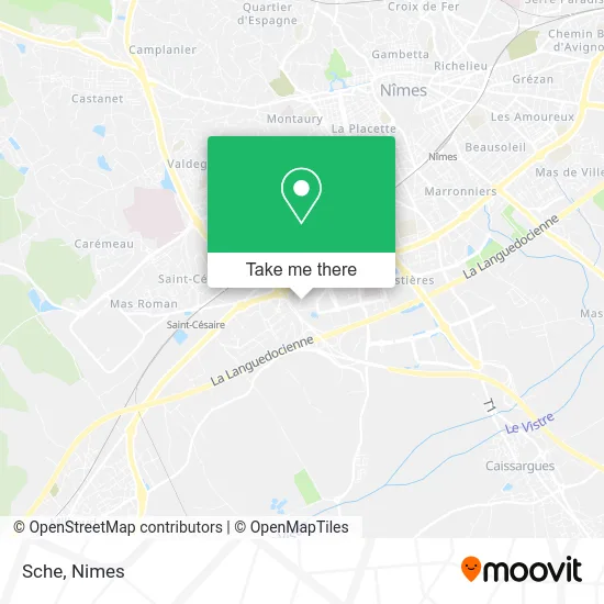
See Sche, Nimes, on the map
Public Transit to Sche in Nimes
Wondering how to get to Sche in Nimes? Moovit helps you find the best way to get to Sche with step-by-step directions from the nearest public transit station.
Moovit provides free maps and live directions to help you navigate through your city. View schedules, routes, timetables, and find out how long does it take to get to Sche in real time.
Looking for the nearest stop or station to Sche? Check out this list of stops closest to your destination: Parc Des Loisirs; Ledoux; Jean Monnet; Lea Blain; La Traverse.
Bus: 16, 7, 8, AERO, 89, 11, 13.
Want to see if there’s another route that gets you there at an earlier time? Moovit helps you find alternative routes or times. Get directions from and directions to Sche easily from the Moovit App or Website.
We make riding to Sche easy, which is why over 1.5 million users, including users in Nimes, trust Moovit as the best app for public transit. You don’t need to download an individual bus app or train app, Moovit is your all-in-one transit app that helps you find the best bus time or train time available.
For information on prices of bus, costs and ride fares to Sche, please check the Moovit app.
Use the app to navigate to popular places including to the airport, hospital, stadium, grocery store, mall, coffee shop, school, college, and university.
Sche Address: Rue Tony Garnier 30900 Nîmes street in Nimes
- Sodirex,
- Restaurant Cannelle Nîmes,
- Parc Hotelier ville active,
- hotelF1 Nîmes Ouest,
- ibis Nîmes Ouest,
- System X,
- Services et Conseils,
- Couvreur - Couverture Puel,
- Com.Occi,
- Médecine du Travail,
- Hôtel C-Suite,
- Hotel Kyriad Nîmes Ouest,
- Emg Sud Est,
- Mfgs,
- IFC Nîmes,
- Passage de Deux,
- Service Accompagnement Social Apf,
- Rue Tony Garnier 46,
- Hotel F1,
- Hôtel Formule 1
Places Near Sche (Nimes)
- Rue Gilles Roberval 285,
- Rond-Point Kilomètre Delta, Nîmes,
- Centre hospitalier Caremeau,
- VILLE ACTIVE, Nîmes,
- Geant Casino,
- Aire De Covoiturage Nîmes Ouest,
- Saint-Césaire,
- E.Leclerc,
- Carrefour Nîmes Sud,
- Le Parnasse, Nîmes,
- Les 7 Collines,
- Hôpital Privé Les Franciscaines,
- Parc Kennedy,
- Clinique Franciscaine,
- La Galerie - Cap Costières,
- Jardins de la Fontaine,
- CHU de Nîmes - Hôpital universitaire Carémeau,
- Kinepolis,
- Polyclinique Du Grand Sud,
- École Nationale De Police
How to get to popular places in Nimes with public transit
Get around Nimes by public transit!
Traveling around Nimes has never been so easy. See step by step directions as you travel to any attraction, street or major public transit station. View bus and train schedules, arrival times, service alerts and detailed routes on a map, so you know exactly how to get to anywhere in Nimes.
When traveling to any destination around Nimes use Moovit's Live Directions with Get Off Notifications to know exactly where and how far to walk, how long to wait for your line, and how many stops are left. Moovit will alert you when it's time to get off — no need to constantly re-check whether yours is the next stop.
Wondering how to use public transit in Nimes or how to pay for public transit in Nimes? Moovit public transit app can help you navigate your way with public transit easily, and at minimum cost. It includes public transit fees, ticket prices, and costs. Looking for a map of Nimes public transit lines? Moovit public transit app shows all public transit maps in Nimes with all bus routes and stops on an interactive map.
Nimes has 1 transit type(s), including: bus, operated by several transit agencies, including TANGO