How to get to Scipion by bus?
Click on the bus route to see step by step directions with maps, line arrival times and updated time schedules.
From Crématorium De Reims, Reims
45 minFrom Aquamoovprunay, Prunay
63 minFrom Bergelyne, Prunay
56 minFrom Forma, Thillois
50 minFrom Girardin, Prunay
59 minFrom Bistrot de la Gare, Prunay
60 minFrom Val Clair, Reims
23 minFrom Yprema, Reims
28 minFrom Spirit S Art, Sillery
35 minFrom Fort de la Pompelle, Puisieulx
35 min
Bus stops near Scipion in Reims
Light Rail stations near Scipion in Reims
- St Thomas, 21 min walk,VIEW
Bus lines to Scipion in Reims
What are the closest stations to Scipion?
The closest stations to Scipion are:
- Cimetiere Du Sud is 380 meters away, 5 min walk.
- Gouraud is 459 meters away, 7 min walk.
- Crayeres is 465 meters away, 7 min walk.
- St Maurice is 515 meters away, 7 min walk.
- Clovis is 773 meters away, 10 min walk.
- St Thomas is 1579 meters away, 21 min walk.
Which bus lines stop near Scipion?
These bus lines stop near Scipion: 25, O1, U2.
What’s the nearest light rail station to Scipion in Reims?
The nearest light rail station to Scipion in Reims is St Thomas. It’s a 21 min walk away.
What’s the nearest bus station to Scipion in Reims?
The nearest bus station to Scipion in Reims is Cimetiere Du Sud. It’s a 5 min walk away.
What time is the first light rail to Scipion in Reims?
The TRAM is the first light rail that goes to Scipion in Reims. It stops nearby at 5:05 AM.
What time is the last light rail to Scipion in Reims?
The TRAM is the last light rail that goes to Scipion in Reims. It stops nearby at 1:07 AM.
What time is the first bus to Scipion in Reims?
The O1 is the first bus that goes to Scipion in Reims. It stops nearby at 5:31 AM.
What time is the last bus to Scipion in Reims?
The O1 is the last bus that goes to Scipion in Reims. It stops nearby at 12:46 AM.
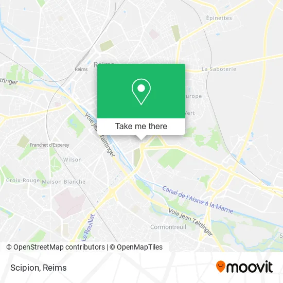
See Scipion, Reims, on the map
Public Transit to Scipion in Reims
Wondering how to get to Scipion in Reims? Moovit helps you find the best way to get to Scipion with step-by-step directions from the nearest public transit station.
Moovit provides free maps and live directions to help you navigate through your city. View schedules, routes, timetables, and find out how long does it take to get to Scipion in real time.
Looking for the nearest stop or station to Scipion? Check out this list of stops closest to your destination: Cimetiere Du Sud; Gouraud; Crayeres; St Maurice; Clovis; St Thomas.
Bus: 25, O1, U2, U5, U6, C.
Want to see if there’s another route that gets you there at an earlier time? Moovit helps you find alternative routes or times. Get directions from and directions to Scipion easily from the Moovit App or Website.
We make riding to Scipion easy, which is why over 1.5 million users, including users in Reims, trust Moovit as the best app for public transit. You don’t need to download an individual bus app or train app, Moovit is your all-in-one transit app that helps you find the best bus time or train time available.
For information on prices of bus, costs and ride fares to Scipion, please check the Moovit app.
Use the app to navigate to popular places including to the airport, hospital, stadium, grocery store, mall, coffee shop, school, college, and university.
Scipion Address: 54 Rue Dieu Lumière 51100 Reims street in Reims
- Musée-Abbaye Saint-Rémi,
- Saint Remi,
- Le Dieu Lumière,
- Foyer Saint Rémi,
- Saint-Thimothée,
- Groupe Aksis,
- Champenoise Sécurité,
- Le Saint Nicaise,
- Basilique Saint-Remi,
- Preparamedical,
- Droits De L'Homme,
- Imprimerie des Salines,
- Centre Médecine Universitaire,
- Taittinger,
- Taittinger (Caves),
- Café Clicquot,
- Champagne Martel,
- Clean Car (Self Car Wash),
- Maison Taittinger,
- Saint-Nicaise
Places Near Scipion (Reims)
- Bétheny, Bétheny,
- Tinqueux, Tinqueux,
- Hôpital Debré, Reims,
- Campus Croix Rouge, Reims,
- St Remi, Reims,
- Polyclinique Reims Bezannes, Bezannes,
- Gare Tgv, Bezannes,
- Bezannes, Bezannes,
- Carrefour, Tinqueux,
- Parc de Champagne, Reims,
- Cormontreuil, Reims,
- Hôpital Maison Blanche, Reims,
- Parc Des Expositions, Reims,
- La Neuvillette, Reims,
- CHU, Reims,
- E. Leclerc Champfleury, Champfleury,
- Croix Blandin, Reims,
- Ikea, Thillois,
- Leclerc, Saint-Brice-Courcelles,
- Centre Commercial Cernay, Reims
How to get to popular places in Reims with public transit
Get around Reims by public transit!
Traveling around Reims has never been so easy. See step by step directions as you travel to any attraction, street or major public transit station. View bus and train schedules, arrival times, service alerts and detailed routes on a map, so you know exactly how to get to anywhere in Reims.
When traveling to any destination around Reims use Moovit's Live Directions with Get Off Notifications to know exactly where and how far to walk, how long to wait for your line, and how many stops are left. Moovit will alert you when it's time to get off — no need to constantly re-check whether yours is the next stop.
Wondering how to use public transit in Reims or how to pay for public transit in Reims? Moovit public transit app can help you navigate your way with public transit easily, and at minimum cost. It includes public transit fees, ticket prices, and costs. Looking for a map of Reims public transit lines? Moovit public transit app shows all public transit maps in Reims with all Bus and Light Rail routes and stops on an interactive map.
Reims has 2 transit type(s), including: Bus and Light Rail, operated by several transit agencies, including Transdev Reims