How to get to Scott Chicotka by bus?
Click on the bus route to see step by step directions with maps, line arrival times and updated time schedules.
From Gazelle Sports Grand Rapids, Kentwood
50 minFrom E Paris Ave SE / 28th St SE, Grand Rapids
49 minFrom FedEx, Grand Rapids
24 minFrom KDP, Kentwood
59 minFrom Allstate Insurance, Grand Rapids
27 minFrom Gill Staffing, Kentwood
50 minFrom Mark A. Fredrickson, MD, Wyoming
36 minFrom 44th & Kalamazoo, Grand Rapids
49 minFrom Lacis Per Outcall Massage, Grand Rapids
32 min
Bus stops near Scott Chicotka in Grand Rapids
Train station near Scott Chicotka in Grand Rapids
- Grand Rapids Vernon J. Ehlers Station, 50 min walk,VIEW
Bus lines to Scott Chicotka in Grand Rapids
What are the closest stations to Scott Chicotka?
The closest stations to Scott Chicotka are:
- Medical Mile Station (Wb) is 58 yards away, 1 min walk.
- Michigan/Coit (Wb) is 177 yards away, 3 min walk.
- Lyon/Lafayette (Wb) is 630 yards away, 8 min walk.
- Grand Rapids Vernon J. Ehlers Station is 4251 yards away, 50 min walk.
Which bus lines stop near Scott Chicotka?
These bus lines stop near Scott Chicotka: 11, 13, 6, 90.
What’s the nearest bus station to Scott Chicotka in Grand Rapids?
The nearest bus station to Scott Chicotka in Grand Rapids is Medical Mile Station (Wb). It’s a 1 min walk away.
What time is the first train to Scott Chicotka in Grand Rapids?
The PERE MARQUETTE is the first train that goes to Scott Chicotka in Grand Rapids. It stops nearby at 6:00 AM.
What time is the last train to Scott Chicotka in Grand Rapids?
The PERE MARQUETTE is the last train that goes to Scott Chicotka in Grand Rapids. It stops nearby at 11:34 PM.
What time is the first bus to Scott Chicotka in Grand Rapids?
The 11 is the first bus that goes to Scott Chicotka in Grand Rapids. It stops nearby at 5:21 AM.
What time is the last bus to Scott Chicotka in Grand Rapids?
The 11 is the last bus that goes to Scott Chicotka in Grand Rapids. It stops nearby at 11:29 PM.
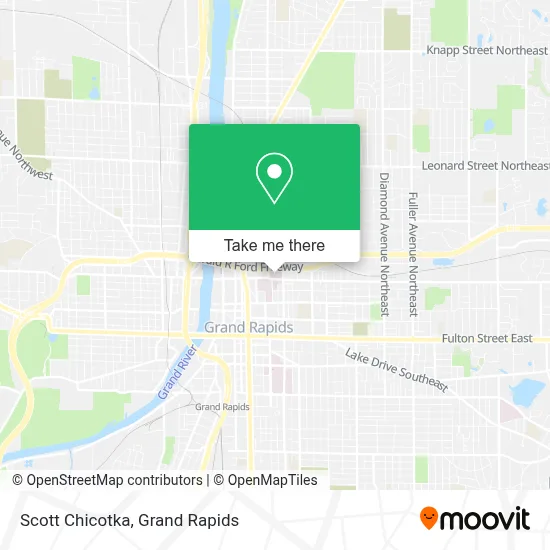
See Scott Chicotka, Grand Rapids, on the map
Public Transit to Scott Chicotka in Grand Rapids
Wondering how to get to Scott Chicotka in Grand Rapids? Moovit helps you find the best way to get to Scott Chicotka with step-by-step directions from the nearest public transit station.
Moovit provides free maps and live directions to help you navigate through your city. View schedules, routes, timetables, and find out how long does it take to get to Scott Chicotka in real time.
Looking for the nearest stop or station to Scott Chicotka? Check out this list of stops closest to your destination: Medical Mile Station (Wb); Michigan/Coit (Wb); Lyon/Lafayette (Wb); Grand Rapids Vernon J. Ehlers Station.
Bus: 11, 13, 6, 90, 45.Train: PERE MARQUETTE.
Want to see if there’s another route that gets you there at an earlier time? Moovit helps you find alternative routes or times. Get directions from and directions to Scott Chicotka easily from the Moovit App or Website.
We make riding to Scott Chicotka easy, which is why over 1.5 million users, including users in Grand Rapids, trust Moovit as the best app for public transit. You don’t need to download an individual bus app or train app, Moovit is your all-in-one transit app that helps you find the best bus time or train time available.
For information on prices of bus, costs and ride fares to Scott Chicotka, please check the Moovit app.
Use the app to navigate to popular places including to the airport, hospital, stadium, grocery store, mall, coffee shop, school, college, and university.
Scott Chicotka Address: 221 Michigan St NE Ste 300 street in Grand Rapids
- Spectrum Health Ostomy Clinic,
- Spectrum Health Shuttle,
- The Rapid: Line 13: Spectrum Health Butterworth Hospital,
- Meijer Heart Center,
- Lemmen-Holton Cancer Pavilion,
- Spectrum Health-Butterworth,
- Spectrum Health Butterworth Hospital,
- Blodgett Butterworth Health Care Foundation ,
- Helen Devos Children's Hospital Radiology,
- Butterworth Hospital Internal Radiology,
- Helen Devos Childrens Hospital Neurology,
- spectrum health radiology,
- Helen DeVos Children's Hospital,
- Butterworth Hospital: 3C: Labor & Delivery,
- Spectrum Health Hospitals - Fred and Lena Meijer Heart Center,
- DeVos Pediatric Ophthalmology,
- Helel DeVos Children's Hospital Food Court,
- Silver Line - Medical Mile,
- Renucci Hospitality House,
- Van Andel Research Institute
Places Near Scott Chicotka (Grand Rapids)
- Byron Center,
- Spectrum Health-Blodgett Hospital, East Grand Rapids,
- Grand Rapids Community College, Grand Rapids,
- Frederik Meijer Gardens, Grand Rapids,
- Union High School, Grand Rapids,
- Helel DeVos Children's Hospital Food Court, Grand Rapids,
- Pine Rest Mental Health, Grand Rapids,
- Woodland Mall, Kentwood,
- Van Andel Arena, Grand Rapids,
- Kent County Courthouse, Grand Rapids,
- John Ball Zoo, Grand Rapids,
- YMCA - David D. Hunting, Grand Rapids,
- Metro Cascade,
- Lemmen-Holton Cancer Pavilion, Grand Rapids,
- Butterworth Hospital Internal Radiology, Grand Rapids,
- Spectrum Health Butterworth Hospital, Grand Rapids,
- University of Michigan Health Metro Health Hospital, Wyoming,
- Hudsonville,
- Grandville, MI, Grandville,
- Blodgett Hospital, East Grand Rapids
How to get to popular places in Grand Rapids with public transit
Get around Grand Rapids by public transit!
Traveling around Grand Rapids has never been so easy. See step by step directions as you travel to any attraction, street or major public transit station. View bus and train schedules, arrival times, service alerts and detailed routes on a map, so you know exactly how to get to anywhere in Grand Rapids.
When traveling to any destination around Grand Rapids use Moovit's Live Directions with Get Off Notifications to know exactly where and how far to walk, how long to wait for your line, and how many stops are left. Moovit will alert you when it's time to get off — no need to constantly re-check whether yours is the next stop.
Wondering how to use public transit in Grand Rapids or how to pay for public transit in Grand Rapids? Moovit public transit app can help you navigate your way with public transit easily, and at minimum cost. It includes public transit fees, ticket prices, and costs. Looking for a map of Grand Rapids public transit lines? Moovit public transit app shows all public transit maps in Grand Rapids with all Bus and Train routes and stops on an interactive map.
Grand Rapids has 2 transit type(s), including: Bus and Train, operated by several transit agencies, including The Rapid, Amtrak and FlixBus-us