How to get to Scouting Location by bus?
Click on the bus route to see step by step directions with maps, line arrival times and updated time schedules.
From Centre National du Football, Clairefontaine-En-Yvelines
138 minFrom Saclay, Saclay
62 minFrom Rambouillet, Rambouillet
55 minFrom Étampes, Etampes
44 minFrom Les Ulis, Les Ulis
70 minFrom Brétigny-sur-Orge, Bretigny-Sur-Orge
83 minFrom Arpajon, Arpajon
64 minFrom Amazon Logistics, Bretigny-Sur-Orge
112 minFrom Marcoussis, Marcoussis
84 minFrom Centre Commercial Auchan, Bretigny-Sur-Orge
97 min
How to get to Scouting Location by train?
Click on the train route to see step by step directions with maps, line arrival times and updated time schedules.
Bus stops near Scouting Location in Dourdan
RER station near Scouting Location in Dourdan
- Dourdan, 17 min walk,VIEW
Bus lines to Scouting Location in Dourdan
- 4451, Gare de Dourdan,VIEW
- 4453, Piscine,VIEW
- 4452, Gare de Dourdan,VIEW
- 4454, Avenue de Paris,VIEW
- 4459, Église,VIEW
- 4450, La Forêt - Paray Douaville,VIEW
- 4463, La Forêt - Monument,VIEW
- 5233, Gare De Dourdan - Zone Industrielle,VIEW
- 5318, Gare De Dourdan - Champarts,VIEW
- 7810, Gare De Dourdan - Gare De Rambouillet - Prairie,VIEW
- 4462, La Forêt,VIEW
- 4455, Jubé de la Pérelle,VIEW
What are the closest stations to Scouting Location?
The closest stations to Scouting Location are:
- Boulevard Des Alliés is 350 meters away, 5 min walk.
- Avenue de Paris is 430 meters away, 6 min walk.
- Gare de Dourdan is 643 meters away, 9 min walk.
- Gare de Dourdan Passerelle is 727 meters away, 10 min walk.
- Jubé de la Pérelle is 756 meters away, 10 min walk.
- Dourdan is 1250 meters away, 17 min walk.
Which train line stops near Scouting Location?
TER (Châteaudun)
Which RER line stops near Scouting Location?
C (Pontoise/ Saint-Quentin-en-Yvelines/ Versailles-Chantiers/ Versailles-Château-Rive-Gauche)
Which bus lines stop near Scouting Location?
These bus lines stop near Scouting Location: 4457, 7810, 9103.
What’s the nearest bus station to Scouting Location in Dourdan?
The nearest bus station to Scouting Location in Dourdan is Boulevard Des Alliés. It’s a 5 min walk away.
What’s the nearest RER station to Scouting Location in Dourdan?
The nearest RER station to Scouting Location in Dourdan is Dourdan. It’s a 17 min walk away.
What time is the first train to Scouting Location in Dourdan?
The TER is the first train that goes to Scouting Location in Dourdan. It stops nearby at 7:58 AM.
What time is the last train to Scouting Location in Dourdan?
The TER is the last train that goes to Scouting Location in Dourdan. It stops nearby at 8:00 PM.
What time is the first bus to Scouting Location in Dourdan?
The 4451 is the first bus that goes to Scouting Location in Dourdan. It stops nearby at 5:27 AM.
What time is the last bus to Scouting Location in Dourdan?
The C is the last bus that goes to Scouting Location in Dourdan. It stops nearby at 2:50 AM.
What time is the first RER to Scouting Location in Dourdan?
The C is the first RER that goes to Scouting Location in Dourdan. It stops nearby at 4:07 AM.
What time is the last RER to Scouting Location in Dourdan?
The C is the last RER that goes to Scouting Location in Dourdan. It stops nearby at 10:18 PM.
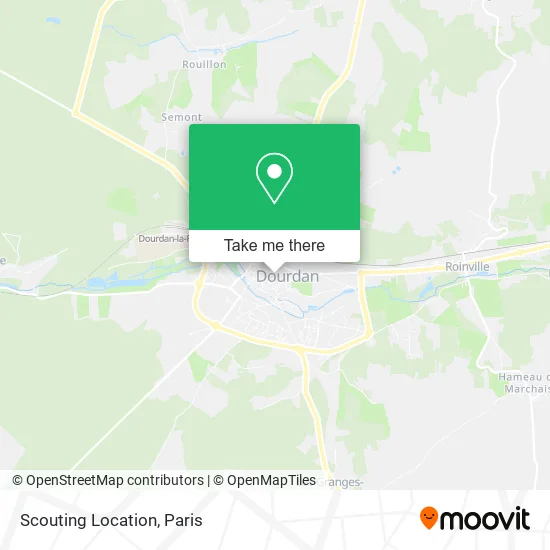
See Scouting Location, Dourdan, on the map
Public Transit to Scouting Location in Dourdan
Wondering how to get to Scouting Location in Dourdan? Moovit helps you find the best way to get to Scouting Location with step-by-step directions from the nearest public transit station.
Moovit provides free maps and live directions to help you navigate through your city. View schedules, routes, timetables, and find out how long does it take to get to Scouting Location in real time.
Looking for the nearest stop or station to Scouting Location? Check out this list of stops closest to your destination: Boulevard Des Alliés; Avenue de Paris; Gare de Dourdan; Gare de Dourdan Passerelle; Jubé de la Pérelle; Dourdan.
Train: TER.RER: C, TER.Bus: 4457, 7810, 9103, 4451, 4453, 4452, 4454, 4459, 4450, 4463, 5233, 5318, 4462.
Want to see if there’s another route that gets you there at an earlier time? Moovit helps you find alternative routes or times. Get directions from and directions to Scouting Location easily from the Moovit App or Website.
We make riding to Scouting Location easy, which is why over 1.5 million users, including users in Dourdan, trust Moovit as the best app for public transit. You don’t need to download an individual bus app or train app, Moovit is your all-in-one transit app that helps you find the best bus time or train time available.
For information on prices of bus, RER and train, costs and ride fares to Scouting Location, please check the Moovit app.
Use the app to navigate to popular places including to the airport, hospital, stadium, grocery store, mall, coffee shop, school, college, and university.
Scouting Location Address: 8 Rue Debertrand 91410 Dourdan street in Dourdan
- Arbour Gitton Marie Hélène,
- Braun Marianne,
- Du 17 Rue de L Abreuvoir,
- Dr. Phung Patrick,
- Abeille Assurances-Dourdan,
- Aux Coeurs des Possibles,
- E.H.P.A.D. Jean Sarran,
- Mr Rapenne Stephan,
- Franck Martin,
- Dallemagne Gil,
- Epicerie Fine,
- Petit Thierry,
- Sacko Mahamadou,
- Henri Scazzola,
- Comaipal,
- Tabac,
- Le P'tit Primeur,
- Romain Bourreau - Ostéopathe D.O,
- FedEx,
- Durukan Zuleyha
Places Near Scouting Location (Dourdan)
- Hôpital Pitié Salpêtrière, Paris,
- 29 Rue Manin, Paris,
- Atelier Des Lumieres, Paris,
- Hopital Foch, Suresnes,
- Créteil Soleil, Creteil,
- Hôpital Saint-Joseph, Paris,
- Hôpital Necker, Paris,
- Marché Saint-Pierre, Paris,
- Galeries Lafayette, Paris,
- Hôpital Henri Mondor, Creteil,
- Beaugrenelle, Paris,
- Gare Routière Flixbus, Paris,
- Hôpital Beaujon, Clichy,
- Galeries Lafayette Haussmann, Paris,
- Hôpital Cochin, Paris,
- Centre Hospitalier des 15/20, Paris,
- Fondation Louis Vuitton, Paris,
- Hopital Lariboisière, Paris,
- Théâtre Mogador, Paris,
- Hôpital de la Pitié-Salpêtrière, Paris
How to get to popular places in Paris with public transit
Get around Dourdan by public transit!
Traveling around Dourdan has never been so easy. See step by step directions as you travel to any attraction, street or major public transit station. View bus and train schedules, arrival times, service alerts and detailed routes on a map, so you know exactly how to get to anywhere in Dourdan.
When traveling to any destination around Dourdan use Moovit's Live Directions with Get Off Notifications to know exactly where and how far to walk, how long to wait for your line, and how many stops are left. Moovit will alert you when it's time to get off — no need to constantly re-check whether yours is the next stop.
Wondering how to use public transit in Dourdan or how to pay for public transit in Dourdan? Moovit public transit app can help you navigate your way with public transit easily, and at minimum cost. It includes public transit fees, ticket prices, and costs. Looking for a map of Dourdan public transit lines? Moovit public transit app shows all public transit maps in Dourdan with all Bus, Train, Metro, Light Rail, RER, Funicular and Gondola routes and stops on an interactive map.
Paris has 7 transit type(s), including: Bus, Train, Metro, Light Rail, RER, Funicular and Gondola, operated by several transit agencies, including RATP, RER, RER Bus de remplacement, Train, Train Bus de remplacement, Tramway Bus de remplacement, TER, ADP, Magical Shuttle, Argenteuil - Boucles de Seine, Autocars Dominique, Bièvre, Brie et 2 Morin, Le Bus - C.C. du Clermontois and Cœur d’Essonne