How to get to Scry Chapelle by bus?
Click on the bus route to see step by step directions with maps, line arrival times and updated time schedules.
From Rockland #45 Express Bus to Port Authority Bus Terminal, NYC, Spring Valley
250 minFrom New City (New), New City
271 minFrom 11A Bus to Port Authority, Spring Valley
250 minFrom Peekskill, NY, Peekskill
346 minFrom Palisades mall, West Nyack
252 minFrom Regeneron Pharmaceuticals Inc, Tarrytown
258 min
Bus stops near Scry Chapelle in New Paltz
Bus lines to Scry Chapelle in New Paltz
- PHK 704, New York (P.A.B.T.) -> Utica,VIEW
- PHK 707F, Utica -> New York (P.A.B.T.),VIEW
- PHK 710, New York (P.A.B.T.) -> Kingston,VIEW
- PHK 723, Kingston -> New York (P.A.B.T.),VIEW
- PHK 758, New York (P.A.B.T.) -> Phoenicia,VIEW
- PHK 777F, Kingston -> New York (Hudson Trailways),VIEW
- ADT A121F, Oneonta (SUNY Campus) -> New York (P.A.B.T.),VIEW
- ADT A411, Albany (Airport - ALB) -> Queens Village,VIEW
- ADT A412, Queens Village -> Albany (Trailways Bus Terminal),VIEW
- ADT P704, New York (P.A.B.T.) -> Utica,VIEW
- ADT P707F, Utica -> New York (P.A.B.T.),VIEW
- ADT P710, New York (P.A.B.T.) -> Kingston,VIEW
- ADT P722, New York (P.A.B.T.) -> Kingston,VIEW
- ADT P723, Kingston -> New York (P.A.B.T.),VIEW
- ADT P777F, Kingston -> New York (Hudson Trailways),VIEW
- CL ROUTE, CL,VIEW
- NPL, New Paltz Loop,VIEW
- UPL-EB, UPL: New Paltz - Train Station - Grand Central,VIEW
- UPL-WB, UPL: Grand Central - Train Station - New Paltz,VIEW
- X, X: New Paltz - Newburgh,VIEW
What are the closest stations to Scry Chapelle?
The closest stations to Scry Chapelle are:
- New Paltz (Suny) is 444 yards away, 6 min walk.
- Rt 32 & Henry Dubois Dr is 655 yards away, 8 min walk.
- New Paltz is 1012 yards away, 13 min walk.
Which bus lines stop near Scry Chapelle?
These bus lines stop near Scry Chapelle: PHK 704, PHK 740, PHK 758, UPL-WB.
What’s the nearest bus station to Scry Chapelle in New Paltz?
The nearest bus station to Scry Chapelle in New Paltz is New Paltz (Suny). It’s a 6 min walk away.
What time is the first bus to Scry Chapelle in New Paltz?
The PHK 755 is the first bus that goes to Scry Chapelle in New Paltz. It stops nearby at 4:40 AM.
What time is the last bus to Scry Chapelle in New Paltz?
The UPL-WB is the last bus that goes to Scry Chapelle in New Paltz. It stops nearby at 10:12 PM.
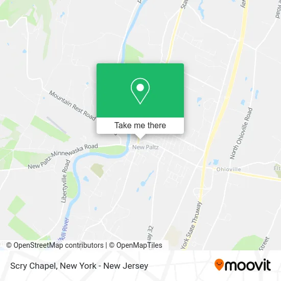
See Scry Chapelle, New Paltz, on the map
Public Transit to Scry Chapelle in New Paltz
Wondering how to get to Scry Chapelle in New Paltz? Moovit helps you find the best way to get to Scry Chapelle with step-by-step directions from the nearest public transit station.
Moovit provides free maps and live directions to help you navigate through your city. View schedules, routes, timetables, and find out how long does it take to get to Scry Chapelle in real time.
Looking for the nearest stop or station to Scry Chapelle? Check out this list of stops closest to your destination: New Paltz (Suny); Rt 32 & Henry Dubois Dr; New Paltz.
Bus: PHK 704, PHK 740, PHK 758, UPL-WB, PHK 707F, PHK 710, PHK 723, CL ROUTE, NPL, UPL-EB, X, PHK 701, PHK 702, PHK 703, PHK 705, PHK 706.
Want to see if there’s another route that gets you there at an earlier time? Moovit helps you find alternative routes or times. Get directions from and directions to Scry Chapelle easily from the Moovit App or Website.
We make riding to Scry Chapelle easy, which is why over 1.5 million users, including users in New Paltz, trust Moovit as the best app for public transit. You don’t need to download an individual bus app or train app, Moovit is your all-in-one transit app that helps you find the best bus time or train time available.
For information on prices of bus and train, costs and ride fares to Scry Chapelle, please check the Moovit app.
Use the app to navigate to popular places including to the airport, hospital, stadium, grocery store, mall, coffee shop, school, college, and university.
Scry Chapelle Address: 3 Church St New Paltz, NY 12561 street in New Paltz
- Rhino Records,
- Sophie G's,
- Krishna Kitchen,
- The End Cut,
- Stellar Yoga,
- The Ridge Tea, Coffee, Spice,
- Little Rabbit Wears,
- Blue Rabbit Studios,
- Meditate New Paltz,
- Blejer Architecture,
- Estatebidz,
- Dog Street Tattoo,
- Young Marketing Campaign,
- Zaytoune,
- Agave,
- Gunks.Com,
- Intuitive Hypnosis Studios,
- Floating Lotus Lash Bar,
- Groovy Blueberry Clothing Company,
- Kontiki Trading Post
Places Near Scry Chapelle (New Paltz)
- 26 Federal Plaza, Manhattan,
- 911 Memorial, Manhattan,
- 376 Hudson Street, Manhattan,
- Pier 83, Manhattan,
- Queens Center Mall, Queens,
- qqqq, Manhattan,
- SoHo, Manhattan,
- Mountainside Hospital, Glen Ridge,
- Rockefeller Center, Manhattan,
- Times Square, Manhattan,
- 66 John Street, Manhattan,
- 111 Centre New York City Supreme Court, Manhattan,
- Bellevue Hospital, Manhattan,
- Hudson Yards, Manhattan,
- Chinatown, Manhattan,
- Katz's Deli, Manhattan,
- 1 Police Plaza, Manhattan,
- Wall Street, Manhattan,
- San Gennaro Feast, Manhattan,
- 3 Stone St, Manhattan
How to get to popular places in New York - New Jersey with public transit
Get around New Paltz by public transit!
Traveling around New Paltz has never been so easy. See step by step directions as you travel to any attraction, street or major public transit station. View bus and train schedules, arrival times, service alerts and detailed routes on a map, so you know exactly how to get to anywhere in New Paltz.
When traveling to any destination around New Paltz use Moovit's Live Directions with Get Off Notifications to know exactly where and how far to walk, how long to wait for your line, and how many stops are left. Moovit will alert you when it's time to get off — no need to constantly re-check whether yours is the next stop.
Wondering how to use public transit in New Paltz or how to pay for public transit in New Paltz? Moovit public transit app can help you navigate your way with public transit easily, and at minimum cost. It includes public transit fees, ticket prices, and costs. Looking for a map of New Paltz public transit lines? Moovit public transit app shows all public transit maps in New Paltz with all Bus, Train, Subway, Light Rail, Ferry and Cable Car routes and stops on an interactive map.
New York - New Jersey has 6 transit type(s), including: Bus, Train, Subway, Light Rail, Ferry and Cable Car, operated by several transit agencies, including MTA Subway, Metro-North Railroad, LIRR, PATH, MTA New York City Transit - Express routes, MTA Bus, NJ Transit, NYC Ferry, NICE bus, Bee-Line Bus, NJ Transit Rail, Norwalk Transit District, Hartford Line, River Valley Transit and HART