How to get to Sea Change Development by bus?
Click on the bus route to see step by step directions with maps, line arrival times and updated time schedules.
From Embassy Of Spain, Washington
44 minFrom Lauriol Plaza, Washington
79 minFrom Fairmont Hotel-Washington, Washington
56 minFrom East Potomac Park, Washington
89 minFrom George Washington University Hospital, Washington
57 minFrom Meridian Hill Park, Washington
79 minFrom US Department of the Treasury, Washington
69 minFrom Children's Hospital, Washington
77 minFrom Warner Theatre, Washington
72 minFrom Barcelona Wine Bar - 14th Street, Washington
68 min
How to get to Sea Change Development by metro?
Click on the metro route to see step by step directions with maps, line arrival times and updated time schedules.
From Embassy Of Spain, Washington
41 minFrom Lauriol Plaza, Washington
60 minFrom Fairmont Hotel-Washington, Washington
44 minFrom East Potomac Park, Washington
66 minFrom George Washington University Hospital, Washington
36 minFrom Meridian Hill Park, Washington
70 minFrom US Department of the Treasury, Washington
45 minFrom Children's Hospital, Washington
70 minFrom Warner Theatre, Washington
45 minFrom Barcelona Wine Bar - 14th Street, Washington
56 min
Bus stops near Sea Change Development in Arlington County
Metro station near Sea Change Development in Arlington County
- Ballston - Mu, 14 min walk,VIEW
Bus lines to Sea Change Development in Arlington County
What are the closest stations to Sea Change Development?
The closest stations to Sea Change Development are:
- Langston Blvd Eb @ John Marshall Dr FS is 407 yards away, 6 min walk.
- Washington Bl+N Nottingham St is 667 yards away, 9 min walk.
- Ballston - Mu is 1173 yards away, 14 min walk.
Which bus line stops near Sea Change Development?
55 (East Falls Church)
Which metro lines stop near Sea Change Development?
These metro lines stop near Sea Change Development: ORANGE, SILVER.
What’s the nearest metro station to Sea Change Development in Arlington County?
The nearest metro station to Sea Change Development in Arlington County is Ballston - Mu. It’s a 14 min walk away.
What’s the nearest bus station to Sea Change Development in Arlington County?
The nearest bus station to Sea Change Development in Arlington County is Langston Blvd Eb @ John Marshall Dr FS. It’s a 6 min walk away.
What time is the first metro to Sea Change Development in Arlington County?
The ORANGE is the first metro that goes to Sea Change Development in Arlington County. It stops nearby at 5:07 AM.
What time is the last metro to Sea Change Development in Arlington County?
The SILVER is the last metro that goes to Sea Change Development in Arlington County. It stops nearby at 12:31 AM.
What time is the first bus to Sea Change Development in Arlington County?
The 55 is the first bus that goes to Sea Change Development in Arlington County. It stops nearby at 5:02 AM.
What time is the last bus to Sea Change Development in Arlington County?
The 55 is the last bus that goes to Sea Change Development in Arlington County. It stops nearby at 1:36 AM.
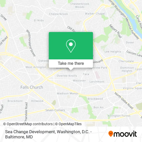
See Sea Change Development, Arlington County, on the map
Public Transit to Sea Change Development in Arlington County
Wondering how to get to Sea Change Development in Arlington County? Moovit helps you find the best way to get to Sea Change Development with step-by-step directions from the nearest public transit station.
Moovit provides free maps and live directions to help you navigate through your city. View schedules, routes, timetables, and find out how long does it take to get to Sea Change Development in real time.
Looking for the nearest stop or station to Sea Change Development? Check out this list of stops closest to your destination: Langston Blvd Eb @ John Marshall Dr FS; Washington Bl+N Nottingham St; Ballston - Mu.
Bus: 55, F50.Metro: ORANGE, SILVER.
Want to see if there’s another route that gets you there at an earlier time? Moovit helps you find alternative routes or times. Get directions from and directions to Sea Change Development easily from the Moovit App or Website.
We make riding to Sea Change Development easy, which is why over 1.5 million users, including users in Arlington County, trust Moovit as the best app for public transit. You don’t need to download an individual bus app or train app, Moovit is your all-in-one transit app that helps you find the best bus time or train time available.
For information on prices of bus and metro, costs and ride fares to Sea Change Development, please check the Moovit app.
Use the app to navigate to popular places including to the airport, hospital, stadium, grocery store, mall, coffee shop, school, college, and university.
Sea Change Development Address: 2245 N Nottingham St Arlington, VA 22205 street in Arlington County
- Overlee Community Association (Overlee Community Pool),
- Billy's Deli Cafe,
- Abw Appliances - Arlin,
- Eyeconic,
- Purple Can Club,
- Maid Brigade,
- District Taco,
- Imgt Inc,
- Benjamin Moore,
- Potomac Paint & Design Centers (Potomac Paint & Decorating Center),
- Curry & Clay Oven,
- Slice Solutions, Inc.,
- Chicago's Pizza with A Twist - Arlington, VA,
- Tiffany Nails & Spa Arlington,
- Nottingham Gardens,
- Liberty Petrol Station,
- Kimberly Renee' Muzinski,
- bp,
- Forno Bravo DC Wood-Fired Pizza Ovens,
- Fly Me To the Moon Bounce
Places Near Sea Change Development (Arlington County)
- M&T Bank Stadium, Baltimore,
- The Anthem, Washington,
- PG Mall, Prince George's County,
- Warner Theatre, Washington,
- Washington National Cathedral, Washington,
- Basilica of the National Shrine, Washington,
- Sibley Memorial Hospital, Washington,
- Pennsylvania Ave NW (3rd st and pennsylvania), Washington,
- Camden Yards, Baltimore,
- Capital One Arena, Washington,
- Amazon Hq2, Arlington County,
- Georgetown, Washington,
- National Zoo, Washington,
- National Theatre, Washington,
- National Museum of African American History and Culture, Washington,
- Westfield Montgomery Mall, Montgomery County,
- Rock Creek Tennis Center, Washington,
- Museum Of The Bible, Washington,
- Marriott Marquis Washington, DC, Washington,
- Washington DC VA Medical Center, Washington
How to get to popular places in Washington, D.C. - Baltimore, MD with public transit
Get around Arlington County by public transit!
Traveling around Arlington County has never been so easy. See step by step directions as you travel to any attraction, street or major public transit station. View bus and train schedules, arrival times, service alerts and detailed routes on a map, so you know exactly how to get to anywhere in Arlington County.
When traveling to any destination around Arlington County use Moovit's Live Directions with Get Off Notifications to know exactly where and how far to walk, how long to wait for your line, and how many stops are left. Moovit will alert you when it's time to get off — no need to constantly re-check whether yours is the next stop.
Wondering how to use public transit in Arlington County or how to pay for public transit in Arlington County? Moovit public transit app can help you navigate your way with public transit easily, and at minimum cost. It includes public transit fees, ticket prices, and costs. Looking for a map of Arlington County public transit lines? Moovit public transit app shows all public transit maps in Arlington County with all Bus, Train, Metro, Light Rail and Ferry routes and stops on an interactive map.
Washington, D.C. - Baltimore, MD has 5 transit type(s), including: Bus, Train, Metro, Light Rail and Ferry, operated by several transit agencies, including WMATA, Montgomery County Ride On, Fairfax Connector, TheBus, PRTC, DASH - Alexandria, Arlington Transit (ART), RTA of Central Maryland, MDOT MTA, MDOT MTA Light RailLink, MDOT MTA Commuter Bus, MDOT MTA Local Bus, FXBGO!, Virginia Railway Express (VRE) and MARC