How to get to Sea Express Logistics by bus?
Click on the bus route to see step by step directions with maps, line arrival times and updated time schedules.
Bus stops near Sea Express Logistics in Saint Mary's County
Bus lines to Sea Express Logistics in Saint Mary's County
What are the closest stations to Sea Express Logistics?
The closest stations to Sea Express Logistics are:
- Liberty St. And Pegg Rd. is 1117 yards away, 14 min walk.
- Westbury Blvd. at Great Mills Rd. is 1192 yards away, 15 min walk.
- Chancellors Run Rd. & Fox Chase Dr. is 1702 yards away, 21 min walk.
Which bus line stops near Sea Express Logistics?
4 (Lexington Park)
What’s the nearest bus station to Sea Express Logistics in Saint Mary's County?
The nearest bus station to Sea Express Logistics in Saint Mary's County is Liberty St. And Pegg Rd.. It’s a 14 min walk away.
What time is the first bus to Sea Express Logistics in Saint Mary's County?
The 1 is the first bus that goes to Sea Express Logistics in Saint Mary's County. It stops nearby at 5:47 AM.
What time is the last bus to Sea Express Logistics in Saint Mary's County?
The 11 is the last bus that goes to Sea Express Logistics in Saint Mary's County. It stops nearby at 10:22 PM.
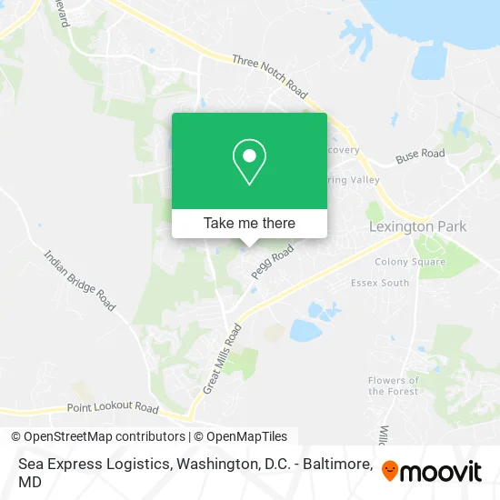
See Sea Express Logistics, Saint Mary's County, on the map
Public Transit to Sea Express Logistics in Saint Mary's County
Wondering how to get to Sea Express Logistics in Saint Mary's County? Moovit helps you find the best way to get to Sea Express Logistics with step-by-step directions from the nearest public transit station.
Moovit provides free maps and live directions to help you navigate through your city. View schedules, routes, timetables, and find out how long does it take to get to Sea Express Logistics in real time.
Looking for the nearest stop or station to Sea Express Logistics? Check out this list of stops closest to your destination: Liberty St. And Pegg Rd.; Westbury Blvd. at Great Mills Rd.; Chancellors Run Rd. & Fox Chase Dr..
Bus: 4, 11, 1, 8.
Want to see if there’s another route that gets you there at an earlier time? Moovit helps you find alternative routes or times. Get directions from and directions to Sea Express Logistics easily from the Moovit App or Website.
We make riding to Sea Express Logistics easy, which is why over 1.5 million users, including users in Saint Mary's County, trust Moovit as the best app for public transit. You don’t need to download an individual bus app or train app, Moovit is your all-in-one transit app that helps you find the best bus time or train time available.
For information on prices of bus, costs and ride fares to Sea Express Logistics, please check the Moovit app.
Use the app to navigate to popular places including to the airport, hospital, stadium, grocery store, mall, coffee shop, school, college, and university.
Sea Express Logistics Address: 46072 Gooseneck Dr Lexington Park, MD 20653 street in Saint Mary's County
- Jiezl Cruz,
- Sabrina's Cleaning,
- Southern Paint,
- My Little Heart's Daycare,
- Pay the Barber,
- Travelers Lodge,
- Lakeside Title Company,
- Taylor Gas,
- Small Town Bargains Thrift Store,
- Chesapeake Shores,
- 2 Soul Sisters,
- Tobacco Hub 20653 A,
- ATM,
- Amazon Locker-Bili,
- ATM,
- Krispy Krunchy Chicken,
- Saint Mary's Landing Apts,
- Columbia Commons,
- Park Villas,
- Safelite AutoGlass
Places Near Sea Express Logistics (Saint Mary's County)
- Rock Creek Tennis Center, Washington,
- Washington National Cathedral, Washington,
- Washington DC VA Medical Center, Washington,
- Pennsylvania Ave NW (3rd st and pennsylvania), Washington,
- National Mall, Washington,
- Basilica of the National Shrine, Washington,
- Georgetown, Washington,
- Museum Of The Bible, Washington,
- Warner Theatre, Washington,
- M&T Bank Stadium, Baltimore,
- National Zoo, Washington,
- Marriott Marquis Washington, DC, Washington,
- PG Mall, Prince George's County,
- Capital One Arena, Washington,
- Westfield Montgomery Mall, Montgomery County,
- Amazon Hq2, Arlington County,
- Camden Yards, Baltimore,
- Sibley Memorial Hospital, Washington,
- National Museum of African American History and Culture, Washington,
- The Anthem, Washington
How to get to popular places in Washington, D.C. - Baltimore, MD with public transit
Get around Saint Mary's County by public transit!
Traveling around Saint Mary's County has never been so easy. See step by step directions as you travel to any attraction, street or major public transit station. View bus and train schedules, arrival times, service alerts and detailed routes on a map, so you know exactly how to get to anywhere in Saint Mary's County.
When traveling to any destination around Saint Mary's County use Moovit's Live Directions with Get Off Notifications to know exactly where and how far to walk, how long to wait for your line, and how many stops are left. Moovit will alert you when it's time to get off — no need to constantly re-check whether yours is the next stop.
Wondering how to use public transit in Saint Mary's County or how to pay for public transit in Saint Mary's County? Moovit public transit app can help you navigate your way with public transit easily, and at minimum cost. It includes public transit fees, ticket prices, and costs. Looking for a map of Saint Mary's County public transit lines? Moovit public transit app shows all public transit maps in Saint Mary's County with all Bus, Train, Metro, Light Rail and Ferry routes and stops on an interactive map.
Washington, D.C. - Baltimore, MD has 5 transit type(s), including: Bus, Train, Metro, Light Rail and Ferry, operated by several transit agencies, including WMATA, Montgomery County Ride On, Fairfax Connector, TheBus, PRTC, DASH - Alexandria, Arlington Transit (ART), RTA of Central Maryland, MDOT MTA, MDOT MTA Light RailLink, MDOT MTA Commuter Bus, MDOT MTA Local Bus, FXBGO!, Virginia Railway Express (VRE) and MARC